Spring Valley, Arizona

Last updated

Spring Valley, Arizona
CDP
Yavapai County incorporated areas Spring Valley highlighted.svg
Location in Yavapai County and the state of Arizona
Usa edcp location map.svg
Red pog.svg
Spring Valley, Arizona
Location in the United States
Coordinates: 34°20′33″N112°9′36″W / 34.34250°N 112.16000°W / 34.34250; -112.16000
Country United States
State Arizona
County Yavapai
Area
[1]
  Total1.02 sq mi (2.64 km2)
  Land1.02 sq mi (2.64 km2)
  Water0.00 sq mi (0.00 km2)
Elevation
3,940 ft (1,201 m)
Population
 (2020)
  Total1,143
  Density1,121.69/sq mi (433.06/km2)
Time zone UTC-7 (MST)
ZIP code
86333
Area code 928
FIPS code 04-69060
GNIS feature ID 38837

Spring Valley is a census-designated place (CDP) in Yavapai County, Arizona, United States. The population was 1,019 at the 2000 census.

Contents

Geography

Spring Valley is located at 34°20′33″N112°9′36″W / 34.34250°N 112.16000°W / 34.34250; -112.16000 (34.342630, -112.159973). [2]

According to the United States Census Bureau, the CDP has a total area of 10.6 square miles (27 km2), all land.

Demographics

Historical population
CensusPop.Note
2020 1,143
U.S. Decennial Census [3]

As of the census [4] of 2000, there were 1,019 people, 427 households, and 283 families residing in the CDP. The population density was 96.5 inhabitants per square mile (37.3/km2). There were 493 housing units at an average density of 46.7 per square mile (18.0/km2). The racial makeup of the CDP was 97.0% White, 0.7% Black or African American, 0.3% Native American, 0.3% Asian, 0.1% Pacific Islander, 1.0% from other races, and 0.7% from two or more races. 4.7% of the population were Hispanic or Latino of any race.

There were 427 households, out of which 17.6% had children under the age of 18 living with them, 56.7% were married couples living together, 6.3% had a female householder with no husband present, and 33.7% were non-families. 28.1% of all households were made up of individuals, and 15.7% had someone living alone who was 65 years of age or older. The average household size was 2.28 and the average family size was 2.79.

In the CDP, the population was spread out, with 23.1% under the age of 18, 3.4% from 18 to 24, 18.5% from 25 to 44, 28.3% from 45 to 64, and 26.7% who were 65 years of age or older. The median age was 49 years. For every 100 females, there were 89.8 males. For every 100 females age 18 and over, there were 95.0 males.

The median income for a household in the CDP was $25,924, and the median income for a family was $34,688. Males had a median income of $41,500 versus $23,047 for females. The per capita income for the CDP was $16,168. About 1.8% of families and 10.9% of the population were below the poverty line, including 1.3% of those under age 18 and 12.8% of those age 65 or over.

Education

Residents are in the Mayer Unified School District. [5]

Spring Ridge Academy is an all-girls boarding school, for troubled teens, that was founded in 1996.

Related Research Articles

<span class="mw-page-title-main">Ak-Chin Village, Arizona</span> CDP in Pinal County, Arizona

Ak-Chin Village is a census-designated place (CDP) in Pinal County, Arizona, United States on the Ak-Chin (Maricopa) Reservation. The population was 862 at the 2010 census, up from 669 in 2000.

<span class="mw-page-title-main">Black Canyon City, Arizona</span> CDP in Yavapai County, Arizona, US

Black Canyon City is an unincorporated community and census-designated place (CDP) in Yavapai County, Arizona, United States. The population is 2,677 as of the 2020 census.

<span class="mw-page-title-main">Congress, Arizona</span> CDP in Yavapai County, Arizona

Congress is a census-designated place (CDP) in Yavapai County, Arizona, United States. Once a gold-mining center for the Congress Mine and then a ghost town, Congress now serves as a retirement and bedroom community for nearby Wickenburg. The population was 1,811 at the 2020 census.

<span class="mw-page-title-main">Cordes Lakes, Arizona</span> CDP in Yavapai County, Arizona

Cordes Lakes is a census-designated place (CDP) in Yavapai County, Arizona, United States. The population was 2,058 at the 2000 census. The Agua Fria National Monument lies to the east and south of the community and Arcosanti is to the north.

<span class="mw-page-title-main">Mayer, Arizona</span> CDP in Yavapai County, Arizona

Mayer is a census-designated place (CDP) in Yavapai County, Arizona, United States. The population was 1,408 at the 2000 census. Mayer includes three sites listed on the National Register of Historic Places: the Mayer Apartments, the Mayer Business Block, and the Mayer Red Brick Schoolhouse.

<span class="mw-page-title-main">Paulden, Arizona</span> CDP in Yavapai County, Arizona

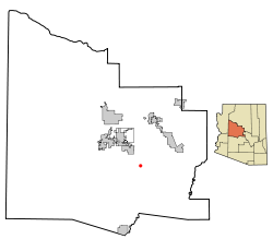
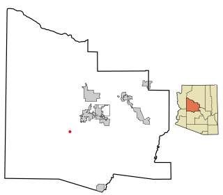
Paulden is a census designated place (CDP) in Yavapai County, Arizona, United States. The population was 5,231 at the 2010 census.

<span class="mw-page-title-main">Peeples Valley, Arizona</span> CDP in Yavapai County, Arizona

Peeples Valley is a census-designated place (CDP) in Yavapai County, Arizona, United States. The population was 374 at the 2000 census.

<span class="mw-page-title-main">Wilhoit, Arizona</span> Census-designated place in Yavapai County, Arizona, United States

Wilhoit is a census-designated place (CDP) in Yavapai County, Arizona, United States. The population was 664 at the 2000 census.

<span class="mw-page-title-main">Williamson, Arizona</span> CDP in Yavapai County, Arizona

Williamson is a census-designated place (CDP) in Yavapai County, Arizona, United States. The population was 3,776 at the 2000 census and 6,196 at the 2020 census. The name "Wiliamson" is a misnomer, perhaps propagated by federal bureaucratic error; the area has long been known as "Williamson Valley" after the major road through the area, Williamson Valley Road.

<span class="mw-page-title-main">Yarnell, Arizona</span> CDP in Yavapai County, Arizona

Yarnell is a census-designated place (CDP) in Yavapai County, Arizona, United States. The population of Yarnell was 649 at the 2010 census. Yarnell's economy is based on ranching, mining and services to travelers and retirees. Peeples Valley, three miles north, is closely linked to Yarnell.

<span class="mw-page-title-main">Home Garden, California</span> Census-designated place in California, United States

Home Garden is a census-designated place (CDP) in Kings County, California, United States. The community is about 1.5 miles (2.4 km) southeast of the city of Hanford. It is part of the Hanford–Corcoran Metropolitan Statistical Area. The population was 1,761 at the 2010 United States Census.

Roosevelt Gardens is a census-designated place (CDP) in Broward County, Florida, United States. The population was 2,749 at the 2020 census.

<span class="mw-page-title-main">Verde Village, Arizona</span> CDP in Yavapai County, Arizona

Verde Village is a census-designated place (CDP) in Yavapai County, Arizona, United States. The population was 11,605 at the 2010 census. It is a retirement and bedroom community for Cottonwood.

<span class="mw-page-title-main">Waverly, Michigan</span> Census-designated place & unincorporated community in Michigan, United States

Waverly is an unincorporated community in Eaton County in the U.S. state of Michigan. It is a census-designated place (CDP) for statistical purposes and has no legal status as a municipality. The population was 23,925 at the 2010 census, up from 16,194 at the 2000 census. Waverly is home to the Lansing Mall and Waverly Community Schools.

<span class="mw-page-title-main">Sewaren, New Jersey</span> Populated place in Middlesex County, New Jersey, US

Sewaren is an unincorporated community and census-designated place (CDP) within Woodbridge Township, in Middlesex County, in the U.S. state of New Jersey. As of the 2010 United States Census, the CDP's population was 2,756.

<span class="mw-page-title-main">Barnegat (CDP), New Jersey</span> Populated place in Ocean County, New Jersey, US

Barnegat is an unincorporated community and census-designated place (CDP) located within Barnegat Township, in Ocean County, in the U.S. state of New Jersey. As of the 2010 United States census, the CDP's population was 2,817.

<span class="mw-page-title-main">Crown Heights, New York</span> Census-designated place in New York, United States

Crown Heights is a hamlet and census-designated place (CDP) in Dutchess County, New York, United States. The population was 2,840 at the 2010 census. It is part of the Poughkeepsie–Newburgh–Middletown, NY Metropolitan Statistical Area as well as the larger New York–Newark–Bridgeport, NY-NJ-CT-PA Combined Statistical Area.

<span class="mw-page-title-main">Mission, Oregon</span> Unincorporated community in the state of Oregon, United States

Mission is an unincorporated community in Umatilla County, Oregon, United States. For statistical purposes, the United States Census Bureau has defined Mission as a census-designated place (CDP). The population was 1,019 at the 2000 census.

<span class="mw-page-title-main">Lake Ketchum, Washington</span> CDP in Washington, United States

Lake Ketchum is a census-designated place (CDP) in Snohomish County, Washington, United States. The population was 930 at the 2010 census.

<span class="mw-page-title-main">Westerly (CDP), Rhode Island</span> CDP in Rhode Island, United States

Westerly is a census-designated place (CDP) in the town of Westerly in Washington County, Rhode Island, United States. The population was 17,682 at the 2000 census. The CDP includes the majority of the town of Westerly's population, with only the rural eastern and coastal southern portions of towns excluded.

References

  1. "2020 U.S. Gazetteer Files". United States Census Bureau. Retrieved October 29, 2021.
  2. "US Gazetteer files: 2010, 2000, and 1990". United States Census Bureau. February 12, 2011. Retrieved April 23, 2011.
  3. "Census of Population and Housing". Census.gov. Retrieved June 4, 2016.
  4. "U.S. Census website". United States Census Bureau . Retrieved January 31, 2008.
  5. "2020 CENSUS - SCHOOL DISTRICT REFERENCE MAP: Yavapai County, AZ" (PDF). U.S. Census Bureau . Retrieved January 30, 2022.