
Lawrence is a village in Nassau County, New York, United States. As of the 2010 United States Census, the village population was 6,483.

The Rockaway Peninsula, commonly referred to as The Rockaways or Rockaway, is a peninsula at the southern edge of the New York City borough of Queens on Long Island, New York. Relatively isolated from Manhattan and other more urban parts of the city, Rockaway became a popular summer retreat in the 1830s. It has since become a mixture of lower, middle, and upper-class neighborhoods. In the 2010s, it became one of the city's most quickly gentrifying areas.
Howard Beach is a neighborhood in the southwestern portion of the New York City borough of Queens. It is bordered to the north by the Belt Parkway and Conduit Avenue in Ozone Park, to the south by Jamaica Bay in Broad Channel, to the east by 102nd–104th Streets in South Ozone Park, and to the west by 75th Street in East New York, Brooklyn. The area consists mostly of low-rise single-family houses.

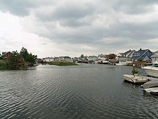
Broad Channel is a neighborhood in the southern portion of the New York City borough of Queens. It occupies the southern portion of Rulers Bar Hassock, the only inhabited island in Jamaica Bay.

Far Rockaway is a neighborhood on the eastern part of the Rockaway peninsula in the New York City borough of Queens. It is the easternmost section of the Rockaways. The neighborhood extends from Beach 32nd Street east to the Nassau County line. Its southern boundary is the Atlantic Ocean; it is one of the neighborhoods along Rockaway Beach.

Rockaway Beach is a neighborhood on the Rockaway Peninsula in the New York City borough of Queens. The neighborhood is bounded by Arverne to the east and Rockaway Park to the west. It is named for the Rockaway Beach and Boardwalk, which is the largest urban beach in the United States, stretching from Beach 3rd to Beach 153rd Streets on the Atlantic Ocean. The neighborhood, with 13,000 residents as of 2010, is also known as the "Irish Riviera" because of its large Irish American population.

The Far Rockaway Branch is an electrified rail line and service owned and operated by the Long Island Rail Road in the U.S. state of New York. The branch begins at Valley Interlocking, just east of Valley Stream station. From Valley Stream, the line heads south and southwest through southwestern Nassau County, ending at Far Rockaway in Queens, thus reentering New York City. LIRR maps and schedules indicate that the Far Rockaway Branch service continues west along the Atlantic Branch to Jamaica. This two-track branch provides all day service in both directions to Grand Central Madison and Penn Station, both in Midtown Manhattan

Hog Island was the name of two islands near Long Island, New York until the 1890s. One is the present day Barnum Island, which includes the villages of Island Park and Harbor Isle in Nassau County. The other was a mile-long (1600 m) barrier island that existed to the south of Rockaway Beach in Queens before being mostly destroyed by the 1893 New York hurricane and completely lost to erosion and storm damage by 1902.

Triboro Coach Corporation was a bus company in New York City, United States, operating local service in Queens and express routes to Manhattan until February 20, 2006, when MTA Bus took over all of its bus operations and services.

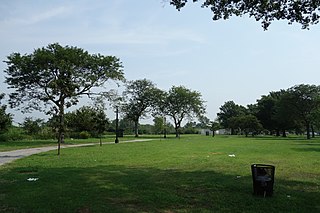
Jacob Riis Park, also called Jacob A. Riis Park and Riis Park, is a seaside park on the southwestern portion of the Rockaway Peninsula in the New York City borough of Queens. It lies at the foot of the Marine Parkway–Gil Hodges Memorial Bridge, east of Fort Tilden, and west of Neponsit and Rockaway Beach. Originally run by the New York City Department of Parks and Recreation, it later became part of the Jamaica Bay Unit of the Gateway National Recreation Area, and is managed by the National Park Service (NPS). It features an extensive sand beach along the Atlantic Ocean coastline and several historic Art Deco structures.

Green Bus Lines, also referred to simply as Green Lines, was a private bus company in New York City, United States. It operated local service in Queens and express service to Manhattan until January 9, 2006, when the city-operated MTA Bus Company took over its routes. It was managed most recently by Jerome Cooper (1928–2015).
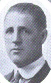
William Frank Brunner was an American businessman and politician who four terms served as a member of the U.S. House of Representatives from New York from 1929 to 1935.

Far Rockaway High School was a public high school in New York City, at 821 Bay 25th Street in Far Rockaway in the borough of Queens. It operated from 1897 to 2011. Its alumni include three Nobel Prize laureates and convicted fraudster Bernard Madoff.
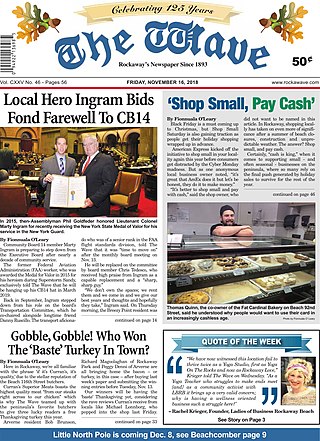
The Wave is the longest-lived and most widely circulated newspaper in the Rockaway Peninsula, New York City Borough of Queens. The weekly newspaper, currently under Editor In Chief Mark C. Healey, is well known to Rockaway residents for coverage of community events and local politics. The paper contains considerable historical information about Rockaway, largely provided by historian Emil Lucev. The Wave's US Postal Statement of Management and Circulation for 2018 indicates the paper was sold to the owners of The Queens Ledger group ending 125 years of independent local control and ownership. Since 2018, the new publisher, lifelong Queens resident, Walter H. Sanchez and his son, John Sanchez, have continued the local charm of the paper with a number of glossy editions including the yearly Rockaway Almanac, Summer Guide, Anniversary Issue and a yearly glossy Rockaway Health and Wellness Guide. On October 1st 2022 The Wave operated a 'Rockaway Family Fun Day Festival' on Beach 116th Street - featuring live bands, rides, health agencies like St. Johns Episcopal Hospital and The Joseph P. Addabbo Family Health Center. The event was also the debut of the yearly 'Meat-Up-Grill' Burger Eating Contest.

The Q35 bus route constitutes a public transit line in southeast Brooklyn as well as the Rockaway Peninsula of southern Queens in New York City. The Q35 is operated by MTA Regional Bus Operations under the MTA Bus Company brand, but was formerly privately operated by Green Bus Lines. The bus provides service between Midwood in central Brooklyn to Rockaway Park on the Rockaway Peninsula, running mainly along Flatbush Avenue in Brooklyn and Newport Avenue on the Rockaway Peninsula. The route utilizes the Marine Parkway–Gil Hodges Memorial Bridge to cross between Brooklyn and Queens.

Peninsula Nursing and Rehabilitation Center, formerly known as Rockaway Beach Hospital and Peninsula General Hospital, was a community hospital in the Far Rockaway neighborhood of Queens, New York. PHC, founded in 1908, which opened on April 30, 1911, was an affiliate of the MediSys Health Network at the time of its 2012 closure.

The Q11, Q21, Q52, and Q53 bus routes constitute a public transit corridor running along Woodhaven and Cross Bay Boulevards in Queens, New York City. The corridor extends primarily along the length of the two boulevards through "mainland" Queens, a distance of 6 miles (9.7 km) between Elmhurst and the Jamaica Bay shore in Howard Beach. The Q52 and Q53 buses, which provide Select Bus Service along the corridor, continue south across Jamaica Bay to the Rockaway peninsula, one of the few public transit options between the peninsula and the rest of the city.
Edgemere Landfill is a former municipal landfill located in Edgemere on the Rockaway peninsula in Queens, New York City. It is located on a man-made peninsula on the Jamaica Bay shoreline, at the eastern end of the Rockaway peninsula. A portion of the site is currently open to the public as Rockaway Community Park. The entire site is owned by the New York City Department of Parks and Recreation.

The Rockaway Beach and Boardwalk is a public park in Rockaway, Queens, New York, composed of the 170-acre (69 ha) Rockaway Beach and the adjacent 5.5-mile (8.9 km) Rockaway Boardwalk. The beach runs from Beach 9th Street in Far Rockaway to Beach 149th Street in Neponsit, a distance of 7 miles (11 km). The boardwalk, a concrete deck, runs from Beach 9th Street to Beach 126th Street in Rockaway Park, at the edge of Belle Harbor. There are also numerous recreational facilities within the park, parallel to the beach and boardwalk.
