All Saints' Church is no longer used for church services. It was owned by Kit Hesketh-Harvey[4] until his death in 2023.[5]
The village has many small businesses such as two takeaway shops, a hairdresser, wood yard, DIY hardware shop & metalworks workshop, funeral directors, and a corner shop. There is also a thriving community-owned pub, The Blue Bell Pub-Cafe which was bought by the local community on 30 June, 2021 and, after extensive refurbishment reopened on 4 June 2022.
Historical references
In 1805, Stoke Ferry is described[6] as being "distant from London 88 miles 2 furlongs; on the Stoke river, which is navigable to this place from the Ouse. Fair, December 6...on the right, 5 m is the seat of Robert Wilson, esq. Inn, Crown."
The village was serving as a post town (under the name 'Stoke') by 1775; the name had been changed to 'Stoke Ferry' by 1816. A type of postmark known as an undated circle was issued to the village in 1828, and it had a Penny Post service, under Brandon (in Suffolk), between 1835 and 1840.
Many photographs of the village can be found in a collection published in 2007 available to purchase at £4.95 from Bonnetts Hardware & DIY in the village.[7]
It once had its own railway station, the terminus of the Downham and Stoke Ferry Railway, a branch from the main line between Cambridge and King's Lynn. It stopped service in the early 1965. From the early 2000s it was used as a wood yard which moved to its new home on Boughton Road North. The site of the old station is currently being developed as a housing complex which will retain its Grade II listed buildings,
There is still a thriving blacksmith's shop, Thomas B. Bonnette, in the heart of the village that has been trading over 100 years. As well as ironwork, they also sell hardware, plumbing supplies, timber and steel. As well as a hairdressers, there are take-aways and many other small businesses that help make Stoke Ferry such a vibrant village.
Hoveton is a village and civil parish in the English county of Norfolk. It is located within the Norfolk Broads, and immediately across the River Bure from the village of Wroxham. Whilst Hoveton is north of the river, Wroxham is south; but many people refer to the whole settlement as "Wroxham".
Welney is a village and civil parish in the Fens of England, and the county of Norfolk. The village is about 10 miles (16 km) south-west of the town of Downham Market, 20 miles (30 km) south of the town of King's Lynn and 45 miles (70 km) west of the city of Norwich. The county boundary with Cambridgeshire is adjacent, with the city of Cambridge 25 miles (40 km) to the south.
Downham Market, sometimes simply referred to as Downham, is a market town and civil parish in Norfolk, England. It lies on the edge of the Fens, on the River Great Ouse, approximately 11 miles south of King's Lynn, 39 miles west of Norwich and 30 miles north of Cambridge.
Marham is a village and civil parish in the English county of Norfolk, approximate 12 miles (19 km) away from King's Lynn. An RAF station, RAF Marham, is situated nearby at Upper Marham. The village covers an area of 1,485 ha and had a population of 2,951 in 788 households as of the 2001 census, increasing to 3,531 at the 2011 Census.
West Dereham is a village and civil parish in the English county of Norfolk. It covers an area of 13.51 km2 (5.22 sq mi) and had a population of 450 at the 2011 Census. For the purposes of local government, it falls within the district of King's Lynn and West Norfolk.
Northwold is a village and civil parish in the English county of Norfolk. It covers an area of 19.72 km2 (7.61 sq mi) and had a population of 1,070 in 448 households at the 2001 census, increasing to 1,085 at the 2011 Census. For the purposes of local government, it falls within the district of King's Lynn and West Norfolk. The civil parish also includes the hamlets of Whittington and Little London.
Barton Bendish is a civil parish and small ancient village in the English county of Norfolk located 10 miles (16 km) south of King's Lynn and 90 miles (140 km) North East of London. It has two medieval parish churches, and once had three. The parish includes the old hamlet of Eastmoor, and covers 3,936 acres (1,593 ha). The village has been settled since Neolithic times and was expanded during the Saxon period. Today the village has a population of 210 as recorded at the 2010 census and contains eight listed buildings, with the two medieval parishes churches being Grade I.
Bawsey is a village and civil parish in the English county of Norfolk. The village is about 4 miles (6.4 km) east of the town of King's Lynn and 40 miles (64 km) west of the city of Norwich. The village sits astride of the B1145 Kings Lynn to Mundesley road that dissects North Norfolk west to east.
Wretton is a village and civil parish in the English county of Norfolk. It covers an area of 4.7 km2 (1.8 sq mi) and had a population of 392 in 155 households at the 2001 census. For the purposes of local government, it falls within the district of King's Lynn and West Norfolk.
Litcham is a village and civil parish in the English county of Norfolk. It is situated some 10 km (6.2 mi) north-east of the town of Swaffham and 40 km (25 mi) west of the city of Norwich. The village is located on the B1145 a route which runs between King's Lynn and Mundesley.
Wormegay is a civil parish in the English county of Norfolk. The village is situated some 9 kilometres south of King's Lynn and 60 km (37 mi) west of Norwich.
Wimbotsham is a village and civil parish in the English county of Norfolk. It is situated close to the River Great Ouse, 2 km (1.2 mi) north of the town of Downham Market, 18 km (11 mi) south of the town of King's Lynn, and 60 km (37 mi) west of the city of Norwich. It covers an area of 6.04 km2 (2.33 sq mi) and had a population of 558 in 262 households at the 2001 census, the population including Bexwell and increasing to 664 at the 2011 Census. For the purposes of local government, it falls within the district of King's Lynn and West Norfolk.
Watlington is a village, civil parish and electoral ward in the English county of Norfolk. It covers an area of 6.93 km2 (2.68 sq mi) and had a population of 2,031 in 852 households at the 2001 census, the population increasing to 2,455 at the 2011 Census. It is in the district of King's Lynn and West Norfolk.
West Lynn is a suburb of King's Lynn in Norfolk, England. It is the part of the town lying on the west bank of the River Great Ouse, linked to the main part of the town on the east bank by a passenger ferry or by a more circuitous 4 km road journey.
Wereham is a small village and civil parish in the English county of Norfolk.
Gayton is a village and civil parish in the English county of Norfolk. The village is located 6 miles (9.7 km) east of King's Lynn and 32 miles (51 km) north-west of Norwich, along the Gaywood River and the B1145 between King's Lynn and Mundesley.
Stoke Holy Cross is a village in South Norfolk which lies approximately 4 miles (6.4 km) south of Norwich.
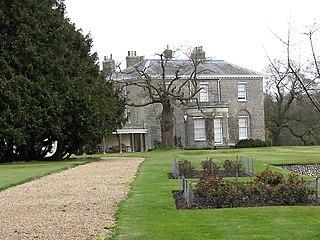
Stow Bardolph, sometimes simply referred to as Stow, is an estate and civil parish in the English county of Norfolk, lying between King's Lynn and Downham Market on the A10.
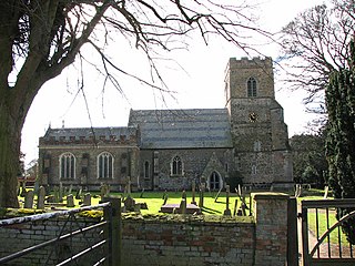
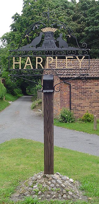
Harpley is a village and civil parish in the English county of Norfolk. It covers an area of 9.29 km2 (3.59 sq mi) and had a population of 353 in 157 households at the 2001 census, the population reducing to 338 at the 2011 Census. For the purposes of local government, it falls within the district of King's Lynn and West Norfolk.
Nordelph is a civil parish near Downham Market in the English county of Norfolk.
This page is based on this Wikipedia article Text is available under the CC BY-SA 4.0 license; additional terms may apply. Images, videos and audio are available under their respective licenses.