
Mount Charleston, including Charleston Peak at 11,916 feet (3,632 m), is the highest mountain in both the Spring Mountains and Clark County, in Nevada, United States. It is the eighth-highest mountain in the state. Well separated from higher peaks by large, low basins, Charleston Peak is the most topographically prominent peak in Nevada, and the eighth-most-prominent peak in the contiguous United States. It is one of eight ultra-prominent peaks in Nevada. It is located about 35 miles (56 km) northwest of Las Vegas within the Mount Charleston Wilderness, which is within the Spring Mountains National Recreation Area of the Humboldt–Toiyabe National Forest.
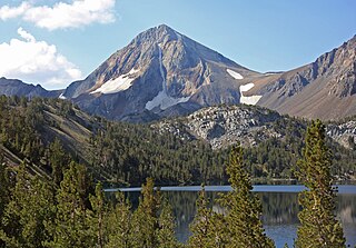
Red Slate Mountain is a summit in the Sierra Nevada. It lies along the Sierra Crest that divides Fresno County from Mono County, California.

Mount Humphreys is a mountain peak in the Sierra Nevada on the Fresno-Inyo county line in the U.S. state of California. It is the 14th highest peak in California, and the highest peak in the Bishop area. The mountain was named by the California Geological Survey of 1873 for Andrew A. Humphreys, the chief engineer of the United States Army at the time.
Ruby Dome is the highest mountain in both the Ruby Mountains and Elko County, in Nevada, United States. It is the twenty-seventh-highest mountain in the state, and also ranks as the thirteenth-most topographically prominent peak in the state. The peak is located about 21 miles (34 km) southeast of the city of Elko within the Ruby Mountains Ranger District of the Humboldt-Toiyabe National Forest. The mountain rises from a base elevation of about 6,000 feet (1,800 m) to a height of 11,387 feet (3,471 m). It is the highest mountain for over 90 miles in all directions.

Frenchman Mountain is located east of Las Vegas in the U.S. state of Nevada. Made up of rocks similar to those found on the bottom of the Grand Canyon, Frenchman Mountain formed when faulting elevated and tilted the rocks followed by erosion, giving it its sharp triangular profile. The mountain provides an example of the Great Unconformity with the tilted Paleozoic Tapeats Sandstone underlain by Paleoproterozoic Vishnu Schist, which is some of the oldest rock on the North American continent, having been created about two billion years ago.

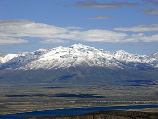
Humboldt Peak is the southernmost high summit in the East Humboldt Range of Elko County in northeastern Nevada. To the west are First and Second Boulder Canyons, to the south is Pole Canyon and Secret Pass, and to the east is the South Fork of Steele Creek and Clover Valley. The summit is the end of a high crest running almost 10 miles (16 km) to the north, and the beginning of a slow descent to Ruby Valley to the southeast. The summit, the fourth highest peak in the range, is located about 16 miles (26 km) southwest of the community of Wells. The mountain is in the East Humboldt Wilderness and Humboldt National Forest.

Currant Mountain is the highest mountain in the White Pine Range in White Pine County, Nevada, United States. It is the twenty-first-highest mountain in the state, and also ranks as the sixteenth-most topographically prominent peak in the state. Its summit consists of a series of three spires on a thin limestone ridge, with the southern spire being the highest at 11,518 feet (3,511 m). To the west are the Duckwater (Shoshone) tribal lands and the northern arm of large Railroad Valley. To the east is the northern part of White River Valley. The peak is located about 37 miles (60 km) southwest of the community of Ely near the Nye County border, within the Currant Mountain Wilderness of the Humboldt-Toiyabe National Forest.

Arc Dome is the highest mountain of the Toiyabe Range in northwestern Nye County, Nevada, United States. It is the thirteenth-highest mountain in the state. Arc Dome also ranks as the second-most topographically prominent peak in Nye County and the eighth-most prominent peak in the state. The peak is located about 53 miles (85 km) north of the community of Tonopah, within the Arc Dome Wilderness of the Humboldt-Toiyabe National Forest.

Ward Mountain is the high point of the Egan Range in south-central White Pine County of eastern Nevada. It ranks thirty-fourth among the most topographically prominent peaks in the state. The summit, part of a three mile long crest, is located just 10 miles (16 km) south of the city of Ely. The Ward Charcoal Ovens State Historic Park is located on the mountain's eastern flank.

Mount Jefferson is the highest mountain in both the Toquima Range and Nye County in Nevada, United States. It is the sixth highest mountain in the state. As the high point of a range which is well separated from other ranges by low basins, Mount Jefferson has a high topographic prominence of 5,861 feet (1,786 m). This makes it the most prominent peak in Nye County and the third most prominent peak in Nevada. For similar reasons, it is also the highest mountain for over 90 miles in all directions. It is located about 50 miles (80 km) northeast of the county seat of Tonopah within the Alta Toquima Wilderness of the Humboldt-Toiyabe National Forest, near the smaller towns of Carvers and Round Mountain. Three distinct summits are located on a broad area of subalpine tundra: North Summit rises to 11,820 feet (3,603 m), Middle Summit to 11,692 feet (3,564 m), and South Summit to 11,949 feet (3,642 m). During the Pleistocene, alpine glaciers eroded several cirques east of the summit plateau.

North Schell Peak is the highest mountain in the Schell Creek Range of White Pine County, Nevada, United States. It is the ninth-highest mountain in the state, and also ranks as the fifth-most topographically prominent peak in the state. The summit is 19 miles (31 km) northeast of the community of Ely within the High Schells Wilderness of the Humboldt-Toiyabe National Forest.

Troy Peak is the highest mountain in the Grant Range in northeastern Nye County, Nevada, United States. It is the thirty-sixth highest mountain in Nevada. Troy Peak also ranks as the third-most topographically prominent peak in Nye County and the fourteenth-most prominent peak in the state. The summit is located 72 miles (116 km) southwest of the city of Ely, within the Grant Range Wilderness of the Humboldt-Toiyabe National Forest.

Mount Wilson is a mountain located in the Spring Mountain range of southern Nevada. It is located on land managed by the United States Bureau of Land Management as the Red Rock Canyon National Conservation Area, part of the Rainbow Mountain Wilderness Area. It is the highest peak in the Red Rock Canyon National Conservation Area.

Spirit Mountain, also known as Avi Kwa' Ame in Mojave, is a mountain in the Laughlin, Nevada area that is listed on the United States National Register of Historic Places. It is the highest point in the Newberry Mountains in Nevada with the summit peak at 5,639 feet. Spirit Mountain is also the highest point in the Spirit Mountain Wilderness.
Black Mountain is a landmark mountain south of the Las Vegas Valley. It is one of the more prominent of the mountains in the McCullough Range.

Yucca Mountain is a mountain in Nevada, near its border with California, approximately 100 miles (160 km) northwest of Las Vegas. Located in the Great Basin, Yucca Mountain is east of the Amargosa Desert, south of the Nevada Test and Training Range and in the Nevada National Security Site. It is the site of the Yucca Mountain nuclear waste repository, which is currently identified by Congressional law as the nation's spent nuclear waste storage facility. However, while licensure of the site through the Nuclear Regulatory Commission is ongoing, political maneuvering led to the site being de-funded in 2010.

Potosi Mountain is a mountain about 30 miles (50 km) southwest of Las Vegas in the Spring Mountains, in Clark County of southern Nevada.
The Mountain States form one of the nine geographic divisions of the United States that are officially recognized by the United States Census Bureau. It is a subregion of the Western United States.

Fortification Hill is a prominence adjacent to Lake Mead in the Lake Mead National Recreation Area; it is located at the northwest terminus region of the Black Mountains (Arizona), and specifically the north region of the Black Mountains. It is near a southern section of Lake Mead, and just northeast of Hoover Dam. It can easily be seen eastward across Las Vegas Bay or from the two northern mountain terminuses of Eldorado Mountains (Nevada), or the Black Mountains (Arizona).
