
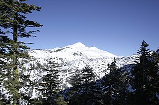
Jobs Peak located in Alpine County, California, is the most prominent peak visible from the Carson Valley in Douglas County, Nevada. The peak offers hiking and backcountry skiing with the view of Lake Tahoe. It is in the Humboldt-Toiyabe National Forest.

Castle Peak is a mountain in California's Sierra Nevada near I-80, Donner Pass, and the Nevada border. It is in the Tahoe National Forest not far off the Pacific Crest Trail, and adjacent to Castle Pass. It was originally named Mount Stanford by the Whitney Survey of 1860–74.
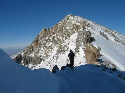
Pyramid Peak is a mountain in the California's Sierra Nevada in the Crystal Range to the west of Lake Tahoe. It is the highest point in the Desolation Wilderness. With an elevation gain of almost 4,100 feet (1,250 m), the Rocky Canyon route is the mountain's most popular approach although it is very arduous. To the east, at the base of the peak, lies Pyramid Lake.

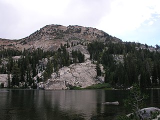
McConnell Peak is a mountain in the Sierra Nevada mountain range at the north end of the Crystal Mountains, to the west of Lake Tahoe. It is located in the Desolation Wilderness in El Dorado County, California.
Silver Peak is a mountain in the Sierra Nevada mountain range at the north end of the Crystal Mountains, to the east of Lake Tahoe. It is located in the Desolation Wilderness in El Dorado County, California.
Red Peak is a mountain in the Sierra Nevada mountain range at the north end of the Crystal Range, to the west of Lake Tahoe. It is located in the Desolation Wilderness in El Dorado County, California.

Ralston Peak is a mountain in the Sierra Nevada mountain range to the west of Lake Tahoe within the Desolation Wilderness in El Dorado County, California. Ralston Peak is a very popular mountain to summit for the views of the wilderness area as it lies very near U.S. Route 50. The closest trailhead to the summit can be found in Camp Sacramento a few miles west of Echo Summit. Ralston Peak can also be accessed from the Pacific Crest Trail between Echo Lake and Lake Aloha. Starting at the nearest trailhead, this route is significantly longer than the trail from Camp Sacramento. But the altitude gain on this route is much less, and the trail is much less steep.

Phipps Peak is a mountain in the Sierra Nevada to the west of Emerald Bay and Lake Tahoe; and to the east of Rockbound Valley and the Crystal Range. The peak is in El Dorado County, California and the Desolation Wilderness.
Rubicon Peak is a mountain in the Sierra Nevada mountain range to the west of Lake Tahoe in the Desolation Wilderness in El Dorado County, California.

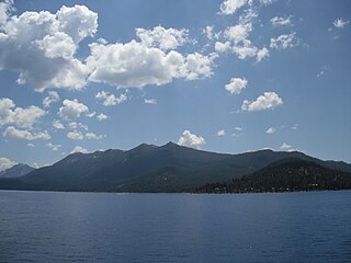
Mount Tallac is a mountain peak southwest of Lake Tahoe, in El Dorado County, California. The peak lies within the Desolation Wilderness in the Eldorado National Forest. It is quite visible from State Routes 89 and 28, and U.S. Route 50. A "cross of snow" is clearly visible on the mountain's face during the winter, spring, and early summer months.

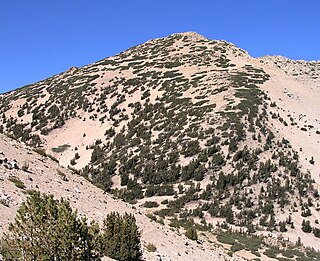
Red Lake Peak is believed to be the vantage point from which John C. Fremont and Charles Preuss made the first recorded sighting of Lake Tahoe by Europeans in February 1844 as Fremont's exploratory expedition made a desperate crossing of the Sierra Nevada through what is now Carson Pass on their way to obtain provisions at Sutter's Fort. The peak lies just north of the pass and generally northwest of the small lake east of the pass for which the peak is named. Lake Tahoe and Stevens Peak are visible to the north from the peak. Elephants Back and Round Top can be seen to the south.

Granite Chief is a mountain located in the Sierra Nevada near Lake Tahoe. The mountain rises to an elevation of 9,010 feet (2,746 m) and receives consistent heavy snowfall during the winter months.

Mount Lola is a mountain in the Sierra Nevada of California. Its summit, located north of Donner Pass and Interstate 80, is the highest point in Nevada County. It is also the highest point in the Sierra Nevada north of Interstate 80. A subsidiary peak 1.2 miles (1.9 km) north of the main summit is highest point in Sierra County at 8,848 feet (2,697 m) NAVD 88.

Leavitt Peak is located in the Emigrant Wilderness near Sonora Pass in the eastern Sierra Nevada range of California. Leavitt Peak is located on the Tuolumne County - Mono County line. The Pacific Crest Trail runs close to the east of Leavitt Peak, at an elevation of about 10,800 feet (3,290 m) elevation. The peak offers views south to Yosemite National Park and north towards South Lake Tahoe.

Mokelumne Peak is a peak in the Mokelumne Wilderness, Sierra Nevada, Amador County, California, consisting of metamorphic and granitic rock.
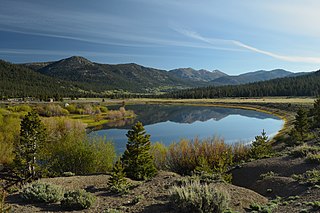
Hope Valley is a broad mountain valley in Alpine County, California, located on the eastern slope of the Sierra Nevada to the northeast of Carson Pass and south of Lake Tahoe. The valley served as a major thoroughfare for the passage of settlers and emigrants to and from California during the Gold Rush era. Sitting at an elevation of just above 7,000 feet (2,100 m) and framed by peaks reaching over 10,000 feet (3,000 m) high, Hope Valley is known for its wide vistas, fly fishing, fall colors, and winter activities.

Jakes Peak is a 9,187-foot-elevation (2,800-meter) mountain summit located in the Sierra Nevada mountain range in El Dorado County, California, United States. It is set within the Desolation Wilderness, on land managed by Eldorado National Forest. This iconic peak is situated above the southwest shore of Lake Tahoe, and approximately seven miles (11 km) northwest of the community of South Lake Tahoe. Topographic relief is significant as the east aspect rises 2,950 feet above the lake in 1.5 miles (2.4 km).
Jobs Sister is a mountain summit located near Lake Tahoe in northern California.
Needle Peak is an 8,971-foot-elevation (2,734 meter) mountain summit in Placer County, California, United States.

Twin Peaks is an 8,878-foot-elevation (2,706 meter) double summit mountain in Placer County, California, United States.

