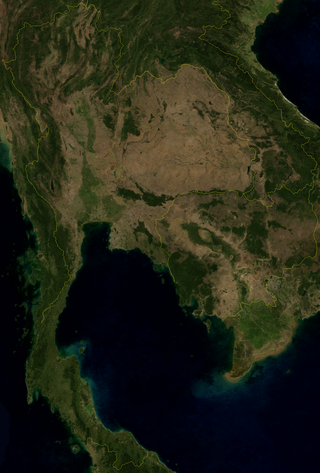
Thailand is in the middle of mainland Southeast Asia. It has a total size of 513,120 km2 (198,120 sq mi) which is the 50th largest in the world. The land border is 4,863 km (3,022 mi) long with Myanmar, Cambodia, Laos and Malaysia. The nation's axial position influenced many aspects of Thailand's society and culture. It controls the only land route from Asia to Malaysia and Singapore. It has an exclusive economic zone of 299,397 km2 (115,598 sq mi).
Chiang Rai is one of Thailand's seventy-six provinces, which lies in upper northern Thailand and is Thailand's northernmost province. It is bordered by the Shan State of Myanmar to the north, Bokeo province of Laos to the east, Phayao to the south, Lampang to the southwest, and Chiang Mai to the west. The provinces is linked to Houayxay Laos by the Fourth Thai–Lao Friendship Bridge that spans the Mekong.

Chiang Mai is the second largest Province (changwat) of Thailand. It lies in upper northern Thailand and has a population of 1.78 million people. It is bordered by Chiang Rai to the northeast, Lampang and Lamphun to the south, Tak to the southwest, Mae Hong Son to the west, and Shan State of Burma to the north. The capital, Chiang Mai, is 685 kilometres (426 mi) north of Bangkok.

Doi Inthanon is the highest mountain in Thailand. It is in Chom Thong District, Chiang Mai Province. This mountain is an ultra prominent peak, known in the past as Doi Luang or Doi Ang Ga, meaning the 'crow's pond top'. Near the mountain's base was a pond where many crows gathered. The name Doi Inthanon was given in honour of Inthawichayanon, the last King of Chiang Mai, who was concerned about the forests in the north and tried to preserve them. He ordered that, after his death, his remains be interred at Doi Luang, which was then renamed in his honour.
Mae Hong Son province, also spelled Maehongson, Mae Hong Sorn or Maehongsorn, is one of Thailand's seventy-six provinces (changwat). It lies in upper northern Thailand and is the westernmost province. Neighboring provinces are Shan State of Myanmar, Chiang Mai and Tak. To the west, the province borders Kayin State and Kayah State of Myanmar.

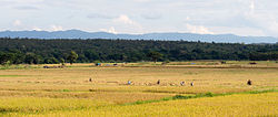
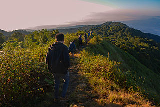
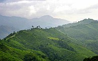
Northern Thailand, or more specifically Lanna, is geographically characterised by several mountain ranges, which continue from the Shan Hills in bordering Myanmar to Laos, and the river valleys which cut through them. Though like most of Thailand, it has a tropical savanna climate, its relatively high elevation and latitude contribute to more pronounced seasonal temperature variation, with cooler winters than the other regions.

Chiang Dao is a district (amphoe) of Chiang Mai province in northern Thailand. It is nicknamed "little Tuscany" and several wines are produced in the area.

The Ruak River is a right hand tributary of the Mekong. The mouth of the Ruak river is at the Thai-Burma border opposite Laos, a spot known as the "Golden Triangle", a popular tourist destination.

Mae Salong, officially known as Santikhiri, is a village in the Thai highlands on Doi Mae Salong mountain of the Daen Lao Range, in Mae Fa Luang District, Chiang Rai Province, the northernmost province of Thailand. The area has an alpine-like landscape and climate, and is known for its hill tribe villages, tea plantations, and cherry blossoms.
Doi Suthep (ดอยสุเทพ), is a mountain ("doi") west of Chiang Mai, Thailand. It is 1,676 metres (5,499 ft) in elevation and is one of the twin peaks of a granite mountain. The other peak is known as Doi Pui and is slightly higher.

The Shan Hills, also known as Shan Highland, is a vast mountainous zone that extends through Yunnan to Myanmar and Thailand. The whole region is made up of numerous peaks separated mostly by narrow valleys, as well as a few broader intermontane basins. The ranges in the area are aligned in such a way that they link to the foothills of the Himalayas further to the northwest.

Doi Tung (ดอยตุง) is a mountain in the Thai highlands of Mae Fa Luang District, Chiang Rai Province, Thailand.

The Daen Lao Range is a mountain range of the Shan Hills in eastern Burma and northern Thailand. Most of the range is in Shan State, with its northern limit close to the border with China, and runs southwards across the Thai border, at the northern end of Thailand.

The Luang Prabang Range, named after Luang Prabang, is a mountain range straddling northwestern Laos and Northern Thailand. Most of the range is located in Sainyabuli Province (Laos), as well as Nan and Uttaradit Provinces (Thailand), with small parts in Phitsanulok and Loei Provinces. Several rivers such as the Nan, Pua and Wa rivers, have their sources in this range. Phu Fa waterfall, the biggest and the tallest waterfall in Nan Province, is also located in these mountains. This range is part of the Luang Prabang montane rain forests ecoregion.

The Khun Tan Range is a mountain range that occupies a central position in Northern Thailand. Most of the range is located in Chiang Mai, western Chiang Rai, Lampang and Lamphun Provinces.

The Phi Pan Nam Range, also Pee Pan Nam, is a 400 km (249 mi) long system of mountain ranges in the eastern half of the Thai highlands. The range lies mostly in Thailand, although a small section in the northeast is within Sainyabuli and Bokeo provinces of Laos.

The Thanon Thong Chai Range is a mountain range in northern Thailand. Its tallest peak is Doi Inthanon, the highest point in Thailand. Most of the range is in Chiang Mai Province, with parts in Mae Hong Son and Lamphun Provinces.

The Dawna Range, also known as Dawna Hills, is a mountain range in eastern Burma and northwestern Thailand. Its northern end is located in Kayah State where it meets the Daen Lao Range, a subrange of the Shan Hills. The range runs southwards along Kayin State as a natural border with Mon State in the west forming parallel ranges to the northern end of the Tenasserim Hills further south and southeast. The Dawna Range extends east of the Salween southwards from the Shan Hills for about 350 km, at the western limit of the Thai highlands. Its southern end reaches the Thai-Myanmar border in the Umphang area, entering Thailand west of Kamphaeng Phet. The Thungyai Naresuan Wildlife Sanctuary is in the Thai side of the range.
The Kayah–Karen montane rain forests is a tropical moist broadleaf forest ecoregion on Mainland Southeast Asia. The montane rain forests cover several connected mountain ranges, including the Daen Lao Range, the Dawna Range, the Karen Hills, the Khun Tan Range, and the Thanon Thong Chai Range.

The Myanmar–Thailand border is the international border between the territory of Myanmar and Thailand. The border is 2,416 km (1,501 mi) in length and runs from the tripoint with Laos in the north to Andaman Sea coast in the south.
 Doi Phu Kha area, Nan Province at the eastern end close to the Lao border
 Wat Phra That Doi Wao and the Daen Lao Range
 Hills, Mae Hong Son Province at the west end of the highlands
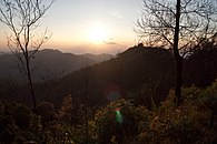 Namtok Mae Surin National Park, Mae Hong Son Province
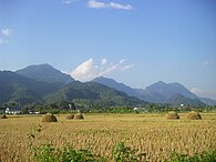 Doi Nang Non, "Mountain of the Sleeping Lady"