The University of Minnesota system is a public university system with five campuses spread across the U.S. state of Minnesota.
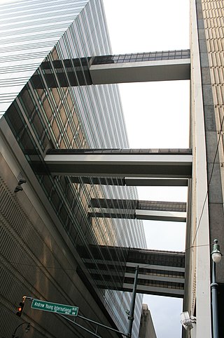
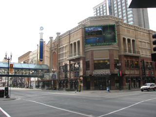
A skyway, skybridge, skywalk, or sky walkway is an elevated type of pedway connecting two or more buildings in an urban area, or connecting elevated points within mountainous recreational zones. Urban skyways very often take the form of enclosed or covered footbridges that protect pedestrians from the weather. Open-top modern skyways in mountains now often have glass bottoms. Sometimes enclosed urban skywalks are made almost totally from glass, including ceilings, walls and floors. Also, some urban skyways function strictly as linear parks designed for walking.

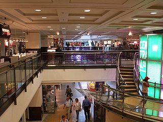
An underground city is a series of linked subterranean spaces that may provide a defensive refuge; a place for living, working or shopping; a transit system; mausolea; wine or storage cellars; cisterns or drainage channels; or several of these. Underground cities may be currently active modern creations or they may be historic including ancient sites, some of which may be all or partially open to the public.

The University of Minnesota is a public land-grant research university in the Twin Cities of Minneapolis and Saint Paul, Minnesota, United States. The Twin Cities campus comprises locations in Minneapolis and Falcon Heights, a suburb of St. Paul, approximately 3 mi (4.8 km) apart. The Twin Cities campus is the oldest and largest in the University of Minnesota system and has the ninth-largest main campus student body in the United States, with 52,376 students at the start of the 2021–22 academic year. It is the flagship institution of the University of Minnesota System, and is organized into 19 colleges, schools, and other major academic units.

The McNamara Alumni Center at the University of Minnesota's Twin Cities campus in Minneapolis, Minnesota. Designed by Antoine Predock, it is one of the more architecturally striking buildings in the Twin Cities. The building, opened in 2000, contains two main components: University office space and 10 meeting rooms for University and public use. The University owns the land, but the University of Minnesota Gateway Corporation, consisting of the U of M Foundation and U of M Alumni Association, owns the structure.
RÉSO, commonly referred to as the Underground City, is the name applied to a series of interconnected office towers, hotels, shopping centres, residential and commercial complexes, convention halls, universities and performing arts venues that form the heart of Montreal's central business district, colloquially referred to as Downtown Montreal. The name refers to the underground connections between the buildings that compose the network, in addition to the network's complete integration with the city's entirely underground rapid transit system, the Montreal Metro. Moreover, the first iteration of the Underground City was developed out of the open pit at the southern entrance to the Mount Royal Tunnel, where Place Ville Marie and Central Station stand today.
WLOL is a radio station in the Twin Cities region of Minnesota. It broadcasts a Catholic Radio format and is part of the Relevant Radio network. WLOL's transmitter is located along the Minnesota River in Savage.

Area code 651 is the telephone numbering plan code for Saint Paul, Minnesota, and the eastern suburbs of the Twin Cities. A dogleg portion also extends to the southeast along the Mississippi River to include cities such as Hastings. The region was the fifth area code created in the state in 1998, when it was carved out of area code 612.
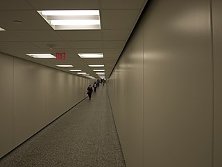
The Houston tunnel system is a network of subterranean, climate-controlled, pedestrian walkways that links 95 full city blocks 20 feet (6 m) below Houston's downtown streets. It is approximately six miles (9.7 km) long. There are similar systems in Chicago, Dallas, Oklahoma City, Montreal, and Toronto. Architectural historian Stephen Fox has stated that the idea for the tunnel system came when the Bank of the Southwest Building was "linked by tunnel to the 1010 Garage and the Mellie Esperson Building" in 1961.

The Twin Cities Assembly Plant is a former Ford Motor Company manufacturing facility in Saint Paul, Minnesota, United States, that operated from 1925 to 2011. In 1912, Ford's first assembly and sales activities in Minnesota began in a former warehouse in Minneapolis. By 1925, Ford had relocated its local operations to the bluffs above the Mississippi River in the Highland Park neighborhood of Saint Paul. In 2006, Ford officials announced plans to close the factory, though it operated for three years past the 2008 closure date initially announced. At the time of its closure, it was the oldest Ford plant in continuous operation. The plant's final truck was completed on December 16, 2011. All of the facility's buildings were demolished and the site underwent extensive environmental remediation in the late 2010s, paid for by the Ford company. Following a multi-year planning and community engagement process, the site was sold to the Ryan Companies, who began redevelopment of the site in 2020 as Highland Bridge, a 122-acre residential and commercial district.

Downtown East is an official neighborhood in Minneapolis, Minnesota, United States. Within Downtown East is the Mill District, which contains former industrial buildings left over from the days when Minneapolis was the flour milling capital of the world. Many of these old mills and factories are being converted to housing, bringing a residential population to a neighborhood that beforehand didn't have many residents. Because of this, the Mill District in Downtown East is one of the fastest growing areas of the city.

The Winnipeg Walkway System, also known as the Winnipeg Skywalk, is a network of pedestrian skyways and tunnels connecting a significant portion of downtown Winnipeg, Manitoba.

Downtown Saint Paul is the central business district of Saint Paul, Minnesota, United States. Its boundaries are the Mississippi River to the south, University Avenue to the north, US 52 to the east, and Kellogg Avenue to the west. It is bounded by the Dayton's Bluff, Summit-University, West Seventh, Frogtown, West Side, and Payne-Phalen neighborhoods. The West Side neighborhood is on the other side of the river, and can be accessed via the Robert Street Bridge or the Wabasha Street Bridge. Interstate 35E and Interstate 94 run through the north side of the neighborhood, providing a separation between the Minnesota State Capitol and other state government buildings with the rest of downtown.


Selby Avenue is a street in Saint Paul, Minnesota, United States, that runs east–west from Summit Avenue near downtown toward the Mississippi River. The street runs through the Summit-University and Union Park neighborhoods. The street, especially between Dale Street and Snelling Avenue, has been associated with Saint Paul's black community. The far eastern end of the street has historically been more densely developed and architecturally significant.

The Cincinnati Skywalk was a series of walkways, primarily indoors and elevated, that allowed pedestrians to traverse downtown Cincinnati, Ohio.

K244FE is a translator broadcasting the sports talk format of the HD3 subcarrier of iHeartMedia's KQQL. Licensed to Minneapolis' "Calhoun Beach" neighborhood, it serves the Minneapolis-St. Paul metropolitan area inside the I-494/I-694 beltway. The station is owned by Educational Media Foundation. All the offices and studios are located in St. Louis Park and the transmitter is atop the IDS Center in downtown Minneapolis.
The Dorothy Day shelter is a homeless shelter campus in Saint Paul, Minnesota, United States. The project is centered around the site of the Dorothy Day Center built in downtown Saint Paul in 1981. The shelter is named after American Catholic and social activist Dorothy Day. The Dorothy Day Center started as a drop-in center for meals to help the homeless population in downtown Saint Paul. The facility is operated by Catholic Charities of St. Paul and Minneapolis in coordination with Ramsey County, Minnesota.