Topock, Arizona

Last updated

Topock, Arizona
Topock-Old Trails Bridge-1914-2.jpg
Old Trails Bridge built in 1914
Mohave County Arizona Incorporated and Unincorporated areas Topock Highlighted 0474750.svg
Location in Mohave County, Arizona
USA Arizona location map.svg
Red pog.svg
Topock
Usa edcp location map.svg
Red pog.svg
Topock
Coordinates: 34°43′6″N114°29′14″W / 34.71833°N 114.48722°W / 34.71833; -114.48722
State Arizona
County Mohave
Area
[1]
  Total0.26 sq mi (0.67 km2)
  Land0.26 sq mi (0.67 km2)
  Water0.00 sq mi (0.00 km2)
Population
 (2020) [2]
  Total2
  Density7.69/sq mi (2.97/km2)
Time zone MST
ZIP code
86436
Area code 928
FIPS code 04-74750

Topock (Mojave: Tuupak) (pronounced /'Toe-pock'/ by locals) is a small unincorporated community and census-designated place (CDP) in Mohave County, Arizona, United States. As of the 2020 census, the population within the CDP was 2. [2] Topock and the surrounding region have a ZIP Code of 86436; in 2010, the population of the 86436 ZCTA was 2,104, [3] almost all of whom live in the Golden Shores CDP to the north.

Contents

Topock lies between Bullhead City and Lake Havasu City and southeast of Needles, California, on the California–Arizona border.

It is known for being a boating town as well as being home to the Old Trails Arch Bridge which used to be the old Route 66 bridge featured in the film The Grapes of Wrath . [4] The crossings of the Colorado River at Topock, including the Old Trails Arch Bridge, are also featured prominently in the opening credits of the movie Easy Rider . [5]

Topock Marina is located just off I-40 on Historic Route 66. Situated on the Colorado River between Needles and Lake Havasu City, the marina is the traditional refueling point for boaters traveling between these two cities.

Topock is the site of one of Pacific Gas & Electric (PG&E)'s recompression stations on its super-rich natural gas pipeline from Texas to San Francisco completed in 1930.

Demographics

Historical population
CensusPop.Note
2020 2
U.S. Decennial Census [6]

History

Old and historic US Highway 66 (Route 66) Santa Fe underpass built in 1945 Topock-Old US Highway 66 (Route 66) underpass-1945.jpg
Old and historic US Highway 66 (Route 66) Santa Fe underpass built in 1945
Santa Fe Water Tank on the historic Route 66 built in 1906 Topock-Railroad Water Tank.jpg
Santa Fe Water Tank on the historic Route 66 built in 1906
Topock Marsh TopockMarsh02.jpg
Topock Marsh

Topock was originally called Mellen, a railroad station and steamboat landing, at the site where the Atlantic and Pacific Railroad built the Red Rock Bridge, a steel cantilever bridge across the Colorado River in May 1890 after three of its earlier less well-built bridges had been washed away by the river upstream at a poorly chosen site at Eastbridge, southeast of Needles, California. The town was named for Captain "Jack" Mellon, a 40-year veteran Colorado River steamboat captain and an owner of the Colorado Steam Navigation Company, though it was misspelled as "Mellen". [7] [8] From 1903 to 1909 Mellen had its own post office. [9] :113

Topock PG&E compressor station

PG&E began delivering natural gas to San Francisco and northern California in 1930 through the longest pipeline in the world, connecting the Texas gas fields to northern California with compressor stations that included compressor stations with cooling towers every 300 miles (480 km), at Topock, Arizona, on the state line, and near the town of Hinkley, California. Today there is a network of eight compressor stations linked by "40,000 miles of distribution pipelines and over 6,000 miles of transportation pipelines" serving "4.2 million customers from Bakersfield to the Oregon border." [10]

In the 1950s and 1960s, at both Topock and Hinkley compressor stations, hexavalent chromium in the form of an additive was used in rust-prevention in "the cooling towers that prepared the gas for transportation through PG&E's pipeline to northern and central California." [10] These cooling waters were then disposed of "adjacent to the compressor stations." [10] [11]

Topock Compressor Station is located in eastern San Bernardino County, California, approximately 12 miles (19 km) southeast of Needles, along the Colorado River. [11] In 1996 following the Hinkley groundwater contamination lawsuits related to the dumping of hexavalent chromium, PG&E began "an investigation and cleanup process governed by the federal Resource Conservation and Recovery Act (RCRA) and the Comprehensive Environmental Response, Compensation, and Liability Act of 1980 (CERCLA). PG&E continues to provide reports on their soil investigation and remedial activities at the Topock compressor station site regarding potential future impacts to the Colorado River and to Arizona's groundwater. [11]

See also

Topock in May 1932 Arizona - Topock - NARA - 23933795 (cropped).jpg
Topock in May 1932

Related Research Articles

<span class="mw-page-title-main">Mohave County, Arizona</span> County in Arizona, United States

Mohave County is in the northwestern corner of the U.S. state of Arizona. As of the 2020 census, its population was 213,267. The county seat is Kingman, and the largest city is Lake Havasu City. It is the fifth largest county in the United States.

<span class="mw-page-title-main">Bullhead City, Arizona</span> City in Mohave County, Arizona

Bullhead City is a city located on the Colorado River in Mohave County, Arizona, United States, 97 miles (156 km) south of Las Vegas, Nevada, and directly across the Colorado River from Laughlin, Nevada, whose casinos and ancillary services supply much of the employment for Bullhead City. Bullhead City is located at the southern end of Lake Mohave.

<span class="mw-page-title-main">Mohave Valley, Arizona</span> CDP in Mohave County, Arizona

Mohave Valley is an unincorporated community and census-designated place (CDP) in Mohave County, Arizona, United States. The population was 2,693 at the 2020 census. It is geographically connected to Needles, California, Fort Mohave and Bullhead City.

<span class="mw-page-title-main">Needles, California</span> City in California, United States

Needles is a city in eastern San Bernardino County, California, in the Mojave Desert region of Southern California. Situated on the western banks of the Colorado River, Needles is located near the California border with Arizona and Nevada. The city is accessible via Interstate 40 and U.S. Route 95. The population was 4,959 at the 2020 census, up from 4,844 at the 2010 census.

<span class="mw-page-title-main">Mohave Valley</span> Landform along the Colorado River in Arizona

The Mohave Valley is a valley located mostly on the east shore of the south-flowing Colorado River in northwest Arizona. The valley extends into California's San Bernardino County; the northern side of the valley extends into extreme southeast Clark County, Nevada. The main part of the valley lies in southwest Mohave County, Arizona and is at the intersection of the southeast Mojave and northwest Sonoran deserts.

Hinkley is an unincorporated community in the Mojave Desert, in San Bernardino County, California, United States, 14 miles (23 km) northwest of Barstow, 59 miles (95 km) east of Mojave, 47 miles (76 km) north of Victorville and about a 120 mile (193 km) drive northeast of Los Angeles. Just north of California State Route 58, the residents have faced concerns over hexavalent chromium in their well water from the world's largest plume of this cancer-causing chemical.

<span class="mw-page-title-main">Arizona State Route 95</span> State highway in Arizona, United States

State Route 95, also known as SR 95, is a north–south state highway along the western edge of Arizona that is split into two sections.

<span class="mw-page-title-main">Yucca, Arizona</span> Community in Mohave County, Arizona

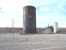
Yucca is an unincorporated community and census-designated place (CDP) in Mohave County, Arizona, United States. As of the 2020 census it had a population of 96, down from 126 at the 2010 census.

<span class="mw-page-title-main">Havasu National Wildlife Refuge</span> National Wildlife Refuge in California and Arizona in the United States

Havasu National Wildlife Refuge is a U.S. National Wildlife Refuge on the lower Colorado River in Arizona and California. It preserves habitat for desert bighorn sheep, the endangered southwestern willow flycatcher, and other animals. The refuge protects 30 river miles - 300 miles (480 km) of shoreline - from Needles, California, to Lake Havasu City, Arizona. One of the last remaining natural stretches of the lower Colorado River flows through the 20-mile-long (32 km) Topock Gorge.

<span class="mw-page-title-main">Sacramento Wash</span> Waterbody in Mohave County, Arizona

The Sacramento Wash is a major drainage of northwest Arizona in Mohave County. The wash is east of the Black Canyon of the Colorado and drains into the south-flowing Colorado River 45 mi south of Lake Mohave, and 90 mi south of Hoover Dam at Lake Mead. The wash outfall is in the center-south of the Havasu-Mohave Lakes Watershed. An equivalent wash drains to the west of the Colorado River and the Black Canyon, draining southeast Nevada and a small part of California, the Piute Wash of the Piute Valley. The Piute Wash outfall is upstream of the Sacramento's outfall by about 15 miles.

<span class="mw-page-title-main">Mohave Mountains</span> Landform in Mohave County, Arizona

The Mohave Mountains are a small 18-mi (29 km) long mountain range of northwest Arizona. The range is a northwest trending range in southwest Mohave County that parallels a southeast-flowing stretch of the Colorado River, the Arizona-California border. The range also forms the southwest border of a flatland region to its east and north, namely, Dutch Flat which lies east, at the south end of Sacramento Valley. Lake Havasu City, AZ on the Colorado, lays opposite the southwest flank of the range, where the London Bridge was reconstructed at Lake Havasu.

<span class="mw-page-title-main">Fort Mohave, Arizona</span> Census-designated place in Arizona, United States

Fort Mohave is an unincorporated community and census-designated place in Mohave County, Arizona, United States. It is named for a nearby fort that was used during the Mohave War. As of the 2020 census, the population of Fort Mohave was 16,190, up from 14,364 in 2010 and 8,919 in 2000. It is a suburb of Bullhead City. Its recent growth has made it the most populous unincorporated community in Mohave County.

<span class="mw-page-title-main">Hinkley groundwater contamination</span> Human-caused environmental event in the US

From 1952 to 1966, Pacific Gas and Electric Company (PG&E) dumped about 370 million gallons of chromium-tainted wastewater into unlined wastewater spreading ponds around the town of Hinkley, California, located in the Mojave Desert about 120 miles north-northeast of Los Angeles.

<span class="mw-page-title-main">Old Trails Bridge</span> Bridge over the Colorado River, US

The Old Trails Bridge is a historic bridge over the Colorado River in San Bernardino County and Mohave County in the United States, that is listed on the National Register of Historic Places (NRHP). It has also been known as Topock Bridge and as Needles Bridge.

Powell was a railroad station and settlement in Mohave County, Arizona, United States from 1883 to 1890.

Beal was a railroad station on the Atlantic and Pacific Railroad line between Needles, California and Topock, Arizona from 1889. It was located 5 miles north on the railroad line to Needles from Mellen.

Eastbridge was a railroad station on the east bank of the Colorado River in Mohave County, Arizona, United States. It was located at the site of the first bridge the Atlantic and Pacific Railroad built across that river, three miles southeast of Needles, in San Bernardino County, California.

<span class="mw-page-title-main">The Needles (Arizona)</span> Rock formation in the Havasu National Wildlife Refuge, Arizona

The Needles are a distinctive group of rock pinnacles, mountain peaks adjacent to the Topock Gorge, and the Colorado River on the northwestern extreme of the Mojave Mountains within the Havasu National Wildlife Refuge in Mohave County, Arizona, United States. They range from 1207 to over 1600 feet in altitude.

Golden Shores is a census-designated place (CDP) in Mohave County, Arizona, United States. The population was 1,927 at the 2020 census. Residents are part of the 86436 ZIP code area, with a mailing address of Topock.

<span class="mw-page-title-main">Red Rock Bridge</span> Former Colorado River bridge in Arizona

The Red Rock Bridge was a bridge across the Colorado River at Topock, Arizona that carried the Atlantic & Pacific Railroad. It was built in 1890, replacing a wooden bridge dating to 1883 that was repeatedly washed out during spring flooding. It was used by the railroad until 1945 when a new bridge was built. The Red Rock Bridge was then converted to carry the automobile traffic of U.S. Route 66, and did so from 1947 until 1966 when Route 66 traffic was directed onto the Interstate 40 bridge. At that time the Red Rock Bridge was abandoned, and it was eventually dismantled in 1976.

References

  1. "2021 U.S. Gazetteer Files: Arizona". United States Census Bureau. Retrieved May 26, 2022.
  2. 1 2 "P1. Race – Topock CDP, Arizona: 2020 DEC Redistricting Data (PL 94-171)". U.S. Census Bureau. Retrieved May 26, 2022.
  3. "Explore Census Data". Archived from the original on February 12, 2020. Retrieved July 13, 2010.
  4. "The Grapes of Wrath Filming Locations".
  5. Kaszynski, William (May 1, 2003). Route 66: Images of America's Main Street. p. 13. ISBN   9780786415533.
  6. "Census of Population and Housing". Census.gov. Retrieved June 4, 2016.
  7. Frederic B. Wildfang, Lake Havasu City, Arcadia Publishing, 2005, pp.34-35
  8. US 66 Photo Gallery Needles and the Colorado River from gbcnet.com Retrieved January 11, 2114.
  9. John and Lillian Theobald, Arizona Territory Post Offices & Postmasters, The Arizona Historical Foundation, Phoenix, 1961.
  10. 1 2 3 "Compressor Stations Environmental Restoration Activities at Compressor Station Properties". Pacific Gas and Electricity. 2015. Retrieved April 16, 2016.
  11. 1 2 3 "Waste Programs Division: Cleanups: Topock Compressor Station Groundwater VRP Site". Arizona Department of Environmental Quality (AZDEQ). 2015. Retrieved April 16, 2016.