
Tanagra is a town and a municipality north of Athens in Boeotia, Greece. The seat of the municipality is the town Schimatari. It is not far from Thebes, and it was noted in antiquity for the figurines named after it. The Tanagra figurines were a mass-produced, mold-cast and fired type of Greek terracotta figurines produced from the later fourth century BC, primarily in Tanagra.

Tegea was a settlement in ancient Arcadia, and it is also a former municipality in Arcadia, Peloponnese, Greece. Since the 2011 local government reform it is part of the Tripoli municipality, of which it is a municipal unit with an area of 118.350 km2. It is near the modern villages of Alea and Episkopi.

Aigeira is a town and a former municipality in northeastern Achaea, West Greece, Greece. Since the 2011 local government reform it is part of the municipality Aigialeia, of which it is a municipal unit. The municipal unit has an area of 103.646 km2. The municipal unit stretches from the Gulf of Corinth, where the town Aigeira is located, to the mountains in the south. The town Aigeira is 26 km (16 mi) southeast of Aigio, 55 km (34 mi) northwest of Corinth and 55 km (34 mi) east of Patras. The Greek National Road 8A and the railway Corinth - Patras run through the town. In a distance of 6 Km from modern Aigeira there is the archaeological site of Ancient Aigeira and the Mycenean Acropolis.
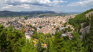
Livadeia is a town in central Greece. It is the capital of the Boeotia regional district. Livadeia lies 90 km (56 mi) north-west of Athens, 64 km (40 mi) west of Chalkida, 63 km (39 mi) south-east of Lamia, 44 km (27 mi) east-south-east of Amfissa, and 91 km (57 mi) east-north-east of Nafpaktos. The town lies some five kilometres west of Greek National Road 3, to which it is linked by National Road 48.

Myus, sometimes Myous or Myos, was an ancient Greek city in Caria. It was one of twelve major settlements of the Ionian League. The city was said to have been founded by Cyaretus, a son of Codrus. Myus was located on a small peninsula at the coast of the Aegean Sea, but it now lies inland due to the sediment deposited by the Maeander River over many centuries. The site of the city lies north of the modern village Avşar in the Söke district of Aydın Province, Turkey
Cleitor or Kleitor, also known as Clitorium, was a town in ancient Arcadia.

Psophis was an ancient Greek city in the northwest end of Arcadia, bounded on the north by Arcadia, and on the west by Elis. It was located near the modern village Psofida, part of the municipality Kalavryta.
Panopeus (Πανοπεύς), or Phanoteus, was a Greek town of ancient Phocis, near the frontier of Boeotia, and on the road from Daulis to Chaeronea. Pausanias said that Panopeus was 20 stadia from Chaeronea and 7 from Daulis; but the latter number is almost certainly a mistake. The ruins at the village of Agios Vlasios, which are clearly those of Panopeus, are about 20 stadia distant from Chaeronea, but as much as 27 stadia distant from Daulis.
Methydrium or Methydrion was a town in central ancient Arcadia, situated 170 stadia north of Megalopolis. It obtained its name, like the places called Interamna, from being situated upon a lofty height between the two rivers Maloetas and Mylaon. According to Greek mythology, it was founded by Orchomenus; but its inhabitants were removed to Megalopolis, upon the establishment of that city (371 BCE). It never recovered its former population, and is mentioned by Strabo among the places of Arcadia which had almost entirely disappeared. It continued, however, to exist as a village in the time of Pausanias, who saw there a temple of Poseidon Hippius upon the river Mylaon. He also mentions, above the river Maloetas, a mountain called Thaumasium, in which was a cave where Rhea took refuge when pregnant with Zeus. At the distance of 30 stadia from Methydrium was a fountain named Nymphasia. Methydrium is also mentioned by Thucydides, Polybius, Pliny the Elder, and Stephanus of Byzantium.

Pheneus or Pheneos was a town in the northeast of ancient Arcadia. Its territory, called Pheniatis, was bounded on the north by that of the Achaean towns of Aegeira and Pellene, east by the Stymphalia, west by the Cleitoria, and south by the Caphyatis and Orchomenia. This territory is shut in on every side by lofty mountains, offshoots of Mount Cyllene and the Aroanian chain; and it is about 7 miles in length and the same in breadth. Two streams descend from the northern mountains, and unite their waters about the middle of the valley; the united river bore in ancient times the name of Olbius and Aroanius. There is no opening through the mountains on the south; but the waters of the united river are carried off by subterranean channels (katavóthra) in the limestone rocks, and, after flowing underground, reappear as the sources of the river Ladon. In order to convey the waters of this river in a single channel to the katavóthra, the inhabitants at an early period constructed a canal, 50 stadia in length, and 30 feet in breadth. This great work, which was attributed to Heracles, had become useless in the time of Pausanias, and the river had resumed its ancient and irregular course; but traces of the canal of Heracles are still visible, and one bank of it was a conspicuous object in the valley when it was visited by William Martin Leake in 1806. The canal of Heracles, however, could not protect the valley from the danger to which it was exposed, in consequence of the katavóthra becoming obstructed, and the river finding no outlet for its waters. The Pheneatae related that their city was once destroyed by such an inundation, and in proof of it they pointed out upon the mountains the marks of the height to which the water was said to have ascended. Pausanias evidently refers to the yellow border which is still visible upon the mountains and around the plain: but in consequence of the great height of this line upon the rocks, it is difficult to believe it to be the mark of the ancient depth of water in the plain, and it is more probably caused by evaporation; the lower parts of the rock being constantly moistened, while the upper are in a state of comparative dryness, thus producing a difference of colour in process of time. It is, however, certain that the Pheneatic plain has been exposed more than once to such inundations. Pliny the Elder says that the calamity had occurred five times; and Eratosthenes related a memorable instance of such an inundation through the obstruction of the katavóthra, when, after they were again opened, the water rushing into the Ladon and the Alpheius overflowed the banks of those rivers at Olympia. The account of Eratosthenes has been confirmed by a similar occurrence in modern times. In 1821 the katavóthra became obstructed, and the water continued to rise in the plain till it had destroyed 7 to 8 square miles of cultivated country. Such was its condition till 1832, when the subterraneous channels again opened, the Ladon and Alpheius overflowed, and the plain of Olympia was inundated. Other ancient writers allude to the katavóthra and subterraneous course of the river of Pheneus.
Haliartus or Haliartos, also known as Ariartus or Ariartos or Hariartus or Hariartos, was a town of ancient Boeotia, and one of the cities of the Boeotian League. It was situated on the southern side of Lake Copais in a pass between the mountain and the lake. It is mentioned in the Catalogue of Ships in the Iliad by Homer, who gives it the epithet ποιήεις (grassy) in consequence of its well-watered meadows.
Gryneium or Gryneion, also Grynium or Grynion (Γρύνιον), Grynia or Gryneia (Γρύνεια) and Grynoi (Γρῦνοι), was a city of ancient Aeolis. It was located 40 stadia from Myrina and 70 from Elaea. In early times it was independent, one of the 12 important cities of Aeolis, but afterwards became subject to Myrina. It contained a sanctuary of Apollo with an ancient oracle and a splendid temple of white marble. Pausanias wrote that at Gryneium, where there was an amazing grove of Apollo, with cultivated trees, and all those which, although they bear no fruit, are pleasing to smell or look upon.
Annaea or Annaia or Anaea or Anaia (Ἀναία), was a town of ancient Ionia. Stephanus of Byzantium placed it in Caria, opposite Samos. Pausanias also puts it on the mainland across from Samos and says it was fortified by the people of that island after being displaced by Androklos of Ephesos. After ten years of mustering forces at Anaia, they were able to launch a force back across and reclaim Samos. Ephorus says that it was named after Anaea, an Amazon who was buried there. If Anaea was opposite Samos, it was in Ionia, which did not extend south of the Maeander River. Thucydides suggests it was on or near the coast, and in or near the valley of the Maeander, and that it was a naval station, close enough Samos to annoy the Samians. Some Samian exiles lived there during the Peloponnesian War.
Oechalia or Oichalia was a town in ancient Messenia, in the plain of Stenyclerus. It was in ruins in the time of Epaminondas, and its position was a matter of dispute in later times. Strabo identified it with Andania, the ancient residence of the Messenian kings, and Pausanias with Carnasium, which was only 8 stadia distant from Andania, and upon the river Charadrus. Carnasium, in the time of Pausanias, was the name given to a grove of cypresses, in which were statues of Apollo Carneius, of Hermes Criophorus, and of Persephone. It was here that the mystic rites of the great goddesses were celebrated, and that the urn was preserved containing the bones of Eurytus, the son of Melaneus.
Elis was the capital city of the ancient polis (city-state) of Elis, in ancient Greece. It was situated in the northwest of the Peloponnese, to the west of Arcadia. Just before the Peneius emerges from the hills into the plain, the valley of the river is contracted on the south by a projecting hill of a peaked form, and nearly 500 feet (150 m) in height. This hill was the acropolis of Elis, and commanded as well the narrow valley of the Peneius as the open plain beyond. The ancient city lay at the foot of the hill, and extended across the river, as Strabo says that the Peneius flowed through the city; but since no remains are now found on the right or northern bank, it is probable that all the public buildings were on the left bank of the river, more especially as Pausanias does not make any allusion to the river in his description of the city.
Leuctra or Leuktra, also Leuctrum or Leuktron, was a town of ancient Laconia, situated on the eastern side of the Messenian Gulf, 20 stadia north of Pephnus, and 60 stadia south of Cardamyle. Strabo speaks of Leuctrum as a colony of the Leuctra in Boeotia, near the minor Pamisus, but this river flows into the sea at Pephnus, about three miles south of Leuctrum. Leuctrum was said to have been founded by Pelops, and was claimed by the Messenians as originally one of their towns. It was awarded to the latter people by Philip II of Macedon in 338 BCE, but in the time of the Roman Empire it was one of the Eleuthero-Laconian towns. Pausanias saw in Leuctra a temple and statue of Athena on the acropolis, a temple and statue of Cassandra, a marble statue of Asclepius, another of Ino, and wooden figures of Apollo Carneius.
Alalcomenae or Alalkomenai, or Alalcomenium or Alalkomenion (Ἀλαλκομένιον), was a town in ancient Boeotia, situated at the foot of Mount Tilphossium, a little to the east of Coroneia, and near Lake Copais. It was celebrated for the worship of Athena, who was said to have been born there, and who is hence called Alalcomeneis (Ἀλαλκομενηΐς) in Homer's Iliad. The temple of the goddess stood, at a little distance from the town, on the Triton River, a small stream flowing into Lake Copais. The town was by a hill which Strabo calls Mount Tilphossium. Strabo also records that the tomb of the seer Teiresias, and the temple of Tilphossian Apollo, were located just outside Alalcomenae.
Coroneia, or Coronea, was a town of ancient Boeotia, and a member of the Boeotian League. It is described by Strabo as situated upon a height near Mount Helicon; its territory was called Κορωνειακή. The town stood upon an insulated hill at the entrance of a valley leading southwards to Mt. Helicon, the principal summit of which is seen at the head of the valley. From this hill there was a fine view over the Lake Copais, and at its foot there was a broad plain extending as far as the marshes of the lake. On either side of the hill flowed two streams, one on the eastern or right hand side, called Coralius or Cuarius, and the other on the left, named Phalarus: a tributary of the latter was the Isomantus or Hoplias. Coroneia is said to have been founded by the Boeotians from Arne in Thessaly, after they had been driven out of their original homes by the Thessalians; and they appear to have called it Coroneia after the Thessalian town of this name. At the same time they built in the plain in front of the city a temple of Athena Itonica, also named after the one in Thessaly, and likewise gave to the river which flowed by the temple the name of Cuarius or Curalius, after the Thessalian river. In this temple was held the festival of the Pamboeotia, which was common to all the Boeotians. The Thessalian origin of Coroneia is also attested by Pausanias, who ascribes its foundation, as well as that of Haliartus, to Athamas and his descendants, who came from Thessaly.
Gortys, or Gortyna (Γόρτυνα), was a town of ancient Arcadia in the district Cynuria, situated near the river Gortynius (Γορτύνιος), also called Lusius (Λούσιος) nearer its sources, which was a tributary of the Alpheius, and was remarkable for the coldness of its waters. The town is said to have been founded by Gortys, a son of Stymphalus, and is described by Pausanias as a village in his time, though it had formerly been a considerable city. Most of its inhabitants were removed to Megalopolis upon the foundation of the latter city in 371 BCE; but it must have continued to be a place of some importance, since Polybius says that it was taken by Euripidas, the general of the Eleians, in the Social War in 219 BCE. At that time it was subject to Thelpusa. It contained a celebrated temple of Asclepius, built of Pentelic marble, and containing statues of Asclepius and Hygieia by Scopas. Cicero alludes to this temple, when he says that near the river Lusius was the sepulchre of one of the Aesclepii, of whom he reckoned three.
Eira, also known as Hira or Ira (Ἰρά), and Hire or Ire (Ἱρὴ), was a fortified settlement on a mountain of the same name, in the north of ancient Messenia, near the Neda River. During the Second Messenian War the Messenians fortified the place, and Aristomenes defended it for ten years against the Spartans. Pausanias dates the capture of the city by the Lacedaemonians to the first year of the 28th Olympiad (668 BCE). The Arcadians welcomed many Messenians who withdrew thither after the capture of Eira, while the captured Messenian prisoners were converted to helots by the Lacedaemonians, and the rest of Messenians who lived on the coast were exiled to Cyllene, in Elis. Pausanias adds that 297 years after the capture of Eira, in the third year of the 102nd Olympiad (370 BCE), the Messenians regained their territory.