Related Research Articles
Common traffic advisory frequency (CTAF) is the name given to the VHF radio frequency used for air-to-air communication at United States, Canadian and Australian non-towered airports.
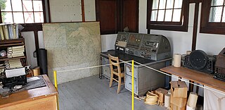
A flight service station (FSS) is an air traffic facility that provides information and services to aircraft pilots before, during, and after flights, but unlike air traffic control (ATC), is not responsible for giving instructions or clearances or providing separation. They do, however, relay clearances from ATC for departure or approaches. The people who communicate with pilots from an FSS are referred to as flight service specialists.

Watsonville Municipal Airport is three miles (5 km) northwest of Watsonville, in Santa Cruz County, California, United States. The airport covers 330 acres (134 ha) and has two runways. The largest aircraft to ever land at Watsonville were 05-5141 and 05-5143, C-17 Globemaster IIIs from March ARB, California.
Yampa Valley Regional Airport is in Routt County, Colorado, United States, serving the communities of Steamboat Springs, Hayden, and Craig, Colorado. The airport is two miles southeast of Hayden, about 20 miles east of Craig and about 25 miles (40 km) west of Steamboat Springs. It has the only scheduled passenger flights in northwest Colorado. It is also used by larger business jets that cannot use the smaller Steamboat Springs Airport.

Chippewa County International Airport is a public use airport in Chippewa County, Michigan, United States. It is located 15 nautical miles south of the central business district of Sault Ste. Marie, Michigan. The airport is owned by the Chippewa County Economic Development Corporation. It was formerly the Kincheloe Air Force Base.
Remote communications outlets (RCO) are remote aviation band radio transceivers, established to extend the communication capabilities of Flight Information Centres (FIC) and flight service stations (FSS).

In aviation, a non-towered airport is an airport without a control tower, or air traffic control (ATC) unit. The vast majority of the world's airports are non-towered. In the United States, there are close to 20,000 non-towered airports compared to approximately 500 airports with control towers. Airports with a control tower without 24/7 ATC service follow non-towered airport procedures when the tower is closed but the airport remains open, for example at night.
Iowa City Municipal Airport, is two miles southwest of downtown Iowa City, in Johnson County, Iowa. It is the oldest civil airport west of the Mississippi River still in its original location.
West Bend Municipal Airport is a city-owned public-use airport located three nautical miles (6 km) east of the central business district of West Bend, a city in Washington County, Wisconsin, United States. It is included in the Federal Aviation Administration (FAA) National Plan of Integrated Airport Systems for 2023–2027, in which it is categorized as a regional reliever airport facility.
This article describes the graphic conventions used in Sectional charts and Terminal area charts published for aeronautical navigation under Visual Flight Rules in the United States of America. The charts are published "in accordance with Interagency Air Cartographic Committee specifications and agreements, approved by the Department of Defense and the Federal Aviation Administration".

Northeast Florida Regional Airport, is located approximately four miles (6 km) north of historic St. Augustine, in St. Johns County, Florida, United States. NFRA serves as a key connection point for air travel in the Northeast Florida region. It is a public airport managed by the St. Johns County Airport Authority on behalf of the citizens of St. Johns County. Airport facilities include both commercial and general aviation terminals.
Platte Valley Airpark is a public-use airport three miles northwest of Hudson, in Weld County, Colorado, United States. It is privately owned by Platte Valley Airpark Ltd. and is 40 miles (64 km) northeast of Denver.
In U.S. and Canadian aviation, MULTICOM is a frequency allocation used as a Common Traffic Advisory Frequency (CTAF) by aircraft near airports where no air traffic control is available. Frequency allocations vary from region to region.
The National Airspace System (NAS) is the airspace, navigation facilities and airports of the United States along with their associated information, services, rules, regulations, policies, procedures, personnel and equipment. It includes components shared jointly with the military. It is one of the most complex aviation systems in the world, and services air travel in the United States and over large portions of the world's oceans.

Craig Field is a public airport four miles southeast of Selma, in Dallas County, Alabama. The FAA's National Plan of Integrated Airport Systems for 2011–2015 categorized it as a general aviation facility. It was previously the U.S. Air Force Craig Air Force Base, closed in 1977.
Muscatine Municipal Airport five miles (8 km) southwest of Muscatine, in Muscatine County, Iowa, United States.
Stevens Field is a public-use, general aviation airport located three miles northwest of the central business district of Pagosa Springs in Archuleta County, Colorado, United States. It is publicly owned by Archuleta County. It has no air traffic control tower or commercial passenger services, but it does have a fixed base operator (FBO), and it is popular among light sport and general aviation aircraft doing cross country flights, where the airport serves as an GA-friendly waypoint, refueling stop, and pilot rest/sleep opportunity. Its address is 61 Aviation Ct, Pagosa Springs, CO.
Hammond Northshore Regional Airport is a city-owned, public-use, joint civil-military, general aviation airport located three nautical miles (6 km) northeast of the central business district of Hammond, a city in Tangipahoa Parish, Louisiana, United States. The airport was previously an uncontrolled facility utilizing VHF-band UNICOM as a Common Traffic Advisory Frequency (CTAF). As a result of the relocation of Army National Guard flight operations from Lakefront Airport to Hammond, a new control tower was constructed at the airport. This tower, staffed by military air traffic controllers from the Air Operations Department of the Louisiana Army National Guard's Army Aviation Support Facility #1 at the airport, became operational on 15 December 2014.
AirNav.com is a privately owned website for pilots and aviation enthusiasts. The site publishes aeronautical and airport information released by the Federal Aviation Administration (FAA) such as runway distances, airfield traffic patterns, airport frequencies, airport operations, facilities and services, chart location, navigational coordinates and locations, radio aids, ownership information and other pertinent information that all pilots need when traveling into or out of an airport or around the United States National Airspace System (NAS). The same information is published in the Airport/Facility Directory (A/FD), updated every 56 days.
Westport Airport is a privately owned, public use airport located three nautical miles (6 km) southwest of the central business district of Wichita, a city in Sedgwick County, Kansas, United States. It is in the Class C airspace of neighboring Wichita Dwight D. Eisenhower National Airport.
References
- 1 2 3 Transport Canada (April 2010). "TP 14371 - Transport Canada Aeronautical Information Manual (TC AIM) - RAC - 1.0 GENERAL 1.2.1 Universal Communications". Archived from the original on 2010-07-09. Retrieved 2010-08-19.
- ↑ Air Traffic Organization Policy ORDER #JO 7210.3X; Subject: Facility Operation and Administration, Section 2 - Use of Communications. U.S. DEPARTMENT OF TRANSPORTATION, FEDERAL AVIATION ADMINISTRATION. 9 February 2012. Retrieved 26 February 2013.
- ↑ "FAA Flight Information service".
- ↑ Fuera de peligro aeropuerto Mercedita. Omar Alfonso. La Perla del Sur. Ponce, Puerto Rico. 23 February 2013. Retrieved 26 February 2013 (Printed edition publication data: Recortes en la FAA: Fuera de peligro el Aeropuerto Mercedita. Year 31. Issue 1526. Page 14. 27 February 2013.).
- ↑ "FAA Aeronautical Information Manual (FAA AIM) - 4-1-9.e. Information Provided by aueronautical Advisory Stations (UNICOM)" . Retrieved 2012-07-21.
- ↑ Aircraft Owners and Pilots Association (15 October 2018). "Changing Unicom Frequencies". Archived from the original on 5 April 2013. Retrieved 26 February 2013.
- ↑ FBO at small airport using unassigned unicom frequency for airport information. NASA ASRS Report 106369, March 1989. 37000 Feet. August 2007. Retrieved 26 February 2013.
- 1 2 3 47 CFR 87.217
- "Chapter 4: Air Traffic Control," Airman's Information Manual (Washington, DC: Superintendent of Documents, 1999).