Prabhas Patan, also known as Somnath Patan or Prabhas Kshetra, historically named Dev Patan, is an area situated in Veraval, Gir Somnath district in Saurashtra region of Gujarat, India. Somnath temple, a place of pilgrimage due to its importance as Jyotirlinga site dedicated to Shiva, is located here.

Amreli is a city and a municipality in Amreli district in Indian state of Gujarat.
Veraval, also known as Somnath, is a municipality and the headquarters of Gir Somnath district in the Indian state of Gujarat. It is also known for the hub of fishing industries in India.
Kodinar is a town and municipality in Gir Somnath district, in the Indian state of Gujarat, 37 kilometres (23 mi) west of Una. Kodinar is close to the Gir Forest National Park. The main transport connections for Kodinar are Diu Airport, Veraval Junction railway station, and Veraval Port.
Mahuva is a town and taluka of Bhavnagar District, in the state of Gujarat, India. Located on the coast of the Arabian Sea, Mahuva is known for its mild weather and green, lush surroundings, including many coconut tree plantations. The town is a part of the Saurashtra region and is known as the Kashmir of Saurashtra. Mahuva is also known for wooden toys, raw onions, groundnuts, and a local variety of mango called the Jamadar. The region is home to a thriving agribusiness industry, particularly enterprises that dehydrate vegetables such as garlic and onions for use in processed foods.
Rajula is a city and municipality in Amreli district in the Indian state of Gujarat. City was known as Rajgadh at the time of local ruler daha dhakhda.

Sihor is a town, a municipality in Bhavnagar district in the Indian state of Gujarat. Placed along the river Gautami, this erstwhile capital of the Gohil Rajputs, surrounded by hills is situated about 20 km from Bhavnagar. It becomes Sihor by corrupting its name from Saraswatpur, Sinhalpur, Sinhpur, Sinhor, and Shihor.
Kankai is a Hindu's holy place situated in the middle of Gir National Park in Junagadh district of Saurashtra region in the state of Gujarat, India.

Dhari is a town in Amreli District in Indian state of Gujarat, India. It is an administrative headquarter of the Dhari tehsil(almost 87 villages and ness).Dhari is the most populous town in Amreli District as per census 2011 with 30352 population. Dhari is located on the bank of Shetrunji River, 42 km(26.2 mi) from district headquarter Amreli & 318 km(199.8 mi) from state capital Gandhinagar. Dhari is famous for kesar mango and Asiatic lion. Dhari is capital of East Gir Forest.
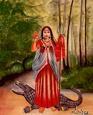
Khoḍiyār is a Hindu folk goddess worshiped in Gujarat and Rajasthan states in India. The suffix Mata or Maa is generally added to her name, similar to other Hindu goddesses.
Gadhakda is a village in Savarkundla tehsil in the Amreli district of Indian state Gujarat. Gadhakda was formerly under the control of Junagadh State. Although it is now a part of the Amreli district, it was once a part of the Bhavnagar district.
Sarsai is a village of Visavadar Taluka Junagadh district, Gujarat State, India. It is located 38 kilometres (24 mi) east of district headquarters Junagadh, and 339 km (211 mi) from state capital Gandhinagar. Its Postal Index Number is 362120. It is located near Satadhar. A popular place named "sant rohidas ashsram" is in Sarsai.
Gir Gadhada is a town in Gir Somnath district in the state of Gujarat, India. Before 2013, it was a town of Una Taluka in Junagadh District, Now it has become the administrative headquarters for 42 villages when that taluka was created as part of the new Gir Somnath District in August of that year. Newly built BAPS Shree Swaminarayana Mandir is a popular place of worship and spiritual activities here. There is another older Swaminarayan mandir nearby. Other temples in the town are Shree Khodiyar Mandir, Shree ramji Mandir, Hanuman Ji mandir, Shiv mandir and Ganpati temple
Mavjinjava (માવજીંજવા) is a small village near Bagasara in the Amreli district of the Saurashtra region in the state of Gujarat, India. There is a population of around 3,754 people in Mavjinjava. More than 3000 people live outside of Manjinjava in places like Surat, Ahmedabad & Mumbai.
Delvada, also known as Delwada, is a village in Una Taluka, Gir Somnath district, Gujarat, India. It is located on the banks of the Machundri River, 5 km from Una and about 8 km from Diu. Several religious and social groups exist in Delvada. These include: Kolis, Patels, Muslim, Brahmin, Lohana, and Sindhi. Due to its proximity to the Arabian Sea, the weather is extremely humid.

Gir Somnath is a district of Gujarat, India. It is located on the southern corner of the Kathiawar peninsula with its headquarters at the City Of Somnath.

There are two sets of Buddhist caves in two different places taking the name of Shana caves.
Gir Gadhada Taluka is a taluka of Gir Somnath district in the state of Gujarat, India. Before 2013 the area was part of Una Taluka, but it became a taluka in its own right with the creation of Gir Somnath District in August of that year. Gir Gadhada Taluka has population around 15,600. The village of Gir Gadhada became its administrative headquarters.
Babra is a town and the taluka headquarter in the Amreli district, Gujarat, India. It is situated to the north of Amreli. The main road linking Rajkot and Bhavnagar and Amreli passes through Babra.
Talala (Gir) is a city and a taluka in Gir Somnath district in the Gujarat state of India, also known as capital of Gir.


