
Venice is a neighborhood of the City of Los Angeles within the Westside region of Los Angeles County, California, United States.
Willowbrook, alternatively named Willow Brook, is an unincorporated community and census-designated place (CDP) in Los Angeles County, California. The population was 24,295 at the 2020 census, down from 35,983 at the 2010 census.

Muscle Beach is the birthplace of the United States physical fitness boom, which started in 1934 with predominantly gymnastics activities on the south side of the Santa Monica Pier. Muscle Beach Venice is the contemporary title of the outdoor weightlifting platform constructed in Venice, California, a distinct neighborhood in the city of Los Angeles, 18 years after Muscle Beach was established.


The Third Street Promenade is a pedestrian mall esplanade, shopping, dining and entertainment complex in the downtown area of Santa Monica, California which originally opened as the Santa Monica Mall on November 8, 1965. It is considered a premier shopping and dining district on the Westside and draws crowds from all over the Greater Los Angeles area. Due to easy access to Downtown Los Angeles via the Big Blue Bus rapid transit service, E Line's terminus station and the Pacific Coast Highway-Santa Monica Freeway Interstate, the neighborhood's north-south thoroughfares connecting to Muscle Beach, Venice Canal Historic District, Marina del Rey, Ballona Wetlands and Los Angeles International Airport, and its proximity to historic U.S. Route 66, Santa Monica Pier, Palisades Park, Tongva Park, Santa Monica State Beach and the Pacific Ocean coupled with Los Angeles's mild mediterranean climate, it is also a popular tourist destination.

The Marvin Braude Bike Trail is a 22-mile (35 km) paved bicycle path that runs mostly along the shoreline of Santa Monica Bay in Los Angeles County, California. The coastal bike trail is widely acknowledged as Los Angeles’ “most popular bike path.”
Bixby Knolls is a neighborhood in Long Beach, California, named after the Bixby family.
Marina Peninsula is a neighborhood in western Los Angeles, California. It is often considered a subsection of the adjacent neighborhood of Venice. Because of its name it is sometimes erroneously thought to be part of the adjacent community of Marina del Rey, California, but it was annexed to Los Angeles along with the rest of Venice in 1925.
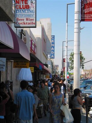
Pacific Boulevard is a street and principal commercial thoroughfare in the city of Huntington Park, California and the Los Angeles County neighborhood of Walnut Park. It runs from Vernon and Santa Fe Avenues in Vernon to Cudahy Street in Walnut Park before changing to Long Beach Boulevard. The Pacific Boulevard commercial district is the third highest grossing commercial district in the County of Los Angeles. The Christmas Lane Parade, seen in millions of homes via television throughout the United States and parts of Europe, has run down Pacific Boulevard since 1946. As many as 300,000 people attend the annual Carnaval Primavera held on Pacific Boulevard each year. Pacific Boulevard is well known to Latino residents of the L.A. area, and a magnet for commerce, culture, and night life.

Beyond Baroque Literary Arts Center is a literary arts center located at 681 Venice Boulevard, Venice, Los Angeles, California, founded in 1968. The center is based near the beach in Los Angeles's old Venice City Hall, built in 1906. It offers an extensive program of public readings, workshops, a project room, bookstore, publications, and chapbook/small press archive.

Alla is a former streetcar station and archaic place name located near Marina del Rey in the Westside region of Los Angeles County, California.
Alsace is an archaic place name. Originally an interurban trolley stop, the name now informally designates an approximately five-block area of unincorporated Los Angeles County in the Westside region, surrounded by the north-of-Jefferson section of Playa Vista, Los Angeles, California.
Cypress Grove, California was a stop on the Redondo Beach via Playa Del Rey Line of the Los Angeles streetcar system.

The Long Beach Marine Stadium is a marine venue located in Long Beach, California. Created in 1932 to host the rowing events for the 1932 Summer Olympics in neighboring Los Angeles, the stadium was the first manmade rowing course in the United States.

The Myrtle Beach Boardwalk & Promenade, located in Myrtle Beach, South Carolina, runs 1.2 miles (1.9 km) along the oceanfront from the Pier 14 at 14th Avenue North to the 2nd Avenue Pier at 2nd Avenue North. The promenade officially opened in May 2010 at a cost of nearly $6.4 million. National Geographic has ranked Myrtle Beach Boardwalk number three in the United States, while Travel and Leisure ranked the boardwalk number two.

The Los Angeles River bicycle path is a Class I bicycle and pedestrian path in the Greater Los Angeles area running from north to east along the Los Angeles River through Griffith Park in an area known as the Glendale Narrows. The 7.4 mile section of bikeway through the Glendale Narrows is known as the Elysian Valley Bicycle & Pedestrian Path. The bike path also runs from the city of Vernon to Long Beach, California. This section is referred to as LARIO, or more formally, the Los Angeles River Bikeway.

