
The Greenbelt is a 203.5-square-kilometre (78.6 sq mi) protected green belt traversing Ottawa, Ontario, Canada. It includes green space, forests, farms, and wetlands from Shirleys Bay in the west and to Green's Creek in the east. It is the largest publicly owned green belt in the world and the most ecologically diverse area in Eastern Ontario. The National Capital Commission (NCC) owns and manages 149.5 square kilometres (57.7 sq mi), and the rest is held by other federal government departments and private interests. Real estate development within the Greenbelt is strictly controlled.

The Office of the Prime Minister and Privy Council building, formerly known as the Langevin Block, is an office building facing Parliament Hill in Ottawa, Ontario, Canada. As the home of the Privy Council Office and Office of the Prime Minister, it is the working headquarters of the executive branch of the Canadian government.

Ottawa West—Nepean is a federal electoral district in Ontario, Canada, that has been represented in the House of Commons of Canada since 1997.
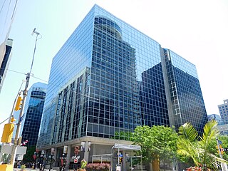
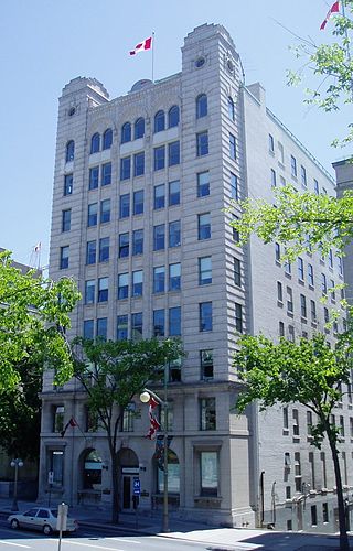
The C.D. Howe Building is an office tower in Ottawa, Ontario, Canada, that is the home of Innovation, Science and Economic Development Canada, the Office of the Auditor General and other smaller tenants. It was built by Olympia and York. The federal government sold the land to O&Y for a dollar and signed an agreement to lease the final building for a set rate until 2012. The eleven-story building was opened in 1978.

Major's Hill Park is a park in downtown Ottawa, Ontario. The park stands above the Rideau Canal at the point where it enters the Ottawa River. The parliament buildings can be seen across the canal to the west, to the north of the park is the National Gallery of Canada, and to the east are the United States embassy and the Byward Market. To the south is the Chateau Laurier hotel, built on land that was once part of the park.

Greely is a suburban-rural community in Ottawa, Ontario, Canada. Located south of the city in Osgoode Ward, it was part of the Township of Osgoode prior to amalgamation in 2001. Greely is currently the largest rural village in terms of land area and the third largest in terms of population in the City of Ottawa. According to the Greely Community Association, it is bounded on the east by Sale Barn Road and Greyscreek Road, on the north by Mitch Owens on the west by Manotick Station Road, and on the south by Snake Island Road. According to the Canada 2011 Census, the population within these boundaries was 9,049.

The current Ottawa City Hall is the city hall of Ottawa, Ontario, Canada. The downtown complex consists of two connected buildings: a modern wing located on Laurier Avenue and a 19th-century heritage wing located on Elgin Street. Although City Hall has frontage on two major streets, the main entrance is on Laurier Avenue, and the municipal address is 110 Laurier Avenue West.

The Confederation Building is a office building in Ottawa, Ontario, Canada. Located just west of the Parliament Buildings at Bank Street and Wellington Street, it is generally considered part of Parliament Hill.

The Transportation Building, 10 Rideau Street, Ottawa, Ontario, Canada is a historic Gothic revival/Chicago school office tower. The building stands at the intersection of Sussex Drive and Rideau Street.
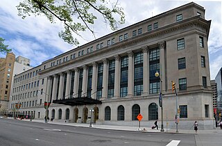
The Wellington Building is a Beaux-Arts architecture office building in Ottawa, Ontario, Canada. It was built between 1924 and 1927 as Canadian headquarters of the Metropolitan Life Insurance Company. The original structure was designed by D. Everett Waid; in 1959, the more restrained classical east wing of the building was added.
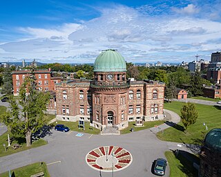
The Dominion Observatory was an astronomical observatory in Ottawa, Ontario that operated from 1902 to 1970. The Observatory was also an institution within the Canadian Federal Government. The observatory grew out of the Department of the Interior's need for the precise coordinates and timekeeping that at that time could only come from an observatory. For several years they had used a small observatory on the Ottawa River for this purpose. In 1902, it was decided that Canada needed a larger national observatory similar to the Royal Greenwich Observatory in Britain.

The Edward Drake Building, formerly the CBC Building, was the name of a modernist office building in Ottawa, Ontario, Canada designed by CBC's chief architect David Gordon McKinstry and constructed between 1961 and 1964.

Tunney's Pasture is a 49-hectare (121-acre) campus in the Canadian capital of Ottawa, Ontario, that is exclusively developed for federal government buildings. It is bordered by Scott Street to the south, Parkdale Avenue to the east, the Kichi Zibi Mikan to the north, and the Champlain Park neighbourhood to the west. While strictly speaking it is confined to this area, people living in the vicinity of it will often call the wider neighbourhood Tunney's Pasture.

Ottawa Centre is an urban provincial electoral district in Ontario, Canada that has been represented in the Legislative Assembly of Ontario since 1968. While the riding's boundaries have changed over the years to account for population changes, the riding has always comprised the central areas of Ottawa, the nation's capital.

Ottawa—Vanier is a provincial electoral district in Ottawa, Ontario, Canada, that has been represented in the Legislative Assembly of Ontario since 1908. It is located in the east end of Ottawa.

Église Unie St-Marc is a small but historic church in Ottawa, Canada. It is the main church for francophone Protestants in the Ottawa Gatineau region. French speaking Protestants are a very small minority in Canada, but one with a history dating back to early Huguenot settlers.
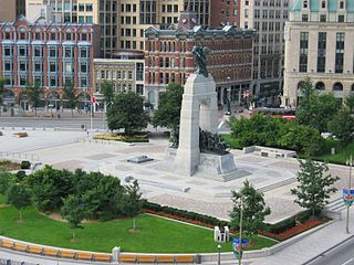
Confederation Square is an urban square in Ottawa, Ontario, Canada, and is considered the second most important ceremonial centre in Canada's capital city, after Parliament Hill. Roughly triangular in area, with Canada's National War Memorial at its centre and the Valiants Memorial at its periphery, the square is bounded by Wellington Street to the north and branches of Elgin Street to the east and west.

National Defence Headquarters (NDHQ) was created through the integration of the Canadian Armed Forces Headquarters with the civilian Department of National Defence (DND) staff in October of 1972. NDHQ is not a specific location, but is instead housed throughout a collection of offices in buildings across the National Capital Region, although it is most commonly identified with the Major-General George R Pearkes Building on Colonel By Drive in Ottawa.
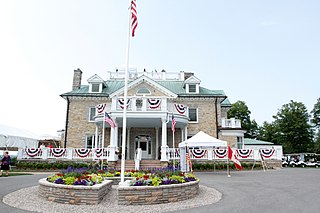
Lornado is the official residence of the United States Ambassador to Canada. It is located in the Rockcliffe Park area of Ottawa, Ontario.
The National Press Building in Ottawa, Canada is a building on Wellington Street, just across from the West Block of the Parliament Buildings, that houses the Parliamentary Press Gallery. The building is owned by the federal government. Originally the press had their offices inside the Centre Block of the Parliament buildings. By the mid-1960s these areas had become overcrowded, and the large number of journalists based in desks lined against the walls of hallways were deemed a fire hazard. Thus the press were moved to their new home across the street. The Italian Renaissance building, originally named the Norlite Building, had been constructed in 1917-1919 and originally held several government agencies.

