
A geographic information system (GIS) consists of integrated computer hardware and software that store, manage, analyze, edit, output, and visualize geographic data. Much of this often happens within a spatial database, however, this is not essential to meet the definition of a GIS. In a broader sense, one may consider such a system also to include human users and support staff, procedures and workflows, the body of knowledge of relevant concepts and methods, and institutional organizations.

A digital elevation model (DEM) or digital surface model (DSM) is a 3D computer graphics representation of elevation data to represent terrain or overlaying objects, commonly of a planet, moon, or asteroid. A "global DEM" refers to a discrete global grid. DEMs are used often in geographic information systems (GIS), and are the most common basis for digitally produced relief maps. A digital terrain model (DTM) represents specifically the ground surface while DEM and DSM may represent tree top canopy or building roofs.

The Blue Marble is a photograph of Earth taken on December 7, 1972, from a distance of around 29,400 kilometers from the planet's surface.

Landsat 7 is the seventh satellite of the Landsat program. Launched on 15 April 1999, Landsat 7's primary goal is to refresh the global archive of satellite photos, providing up-to-date and cloud-free images. The Landsat program is managed and operated by the United States Geological Survey, and data from Landsat 7 is collected and distributed by the USGS. The NASA WorldWind project allows 3D images from Landsat 7 and other sources to be freely navigated and viewed from any angle. The satellite's companion, Earth Observing-1, trailed by one minute and followed the same orbital characteristics, but in 2011 its fuel was depleted and EO-1's orbit began to degrade. Landsat 7 was built by Lockheed Martin Space Systems.

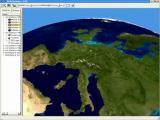
NASA WorldWind is an open-source virtual globe. According to the website, "WorldWind is an open source virtual globe API. WorldWind allows developers to quickly and easily create interactive visualizations of 3D globe, map and geographical information. Organizations around the world use WorldWind to monitor weather patterns, visualize cities and terrain, track vehicle movement, analyze geospatial data and educate humanity about the Earth." It was first developed by NASA in 2003 for use on personal computers and then further developed in concert with the open source community since 2004. As of 2017, a web-based version of WorldWind is available online. An Android version is also available.

Satellite images are images of Earth collected by imaging satellites operated by governments and businesses around the world. Satellite imaging companies sell images by licensing them to governments and businesses such as Apple Maps and Google Maps.

Google Earth is a computer program that renders a 3D representation of Earth based primarily on satellite imagery. The program maps the Earth by superimposing satellite images, aerial photography, and GIS data onto a 3D globe, allowing users to see cities and landscapes from various angles. Users can explore the globe by entering addresses and coordinates, or by using a keyboard or mouse. The program can also be downloaded on a smartphone or tablet, using a touch screen or stylus to navigate. Users may use the program to add their own data using Keyhole Markup Language and upload them through various sources, such as forums or blogs. Google Earth is able to show various kinds of images overlaid on the surface of the Earth and is also a Web Map Service client. In 2019, Google revealed that Google Earth now covers more than 97 percent of the world, and has captured 10 million miles of Street View imagery.
A Web Map Service (WMS) is a standard protocol developed by the Open Geospatial Consortium in 1999 for serving georeferenced map images over the Internet. These images are typically produced by a map server from data provided by a GIS database.

ArcGIS is a family of client, server and online geographic information system (GIS) software developed and maintained by Esri.

gvSIG, geographic information system (GIS), is a desktop application designed for capturing, storing, handling, analyzing and deploying any kind of referenced geographic information in order to solve complex management and planning problems. gvSIG is known for having a user-friendly interface, being able to access the most common formats, both vector and raster ones. It features a wide range of tools for working with geographic-like information.

The Geospatial Data Abstraction Library (GDAL) is a computer software library for reading and writing raster and vector geospatial data formats, and is released under the permissive X/MIT style free software license by the Open Source Geospatial Foundation. As a library, it presents a single abstract data model to the calling application for all supported formats. It may also be built with a variety of useful command line interface utilities for data translation and processing. Projections and transformations are supported by the PROJ library.
Digital Earth is the name given to a concept by former US vice president Al Gore in 1998, describing a virtual representation of the Earth that is georeferenced and connected to the world's digital knowledge archives.

Terrain cartography or relief mapping is the depiction of the shape of the surface of the Earth on a map, using one or more of several techniques that have been developed. Terrain or relief is an essential aspect of physical geography, and as such its portrayal presents a central problem in cartographic design, and more recently geographic information systems and geovisualization.

Web mapping or an online mapping is the process of using, creating, and distributing maps on the World Wide Web, usually through the use of Web geographic information systems. A web map or an online map is both served and consumed, thus, web mapping is more than just web cartography, it is a service where consumers may choose what the map will show.

Computer cartography is the art, science, and technology of making and using maps with a computer. This technology represents a paradigm shift in how maps are produced, but is still fundamentally a subset of traditional cartography. The primary function of this technology is to produce maps, including creation of accurate representations of a particular area such as, detailing major road arteries and other points of interest for navigation, and in the creation of thematic maps. Computer cartography is one of the main functions of geographic information systems (GIS), however, GIS is not necessary to facilitate computer cartography and has functions beyond just making maps. The first peer-reviewed publications on using computers to help in the cartographic process predate the introduction of full GIS by several years.
Earth3D was developed as part of a diploma thesis of Dominique Andre Gunia at Braunschweig University of Technology to display a virtual globe of the earth. It was developed before Google bought Keyhole, Inc and changed their product into Google Earth. Earth3D downloads its data from a server while the user navigates around. The data itself is saved in a Quadtree. It uses data from NASA, USGS, the CIA and the city of Osnabrück.

The Geoscope was a proposal by Buckminster Fuller around 1960 to create a 200-foot-diameter (61 m) globe that would be covered in colored lights so that it could function as a large spherical display. It was envisioned that the Geoscope would be connected to computers which would allow it to display both historical and current data, and enable people to visualize large scale patterns around the world. Several projects by his students to build a "miniature Earth", starting with a 20-foot version at Cornell University in 1952, were precursors of the Geoscope proposal. Before proposing the Geoscope, Fuller had invented the Dymaxion map, a novel map projection for the whole Earth.
Biosphere3D is an open-source project that targets interactive landscape scenery rendering based on a virtual globe. The software system supports multiple scales but focuses primarily on the creation of realistic views from eye-level or near ground level. The software is released under the MPL license and developed by Zuse Institute Berlin, Lenné3D and the open-source community for use on personal computers.
In science, the concept of a macroscope is the antithesis of the microscope, namely a method, technique or system appropriate to the study of very large objects or very complex processes, for example the Earth and its contents, or conceptually, the Universe. Obviously, a single system or instrument does not presently exist that could fulfil this function, however its concept may be approached by some current or future combination of existing observational systems. The term "macroscope" has also been applied to a method or compendium which can view some more specific aspect of global scientific phenomena in its entirety, such as all plant life, specific ecological processes, or all life on earth. The term has also been used in the humanities, as a generic label for tools which permit an overview of various other forms of "big data". As discussed here, the concept of a "macroscope" differs in essence from that of the macroscopic scale, which simply takes over from where the microscopic scale leaves off, covering all objects large enough to be visible to the unaided eye, as well as from macro photography, which is the imaging of specimens at magnifications greater than their original size, and for which a specialised microscope-related instrument known as a "Macroscope" has previously been marketed. For some workers, one or more "macroscopes" can already be constructed, to access the sum of relevant existing observations, while for others, deficiencies in current sampling regimes and/or data availability point to additional sampling effort and deployment of new methodologies being required before a true "macroscope" view of Earth can be obtained.

Terravision is a 3D mapping software developed in 1993 by the German company ART+COM in Berlin as a "networked virtual representation of the Earth based on satellite images, aerial shots, altitude data and architectural data". Development of the project was supported by the Deutsche Post.

