WSR-57 radars were the USA's main weather surveillance radar for over 35 years.[1] The National Weather Service operated a network of this model radar across the country, watching for severe weather.
Under the Joint Electronics Type Designation System (JETDS), all U.S. military radar and tracking systems are assigned a unique identifying alphanumeric designation. The letters “AN” (for Army-Navy) are placed ahead of a three-letter code.[2]
The first letter of the three-letter code denotes the type of platform hosting the electronic device, where A=Aircraft, F=Fixed (land-based), S=Ship-mounted, and T=Ground transportable.
The second letter indicates the type of equipment, where P=Radar (pulsed), Q=Sonar, and R=Radio.
The third letter indicates the function or purpose of the device, where G=Fire control, R=Receiving, S=Search, and T=Transmitting.
Thus, the AN/FPS-41 represents the 41st design of an Army-Navy “Fixed, Radar, Search” electronic device.[2][3]
The WSR-57 (Weather Surveillance Radar - 1957) was the first 'modern' weather radar. Initially commissioned at the Miami Hurricane Forecast Center, the WSR-57 was installed in other parts of the CONUS (continental United States).[4] The WSR-57 was the first generation of radars designed expressly for a national warning network.[5]
The WSR-57 was designed in 1957 by Dewey Soltow using World War II technology. It gave only coarse reflectivity data and no velocity data, which made it extremely difficult to predict tornadoes.[4] Weather systems were traced across the radar screen using grease pencils. Forecasters had to manually turn a crank to adjust the radar's scan elevation, and needed considerable skill to judge the intensity of storms based on green blotches on the radar scope.[1]
The military designation for the WSR-57 is AN/FPS-41.[4]
NOAA has pictures of the Charleston, SC, WSR-57 radar image of the 1989 Hurricane Hugo. A WSR-57 dish, located on the roof of the National Hurricane Center (NHC), was blown away by Hurricane Andrew. The NHC report on Hurricane Andrew shows its last radar image, as well as images from nearby WSR-88D radars. As the network of WSR-57 radars aged, some were replaced with WSR-74S models of similar performance but with better reliability. WSR-57 operators sometimes had to scramble for spare parts no longer manufactured in this country.[1] 128 of the WSR-57 and WSR-74 model radars were spread across the country as the National Weather Service's radar network until the 1990s.[6] The WSR-57 radars were gradually replaced by the Weather Surveillance Radar - 1988, Doppler, WSR-88D, which NOAA named the NEXRAD network.
The last WSR-57 radar in the United States was decommissioned on December 2, 1996.[1]
Radar sites
The 66[1] former sites of the WSR-57 include[4][7][8][9] the following:
Research radar; not part of the national operational network. Originally located at NSSL facility on the University of Oklahoma - Norman's North Research Campus near 35.23807,-97.46264 and later relocated to Woodward, OK in the 1980s as an off-network radar operated to support local emergency management and ARES services in an area of poor network radar coverage. Radar tower and antenna remains in place at 36.44133,-99.37137
1962?
Probably not counted among first 31
1980s
Catalina Island, CA (STC?)
a.k.a. Santa Catalina - atop Blackjack Mountain.
June 1, 1963
Among first 31
March 24, 1968
Station closed
Little Rock, AR (LIT was the WSR-57 designator. LZK is the WSR-88D and WFO Designation.)
April 19, 1961
Among first 31
Moved to North Little Rock Airport with NWSFO in 1975. Final decommissioning was June 8, 1995
Sacramento, CA (SAC)
February 2, 1960
Among first 31
August 24, 1995
Washington, D.C. (IAD)
At Washington Dulles International Airport, Dulles, VA.
At Jackson International Airport at Thompson Field.
March 7, 1969
Replaced a WSR-3
June 21, 1995
Limon, CO (LIC)
July 1, 1970
December 22, 1995
Garden City, KS (GCK)
March 31, 1970
September 1, 1994
Grand Island, NE (GRI)
June 15, 1971
January 19, 1996
Has been torn down to make way for a new airport terminal
Buffalo, NY (BUF)
October 29, 1961
February 14, 1996
A note on the chronological ranks - The first 31 were built through the early 1960s, at existing Weather Bureau offices. 14 were along the Gulf and Atlantic coasts. 11 were in the Midwest. 3 were inland of the East Coast, and California and Montana had one each on mountaintops. The late 1960s saw 14 more built east of the Rockies.
Nashville, TN (BNA)
(OHX is the WSR-88D) At Old Hickory Lake
November 30, 1970
Replaced a WSR-3
January 19, 1996
Memphis, TN
(MEG is the WSR-88D) At the Millington Naval Air Station (NQA). Moved to Memphis (MEM)
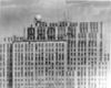
Last image of Miami's WSR-57 blown off by Hurricane Andrew.
The radar uses a wavelength of 10.3cm.[12] This corresponds to an operating frequency of 2890MHz. This frequency is in the S band, which is also used by today's weather radar network.
WSR-57 radars had the following interesting statistics:[12]
Dish diameter: 12 feet (3.7m)
Power output: 410,000 watts
Maximum range: 915km (494nm)
Related Research Articles
The National Hurricane Center (NHC) is the division of the United States' NOAA/National Weather Service responsible for tracking and predicting tropical weather systems between the Prime Meridian and the 140th meridian west poleward to the 30th parallel north in the northeast Pacific Ocean and the 31st parallel north in the northern Atlantic Ocean. The agency, which is co-located with the Miami branch of the National Weather Service, is situated on the campus of Florida International University in University Park, Miami, Florida.
The National Weather Service (NWS) is an agency of the United States federal government that is tasked with providing weather forecasts, warnings of hazardous weather, and other weather-related products to organizations and the public for the purposes of protection, safety, and general information. It is a part of the National Oceanic and Atmospheric Administration (NOAA) branch of the Department of Commerce, and is headquartered in Silver Spring, Maryland, within the Washington metropolitan area. The agency was known as the United States Weather Bureau from 1890 until it adopted its current name in 1970.
NEXRAD or Nexrad is a network of 159 high-resolution S-band Doppler weather radars operated by the National Weather Service (NWS), an agency of the National Oceanic and Atmospheric Administration (NOAA) within the United States Department of Commerce, the Federal Aviation Administration (FAA) within the Department of Transportation, and the U.S. Air Force within the Department of Defense. Its technical name is WSR-88D.
WSR-74 radars were Weather Surveillance Radars designed in 1974 for the National Weather Service. They were added to the existing network of the WSR-57 model to improve forecasts and severe weather warnings. Some have been sold to other countries like Australia, Greece, and Pakistan.
Weather radar, also called weather surveillance radar (WSR) and Doppler weather radar, is a type of radar used to locate precipitation, calculate its motion, and estimate its type. Modern weather radars are mostly pulse-Doppler radars, capable of detecting the motion of rain droplets in addition to the intensity of the precipitation. Both types of data can be analyzed to determine the structure of storms and their potential to cause severe weather.
The National Severe Storms Laboratory (NSSL) is a National Oceanic and Atmospheric Administration (NOAA) weather research laboratory under the Office of Oceanic and Atmospheric Research. It is one of seven NOAA Research Laboratories (RLs).
The Cooperative Institute for Severe and High-Impact Weather Research and Operations (CIWRO) is one of 16 NOAA Cooperative Institutes (CIs), hosted at the University of Oklahoma. Before Oct. 1, 2021, it was known as the Cooperative Institute for Mesoscale Meteorological Studies (CIMMS). The CIMMS/CIWRO, a research organization created in 1978 by a cooperative agreement between the University of Oklahoma (OU) and the National Oceanic and Atmospheric Administration (NOAA), promotes collaborative research between NOAA and OU scientists on problems of mutual interest to improve basic understanding of mesoscale meteorological phenomena, weather radar, and regional climate to help produce better forecasts and warnings that save lives and property. CIMMS/CIWRO research contributes to the NOAA mission through improvement of the observation, analysis, understanding, and prediction of weather elements and systems and climate anomalies ranging in size from cloud nuclei to multi-state areas.
The Aggie Doppler Radar (ADRAD) is a Doppler weather radar located on the roof of the Eller Oceanography & Meteorology Building on the Texas A&M University campus in College Station, Texas.
Volumetric Imaging and Processing of Integrated Radar, known by the acronym VIPIR, is an analysis and display program for Doppler weather radar, created and sold by Baron Services. This software allows improved analysis of radar data for private users, in particular television stations, similar to the Weather Decision Support System program used by the National Weather Service.
The AN/APS-2, originally known as ASG, was a surface search radar developed by Philco originally for use in US Coast Guard blimps to detect German submarines. It proved better than several similar models then being built, and was ordered by the RAF Coastal Command where it was known as ASV Mark V. It was used primarily on British Liberator GR bombers, where they were instrumental in closing the Mid-Atlantic Gap and the subsequent destruction of the German U-boat fleet in May/June 1943.
The WSR-1 or Weather Surveillance Radar-1 was one of the first weather radars and the first used by a civilian organization in the US. The WSR-1 series was a modified version of the AN/APS-2F radar, which the Weather Bureau acquired from the Navy. The WSR-1A, WSR-3, and WSR-4 were also variants of this radar. The first WSR-1 in the USA was at Washington National Airport in Washington, D.C. in 1947, and the last WSR-3 was retired by 1978.
The Warning Decision Training Division (WDTD), known as the Warning Decision Training Branch until April 1, 2015, is one of three training organizations in the NWS Training Division which also includes the Forecast Decision Training Branch and the NWS Training Center. WDTD develops and delivers training on the integrated elements of the warning process within a National Oceanic and Atmospheric Administration (NOAA)/National Weather Service (NWS) forecast office. WDTD instructors develop and deliver a variety of in-residence, teletraining, and on-line asynchronous training content.
National Weather Service Lincoln, Illinois also known as National Weather Service Central Illinois is a weather forecast office responsible for monitoring weather conditions for 35 counties in Central and Southeastern Illinois. The Central Illinois office initially consisted of two forecast offices in Peoria and Springfield until the current location in Lincoln became the sole local forecast office in 1995. Federal meteorology offices and stations in the region date back to the 19th century when the Army Signal Service began taking weather observations using weather equipment at the Springer Building in Springfield. Since that time the presence of the National Weather Service greatly increased with the installation of new weather radars, stations and forecast offices. The current office in Lincoln maintains a WSR-88D (NEXRAD) radar system, and Advanced Weather Interactive Processing System (AWIPS) that greatly improve forecasting in the region. Lincoln is in charge of weather forecasts, warnings and local statements as well as aviation weather.
National Weather Service - North Little Rock, AR, also known as National Weather Service - Little Rock, AR, is a local weather forecast office responsible for monitoring weather conditions for 47 of Arkansas's 75 counties, excluding 7 counties in Northwestern Arkansas, 9 counties in Southwestern and South Central Arkansas, Ashley and Chicot counties in Extreme Southeastern Arkansas, and 14 counties in Eastern Arkansas. Those counties are monitored by the Weather Service offices in Tulsa, Shreveport, Jackson (MS), and Memphis respectively. The current office in North Little Rock maintains a WSR-88D (NEXRAD) radar system and Advanced Weather Interactive Processing System (AWIPS) that greatly improve forecasting in the region. North Little Rock is in charge of weather forecasts, warnings and local statements as well as aviation weather. The name of the Doppler weather radar (WSR-88D) code used by this office is LZK. The National Weather Service at North Little Rock, Arkansas programs 12 NOAA Weather Radio transmitters across Arkansas, with 25 transmitters statewide.
National Weather Service - Memphis, TN is a local weather forecast office responsible for monitoring weather conditions in the U.S. Mid-South region for counties in Eastern Arkansas, the Missouri Bootheel, Northern Mississippi, and Western Tennessee. The current office in Memphis maintains a WSR-88D (NEXRAD) radar system, and Advanced Weather Interactive Processing System (AWIPS) that greatly improve forecasting in the region. Memphis is in charge of weather forecasts, warnings and local statements as well as aviation weather. The name of the Doppler weather radar (WSR-88D) used by this office is MEG. Darone Jones is the Meteorologist-In-Charge (MIC) of this office.
National Weather Service - Tulsa, Oklahoma (TSA) is a local weather forecast office responsible for monitoring weather conditions for 7 counties in Northwestern Arkansas, and 25 counties in Eastern Oklahoma. The current office in Tulsa maintains a WSR-88D (NEXRAD) radar system, and Advanced Weather Interactive Processing System (AWIPS) that greatly improve forecasting in the region. Tulsa is in charge of weather forecasts, warnings and local statements as well as aviation weather and NOAA Weather Radio broadcasts in its service area. The office operates two Doppler weather radars, one in Tulsa (INX), and the other in Fort Smith, Arkansas (SRX). Steve Piltz is the Meteorologist-In-Charge (MIC) of this office.
Leslie R. Lemon was an American meteorologist bridging research and forecasting with expertise in weather radar, particularly regarding severe convective storms. Lemon was, along with Charles A. Doswell III, a seminal contributor to the modern conception of the supercell which was first identified by Keith Browning, and he developed the Lemon technique to estimate updraft strength and thunderstorm organization also as a continuation of Browning's work.
National Weather Service Nashville is a weather forecast office responsible for monitoring weather conditions for 38 counties in Middle Tennessee. The office is in charge of weather forecasts, warnings, and local statements as well as aviation weather. It is equipped with a WSR-88D (NEXRAD) radar and an Automated Surface Observing System (ASOS) that greatly increases the ability to forecast. While it is officially the Nashville forecast office, the WFO is technically located in Wilson County near Old Hickory, Tennessee, along the shoreline of Old Hickory Lake near the Davidson/Wilson County line.
National Weather Service Louisville is a weather forecast office responsible for monitoring weather conditions for 49 counties in north-central, south-central, and east-central Kentucky and 10 counties in southern Indiana. The office is in charge of weather forecasts, warnings and local statements as well as aviation weather. It is also equipped with a WSR-88D (NEXRAD) radar, and an Automated Surface Observing System (ASOS) that greatly increase the ability to forecast. The NEXRAD radar site utilized by the forecast office is located near West Point, Kentucky on the north side of the Fort Knox Military Reservation.
The Langley Hill Doppler radar (KLGX) is a National Weather Service NEXRAD Doppler weather radar station on the Pacific coast of Washington State, in the United States. Prior to its construction, Washington's Olympic Peninsula coast was the only portion of the U.S. coastline without weather radar coverage, and "virtually no radar coverage [is] available over the ocean, where the majority of western Washington's weather originates" according to a Weather Service report to the United States Congress.
↑ National Weather Service Detroit/Pontiac Forecast Office. "Beecher 50th Anniversary Commemoration". National Weather Service Central Region Headquarters. Retrieved 2014-06-26.
This page is based on this Wikipedia article Text is available under the CC BY-SA 4.0 license; additional terms may apply. Images, videos and audio are available under their respective licenses.


