
Palakkad is one of the 14 districts in the Indian state of Kerala. It was carved out from the southeastern region of the former Malabar District on 1 January 1957. It is located at the centre of Kerala. It is the largest district in the state since 2006. The city of Palakkad is the district headquarters. Palakkad is bordered on the northwest by the Malappuram district, on the southwest by the Thrissur district, on the northeast by Nilgiris district, and on the east by Coimbatore district of Tamil Nadu. The district is nicknamed "The granary of Kerala". Palakkad is the gateway to Kerala due to the presence of the Palakkad Gap, in the Western Ghats. The 2,383 m high Anginda peak, which is situated in the border of Palakkad district, Nilgiris district, and Malappuram district, in Silent Valley National Park, is the highest point of elevation in Palakkad district. Palakkad city is located just 50 km away from Coimbatore, a major city in Tamil Nadu state.

Palakkad Gap or Palghat Gap is a low mountain pass in the Western Ghats between Coimbatore in Tamil Nadu and Palakkad in Kerala. It has an average elevation of 140 metres (460 ft) with a width of 24–30 kilometres (15–19 mi). The pass is located between the Nilgiri Hills to the north and Anaimalai Hills to the south.

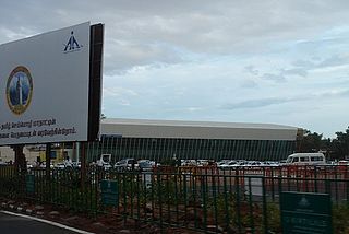
Palakkad, formerly known as Palghat, historically known as Palakkattussery is a city and municipality in the Indian state of Kerala. It is the administrative headquarters of the Palakkad District. Palakkad is most densely populated municipality and fourth densely populated city in Kerala. It was established before Indian independence under British rule and was known by the name Palghat. Palakkad is famous for the ancient Palakkad Fort, which is situated at the heart of the city and was captured and rebuilt by Hyder Ali in 1766. The city is situated about 347 kilometres (216 mi) northeast of the state capital Thiruvananthapuram.
Kochi is a major port city in the Indian state of Kerala. The city is widely known as the commercial or economic capital of the state of Kerala.

Ettimadai is a suburb of Coimbatore in the state of Tamilnadu, India. Ettimadai is located between Palakkad and Coimbatore along the Salem - Kochi Highway (NH544) close to Tamil Nadu - Kerala border. Ettimadai Town panjayat is one of the fast-growing south-western suburbs of Coimbatore. The renowned Amrita Vishwa Vidyapeetham University, along with its schools are situated here. It is 20 km (12 mi) from Gandhipuram, heart of coimbatore city and it is home to a railway station. There are other colleges such as Venkateshwara College of Business and Computer Applications, Nehru group of institution, Narayanana guru college of arts and technology.

Madukkarai is a suburb of Coimbatore city in the Indian state of Tamil Nadu. It is the gateway to Coimbatore city from Kerala State and is located around 12 km from the Kerala border. The Coimbatore International Airport is about 27 km from here. It is the administrative centre for Madukkarai taluk.

Kerala, a state in Southern India, has a network of 11 National Highways, 72 State Highways and many district roads.
Pathirippala is a town in Palakkad district, Kerala, India, between Ottappalam and Palakkad on the Palakkad–Ponnani state highway SH 23.
Tanalur (താനാളൂർ) is a census town in Malappuram district in the state of Kerala, India. It is a suburban town of neighbouring Tanur Municipality and comes under Tanur Block as well as Tanur. It falls under Tirur Taluk.

National Highway 966 is a highway which connects Palakkad, Malappuram and Kozhikode district headquarters in Kerala. It was previously known as NH 213. It covers a distance of 125 km. At Ramanattukara, near Kozhikode, it joins NH 66. At Palakkad it joins NH 544, which connects Coimbatore and Cochin through Palakkad.

.
The Indian city of Thiruvananthapuram has a well-developed transport infrastructure. The city and its suburbs may be traversed using road and rail. Within the city, city buses, taxis and auto rickshaws provide mobility. Scooters and motorcycles are the favored means of personal transport. Ola, Uber and other taxi services operate there.

Tamil Nadu, a state in South India, has a highly developed, dense, and modern transportation infrastructure, encompassing both public and private transport. Its capital city, Chennai is well-connected by land, sea, and air and serves as a major hub for entry into South India.

National Highway 544, commonly referred to as NH 544, is a 340-kilometre-long (210 mi) National Highway in South India connecting Salem city in Tamil Nadu to the city of Kochi in Kerala. It is also called the Salem-Kochi Highway. The highway runs through the states of Kerala and Tamil Nadu, connecting various important cities and towns such as Salem, Erode, Coimbatore, Palakkad, Thrissur and Kochi. It is a spur of National Highway 44, which forms the North South Corridor of the National Highway network of India.It passes south of Coimbatore. NH544 is the only highway in kerala which is fully 4lane including kuthiran Road Tunnel. It was formerly designated National Highway 47.

Kanjikode or Kanchikode is an industrial town located 13 km (8.1 mi) east of Palakkad. Kanjikode is the second largest industrial hub in Kerala after Kochi. The town is part of Pudussery Panchayat. It is one of the growing suburbs of Palakkad city. First and the only Indian Institute of Technology in Kerala, Indian Institute of Technology,Palakkad was established in Kanjikode.
Coimbatore is a city in the state of Tamil Nadu, India. Most transportation in the city and suburbs is over its road network. Coimbatore is well connected to most cities and towns in India by road, rail, and air, but not through waterways. The city has successful transport infrastructure compared to other Indian cities, though road infrastructures are not well maintained and developed according to the growing needs of transport, making traffic congestion a major problem in the city. A comprehensive transport development plan has been made to address many traffic problems.
National Highway 183A, also known as NH 183A, is a National Highway in the Indian state of Kerala that runs from Chavara Titanium Junction, Kollam, to Vandiperiyar via Adoor and Pathanamthitta. It is the 4th National Highway passing through the Kollam district.

The district capital of Wayanad is Kalpetta town. Kalpetta has very good road connectivity with the rest of Kerala and neighboring South Indian cities. National Highway 766 (India) NH766 connects Kalpetta with Kozhikode and Mysore. State Highways connect Kalpetta with Ooty in Tamil Nadu and Madikeri in Karnataka.
Kozhikode district has an extensive network of road, rail and air travel services. Kozhikode city is the epicenter of the district. Vatakara and Thamarassery are other transport hubs.
Palakkad Road, is an arterial road in Coimbatore, India. This road connects the city to Palakkad and the state of Kerala and the south-west suburbs in the Coimbatore metropolitan area.


