Walker circulation

Last updated

A schematic diagram of the quasi-equilibrium and La Nina phase of the southern oscillation. The Walker circulation is seen at the surface as easterly trade winds which move water and air warmed by the sun towards the west. The western side of the equatorial Pacific is characterized by warm, wet low pressure weather as the collected moisture is dumped in the form of typhoons and thunderstorms. The ocean is some 60 cm higher in the western Pacific as the result of this motion. The water and air are returned to the east. Both are now much cooler, and the air is much drier. An El Nino episode is characterised by a breakdown of this water and air cycle, resulting in relatively warm water and moist air in the eastern Pacific. LaNina.png
A schematic diagram of the quasi-equilibrium and La Niña phase of the southern oscillation. The Walker circulation is seen at the surface as easterly trade winds which move water and air warmed by the sun towards the west. The western side of the equatorial Pacific is characterized by warm, wet low pressure weather as the collected moisture is dumped in the form of typhoons and thunderstorms. The ocean is some 60 cm higher in the western Pacific as the result of this motion. The water and air are returned to the east. Both are now much cooler, and the air is much drier. An El Niño episode is characterised by a breakdown of this water and air cycle, resulting in relatively warm water and moist air in the eastern Pacific.

The Walker circulation, also known as the Walker cell, is a conceptual model of the air flow in the tropics in the lower atmosphere (troposphere). According to this model, parcels of air follow a closed circulation in the zonal and vertical directions. This circulation, which is roughly consistent with observations, is caused by differences in heat distribution between ocean and land. In addition to motions in the zonal and vertical direction the tropical atmosphere also has considerable motion in the meridional direction as part of, for example, the Hadley Circulation.

Contents

The Walker circulation is caused by the pressure gradient force that results from a high pressure system over the eastern Pacific Ocean, and a low pressure system over Indonesia. The Walker circulations of the tropical Indian, Pacific, and Atlantic basins result in westerly surface winds in northern summer in the first basin and easterly winds in the second and third basins. As a result, the temperature structure of the three oceans display dramatic asymmetries. The equatorial Pacific and Atlantic both have cool surface temperatures in northern summer in the east, while cooler surface temperatures prevail only in the western Indian Ocean. [1] These changes in surface temperature reflect changes in the depth of the thermocline. [2]

Changes in the Walker circulation with time occur in conjunction with changes in surface temperature. Some of these changes are forced externally, such as the seasonal shift of the sun into the Northern Hemisphere in summer. Other changes appear to be the result of coupled ocean-atmosphere feedback in which, for example, easterly winds cause the sea surface temperature to fall in the east, enhancing the zonal heat contrast and hence intensifying easterly winds across the basin. These anomalous easterlies induce more equatorial upwelling and raise the thermocline in the east, amplifying the initial cooling by the southerlies. From an oceanographic point of view, the equatorial cold tongue is caused by easterly winds. Were the Earth climate symmetric about the equator, cross-equatorial wind would vanish, and the cold tongue would be much weaker and have a very different zonal structure than is observed today. [3]

The Walker circulation was discovered by Gilbert Walker. The term "Walker circulation" was coined in 1969 by the Norwegian-American meteorologist Jacob Bjerknes. [4]

Walker's methodology

Gilbert Walker was an established applied mathematician at the University of Cambridge when he became director-general of observatories in India in 1904. [5] While there, he studied the characteristics of the Indian Ocean monsoon, the failure of whose rains had brought severe famine to the country in 1899. Analyzing vast amounts of weather data from India and the rest of the world, over the next fifteen years he published the first descriptions of the great seesaw oscillation of atmospheric pressure between the Indian and Pacific Ocean, and its correlation to temperature and rainfall patterns across much of the Earth's tropical regions, including India. He also worked with the Indian Meteorological Department especially in linking the monsoon with Southern Oscillation phenomenon. He was made a Companion of the Order of the Star of India in 1911. [5]

Walker determined that the time scale of a year (used by many studying the atmosphere) was unsuitable because geospatial relationships could be entirely different depending on the season. Thus, Walker broke his temporal analysis into December–February, March–May, June–August, and September–November.

Walker then selected a number of "centers of action", which included areas such as the Indian Peninsula. The centers were in the hearts of regions with either permanent or seasonal high and low pressures. He also added points for regions where rainfall, wind or temperature was an important control.

He examined the relationships of the summer and winter values of pressure and rainfall, first focusing on summer and winter values, and later extending his work to the spring and autumn.

He concludes that variations in temperature are generally governed by variations in pressure and rainfall. It had previously been suggested that sunspots could be the cause of the temperature variations, but Walker argued against this conclusion by showing monthly correlations of sunspots with temperature, winds, cloud cover, and rain that were inconsistent.

Walker made it a point to publish all of his correlation findings, both of relationships found to be important as well as relationships that were found to be unimportant. He did this for the purpose of dissuading researchers from focusing on correlations that did not exist.

Oceanic effects

Average equatorial Pacific temperatures Mean sst equatorial pacific.gif
Average equatorial Pacific temperatures
Graph showing a tropical ocean thermocline (depth vs. temperature). Note the rapid change between 100 and 1000 meters. The temperature is nearly constant after 1500 meters depth. THERMOCLINE.png
Graph showing a tropical ocean thermocline (depth vs. temperature). Note the rapid change between 100 and 1000 meters. The temperature is nearly constant after 1500 meters depth.

The Walker Circulations of the tropical Indian, Pacific, and Atlantic basins result in westerly surface winds in Northern Summer in the first basin and easterly winds in the second and third basins. As a result, the temperature structure of the three oceans display dramatic asymmetries. The equatorial Pacific and Atlantic both have cool surface temperatures in Northern Summer in the east, while cooler surface temperatures prevail only in the western Indian Ocean. [6] These changes in surface temperature reflect changes in the depth of the thermocline. [7]

Changes in the Walker Circulation with time occur in conjunction with changes in surface temperature. Some of these changes are forced externally, such as the seasonal shift of the Sun into the Northern Hemisphere in summer. Other changes appear to be the result of coupled ocean-atmosphere feedback in which, for example, easterly winds cause the sea surface temperature to fall in the east, enhancing the zonal heat contrast and hence intensifying easterly winds across the basin. These enhanced easterlies induce more equatorial upwelling and raise the thermocline in the east, amplifying the initial cooling by the southerlies. This coupled ocean-atmosphere feedback was originally proposed by Bjerknes. From an oceanographic point of view, the equatorial cold tongue is caused by easterly winds. Were the earth climate symmetric about the equator, cross-equatorial wind would vanish, and the cold tongue would be much weaker and have a very different zonal structure than is observed today. [8] The Walker cell is indirectly related to upwelling off the coasts of Peru and Ecuador. This brings nutrient-rich cold water to the surface, increasing fishing stocks. [9]

El Niño–Southern Oscillation

The Walker circulation is caused by the pressure gradient force that results from a high pressure system over the eastern Pacific Ocean and a low pressure system over Indonesia. The Walker circulation causes an upwelling of cold deep sea water, thus cooling the sea surface. El Niño results when this circulation decreases or stops, as the impaired or inhibited circulation causes the ocean surface to warm to above average temperatures. A markedly increased Walker circulation causes a La Niña by intensifying the upwelling of cold deep sea water; which cools the sea surface to below average temperatures.

During non-El Niño conditions, the Walker circulation is seen at the surface as easterly trade winds that move water and air warmed by the sun toward the west. This also creates ocean upwelling off the coasts of Peru and Ecuador and brings nutrient-rich cold water to the surface, increasing fishing stocks. [10] The western side of the equatorial Pacific is characterized by warm, wet, low-pressure weather as the collected moisture is dumped in the form of typhoons and thunderstorms. The ocean is some 60 cm (24 in) higher in the western Pacific as the result of this motion. [11] [12] [13] [14]

A scientific study published in May 2006 in the journal Nature indicates that the Walker circulation has been slowing since the mid-19th century. The authors argue that global warming is a likely causative factor in the weakening of the wind pattern. [15] However, a 2011 study from The Twentieth Century Reanalysis Project shows that, aside from El Niño–Southern Oscillation cycles, the overall speed and direction of the Walker circulation remained steady between 1871 and 2008. [16]

See also

Related Research Articles

<span class="mw-page-title-main">El Niño–Southern Oscillation</span> Climate phenomenon that periodically fluctuates between three phases

El Niño–Southern Oscillation (ENSO) is an irregular periodic variation in winds and sea surface temperatures over the tropical eastern Pacific Ocean, affecting the climate of much of the tropics and subtropics. The warming phase of the sea temperature is known as El Niño and the cooling phase as La Niña. The Southern Oscillation is the accompanying atmospheric component, coupled with the sea temperature change: El Niño is accompanied by high air surface pressure in the tropical western Pacific and La Niña with low air surface pressure there. The two periods last several months each and typically occur every few years with varying intensity per period.
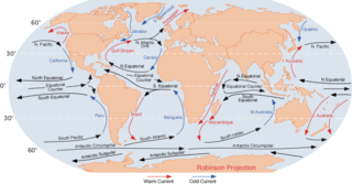
<span class="mw-page-title-main">Ocean current</span> Directional mass flow of oceanic water generated by external or internal forces

An ocean current is a continuous, directed movement of seawater generated by a number of forces acting upon the water, including wind, the Coriolis effect, breaking waves, cabbeling, and temperature and salinity differences. Depth contours, shoreline configurations, and interactions with other currents influence a current's direction and strength. Ocean currents are primarily horizontal water movements.
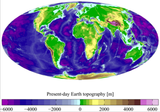
<span class="mw-page-title-main">Physical oceanography</span> Study of physical conditions and processes within the ocean

Physical oceanography is the study of physical conditions and physical processes within the ocean, especially the motions and physical properties of ocean waters.
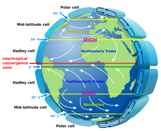
<span class="mw-page-title-main">Atmospheric circulation</span> Process which distributes thermal energy about the Earths surface

Atmospheric circulation is the large-scale movement of air and together with ocean circulation is the means by which thermal energy is redistributed on the surface of the Earth. The Earth's atmospheric circulation varies from year to year, but the large-scale structure of its circulation remains fairly constant. The smaller-scale weather systems – mid-latitude depressions, or tropical convective cells – occur chaotically, and long-range weather predictions of those cannot be made beyond ten days in practice, or a month in theory.

<span class="mw-page-title-main">Rossby wave</span> Inertial wave occurring in rotating fluids

Rossby waves, also known as planetary waves, are a type of inertial wave naturally occurring in rotating fluids. They were first identified by Sweden-born American meteorologist Carl-Gustaf Arvid Rossby in the Earth's atmosphere in 1939. They are observed in the atmospheres and oceans of Earth and other planets, owing to the rotation of Earth or of the planet involved. Atmospheric Rossby waves on Earth are giant meanders in high-altitude winds that have a major influence on weather. These waves are associated with pressure systems and the jet stream. Oceanic Rossby waves move along the thermocline: the boundary between the warm upper layer and the cold deeper part of the ocean.

<span class="mw-page-title-main">High-pressure area</span> Region with higher atmospheric pressure

A high-pressure area, high, or anticyclone, is an area near the surface of a planet where the atmospheric pressure is greater than the pressure in the surrounding regions. Highs are middle-scale meteorological features that result from interplays between the relatively larger-scale dynamics of an entire planet's atmospheric circulation.

<span class="mw-page-title-main">Low-pressure area</span> Area with air pressures lower than adjacent areas

In meteorology, a low-pressure area, low area or low is a region where the atmospheric pressure is lower than that of surrounding locations. Low-pressure areas are commonly associated with inclement weather, while high-pressure areas are associated with lighter winds and clear skies. Winds circle anti-clockwise around lows in the northern hemisphere, and clockwise in the southern hemisphere, due to opposing Coriolis forces. Low-pressure systems form under areas of wind divergence that occur in the upper levels of the atmosphere (aloft). The formation process of a low-pressure area is known as cyclogenesis. In meteorology, atmospheric divergence aloft occurs in two kinds of places:

The Tropical Ocean Global Atmosphere program (TOGA) was a ten-year study (1985–1994) of the World Climate Research Programme (WCRP) aimed specifically at the prediction of climate phenomena on time scales of months to years.

<span class="mw-page-title-main">Thermocline</span> Thermal layer in a body of water

A thermocline is a distinct layer based on temperature within a large body of fluid with a high gradient of distinct temperature differences associated with depth. In the ocean, the thermocline divides the upper mixed layer from the calm deep water below.

<span class="mw-page-title-main">Prevailing winds</span> Strongest direction of wind on a region of Earths surface

In meteorology, prevailing wind in a region of the Earth's surface is a surface wind that blows predominantly from a particular direction. The dominant winds are the trends in direction of wind with the highest speed over a particular point on the Earth's surface at any given time. A region's prevailing and dominant winds are the result of global patterns of movement in the Earth's atmosphere. In general, winds are predominantly easterly at low latitudes globally. In the mid-latitudes, westerly winds are dominant, and their strength is largely determined by the polar cyclone. In areas where winds tend to be light, the sea breeze/land breeze cycle is the most important cause of the prevailing wind; in areas which have variable terrain, mountain and valley breezes dominate the wind pattern. Highly elevated surfaces can induce a thermal low, which then augments the environmental wind flow.

<span class="mw-page-title-main">Sea surface temperature</span> Water temperature close to the oceans surface

Sea surface temperature (SST), or ocean surface temperature, is the ocean temperature close to the surface. The exact meaning of surface varies in the literature and in practice. It is usually between 1 millimetre (0.04 in) and 20 metres (70 ft) below the sea surface. Sea surface temperatures greatly modify air masses in the Earth's atmosphere within a short distance of the shore. Local areas of heavy snow can form in bands downwind of warm water bodies within an otherwise cold air mass. Warm sea surface temperatures can develop and strengthen cyclones over the Ocean. Experts call this process tropical cyclogenesis. Tropical cyclones can also cause a cool wake. This is due to turbulent mixing of the upper 30 metres (100 ft) of the ocean. Sea surface temperature changes during the day. This is like the air above it, but to a lesser degree. There is less variation in sea surface temperature on breezy days than on calm days. Ocean currents, such as the Atlantic Multidecadal Oscillation, can affect sea surface temperatures over several decades. Thermohaline circulation has a major impact on average sea surface temperature throughout most of the world's oceans.

<span class="mw-page-title-main">Madden–Julian oscillation</span> Tropical atmosphere element of variability

The Madden–Julian oscillation (MJO) is the largest element of the intraseasonal variability in the tropical atmosphere. It was discovered in 1971 by Roland Madden and Paul Julian of the American National Center for Atmospheric Research (NCAR). It is a large-scale coupling between atmospheric circulation and tropical deep atmospheric convection. Unlike a standing pattern like the El Niño–Southern Oscillation (ENSO), the Madden–Julian oscillation is a traveling pattern that propagates eastward, at approximately 4 to 8 m/s, through the atmosphere above the warm parts of the Indian and Pacific oceans. This overall circulation pattern manifests itself most clearly as anomalous rainfall.

<span class="mw-page-title-main">Tropical cyclogenesis</span> Development and strengthening of a tropical cyclone in the atmosphere

Tropical cyclogenesis is the development and strengthening of a tropical cyclone in the atmosphere. The mechanisms through which tropical cyclogenesis occurs are distinctly different from those through which temperate cyclogenesis occurs. Tropical cyclogenesis involves the development of a warm-core cyclone, due to significant convection in a favorable atmospheric environment.

In physical oceanography and fluid dynamics, the wind stress is the shear stress exerted by the wind on the surface of large bodies of water – such as oceans, seas, estuaries and lakes. When wind is blowing over a water surface, the wind applies a wind force on the water surface. The wind stress is the component of this wind force that is parallel to the surface per unit area. Also, the wind stress can be described as the flux of horizontal momentum applied by the wind on the water surface. The wind stress causes a deformation of the water body whereby wind waves are generated. Also, the wind stress drives ocean currents and is therefore an important driver of the large-scale ocean circulation. The wind stress is affected by the wind speed, the shape of the wind waves and the atmospheric stratification. It is one of the components of the air–sea interaction, with others being the atmospheric pressure on the water surface, as well as the exchange of energy and mass between the water and the atmosphere.

<span class="mw-page-title-main">Glossary of tropical cyclone terms</span>

The following is a glossary of tropical cyclone terms.

The Tropical Atlantic SST Dipole refers to a cross-equatorial sea surface temperature (SST) pattern that appears dominant on decadal timescales. It has a period of about 12 years, with the SST anomalies manifesting their most pronounced features around 10–15 degrees of latitude off of the Equator. It is also referred to as the interhemispheric SST gradient or the Meridional Atlantic mode.

There are a number of explanations of the asymmetry of the Intertropical Convergence Zone (ITCZ), known by sailors as the Doldrums.

<span class="mw-page-title-main">Papagayo Jet</span>

The Papagayo jet, also referred to as the Papagayo Wind or the Papagayo Wind Jet, are strong intermittent winds that blow approximately 70 km north of the Gulf of Papagayo, after which they are named. The jet winds travel southwest from the Caribbean and the Gulf of Mexico to the Pacific Ocean through a pass in the Cordillera mountains at Lake Nicaragua. The jet follows the same path as the northeast trade winds in this region; however, due to a unique combination of synoptic scale meteorology and orographic phenomena, the jet winds can reach much greater speeds than their trade wind counterparts. That is to say, the winds occur when cold high-pressure systems from the North American continent meet warm moist air over the Caribbean and Gulf of Mexico, generating winds that are then funneled through a mountain pass in the Cordillera. The Papagayo jet is also not unique to this region. There are two other breaks in the Cordillera where this same phenomenon occurs, one at the Chivela Pass in México and another at the Panama Canal, producing the Tehuano (Tehuantepecer) and the Panama jets respectively.

Ocean dynamical thermostat is a physical mechanism through which changes in the mean radiative forcing influence the gradients of sea surface temperatures in the Pacific Ocean and the strength of the Walker circulation. Increased radiative forcing (warming) is more effective in the western Pacific than in the eastern where the upwelling of cold water masses damps the temperature change. This increases the east-west temperature gradient and strengthens the Walker circulation. Decreased radiative forcing (cooling) has the opposite effect.

The recharge oscillator model for El Niño–Southern Oscillation (ENSO) is a theory described for the first time in 1997 by Jin., which explains the periodical variation of the sea surface temperature (SST) and thermocline depth that occurs in the central equatorial Pacific Ocean. The physical mechanisms at the basis of this oscillation are periodical recharges and discharges of the zonal mean equatorial heat content, due to ocean-atmosphere interaction. Other theories have been proposed to model ENSO, such as the delayed oscillator, the western Pacific oscillator and the advective reflective oscillator. A unified and consistent model has been proposed by Wang in 2001, in which the recharge oscillator model is included as a particular case.

References

  1. Bureau of Meteorology. "The Walker Circulation". Commonwealth of Australia. Retrieved 1 July 2014.
  2. Zelle, Hein; Gerrian Appledoorn; Gerritt Burgers; Geert Jan Van Oldenborgh (2004). "Relationship Between Sea Surface Temperature and Thermocline Depth in the Eastern Equatorial Pacific". Journal of Physical Oceanography. 34 (3): 643–655. Bibcode:2004JPO....34..643Z. CiteSeerX   10.1.1.12.3536 . doi:10.1175/2523.1. S2CID   16785385.
  3. Xie, Shang-Ping (1 February 1998). "Ocean-Atmosphere Interaction in the Making of the Walker Circulation and Equatorial Cold Tongue". Journal of Climate. 11 (2): 189–201. Bibcode:1998JCli...11..189X. doi: 10.1175/1520-0442(1998)011<0189:OAIITM>2.0.CO;2 . JSTOR   26242917. INIST   2154325.
  4. Bjerknes, J. (March 1969) "Atmospheric teleconnections from the equatorial Pacific," Monthly Weather Review, 97 (3) : 163–172. From pp. 167–168: "It seems reasonalble to assume that it is the gradient of sea temperature along the Equator which is the cause of the thermal circulation entered in figure 8. Hereafter, in the present article that circulation will be referred to as the "Walker Circulation" since it can be shown to be an important part of the mechanism of Walker's "Southern Oscillation." " Available at: N.O.A.A.
  5. 1 2 Rao, C. Hayavando, ed. (1915). The Indian Biographical Dictionary. Madras: Pillar & Co. p. 456. Retrieved 20 March 2010.
  6. Bureau of Meteorology. "The Walker Circulation". Commonwealth of Australia. Retrieved 1 July 2014.
  7. Zelle, Hein, Gerrian Appledoorn, Gerritt Burgers, and Gert Jan Van Oldenborgh (March 2004). "Relationship Between Sea Surface Temperature and Thermocline Depth in the Eastern Equatorial Pacific". Journal of Physical Oceanography. 34 (3): 643. Bibcode:2004JPO....34..643Z. CiteSeerX   10.1.1.12.3536 . doi:10.1175/2523.1. S2CID   16785385.{{cite journal}}: CS1 maint: multiple names: authors list (link)
  8. Ocean-atmosphere interaction in the making of the Walker circulation and equatorial cold tongue
  9. Jennings, S., Kaiser, M.J., Reynolds, J.D. (2001) "Marine Fisheries Ecology." Oxford: Blackwell Science Ltd. ISBN   0-632-05098-5
  10. Jennings, S., Kaiser, M.J., Reynolds, J.D. (2001) "Marine Fisheries Ecology." Oxford: Blackwell Science Ltd. ISBN   0-632-05098-5 [ page needed ]
  11. Pidwirny, Michael (2 February 2006). "Chapter 7: Introduction to the Atmosphere". Fundamentals of Physical Geography. physicalgeography.net. Retrieved 30 December 2006.
  12. "Envisat watches for La Niña". BNSC via the Internet Wayback Machine. 9 January 2011. Archived from the original on 24 April 2008. Retrieved 26 July 2007.
  13. "The Tropical Atmosphere Ocean Array: Gathering Data to Predict El Niño". Celebrating 200 Years. NOAA. 8 January 2007. Retrieved 26 July 2007.
  14. "Ocean Surface Topography". Oceanography 101. JPL. 5 July 2006. Archived from the original on 14 April 2009. Retrieved 26 July 2007. "Annual Sea Level Data Summary Report July 2005 – June 2006" (PDF). The Australian Baseline Sea Level Monitoring Project. Bureau of Meteorology. Archived from the original (PDF) on 7 August 2007. Retrieved 26 July 2007.
  15. Weakening of tropical Pacific atmospheric circulation due to anthropogenic forcing
  16. The Twentieth Century Reanalysis Project. Quarterly Journal of the Royal Meteorological Society, 137: 1–28. doi : 10.1002/qj.776, http://onlinelibrary.wiley.com/doi/10.1002/qj.776/abstract

General references