Wheatbelt (Western Australia)

Last updated

Wheatbelt
Western Australia
Wheatbelt (Western Australia)
Location of the Wheatbelt region in Western Australia
LGA(s)
State electorate(s)
Federal division(s)
Location of the Wheatbelt within Western Australia WA Wheatbelt A4.jpg
Location of the Wheatbelt within Western Australia
Grain receival and storage facility at Yealering Yealering grain receival and storage.JPG
Grain receival and storage facility at Yealering
Land degradation caused by excessive clearing with resulting salinity, near Babakin Wheatbelt Versalzungsschaden.JPG
Land degradation caused by excessive clearing with resulting salinity, near Babakin
Bencubbin-Kellerberrin Road Bencubbin-Kellerberrin Road, 2014(2).JPG
Bencubbin–Kellerberrin Road

The Wheatbelt is one of nine regions of Western Australia defined as administrative areas for the state's regional development, and a vernacular term for the area converted to agriculture during colonisation. [lower-alpha 1] It partially surrounds the Perth metropolitan area, extending north from Perth to the Mid West region, and east to the Goldfields–Esperance region. It is bordered to the south by the South West and Great Southern regions, and to the west by the Indian Ocean, the Perth metropolitan area, and the Peel region. Altogether, it has an area of 154,862 square kilometres (59,793 sq mi) (including islands).

Contents

The region has 42 local government authorities, with an estimated population of 75,000 residents. The Wheatbelt accounts for approximately three per cent of Western Australia's population. [3]

Ecosystems

The area, once a diverse ecosystem, reduced when clearing began in the 1890s with the removal of plant species such as eucalypt woodlands and mallee, is now home to around 11% of Australia's critically endangered plants. [4]

A number of nationally threatened birds reside in the Wheatbelt, including the endangered Carnaby's black cockatoo and the vulnerable malleefowl. [5]

The Wheatbelt encompasses a range of ecosystems and, as a result, there are a range of industries operating in the region.[ clarification needed ]

In the Interim Biogeographic Regionalisation for Australia there are a number of subdivisions such as the Avon Wheatbelt (AVW), and a further breakdown of Avon Wheatbelt P1 (AW1) and Avon Wheatbelt P2 (AW2), Jarrah Forest, Geraldton Sandplains and Mallee regions.

Industry and economy

Near the coast, the region receives relatively high rainfall and mild temperatures, and its 150 kilometres (93 mi) of coastline is a significant tourist area. In contrast, the eastern fringe is very arid, and is mainly used for pastoral farming of sheep. Mining of gold, nickel and iron ore also occurs. The remainder of the region is highly suited to agriculture, and is the source of nearly two thirds of the state's wheat production, half of its wool production, and the majority of its lamb and mutton, oranges, honey, cut flowers and a range of other agricultural and pastoral products.

Change

With a range of climate and economic changes in the region, considerable effort is made by government at all levels to cope with the decline of some communities, and create opportunities for ventures that keep population in the region. [6] Cultural change with population changes in many localities has been identified by local museums and historical societies, including online documentation. [7]

Bruce Rock
Corrigin
Cunderdin
Dowering
Goomalling
Hyden
Kellerberrin
Koorda
Kulin
Lake Grace
Meckering
Merredin
Narrembeen
Newdegate
Nungarin
Southern Cross
Westonia
Wyalkatchem
Yelbeni


Also the literary tradition of writers including the wheatbelt in their writing included: [8]

Albert Facey
Peter Cowan
Dorothy Hewett
Jack Davis
Elizabeth Jolley
John Kinsella

Lesser known writers also have the wheatbelt environment in their writing such as Lilian Wooster Greaves.

Transport

The Wheatbelt once had an extensive railway system, which transported bulk wheat grain. It has been reduced in part, while the main lines are being supported. Grain is transported on those lines to ports for export from the CBH grain receival points (grain silos), which are primarily located in the Wheatbelt region.

Six main highways radiating out from Perth serve the Wheatbelt: Brand Highway (north-west to Geraldton ), Great Northern Highway (north-east to Wyndham ), Great Eastern Highway (east to Kalgoorlie ), Great Southern Highway (east to York , then south to Cranbrook ), Brookton Highway (east-south-east to Brookton ), and Albany Highway (south-east to Albany ). A network of main roads connects towns within the Wheatbelt to each other, the highways, and neighbouring regions, with local roads providing additional links and access to smaller townsites. Roads are often named after the towns they connect. [9] [10] [11]

Local government areas

The following list is the shires listed in the Wheatbelt as designated by the Wheatbelt Development Commission. [12] Some shires in adjoining regions are traditionally considered part of the Wheatbelt – there are shires in the Great Southern, Goldfields-Esperance and Mid West regions that are dominantly grain growing areas.

Wheat growing north-east of Northam Wheatbelt panorama-2.JPG
Wheat growing north-east of Northam

Sub-regions within the Wheatbelt

There are numerous subdivisions of the Wheatbelt, and in most cases the separation is by local government areas.

Wheatbelt Development Commission

The Wheatbelt Development Commission [13] (WDC) breaks the region up into five sub-regions with four offices:

Tourism regions

Most of the Wheatbelt is included in the larger Australia's Golden Outback. [14] [15] [16]

Due to their proximity to Perth, however, the following shires are instead promoted as part of the Destination Perth region. The tourist precincts are included: [17]

Finally, the northwestern Shire of Dandaragan is promoted as part of Australia's Coral Coast region due to the presence of the larger seaside towns of Cervantes and Jurien Bay, which developed independently of wheat-growing. [19]

Other regional designations

The Wheatbelt is separated into other designations at various times as well:

See also

Notes

  1. Some early twentieth century references have "wheat belt" as two separate words. [1] [2]

Related Research Articles

<span class="mw-page-title-main">Cunderdin, Western Australia</span> Town in the Wheatbelt region of Western Australia

Cunderdin is a town located in the Wheatbelt region of Western Australia 156 km east of Perth, along the Great Eastern Highway. Due to it being on the route of the Goldfields Water Supply Scheme it is also on the Golden Pipeline Heritage Trail. It is a rural community consisting of a district high school and an agricultural college.

<span class="mw-page-title-main">Division of O'Connor</span> Australian federal electoral division

The Division of O'Connor is an Australian electoral division in the state of Western Australia. It is one of Western Australia's three rural seats, and one of the largest electoral constituencies in the world.

<span class="mw-page-title-main">Tammin, Western Australia</span> Town in Western Australia

Tammin is a town in the central agricultural region of Western Australia, 184 kilometres (114 mi) east of Perth and midway between the towns of Cunderdin and Kellerberrin on the Great Eastern Highway.

<span class="mw-page-title-main">Kellerberrin, Western Australia</span> Town in Western Australia

Kellerberrin is a town in the Wheatbelt region of Western Australia, 205 kilometres (127 mi) east of Perth on the Great Eastern Highway. The town serves as a stop on the Prospector and MerredinLink rural train services. It is also located on the Golden Pipeline Heritage Trail.

<span class="mw-page-title-main">Wyalkatchem, Western Australia</span> Town in Western Australia

Wyalkatchem is a town in the central Wheatbelt region, 192 kilometres (119 mi) east-north-east of Perth, 35 kilometres (22 mi) east of Dowerin and 44 kilometres (27 mi) south of Koorda. At the 2021 census, Wyalkatchem had a population of 358.

Merredin was an electoral district of the Legislative Assembly in the Australian state of Western Australia from 1950 to 2008.

<span class="mw-page-title-main">Shire of Nungarin</span> Local government area in Western Australia

The Shire of Nungarin is a local government area in the Wheatbelt region of Western Australia, and with a population of 255 as of the 2021 census, is one of the nation's least populous. It is located about 40 kilometres (25 mi) north of Merredin and about 300 kilometres (186 mi) east of the state capital, Perth. The Shire covers an area of 1,164 square kilometres (449 sq mi), and its seat of government is the town of Nungarin.

<span class="mw-page-title-main">Trayning, Western Australia</span> Town in Western Australia

Trayning is a town in the north-eastern Wheatbelt region of Western Australia, 236 kilometres (147 mi) east of the state capital, Perth, on the Nungarin–Wyalkatchem Road. At the 2006 census, Trayning had a population of 122.

Mount Marshall was an electoral district of the Legislative Assembly in the Australian state of Western Australia from 1930 to 1989.

<span class="mw-page-title-main">Electoral district of Central Wheatbelt</span> State electoral district of Western Australia

Central Wheatbelt is an electoral district of the Legislative Assembly in the Australian state of Western Australia.

<span class="mw-page-title-main">Division of Durack</span> Australian federal electoral division

The Division of Durack is an Australian Electoral Division in the state of Western Australia.

<span class="mw-page-title-main">Kununoppin</span> Town in Western Australia

Kununoppin is a small town in the Wheatbelt region of Western Australia. The town is located on the Nungarin–Wyalkatchem Road and in the Shire of Trayning local government area, 257 kilometres (160 mi) north east of the state capital, Perth, Western Australia. At the 2006 census, Kununoppin had a population of 151.

<span class="mw-page-title-main">Western Australian Government Railway lines and operations centres</span>

Western Australian Government Railways railway system during its peak operational time in the 1930s to 1950s was a large system of over 6,400 kilometres (4,000 mi) of railway line.

<span class="mw-page-title-main">Major roads in the Wheatbelt region of Western Australia</span>

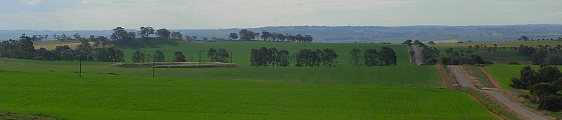
Highways and main roads in the Wheatbelt region of Western Australia form the basis of a road network, which is primarily used by the mining, agriculture, and tourism industries. Main Roads Western Australia maintains and controls these major roads, with offices based in Northam and Narrogin.

<span class="mw-page-title-main">Northam railway station, Western Australia</span> Railway station in Northam, Western Australia

Northam railway station is located in Northam on the Eastern Railway route in Western Australia. It is the second and more recent railway station in Northam.

<span class="mw-page-title-main">Wheatbelt newspapers</span> Newspapers published in the Wheatbelt region of Western Australia

This is a list of newspapers published in, or for, the Wheatbelt region of Western Australia.

<span class="mw-page-title-main">Brookton to Corrigin railway</span> Railway line in Western Australia

Brookton to Corrigin railway was a railway line in the Western Australian wheatbelt, between Brookton and Corrigin.

References

  1. "THE WHEAT BELT". The West Australian . Perth. 13 October 1920. p. 7. Retrieved 11 September 2015 via National Library of Australia.
  2. "The New Agricultural Commissioner for Western Australia's Wheat Belt". Bunbury Herald . WA. 27 April 1911. p. 3. Retrieved 11 September 2015 via National Library of Australia.
  3. "Government of Western Australia Department of Regional Development" (PDF). Wheatbelt: a region in profile 2014. 2014. Archived from the original (PDF) on 19 October 2016. Retrieved 17 May 2016.
  4. Silcock, Jen (1 September 2016). "Hanging on: What does it mean to be Red Hot?: Australia's most imperilled plants and their recovery". Wildlife Australia. 53 (3).
  5. Nationally threatened birds of the Western wheatbelt Australian government, Environment Australia 2000, accessed 7 May 2019
  6. "Wheatbelt Development Commission" . Retrieved 7 April 2024.
  7. "Museums in the wheatbelt" . Retrieved 7 April 2024.
  8. Hughes-d'Aeth, Tony; ProQuest (Firm) (2017), Like nothing on this earth : [a literary history of the wheatbelt], UWA Publishing, ISBN   978-1-76080-163-2
  9. Main Roads Western Australia (28 February 2011). "Wheatbelt Network" (Map). Intergrated Service Arrangement. 1:2,040,816. Government of Western Australia. Archived from the original (PDF) on 3 August 2013. Retrieved 5 October 2013.
  10. Main Roads Western Australia (13 August 2013). Wheatbelt North Region map (PDF) (Map). 1:721,154. Version 1.0. Government of Western Australia. Archived from the original on 29 August 2013. Retrieved 5 October 2013.
  11. Main Roads Western Australia (13 August 2013). Wheatbelt South Region map (PDF) (Map). 1:590,551. Version 1.0. Government of Western Australia. Archived from the original on 29 August 2013. Retrieved 5 October 2013.
  12. http://wheatbelt.wa.gov.au/Maps – the most helpful maps being the "Wheatbelt Development Commission Map"
  13. "Wheatbelt Development Commission" . Retrieved 2 October 2013.
  14. Western Australian Visitor Centre (2020), Western Australia's golden outback self drive guide : Gascoyne & Murchison, Wheatbelt, Esperance & Fitzgerald Coast, Kalgoorlie & Goldfields, Australia's Golden Outback, retrieved 28 October 2020
  15. "Western Australia's Wheatbelt Holiday Destination | Australia's Golden Outback". Australia's Golden Outback. Retrieved 28 October 2020.
  16. Western Australian Visitor Centre (2020), Australia's golden outback, Western Australia : holiday planner, Western Australian Visitor Centre, retrieved 10 February 2019
  17. "Conditions of Membership". Destination Perth. Destination Perth. Retrieved 4 September 2022.
  18. "Avon Valley". Destination Perth. Retrieved 4 September 2022.
  19. "The Coral Coast Highway". Australia's Coral Coast. Retrieved 4 September 2022.
  20. True, Denise; Western Australia. Department of Agriculture (1995), North-east wheatbelt remnant vegetation survey. Volume A, Koorda : prepared for WA Department of Agriculture, The Dept, retrieved 11 February 2019
  21. Wooller, Susan J; Moore, Susan A; Australian Heritage Commission; Western Australian Natural Environment Evaluation Panel (2000), Regional assessment of the wheatbelt of Western Australia : Central Wheatbelt, Murdoch University, ISBN   978-0-86905-746-9
  22. Promaco Geodraft (2013), The Open Wheatbelt (5th edition, January 2013 ed.), [Mount Hawthorn, Western Australia] Promaco Geodraft, retrieved 11 February 2019

Further reading

32°S118°E / 32°S 118°E / -32; 118