Wissahickon Creek rises in Montgomery County, runs approximately 23 miles (37km) passing through and dividing Northwest Philadelphia before emptying into the Schuylkill River at Philadelphia. Its watershed covers about 64 square miles (170km2).[2]
Much of the creek now runs through or next to parkland, with the last few miles running through a deep gorge. The beauty of this area attracted the attention of literary personages like Edgar Allan Poe and John Greenleaf Whittier. The gorge area is now part of Wissahickon Valley Park in Philadelphia, and the Wissahickon Valley is known as one of 600 National Natural Landmarks of the United States.
The name of the creek comes from the Lenape word wiessahitkonk, for "catfish creek" or "stream of yellowish color."[3][4] On the earliest map of this region of Pennsylvania, by Thomas Holme, the stream is called Whitpaine's creek, after one of the original settlers Richard Whitpaine, who owned several large tracts on the creek.[5] Whitpaine was an early land owner in the days of William Penn.
Industry sprang up along the Wissahickon not long after European settlement, with America's first paper mill set up on one of the Wissahickon's tributaries. A few of the dams built for the mills remain visible today.
Though at first fairly tame, in its last 7 miles (11km), the Wissahickon stream drops over 100 feet (30m) in altitude. Its dramatic geography and dense forest attract thousands of walkers, riders, and bikers.
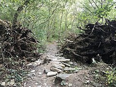
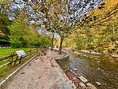
The most popular trail for exploring the lower Wissahickon valley is Forbidden Drive (officially known as Wissahickon Drive), a gravel road that follows the Wissahickon Creek from Lincoln Drive to the County Line. It received its familiar name in the 1920s when automobiles were first banned from the road.[6] Bicyclists and equestrians may use Forbidden Drive without a permit. Other trails in the area are more restricted, with some prohibiting cyclists or equestrians, and others requiring a permit for bicyclists and equestrians.Trails requiring a permit include, Upper Wissahickon area, and the soft trails of Pennypack park.[7] "For these areas, a permit is required to use a: bicycle, horse, carriage, horse-drawn vehicles, non-motorized vehicles, wheeled vehicles."[7] Permits can be attained by means of an application and $35 fee.[7]All users of the park are asked to stay on marked trails to protect against erosion.
A paved path on the west bank connects the junction of Forbidden Drive and Lincoln Drive south to Ridge Avenue at the confluence of the Wissahickon and Schuylkill River. This path is a popular access point for cyclists coming off the River Drive bike paths to Center City Philadelphia, or for pedestrians departing the Manayunk/Norristown Line transit route at Wissahickon Station or Bus Interchange.
Forbidden Drive is also accessible at its midpoint at the Valley Green Inn.[8] Valley Green Road can be reached from Springfield Avenue in Chestnut Hill, two blocks west of St. Martin's Lane and the St. Martin's railroad station on the Chestnut Hill West Line. Just above Valley Green, Wise's Mill Road meets Forbidden Drive, connecting it to Henry Avenue in Roxborough. Wise's Mill Road may be the same as that described in Edgar Allan Poe's 1844 story "Morning on the Wissahiccon": "I would advise the adventurer who would behold its finest points to take the Ridge Road, running westwardly from the city, and, having reached the second lane beyond the sixth mile-stone, to follow this lane to its termination. He will thus strike the Wissahiccon, at one of its best reaches ...". Forbidden Drive ends at Northwestern Avenue (which is the county line) after crossing Bell's Mill Road.
A number of trails climb out of the valley from Forbidden Drive to the "upper trails" which run along the precipitous walls of the valley. Many of these upper trails have been marked with colored blazes. The green blazed trail has been designated a multi-use trail approved for mountain bikers with permits. The blue blazed trail has been designated a hiking trail only. All trails in the Andorra Natural Area are prohibited to all bicycles. The orange trail parallels the creek on its east bank, and while it has fewer rolling hills than the park's other trails, it is often much steeper and rockier. It is accessible only by foot.
Several hiking and biking trails follow the creek along most of its course, including the 12-mile long Green Ribbon Trail from North Wales to Flourtown,[9] and the developed Wissahickon Trail in Wissahickon Valley Park. There are plans to combine these trails into a continuous 20-mile multi-use route to be called the Wissahickon Trail, following the creek from near its origin in Lansdale to its outlet at the Schuylkill River.[10]
Devil's Pool is an attraction best reached from Valley Green by crossing the stream and taking the footpath on the eastern bank, going downstream to the mouth of the Cresheim Creek. As the ravine widens into the Cresheim, the waters gather in a basin surrounded on either side by rocky outcroppings before flowing into the Wissahickon Creek. Legend has it that the Native American Lenape tribes used this as a spiritual area, where local author Phyllis Knapp Thomas writes that "...the Good Spirit is claimed to have banished the Evil Spirit into deep, dark waters."[11] Although it is not legal due to unsafe levels of pollutants, Devil's pool has become a popular area to swim, lounge, and drink. Unfortunately, Devil's pool often falls victim to litter and vandalism. However, recent efforts to clean the site by the Friends of the Wissahickon have been moderately successful.
One trail to hike on in this park leads to a precipice overlooking the gorge. It can be found by entering the main footpath at the Ridge Avenue entrance and following the west bank to Hermit's Lane Bridge. Coming from Blue Stone Bridge, follow the path at the west end to Lover's Leap.
Another outlook in the park is Mom Rinker's Rock, on a ridge on the eastern side of the Park just north of the Walnut Lane Bridge, close by the Toleration statue. Here on a moonlit night in May 1847, George Lippard, romancer of the Wissahickon, was married to his frail young wife according to so-called Indian rites. Years afterward in 1883, the Toleration statue was erected, a marble statue of a man in simple Quaker clothing. Atop Mom Rinker's Rock, the nine-foot-eight-inch statue has the single word "Toleration" carved into its four-foot-three-inch base. Created by late 19th-century sculptor Herman Kirn, it was brought to the site by landowner John Welsh, reported to have purchased the statue at the Centennial Exposition in Philadelphia. Welsh, a former Fairmount Park Commissioner and U.S. Ambassador to Britain, donated his land to the Park prior to his death in 1886.
Some miles away is the path leading to the Indian statue, a dramatic 15ft (4.6m) high white marble sculpture of a kneeling Lenape warrior which was sculpted in 1902 by John Massey Rhind. (The statue is popularly but erroneously known as "Teedyuscung," the name of an 18th-century Delaware chief.) Commissioned by Mr. and Mrs. Charles W. Henry, it is a tribute to the Lenape Indians who hunted and fished in the Wissahickon prior to the arrival of colonists. The statue can also be viewed from Forbidden Drive across the creek if one stands just north of the path to the Rex Avenue Bridge.
Geology
A tremendous variety of geology is evident along Wissahickon Creek. Three of the geologic regions that the stream passes through are the Newark Basin of Triassicsandstone and shale, the limestone and dolomite of the Chester Valley, and the Wissahickon Formation where the waters of the stream flow into the Schuylkill and eventually the Delaware Rivers.
A unique and very distinctive rock of the Wissahickon Creek valley is Wissahickon schist, the predominant bedrock underlying the Philadelphia region, found over a broad swath of southeastern Pennsylvania from Trenton into Delaware and Maryland. This Precambrian to Cambrian stone, first studied in the Wissahickon gorge, has flecks of glittery mica, small garnets, and many-toned shadings of gray, brown, tan, and blue, and is attractive enough to have become a common building material in the 19th and early 20th centuries.
In addition to Wissahickon schist, there are layers of quartzite in the valley. Both schist and quartzite are metamorphic rocks formed from sedimentary deposits of mud and sand that one time were washed from ancient continents into a shallow sea. These sedimentary deposits were over time compressed into shale and sandstone. During long periods of mountain building, the shale and sandstone were slowly transformed into the schist and quartzite found today. In some places, the compression and heat were extreme enough to fuse the schist with emerging igneous rocks into hard-banded gneiss.
Other rocks in the valley are layers of igneous pegmatite and remains of graniteplutons, embedded crystals within the schist. A few locations close to Devil's Pool and along Bell's Mill Road have a talc schist which contains the mineral talc, so soft it can be scratched with a fingernail.
Thomas Holmes' 1687 map showing Wissahickon Creek (here called Whitpaine's creek) in Germantown then north of PhiladelphiaThe Monastery in 2010
In 1694, Johannes Kelpius arrived in Philadelphia with a group of like-minded German Pietists to live in the valley of the Wissahickon Creek. They formed a monastic community and became known as the Hermits or Mystics of the Wissahickon. Kelpius was a musician, writer, and occultist. He frequently meditated (some believe in a cave—the Cave of Kelpius40°01′25″N75°12′02″W / 40.023544°N 75.200665°W / 40.023544; -75.200665)[12] along the banks of the Wissahickon and awaited the end of the world, which was expected in 1694. No sign or revelation accompanied that year, but the faithful continued to live in celibacy by the stream, searching the stars and hoping for the end. Kelpius described the type of meditation he used in his Method of Prayer. (See Further Reading below on this book.) Kelpius died in 1708 and the group disbanded some time thereafter. Some members likely gave up on celibacy and married. A few joined the somewhat like-minded religious colony of Ephrata Cloister under Conrad Beissel in Ephrata, Lancaster County, even though no previous connection existed between the two communities. At least two from the original group, Johann Seelig and Konrad Matthaei, continued as hermits along the Wissahickon into the 1740s.
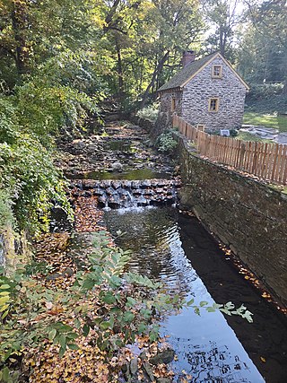
Other religious groups were also associated with the Wissahickon: On Christmas Day in 1723 the first congregation of the Church of the Brethren in America – often called Dunkard Brethren – baptized several new members in the stream. Around 1747 an individual with connections to both the Dunkards and the Ephrata Cloister built a stone house on land previously owned by Dunkards. The structure, used for church retreats, still stands today, and is known as The Monastery, a remaining witness to the Wissahickon's days as an isolated religious refuge.
Development
Valley Green Inn, a landmark along the Wissahickon Creek
The same steep slopes and gorge that provided an attractive isolation to religious adherents in the 17th and early 18th centuries provided an efficient source of energy for the development of water mills in later years. One miller had by 1690 already constructed a dam, sawmill, gristmill, and house by the narrow shelf of land at the confluence of the Wissahickon with the Schuylkill River, but the rugged terrain of the valley forestalled further development alongside the stream itself. By 1730, however, eight mills had been constructed, and by 1793, twenty-four, along with many dams. Most of America was still wilderness, but the Wissahickon Valley was a developing industrial center. There were more than fifty watermills by 1850, though the thickly forested region about the stream still retained the character of a wilderness. Access roads were being constructed into the steep valley, but there was still no road that followed the stream itself. The nature of the rugged terrain can be comprehended in an event that had occurred during the Revolutionary WarBattle of Germantown, which was fought not too far from the stream. The American General John Armstrong, compelled by the rough terrain to abandon a cannon in the valley, expressed his contempt for the "horrendous hills of the Wissahickon." Later legends tell of American spies taking advantage of the terrain to retrieve information from an informant named Mom Rinker, who allegedly perched atop a rock overlooking the valley to drop balls of yarn which contained messages about British troop movements during the occupation of Philadelphia. This is likely a legend, for other stories speak of a witch named Mom Rinkle who had little to do with the Revolution. There is a Mom Rinker's Rock in the park today.
Not until 1826 were the cliffs near the creek's mouth blasted away to provide access to the cluster of mills at Rittenhousetown,[13] approximately 1.5mi (2.4km) up the creek on Paper Mill Run (also known as Monoshone Creek), a small tributary of the Wissahickon. Here William Rittenhouse (grandfather of the astronomer David Rittenhouse) had in the early 18th century built the first paper mill in America. Gradually this road and other mill access roads were connected, and in 1856 a private toll road, the Wissahickon Turnpike, linked the entire valley.[14] Long gone were the religious mystics; here instead the mills of Wissahickon Creek made paper, cloth, gunpowder, sawed lumber, milled wheat and corn, and pressed oil from flax. A sizable population worked at the mills and lived in the valley in small villages like Rittenhousetown and Pumpkinville. The nation was becoming an industrial nation, and the Wissahickon was leading the way.
Benjamin Franklin already had noted in his will the high elevation and quality of Wissahickon water, proposing that in some future day the stream be dammed to supply a safe and pure water source for Philadelphia's water supply, and even allocating funds for this purpose. This did not happen, but the quest for pure water affected the Wissahickon's subsequent history. Seeking to prevent the stream's industrial discharges from affecting the purity of the water of the Schuylkill River, the Fairmount Park Commission took title of much of the land along the Wissahickon in 1869-1870, and continued to expand its holdings in subsequent decades. The mills were razed; the last active mill was demolished in 1884. Several decades later the Schuylkill River itself became seriously polluted by sources in the coal fields far upstream beyond Philadelphia's control, but the waters of the Wissahickon had been restored and the beauty of the Wissahickon Valley had been preserved. Most of America became more industrialized, but the Wissahickon valley quietly returned to its original wilderness character.
The reason the Wissahickon Valley retained its wilderness character, even after its clean waters were no longer essential to the water supply of the city of Philadelphia, was the advent of Romanticism and the changing attitudes which this thought engendered about nature. Before the 19th century, nature had seemed a capricious and ambivalent force, at times a dream, but at times a nightmare. Nature, according to orthodox Christian thought, had fallen with man; though the Renaissance brought about both a new view of mankind and nature, this new attitude took time to grow, but it eventually resulted in a literary and artistic movement known as Romanticism. Romantics valued heroism and chivalry in people, and regarded the wild, free, and untamed nature as the "natural" model of true beauty. Philadelphians finally came to value their Wissahickon valley for its wild character. Even when the mills were still operating, there were remote stretches of wild bluffs and overarching trees; now the old mills had become romantic and picturesque, with mossy stone walls suggesting medieval ruins. In 1924, area residents formed the non-profit group "Friends of the Wissahickon", which still works to maintain the park's unique landscape to this day. Remarks on the Wissahickon in literature by such as Fanny Kemble, Edgar Allan Poe, George Lippard, and others are noted below.
However much the stream and its valley were appreciated, it still divided parts of the city. To help overcome this, in 1906 the Walnut Lane Bridge was built over the stream, which was the world's largest concrete arch bridge at the time.[15] The bridge joined the Roxborough and Germantown neighborhoods of Philadelphia, formerly separated by the Wissahickon gorge. The bridge is but 480 feet (150m) long, with a width of 60 feet (18m), but its center arch spans an impressive 225 feet (69m), the crown of the arch is 109 feet (33m) above the water, and the sidewalks of the bridge 120 feet (37m) above the Wissahickon.
Wissahickon Day
In the past, there was an annual parade of horses, riders, and carriage annually in May for Wissahickon Day, a festive Gala popular among Philadelphia's Equestrians and social elites.[16]
The Wissahickon Memorial Bridge, also known as Henry Avenue Bridge, is a stone and concrete bridge that carries Henry Avenue over Wissahickon Creek, joining Roxborough and the East Falls-Germantown neighborhoods in Philadelphia.[17][18][19] It was completed in 1932 and is 915 feet (279m) long, 84 feet (26m) wide, and 185 feet (56m) above water. It was originally designed to carry a planned extension of a subway into Roxborough, but the subway never reached the bridge. The bridge has been known as a suicide bridge since its opening. Beginning in 1941 for an unknown duration of time a policeman patrolled the span, questioning all pedestrians walking the bridge.[20]
Fairmount Park
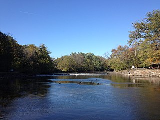
Fairmount Park near where Wissahickon and Cresheim Creeks meet.
Once the stream enters the city of Philadelphia, the creek valley and its deeply wooded gorge form part of the Fairmount Park system in Philadelphia, a jewel of a park and of nature set in the middle of an urban landscape. The park here is a ruggedly beautiful valley for the naturalists, artists, fishermen, bicyclists, equestrians, and hikers who are drawn to the wooded, steep banks of the stream. Precipitous wooded inclines that rise more than 200 feet (61m) above the water create a feeling of remoteness and mountain vastness. There are two main and many smaller bridle paths crossing the park's 1,372 acres (5.55km2) along the Wissahickon Creek. Thomas Mill Covered Bridge, the only covered bridge in a major US city, spans the creek in the park. The Wissahickon Valley is one of fewer than 600 National Natural Landmarks in America. Recently, interest in reintroducing brook trout to the Wissahickon Valley portion of Fairmount park has been growing.
References in culture
Literature
Among the earliest references to the valley was by William Cobbett in his book Rural Rides, which takes the form of a series of letters. In one dated 1821 he said,
These are the fogs that sweep off the new settlers in the American woods. I remember a valley in Pennsylvania, in a part called Wysihicken [sic]. In looking from a hill, over this valley, early in the morning, in November, it presented one of the most beautiful sights that my eyes ever beheld. It was a sea bordered with beautifully formed trees of endless variety of colours. As the hills formed the outsides of the sea, some of the trees showed only their tops; and, every now and then, a lofty tree growing in the sea itself, raised its head above the apparent waters. Except the setting-sun sending his horizontal beams through all the variety of reds and yellows of the branches of the trees in Long Island, and giving, at the same time, a sort of silver cast to the verdure beneath them, I have never seen anything so beautiful as the foggy valley of the Wysihicken.[21]
Actress Fanny Kemble, grandmother to novelist Owen Wister, visited the stream in 1832; her writing awakened a more general interest in the stream and its valley. Her description of the gorge's dramatic end at the stream's confluence with the Schuylkill River and her verse To the Wissahickon both sparked a keen interest in this natural treasure often overlooked by its neighbors. She wrote:
The thick, bright, rich-tufted cedars, basking in the warm amber glow, the picturesque mill, the smooth open field, along whose side the river waters, after receiving this child of the mountains into their bosom, wound deep, and bright, and still, the whole radiant with the softest light I ever beheld, formed a most enchanting and serene subject of contemplation.
Edgar Allan Poe alluded to Fanny Kemble's writing in his description of a beautiful Wissahickon valley in his 1844 essay "Morning on the Wissahiccon", in which he wrote:
Now the Wissahiccon is of so remarkable a loveliness that, were it flowing in England, it would be the theme of every bard, and the common topic of every tongue, if, indeed, its banks were not parcelled off in lots, at an exorbitant price, as building-sites for the villas of the opulent. Yet it is only within a very few years that any one has more than heard of the Wissahiccon ... the brook is narrow. Its banks are generally, indeed almost universally, precipitous, and consist of high hills, clothed with noble shrubbery near the water, and crowned at a greater elevation, with some of the most magnificent forest trees of America, among which stands conspicuous the liriodendron tulipiferum. The immediate shores, however, are of granite, sharply defined or moss-covered, against which the pellucid water lolls in its gentle flow, as the blue waves of the Mediterranean upon the steps of her palaces of marble.
The erratic and almost forgotten novelist George Lippard frequently wrote about the Wissahickon, and was even married at sunset on or around May 14, 1847, on a rocky crag called Mom Rinker's Rock, overlooking the stream. One of his books, The Rose of Wissahikon; or, The Fourth of July, 1776. A Romance, Embracing the Secret History of the Declaration of Independence (1847) may refer not only to the Wissahickon, but to his wife, the former Rose Newman. He wrote:
A poem of everlasting beauty and a dream of magnificance – the world-hidden, wood embowered Wissahickon.
The Wissahickon is mentioned very briefly in A Biography of the Poet, Sidney Lanier by Edwin Mims.
Mark Twain mentioned the Wissahickon during the short time he spent in Philadelphia working for The Philadelphia Inquirer: "Unlike New York, I like this Philadelphia amazingly, and the people in it ... I saw small steamboats, with their signs up—"For Wissahickon and Manayunk 25cents." Geo. Lippard, in his Legends of Washington and his Generals, has rendered the Wissahickon sacred in my eyes, and I shall make that trip, as well as one to Germantown, soon ..."
Ron P. Swegman, a fly fishing angler, artist, and author, wrote extensively about Wissahickon Creek in two illustrated essay collections, Philadelphia on the Fly (Frank Amato Publications, 2005)[22] and Small Fry: The Lure of the Little (The Whitefish Press, 2009).[23] Both books describe the Wissahickon Valley and the experience of fly fishing along Wissahickon Creek in the early twenty-first century.
The Swann Memorial Fountain (1924), a fountain sculpture by Alexander Stirling Calder that is located in the center of Logan Circle, also known by its historic name Logan Square, in Philadelphia, contains three large Native American figures that symbolize the area's major streams: the Delaware, the Schuylkill, and the Wissahickon. The young girl leaning on her side against an agitated, water-spouting swan represents the Wissahickon Creek.
Music
There exists a song called "The Gentle Wissahickon: A Ballad" published in 1857 by Edmund L Walker, 142 Chestnut Street, Philadelphia. The words are by Col. James G Wallace, the music by Herman Trevor, and it recalls a "happy childhood time", "the picnic grove", and at the end "dear Alice Ray" who became the singer's "blushing bride."
There exists sheet music mentioning the Wissahickon:
The Wissahickon Gallopade[41] by J. B. Bishop, 1856 (4 pages)
Sounds from the Wissahickon waltzes[42] by Harry M. Rollin, 1871 (10 pages).
"Wissahickon Drive" is the name of one of the tracks on the CD Here's to You by the Bog Wanderers, "a collection of original, contemporary and traditional slides, jigs, reels, waltzes and songs." Liner notes say the tune is "of the great fiddler/composer Liz Carroll."
Motion pictures
In the 1981 Brian DePalma–directed film Blow Out starring Nancy Allen and John Travolta, the car crash that Travolta's character records is of an auto traveling northbound on Lincoln Drive and crashing headfirst into the Wissahickon Creek. The site is just south of the intersection of Lincoln Drive and Forbidden Drive. Travolta's character plays his recorded film footage repeatedly, and the creek's location is easy to determine.
Roxborough is a neighborhood in Northwest Philadelphia, Pennsylvania, United States. It is bordered to the southwest, along the Schuylkill River, by the neighborhood of Manayunk, along the northeast by the Wissahickon Creek section of Fairmount Park, and to the southeast by the neighborhood of East Falls. Beyond Roxborough to the northwest is Montgomery County. Roxborough's ZIP Code is 19128. Most of Roxborough is in Philadelphia's 21st Ward.
The Schuylkill River is a river running northwest to southeast in eastern Pennsylvania. The river was improved by navigations into the Schuylkill Canal, and several of its tributaries drain major parts of Pennsylvania's Coal Region. It flows for 135 miles (217 km) from Pottsville to Philadelphia, where it joins the Delaware River as one of its largest tributaries.
Fairmount Park is the largest municipal park in Philadelphia and the historic name for a group of parks located throughout the city. Fairmount Park consists of two park sections named East Park and West Park, divided by the Schuylkill River, with the two sections together totalling 2,052 acres (830 ha). Management of Fairmount Park and the entire citywide park system is overseen by Philadelphia Parks & Recreation, a city department created in 2010 from the merger of the Fairmount Park Commission and the Department of Recreation.
Swatara Creek is a 72-mile-long (116 km) tributary of the Susquehanna River in east-central Pennsylvania in the United States. It rises in the Appalachian Mountains in central Schuylkill County and passes through northwest Lebanon County before draining into the Susquehanna at Middletown in Dauphin County.
Tulpehocken Creek is a 39.5-mile-long (63.6 km) tributary of the Schuylkill River in southeastern Pennsylvania in the United States, and during the American Canal Age, once provided nearly half the length of the Union Canal linking the port of Philadelphia, the largest American city and the other communities of Delaware Valley with the Susquehanna basin and the Pennsylvania Canal System connecting the Eastern seaboard to Lake Erie and the new settlements of the Northwest Territory via the Allegheny, Monongahela, and Ohio Rivers at Pittsburgh.
Manayunk is a neighborhood in the section of Lower Northwest Philadelphia in the state of Pennsylvania. Located adjacent to the neighborhoods of Roxborough and Wissahickon and also on the banks of the Schuylkill River, Manayunk contains the first canal begun in the United States.
Cobbs Creek is an 11.8-mile-long (19.0 km) tributary of Darby Creek in Delaware County, Pennsylvania, in the United States. It forms an approximate border between Montgomery County and Delaware County. After Cobbs Creek passes underneath Township Line Road, it forms the border between Philadelphia County and Delaware County. It runs directly through the two sides of Mount Moriah Cemetery which spans the border of Southwest Philadelphia and Yeadon, Pennsylvania. It later joins Darby Creek before flowing into the Delaware River.
East Falls is a neighborhood in Lower Northwest, Philadelphia, Pennsylvania, United States. It lies on the east bank of the "Falls of the Schuylkill," cataracts submerged in 1822 by the Schuylkill Canal and Fairmount Water Works projects. East Falls sits next to the Germantown, Roxborough, Allegheny West, and the Nicetown-Tioga neighborhoods. Wissahickon Valley Park separates it from Manayunk, Philadelphia.
Neshaminy Creek is a 40.7-mile-long (65.5 km) stream that runs entirely through Bucks County, Pennsylvania, rising south of the borough of Chalfont, where its north and west branches join. Neshaminy Creek flows southeast toward Bristol Township and Bensalem Township to its confluence with the Delaware River.
Northwest Philadelphia is a section of the city of Philadelphia. The official boundary is Stenton Avenue to the north, the Schuylkill River to the southwest, Northwestern Avenue to the northwest, Roosevelt Boulevard to the south, and Wister Street and Stenton Avenue to the east. Conventionally, the area east of Wissahickon Creek, which comprises Germantown, Mount Airy, Chestnut Hill, and Cedarbrook, is termed the 'Upper Northwest', and the are west of the creek, which comprises Roxborough, Wissahickon, East Falls, and Manayunk, is termed the 'Lower Northwest'. The area of Philadelphia west of the Schuylkill River is known as West Philadelphia. The Philadelphia Police Department patrols two districts located within Northwest Philadelphia. The two patrol districts serving Northwest Philadelphia are the 5th and 14th districts.
Poquessing Creek is a 10.3-mile-long (16.6 km) creek, a right tributary of the Delaware River, that forms the boundary between Philadelphia and Bensalem Township, which borders it to the northeast along the Delaware. It has defined this boundary between Bucks and Philadelphia counties since 1682.
Johannes Kelpius was a German Pietist, mystic, musician, and writer. He was also interested in the occult, botany, and astronomy. He came to believe with his followers – called the "Society of the Woman in the Wilderness" – that the end of the world would occur in 1694. This belief, based on an elaborate interpretation of Revelation 12:6, anticipated the advent of a heavenly kingdom somewhere in the wilderness during that year. Kelpius felt that the seventeenth-century Province of Pennsylvania, given its reputation for religious toleration at the edge of a barely settled wilderness, was the best place to be. Philadelphia had been founded in 1682, but the city and the Province of Pennsylvania had quickly become a tolerant haven and refuge for many pietist, communitarian, or free-thinking groups who were leaving the Old World for the congenial religious climate of the British colony. Kelpius and his followers crossed the Atlantic and lived in the valley of the Wissahickon Creek in Philadelphia from 1694 until his death. It is reported that they lived communally, though they also spent time in solitary meditation in caves and small cells scattered about their common living quarters. Though no sign or revelation accompanied the year 1694, the faithful, known as the Hermits or Mystics of the Wissahickon, continued to live in celibacy, searching the stars and hoping for the end.
Paper Mill Run, also known as Monoshone Creek, is a small tributary of Wissahickon Creek that is located in Philadelphia, Pennsylvania, USA. Its watershed includes parts of the Mount Airy and Germantown neighborhoods of Philadelphia.
The Schuylkill River Trail is a multi-use trail along the banks of the Schuylkill River in southeastern Pennsylvania. Partially complete as of 2018, the trail is ultimately planned to run about 140 miles (230 km) from the river's headwaters in Schuylkill County to Fort Mifflin in Philadelphia.
The Lehigh Canal is a navigable canal that begins at the mouth of Nesquehoning Creek on the Lehigh River in the Lehigh Valley and Northeastern regions of Pennsylvania. It was built in two sections over a span of 20 years beginning in 1818. The lower section spanned the distance between Easton and present-day Jim Thorpe. In Easton, the canal met the Delaware and Morris Canals, which allowed anthracite coal and other goods to be transported further up the U.S. East Coast. At its height, the Lehigh Canal was 72 miles (116 km) long.
Wissahickon may refer to the following in the U.S. state of Pennsylvania:
Cresheim Creek is a creek in southeastern Pennsylvania. Rising at Wyndmoor in Springfield Township, it runs about 2.7 miles (4.3 km) southwest, passing through part of Northwest Philadelphia and forming the boundary between Mount Airy and Chestnut Hill, before emptying into the Wissahickon Creek at Devil's Pool not far south of the Valley Green Inn.
Wissahickon is a neighborhood in the section of Lower Northwest Philadelphia in the state of Pennsylvania, United States. Wissahickon is located adjacent to the neighborhoods of Roxborough and Manayunk, and it is bounded by the Wissahickon Valley Park, Ridge Avenue, Hermit Street, and Henry Avenue. The name of the neighborhood is derived from the Lenni Lenape word wisameckham, for "catfish creek", a reference to the fish that were once plentiful in the Wissahickon Creek.
Wissahickon Valley Park is a large urban park that is located in Northwest Philadelphia, Pennsylvania. It protects 2,042 acres (8.26 km2) of woodland surrounding the Wissahickon Creek between the Montgomery County border and the Schuylkill River. For several miles, the creek winds through a dramatic wooded gorge known as the Wissahickon Valley, a National Natural Landmark.
Brandt, Francis Burke. Wissahickon Valley within the city of Philadelphia. Philadelphia: Corn Exchange National Bank, 1927. Entire book is available for download from the Penn State Digital Library at this site.
Conwill, Joseph D. "The Wissahickon Valley: To A Wilderness Returned." Pennsylvania Heritage. Summer, 1986.
Grove, Victor. Philadelphia: A Hiker's Paradise. Philadelphia, PA: Old City Publishing, 2005. ISBN1-933153-01-6 (Contains many photos of Wissahickon Creek and area)
Herman, Andrew Mark. Along the Wissahickon Creek. Arcadia Publishing, 2004. ISBN0-7385-3521-4
Kelpius, Johannes, and Richards, Kirby, Ph.D. A Method of Prayer. A Mystical Pamphlet from Colonial America. Philadelphia: Schuylkill Wordsmiths, 2006. (A new translation of Kelpius's pamphlet, with informative background materials and the original German. Available at Amazon.com.)
Swegman, Ron P. Philadelphia on the Fly. Frank Amato Publications, 2005. ISBN1-57188-361-4
Swegman, Ron P. Small Fry: The Lure of the Little. The Whitefish Press, 2009. ISBN0-9842677-0-0
This page is based on this Wikipedia article Text is available under the CC BY-SA 4.0 license; additional terms may apply. Images, videos and audio are available under their respective licenses.


