Glasgow is the most populous city in Scotland, and is the third-most populous city in the United Kingdom, as well as being the 27th largest city by population in Europe. In 2022, it had an estimated population as a defined locality of 632,350 and anchored an urban settlement of 1,028,220. Formed as a county of itself in 1893, the city had previously been in the historic county of Lanarkshire and has also grown to include settlements that were once part of Renfrewshire and Dunbartonshire. It now forms the Glasgow City Council area, one of the 32 council areas of Scotland, and is administered by Glasgow City Council.

Rutherglen is a town in South Lanarkshire, Scotland, immediately south-east of the city of Glasgow, three miles from its centre and directly south of the River Clyde. Having previously existed as a separate Lanarkshire burgh, in 1975 Rutherglen lost its own local council and administratively became a component of the City of Glasgow District within the Strathclyde region. In 1996 the towns were reallocated to the South Lanarkshire council area.

Cathcart is an area of Glasgow between Battlefield, Mount Florida, King's Park, Muirend and Newlands. The White Cart Water flows through Cathcart, downstream from Linn Park. In 2014, it was rated one of the most attractive postcode areas to live in Scotland.

Shawlands is a Southside suburb of Glasgow, Scotland, located two miles south of the River Clyde. The area, considered the "Heart of the Southside", is known for its independent restaurants and cafés, art scene, public parks, period terraces, and red and blond sandstone tenements. Shawlands was named one of the best places to live in Scotland in 2022 and 2023 by The Sunday Times, and one of the world's coolest neighbourhoods by Time Out Magazine with judges describing it as "the city's best area to live and socialise”. It is located between Pollok Country Park – the home of the Burrell Collection and Pollok House – and the acclaimed Victorian park Queen's Park.
Garnethill is a predominantly residential area of the city of Glasgow, Scotland with a number of important public buildings.

Kelvingrove Park is a public park located on the River Kelvin in the West End of the city of Glasgow, Scotland, containing the Kelvingrove Art Gallery and Museum.
Burnbank is an area in the town of Hamilton, South Lanarkshire, Scotland. It was formerly a separate mining village before being absorbed into the town.

Broomhill is a district in the West End of the city of Glasgow, Scotland. North of the River Clyde, it is bounded by the districts of Thornwood and Partick to the south, Hyndland to the east, and Jordanhill, Scotstoun and Victoria Park to the west.
Hamiltonhill is a residential neighbourhood in the Scottish city of Glasgow, situated between Possilpark to the north and east and Port Dundas to the south. To the west of Hamiltonhill is a nature reserve bordering the Forth and Clyde Canal's Glasgow Branch section. The neighbourhood falls under the Canal ward of Glasgow City Council.

Barton Stacey is a village and undulating civil parish, which includes the hamlets of Bransbury, Newton Stacey, Drayton and Cocum, in the Test Valley district of Hampshire, England, centred about 7 miles (11 km) south-east of Andover. It is bounded to the north by the estate of Drayton Lodge, and, to the south, by the minor A30 road; both being east–west routes, and connected by The Street/Cocum Road, the main road that bisects the village. The distance between the A303 and A30 at this point is 2 miles (3.2 km), which is twice the width of the parish.

Dalmuir is an area nine miles northwest of Glasgow, Scotland, on the western side of Clydebank, and part of West Dunbartonshire Council Area. The name is a lowland Scots derivation of the Gaelic meaning Big Field. The area was originally two separate villages with Dalmuir Shore joining with Clydebank in 1886 and Dalmuir Village in 1906, during a period of rapid industrialization and expansion. Dalmuir is bounded by the village of Old Kilpatrick to the west, the Mountblow and Parkhall housing schemes to the north, and the Clydebank town centre area to the east. To the south is the River Clyde.

Burnside is a mostly residential area in the town of Rutherglen in South Lanarkshire, Scotland. Including the neighbourhoods of High Burnside and High Crosshill, respectively south and north-west of its main street, it borders Overtoun Park in Rutherglen plus several other residential areas of the town, as well as western parts of neighbouring Cambuslang.

Charing Cross is a major road junction and area within the centre of Glasgow, Scotland. It is situated north of the River Clyde at the intersection of Sauchiehall Street, St George's Road, Woodlands Road, North Street and Newton Street, as well as being at a major interchange of the M8 motorway. Charing Cross marks the notional boundary between the City Centre and the West End of the city.

Auldhouse is an area of the Scottish city of Glasgow. It is situated south of the River Clyde along the banks of the Auldhouse Burn, a tributary of the White Cart Water.
The Square Mile of Murder relates to an area of west-central Glasgow, Scotland. The term was first coined by the Scottish journalist and author Jack House, whose 1961 book of the same name was based on the fact that four of Scotland's most infamous murders were committed within an area of 1 square mile.
Kelvingrove is a neighbourhood in the city of Glasgow, Scotland. It is situated north of the River Clyde in the West End of the city, and directly borders Kelvingrove Park to the north and the grounds of the Kelvingrove Art Gallery and Museum to the west. Its other boundaries are not precisely defined, but roughly correspond to Sauchiehall Street to the south opposite the Sandyford neighbourhood, and the Charing Cross area to the east.

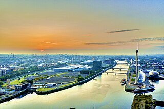
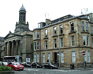
Sandyford is an area of Glasgow, Scotland. It is north of the River Clyde and forms part of the western periphery of the city centre. Formerly the name of a ward under Glasgow Town Council in the first part of the 20th century, it is within a continuous area of fairly dense urban development bordering several other neighbourhoods whose mutual boundaries have blurred over time, and is possibly less well known than all of the places which adjoin it, particularly Anderston and Finnieston.
Burnbank Park was a sports ground in Glasgow, Scotland. It was situated in the city's Woodlands area, found at Barrington Drive. No trace of the ground remains, having been built on by sandstone tenement housing in the late 19th century, which survives into the 21st century. The name endures locally with the Burnbank Bowling Club a few blocks to the south, founded in 1866, around the same time the sports grounds were coming into use for team sports.

On 28 May 2021, Scottish pensioner Esther Brown was raped and murdered at her flat in Woodlands, Glasgow.


