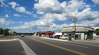
Boyne Falls is a village in Charlevoix County in the U.S. state of Michigan. The population was 358 at the 2020 census. The village is located within Boyne Valley Township.

Pickford Township is a civil township of Chippewa County in the U.S. state of Michigan. As of the 2010 census, the township population was 1,595.

Dimondale is a village in Eaton County in the U.S. state of Michigan. The population was 1,234 at the 2010 census. The village is located within Windsor Charter Township. Dimondale is a suburb of Lansing, which is northeast of the village in Ingham County.
Norman Township is a civil township of Manistee County in the U.S. state of Michigan. The population was 1,567 at the 2020 census.

Freeland is a census-designated place in Tittabawassee Township, Saginaw County in the U.S. state of Michigan. It is part of the Saginaw-Midland-Bay Metropolitan Area. As of the 2000 census, the CDP population was 5,147. The CDP covers an area in the central portion of Tittabawassee Township. The Freeland post office, ZIP code 48623, serves nearly the entire township, as well as portions of Midland and Williams townships to the north, Frankenlust and Kochville townships to the east, Thomas and Richland townships to the south, and Ingersoll Township to the west.

Ypsilanti Charter Township is a charter township of Washtenaw County in the U.S. state of Michigan. The population was 53,362 at the 2010 census. The city of Ypsilanti is mostly surrounded by the township, but the two are administered autonomously.

Larimore is a city in Grand Forks County, North Dakota, United States. It is located three miles south of the junction of U.S. Route 2 and North Dakota Highway 18. Larimore is part of the "Grand Forks, ND-MN Metropolitan Statistical Area" or "Greater Grand Forks". The population was 1,260 at the 2020 census.

Watford City, founded in 1914, is a city in and the county seat of McKenzie County, North Dakota, United States. The population was 6,207 at the 2020 census, making it the thirteenth largest city in North Dakota. Because Watford City is part of the Bakken field, the North Dakota oil boom has significantly increased population and construction since the 2010 census.

Park River is a city in Walsh County, North Dakota, United States. The population was 1,424 at the 2020 census. Park River was founded in 1884.

The Huron River is a 130-mile-long (210 km) river in southeastern Michigan, rising out of the Huron Swamp in Springfield Township in northern Oakland County and flowing into Lake Erie, as it forms the boundary between present-day Wayne and Monroe counties. Thirteen parks, game areas, and recreation areas are associated with the river, which passes through the cities of Dexter, Ann Arbor, Ypsilanti, Belleville, Flat Rock and Rockwood that were developed along its banks.
Advance Township is a township in Pembina County, North Dakota, United States. At the time of the 2000 Census, its population was 143, with an estimated 122 people as of 2009.
Ypsilanti Township is one of the sixty-two townships of Stutsman County, North Dakota, United States. The population was 160 at the 2020 census. The median household income was $29,444.

Manning is a small town in, and the county seat of, Dunn County, North Dakota, United States. Manning was founded in 1908 to serve as the seat of Dunn County, itself organized that year. Its population was not reported in the 2000 census, but was included in the 2020 census, where a population of 47 was given.

Van Hook is a thriving resort community built on the shores of Lake Sakakawea. The town was disbanded in the 1950s with the flooding of Lake Sakakawea and for a very short period of time was classified as a ghost town in the north central United States, located in Van Hook Township in Mountrail County, North Dakota. The original town site was mostly left not flooded when Lake Sakakawea was formed in the 1950s behind Garrison Dam.
Lake Leelanau is an unincorporated community and census-designated place (CDP) in Leland Township, Leelanau County, Michigan, near the lake of the same name. As of the 2020 census it had a population of 229. It is situated along M-204 at the "narrows" that separate North and South Lake Leelanau.

Tagus is a ghost town in Mountrail County, North Dakota, United States. The town was founded in 1900, approximately forty miles west of Minot and along the Great Northern Railway's transcontinental route. It incorporated in 1908 and reached a peak population of 140 in 1940. It was originally named Wallace, but was later renamed Tagus to avoid confusion with the town of Wallace, Idaho.

St. Anthony or Saint Anthony is an unincorporated town in southeastern Morton County, North Dakota, United States. It lies a short distance to the west of North Dakota Highway 6, south of the city of Mandan, the county seat of Morton County. It has the ZIP code 58566. In 2018, the population was estimated to be less than 30.

Menoken is an unincorporated community and a census-designated place (CDP) in southwestern Burleigh County, North Dakota, United States. It was designated as part of the U.S. Census Bureau's Participant Statistical Areas Program on June 10, 2010. It was not counted separately during the 2000 Census, but was included in the 2010 Census, where a population of 70 was reported.

Solon Township is a civil township of Leelanau County in the U.S. state of Michigan. The population was 1,562 at the 2020 census. Solon Township is home to the community of Cedar.
Rock is an unincorporated community in Delta County, Michigan, United States. Rock is located in Maple Ridge Township along M-35 and the Canadian National Railway, 16.5 miles (26.6 km) north-northwest of Gladstone. Rock has a post office with ZIP code 49880.


