1990 Interstate 75 fog disaster

Last updated

1990 Interstate 75 fog disaster
1990 I-75 fog pileup.jpg
Details
DateDecember 11, 1990
c.9:10am – c.9:20am (EST)
Location Interstate 75 in McMinn County, Tennessee
Coordinates 35°19′28.7″N84°46′56.8″W / 35.324639°N 84.782444°W / 35.324639; -84.782444
CountryUnited States
Incident type Multi-vehicle traffic collision
CauseLoss of visibility due to sudden appearance of dense fog
Statistics
Vehicles99
Deaths12
Injured42

The 1990 Interstate 75 fog disaster was a traffic collision that occurred on the morning of December 11, 1990, on a section of Interstate 75 (I-75) near Calhoun, Tennessee, during dense fog which obscured the visibility of motorists. The collisions occurred in an area where fog is common and had been the site of previous multi-vehicle collisions caused by poor visibility. It consisted of a series of multi-vehicle collisions that ultimately involved 99 vehicles, and resulted in 12 deaths and 42 injuries. It was reportedly the largest motor vehicle collision in United States history when it occurred, in terms of the number of vehicles, and was the largest and second deadliest vehicle accident in Tennessee history behind the 1972 Bean Station bus-truck collision, which killed 14. [1] The disaster resulted in multiple safety improvements to the section of I-75 where the collision occurred.

Contents

Background

Previous fog-related collisions
DateNumber of vehiclesCasualties
March 9, 1974 [2] 183 killed, 10 injured
April 19, 1974 [3] 99 injured
June 12, 1976 [3] 4None
December 16, 1977 [3] 147 injured
November 5, 1978 [4] 6246 injured
April 15, 1979 [3] 183 killed, 14 injured

The stretch of I-75 where the collision occurred consists of an approximately 10-mile (16 km) section in Bradley and McMinn counties between mileposts 29 and 39 that is prone to dense fog, which often appears rapidly. It is located about 40 miles (64 km) northeast of Chattanooga and 70 miles (110 km) southwest of Knoxville. The stretch is located within two separate valleys bounded by ridges within the Ridge and Valley Appalachians and is bisected by the Hiwassee River, which forms the boundaries between the two counties. Multiple creeks that span both the valleys that the Interstate is in and adjacent valleys flow into the Hiwassee River near where the Interstate crosses. The Chickamauga Dam, located downstream from this section of the Hiwassee on the Tennessee River, creates a reservoir which backs up into this section of the Hiwassee River, and as a result creates large lakes near the Interstate where creeks run into the Hiwassee. The Hiwassee River bridges are at one of the lowest elevations on I-75 in Tennessee. A paper mill operated by Resolute Forest Products, formerly Bowater, is located on the north bank of the Hiwassee about three miles (4.8 km) east of the Interstate in Calhoun. The plant operates wastewater treatment settling ponds adjacent to the Interstate and owns land on both sides of the Interstate at the accident site. All of these factors have been provided as explanations for why fog is unusually common in this area. [5] [6] [7]

The section of I-75 where the crash occurred was first opened to traffic on December 24, 1973. [8] The first multi-vehicle collision during heavy fog on this section occurred on March 9, 1974. [2] This collision involved 18 vehicles, and resulted in 3 deaths and 10 injuries. [3] A total of five additional fog-related multi-vehicle collisions occurred along this stretch in the 1970s. [9] The largest of these collisions took place on November 5, 1978, on the Hiwassee River bridges. [9] This collision involved 62 vehicles, and resulted in 46 injuries. [4] The final multi-vehicle collision along this stretch before the 1990 collision occurred on April 15, 1979. [5] This collision involved 18 vehicles, and resulted in 3 deaths and 14 injuries. Both of these collisions were investigated by the National Transportation Safety Board (NTSB), which concluded that the differing reactions of drivers to the fog were major contributors to the causes of both collisions. [3] Some also questioned if Bowater's nearby settling ponds were a factor in the formation of the fog that preceded these collisions. Bowater denied responsibility for any of the fog that led to these collisions, but reached an out-of-court settlement with family members of two of the victims of the 1979 crash. [10] As a result of the 1979 pileup, the Tennessee Department of Transportation (TDOT) installed dual warning signs the following year which read "Extreme Dense Fog Area Next 5 Miles" along this stretch in each direction, which contained flashing lights that would activate if fog was detected. [9] The Tennessee Highway Patrol (THP) also began sending troopers to each end of the fog zone to ensure that motorists would slow down on foggy days. [5] The northbound sign's lights were reportedly not working on this day, [9] and the southbound sign's lights had been flashing continuously for the past three days, which was believed to have caused some motorists to ignore them. [5]

Collision and response

The collisions began on December 11, 1990, around 9:10 a.m. Eastern Time when a tractor-semitrailer slowed in the southbound lanes of I-75 near the State Route 163 (SR 163) interchange (exit 36) in McMinn County less than one mile (1.6 km) north of the Hiwassee River Bridges. [11] This vehicle was quickly struck from behind by another tractor-trailer that had failed to slow. [11] Both drivers were uninjured and quickly exited their vehicles. [11] At around the same time a passenger car struck the second truck which was then struck by another semi-truck. [3] This collision started a fire which killed the occupants of the car and quickly consumed three vehicles. [3] The collision spread to the northbound lanes around this time when a passenger car slowed near the site of the collision in the southbound lanes and was subsequently struck by another car from behind. [3] These vehicles were then struck by a pickup truck, which started a chain reaction that quickly spread to other vehicles. [11] Over the next several minutes, a series of chain-reaction crashes occurred which ultimately consumed 99 vehicles and resulted in 12 deaths and 42 injuries. [11] Some of the crashes set off multiple explosions and fires. [12] The crash site extended 12 mile (0.80 km) north and south of where the crash began. [11] [3] Of the 99 vehicles involved in the crash, 72 had been traveling in the southbound lanes, and 27 in the northbound lanes. [9]

Many of the vehicles involved in the collision were damaged or burned beyond recognition, while others received only minor damage. [7] Some of the injured received severe burns, and some of the victims' bodies were burned beyond recognition. [9] Most survivors and first responders reported having breathing problems due to smoke inhalation. [7] Some of the fires ignited by the crashes burned hot enough to damage the asphalt. [11] [3]

The first 9-1-1 call was received by the Bradley County Sheriff's Office dispatcher at 9:14 a.m., and the first law enforcement officer arrived on the scene three minutes later as the collisions were still occurring. [7] He immediately radioed for back up and emergency medical services. [1] He also sent out a plea for the Interstate to be closed. [1] Within minutes, additional law enforcement and EMS personnel from multiple agencies arrived on the scene. [7] More than 200 rescue personnel, some from as far away as Chattanooga and Knoxville, eventually arrived on the scene. [7] Injured victims from the crash were taken to hospitals in nearby Cleveland and Athens, as well as in Chattanooga and Knoxville. [13] A team of investigators from the NTSB later arrived to investigate the cause of the disaster. [14]

Investigation

Investigators examine the remains of a tractor-trailer involved in the accident 1990 I-75 fog accident semi truck.jpg
Investigators examine the remains of a tractor-trailer involved in the accident

Multiple survivors described the fog as rapidly appearing, with one survivor stating "it was like somebody throwing a blanket across your windshield". [3] The fog was also described by witnesses as unusually thick, obscuring visibility to near zero. [7] One survivor stated that he stood underneath the SR 163 overpass and could not see the bridge above him. [3] Multiple witnesses reported either light fog or no fog at all prior to the collision. [15] Initial reports stated that at least 15 people were killed and more than 50 injured, [14] [13] [16] but investigators later determined that 12 people had been killed and 42 people treated for injuries. [7]

The NTSB report on the collision was released on September 28, 1992. It concluded that the probable cause of the collision was "drivers responding to the sudden loss of visibility by operating their vehicles at significantly varying speeds". [11] The report also identified four major safety issues associated with the crash, and made recommendations to address these issues to a number of agencies including the U.S. Department of Transportation (USDOT), Federal Highway Administration (FHWA), National Highway Traffic Safety Administration (NHTSA), TDOT, THP, multiple local law enforcement agencies, and multiple private companies and organizations. The recommendations to TDOT and the THP included the installation of a fog detection system and a system to warn and slow drivers through the area when fog is present. [11]

Due to the rapid appearance and thickness of the fog, many immediately suspected once again that the nearby Bowater paper mill and its settling ponds may have played a role in the fog's formation. [7] The NTSB report on the collision stated that the settling ponds and steam emitted from the Bowater plant, as well as other nearby plants, may have played a role in the formation of the fog, but did not conclude this with absolute certainty. [11] Many meteorological experts believed that the fog's rapid appearance may have been caused by a temperature inversion, due to the fact that the temperature in the area had varied by 32 °F (18 °C) the previous day, while others also suspected that Bowater may have played a role. [5] A study conducted by the University of Tennessee at the request of TDOT in January 1979 had listed the settling ponds as possible contributors to fog in the area but concluded that further research was needed to confirm this. The report recommended more extensive studies be conducted, and in 1980 the state proposed spending $100,000 (equivalent to $280,166 in 2021 [17] ) to directly study the emissions from Bowater and whether or not they contributed to the fog, but the study was later cancelled. [6] Critics alleged that the state cancelled the study due to political pressure from Bowater. [10] Bowater also commissioned a study in 1979 in an effort to counter the UT study, which instead concluded that Bowater's emissions did contribute to the fog, but not to what extent. [6] A study conducted by the U.S. Department of Energy in 1981 concluded that the presence of Bowater made dense fog in the area three times more likely than under normal conditions. [18]

Aftermath

Bowater denied any responsibility for the fog that formed on the day of the collision, and instead claimed that dense fog had been a natural occurrence even before the plant had been constructed. [15] Bowater also accused the State of Tennessee of failing to implement necessary fog detection and warning equipment along that stretch of I-75. [15] They did, however, agree to an out-of-court settlement of $10 million (equivalent to $16.8 million in 2021 [17] ) with 44 victims and family members of victims in January 1994. [19] They also agreed to limit the usage of the 235-acre (95 ha) pond closest to the Interstate. [6]

Others echoed Bowater's criticism of TDOT for failing to implement a proper fog detection system after the accidents in the 1970s. [3] TDOT eventually paid $800,000 to settle lawsuits that alleged negligence of the conditions of the area. [6] As a result of the collision, TDOT instituted several safety measures along this stretch of highway. [20] The stretch of I-75 between mileposts 31 and 39 was designated as a "fog advisory zone" or "fog advisory area", which contains large warning signs on both sides of the road in both directions that warn motorists when they are entering and leaving the area. [21] Most of the roadway was re-striped in this zone with extra painted markings and reflectors to make it more visible to drivers. A $4.5 million (equivalent to $7.73 million in 2021 [17] ) computerized fog detection system was installed in this area in 1993. [20] This system monitors three miles (4.8 km) of the highway north and south of the Hiwassee River with nine forward scatter visibility sensors, 14 microwave radar vehicle detectors, and 21 closed-circuit television (CCTV) cameras. It is connected to a warning system that contains flashing lights, electronic signs, and variable speed limits within the fog advisory zone, and electronic controlled swing gates which block access to the interstate from six entrance ramps in and near this stretch in the event of dense fog. [3] The system automatically drops the speed limit from 70 to 50 miles per hour (113 to 80 km/h) when visibility drops below 14 mile (0.40 km), and to 35 miles per hour (56 km/h) when the visibility drops below 480 feet (150 m). [21] The swing gates at the entrance ramps activate when visibility drops below 240 feet (73 m). [21] The system began operation in December 1993, [22] and in 2006, a $6.6 million (equivalent to $8.66 million in 2021 [17] ) upgrade was completed which installed the video cameras. [3] Since the system's implementation, no major multi-vehicle wrecks have occurred along this stretch in foggy conditions. [20] The stretch was first closed due to fog on the mornings of December 15 and 16, 2015. [23]

The collision was the subject of a 1997 Forensic Files episode titled "Killer Fog". [5] Dr. Lawrence Weiss' 2004 book Collision on I-75, published by the American Public Health Association, is about the collision and the events leading up to it. [24] A chapter about the event is included in the 2012 book Tennessee Tragedies: Natural, Technological, and Societal Disasters in the Volunteer State, written by former TEMA official Allen R. Coggins. [25] The first chapter in author Dewaine A. Speaks' 2019 book Historic Disasters of East Tennessee chronicles the event. [26]

Related Research Articles

<span class="mw-page-title-main">Interstate 75</span> Interstate Highway from Michigan to Florida

Interstate 75 (I-75) is a major north–south Interstate Highway in the Great Lakes and Southeastern regions of the United States. As with most Interstates that end in 5, it is a major cross-country, north–south route, traveling from State Road 826 and SR 924 on the Hialeah–Miami Lakes border to Sault Ste. Marie, Michigan, at the Canadian border. It is the second-longest north–south Interstate Highway and the seventh-longest Interstate Highway overall.

<span class="mw-page-title-main">Interstate 24</span> Interstate Highway in Illinois, Kentucky, Tennessee, and Georgia

Interstate 24 (I-24) is an Interstate Highway in the Midwestern and Southeastern United States. It runs diagonally from I-57, 10 miles (16 km) south of Marion, Illinois, to Chattanooga, Tennessee, at I-75. It travels through Illinois, Kentucky, Tennessee, and Georgia. As an even-numbered Interstate, it is signed as an east–west route, though the route follows a more southeast–northwest routing, passing through Nashville, Tennessee. The numbering deviates from the standard Interstate Highway System grid, lying further north than its number would indicate west of Nashville. The short segment within Georgia bears the unsigned designation State Route 409 (SR 409).

<span class="mw-page-title-main">Interstate 40</span> Interstate Highway across south-central US

Interstate 40 (I-40) is a major east–west transcontinental Interstate Highway in the southeastern and southwestern portions of the United States. At a length of 2,556.61 miles (4,114.46 km), it is the third-longest Interstate Highway in the country, after I-90 and I-80. From west to east, it passes through California, Arizona, New Mexico, Texas, Oklahoma, Arkansas, Tennessee, and North Carolina. Its western end is at I-15 in Barstow, California, while its eastern end is at a concurrency with U.S. Route 117 (US 117) and North Carolina Highway 132 (NC 132) in Wilmington, North Carolina. Major cities served by the interstate include Flagstaff, Arizona; Albuquerque, New Mexico; Amarillo, Texas; Oklahoma City, Oklahoma; Little Rock, Arkansas; Memphis, Nashville, and Knoxville in Tennessee; and Asheville, Winston-Salem, Greensboro, Durham, Raleigh, and Wilmington in North Carolina.

<span class="mw-page-title-main">McMinn County, Tennessee</span> County in Tennessee, United States

McMinn County is a county in the U.S. state of Tennessee. It is located in East Tennessee. As of the 2020 census, the population was 53,794. The county has a total area of 432 square miles (1,120 km2). Most of the county is within the Ridge and Valley province of the Appalachian Mountains. Its county seat is Athens. McMinn County comprises the Athens, TN Micropolitan Statistical Area.

<span class="mw-page-title-main">Interstate 43</span> Interstate Highway in eastern Wisconsin

Interstate 43 (I-43) is a 191.55-mile-long (308.27 km) Interstate Highway located entirely within the US state of Wisconsin, connecting I-39/I-90 in Beloit with Milwaukee and I-41, U.S. Highway 41 (US 41) and US 141 in Green Bay. State Trunk Highway 32 (WIS 32) runs concurrently with I-43 in two sections and I-94, I-894, US 10, US 41, US 45, and WIS 57 overlap I-43 once each. There are no auxiliary or business routes connected to I-43, though an alternate route to direct traffic during road closures is signed along local and state highways from Milwaukee County north into Brown County.

<span class="mw-page-title-main">Hiwassee River</span> River in the United States of America

The Hiwassee River originates from a spring on the north slope of Rocky Mountain in Towns County in the northern area of the State of Georgia. It flows northward into North Carolina before turning westward into Tennessee, flowing into the Tennessee River a few miles west of what is now State Route 58 in Meigs County, Tennessee. The river is about 147 miles (237 km) long.

<span class="mw-page-title-main">Multiple-vehicle collision</span> Road traffic accident involving many vehicles

A multiple vehicle collision is a road traffic collision involving many vehicles. Generally occurring on high-capacity and high-speed routes such as freeways, they are one of the deadliest forms of traffic collisions. The most disastrous pileups have involved more than a hundred vehicles.

<span class="mw-page-title-main">Tennessee Department of Transportation</span> Department of transportation for the U.S. state of Tennessee

The Tennessee Department of Transportation (TDOT) is the department of transportation for the State of Tennessee, with multimodal responsibilities in roadways, aviation, public transit, waterways, and railroads. It was established in 1915 as the Tennessee Department of Highways and Public Works, and renamed the Tennessee Department of Transportation in 1972. The core agency mission of TDOT is to provide a safe and reliable transportation system for people, goods, and services that supports economic prosperity in Tennessee. Since 1998, TDOT has been ranked amongst the top five in the nation for quality highway infrastructure. It is primarily headquartered in downtown Nashville and operates four regional offices in Chattanooga, Jackson, Knoxville, and Nashville.

<span class="mw-page-title-main">Interstate 640</span> Highway in Knoxville, Tennessee, United States

Interstate 640 (I-640) is an east–west auxiliary Interstate Highway in Knoxville, Tennessee. It serves as a bypass for I-40 around Downtown Knoxville and is also an alternative route for traffic passing between I-40 and I-75. All trucks carrying hazardous cargo through Knoxville are required to use I-640. It has a total length of 10.80 miles (17.38 km) and runs approximately three miles (4.8 km) north of downtown through the northern neighborhoods of Knoxville.

<span class="mw-page-title-main">Pellissippi Parkway</span> Highway in Tennessee, United States

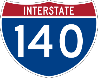
The Pellissippi Parkway is a major highway in Knox and Blount counties in the Knoxville metropolitan area in Tennessee that extends 19.75 miles (31.78 km) from State Route 62 at Solway to SR 33 in Alcoa. It provides access to the cities of Oak Ridge and Maryville from Interstates 40 and 75 in the western part of Knoxville and also serves a major corridor that includes Oak Ridge National Laboratory, Y-12 National Security Complex, and a number of science and technology firms. The central portion of the Pellissippi Parkway is included in the Interstate Highway System and is designated Interstate 140 (I-140), while the remainder is designated as State Route 162. The entire highway is part of the National Highway System, a national network of roads identified as important to the national economy, defense, and mobility. It takes its name from an older name for the Clinch River of Native American origin.

<span class="mw-page-title-main">Interstate 81 in Tennessee</span> Section of Intersate Highway in Tennessee, United States

Interstate 81 (I-81) is part of the Interstate Highway System that runs 855.02 miles (1,376.02 km) northward from Dandridge, Tennessee, to the Thousand Islands Bridge at the Canadian border near Fishers Landing, New York. In Tennessee, I-81 serves the northeastern part of the state, running 75.66 miles (121.76 km) from its southern terminus with I-40 in Dandridge to the Virginia state line in Bristol. The route serves the Tri-Cities region of the state and the eastern parts of the Knoxville metropolitan area, terminating about 35 miles (56 km) east of Knoxville. I-81 bypasses most cities that it serves, instead providing access via interchanges with state and federal routes. It remains in the Ridge-and-Valley topographic region of the Appalachian Mountains for its entire length in Tennessee, and runs in a northeast to southwest direction.

<span class="mw-page-title-main">Interstate 40 in Tennessee</span> Interstate Highway in Tennessee, United States

Interstate 40 (I-40) is part of the Interstate Highway System that runs 2,556.61 miles (4,114.46 km) from Barstow, California, to Wilmington, North Carolina. The highway crosses Tennessee from west to east, from the Mississippi River at the Arkansas border to the Blue Ridge Mountains at the North Carolina border. At 455.28 miles (732.70 km), the Tennessee segment of I-40 is the longest of the eight states through which it passes and the state's longest Interstate Highway.

<span class="mw-page-title-main">Interstate 65 in Tennessee</span> Interstate Highway in Tennessee, United States

Interstate 65 (I-65) is part of the Interstate Highway System that runs 887.30 miles (1,427.97 km) north–south from Mobile, Alabama, to Gary, Indiana. In Tennessee, I-65 traverses the middle portion of the state, running from Ardmore at the Alabama border to the Kentucky border near Portland. The route serves the state capital and largest city of Nashville, along with many of its suburbs. Outside of urban areas, the Interstate bypasses most cities and towns that it serves, instead providing access via state and U.S. Highways. The Interstate passes through the Highland Rim and Nashville Basin physiographic regions of Tennessee, and is often used as the dividing line between the eastern and western portions of the former.

<span class="mw-page-title-main">Interstate 75 in Tennessee</span> Highway in Tennessee

Interstate 75 (I-75) in the US state of Tennessee runs from Chattanooga to Jellico by way of Knoxville. I-75 enters the East Tennessee region from Georgia, following the Tennessee Valley all the way through Knoxville to near Rocky Top, then climbs into the Cumberland Mountains before crossing over into Kentucky at Jellico.

<span class="mw-page-title-main">U.S. Route 11 in Tennessee</span> Highway in Tennessee

U.S. Route 11 (US 11) in the U.S. state of Tennessee travels from the Georgia state line in Chattanooga to Knoxville, where it then splits into US 11E and US 11W. These two highways then travel to the Virginia state line near Kingsport and Bristol. During its length, it shares concurrencies with State Route 2 (SR 2) and SR 38.

<span class="mw-page-title-main">APD-40</span> Highway in Cleveland, Tennessee, United States

APD-40 or APD 40 refers to a road composed of the U.S. Route 64 Bypass and a section of State Route 60 (SR 60) which forms a partial beltway around the business district of Cleveland, Tennessee. The route takes its name from its part of Corridor K of the Appalachian Development Highway System, and is sometimes called Appalachian Highway or simply the Cleveland Bypass. The route is also designated as Veterans Memorial Highway. The US 64 Byp. section of the road is also multiplexed with unsigned State Route 311 and US 74. The road is a four-lane divided highway its entire length and parts are controlled-access. The bypass is an east-west route and the state route is a north-south.

The 1991 Interstate 5 dust storm was a dust storm which occurred on November 29, 1991, along Interstate 5 (I-5) north of the city of Coalinga, California. The storm caused a 104-vehicle traffic collision on the highway which killed 17 people and injured 150.

<span class="mw-page-title-main">1972 Bean Station bus-truck collision</span> Bus/semi-truck collision in Bean Station, Tennessee

The 1972 Bean Station bus-truck collision was a head-on collision involving a double-decker Greyhound bus and a tractor-trailer on U.S. Route 11W in Grainger County, Tennessee, that occurred near the town of Bean Station on the morning of May 13, 1972.

The 75/24 Split, also commonly known simply as "The Split", is the name given to the interchange between Interstates 75 and 24 in Chattanooga, Tennessee. The interchange was originally constructed between 1959 and 1961 as a simple directional-T interchange. Although Chattanooga is only a mid-sized city by national standards, the interchange is the convergence point of two major north-south freight corridors, running between Atlanta and Detroit, and Atlanta and Chicago, respectively. As a result, the interchange has been ranked as one of the most congested bottlenecks in the country, rendering its original design obsolete, and has become notorious for congestion and accidents. The interchange is currently undergoing extensive reconstruction in two phases.

References

  1. 1 2 3 Sneed, Calvin (December 11, 2015). ""Stumbling Out Of The Fog:" Memories Of The Worst Traffic Accident in Tennessee History". Chattanooga, Tennessee: WTVC-TV . Retrieved January 15, 2021.
  2. 1 2 "3 Burn to Death In I-75 Pileup Of 16 Vehicles". The Tennessean. Nashville. March 10, 1974. p. 2-A. Retrieved January 15, 2021 via Newspapers.com.
  3. 1 2 3 4 5 6 7 8 9 10 11 12 13 14 15 16 Bregel, Emily (December 5, 2010). "Echoes from the Fog". Chattanooga Times Free Press . Retrieved January 26, 2019.
  4. 1 2 "62 Cars Pile Up In Chain Crash On Foggy I-75". The Tennessean. Nashville. Associated Press. November 6, 1978. pp. 1, 14 . Retrieved January 15, 2021 via Newspapers.com.
  5. 1 2 3 4 5 6 "Forensic Files: Killer Fog (Season 2, Episode 3)". IMDB. Retrieved January 12, 2019.
  6. 1 2 3 4 5 Bergel, Emily (December 5, 2010). "Fog-induced wreck prompted lawsuits". Chattanooga Times Free Press. Retrieved January 26, 2019.
  7. 1 2 3 4 5 6 7 8 9 Speaks, Dewaine A. (August 5, 2019). Historic Disasters of East Tennessee. Mount Pleasant, South Carolina: Arcadia Publishing. pp. 17–23. ISBN   9781467141895 via Google Books.
  8. Hatcher, Bill (December 27, 1973). "Incomplete I-75 Open". Cleveland Daily Banner. p. 1.
  9. 1 2 3 4 5 6 George, Dan (December 10, 1991). "Investigators, Victims Still Seeking Answers to Tennessee Pileup". Associated Press. Retrieved January 15, 2021.
  10. 1 2 "Report blames factory, state for I-75 pileup". The Tennessean. Nashville. Associated Press. August 26, 1992. p. 3-B. Retrieved January 15, 2021 via Newspapers.com.
  11. 1 2 3 4 5 6 7 8 9 10 National Transportation Safety Board (September 28, 1992). Multiple-vehicle collisions and fire during limited visibility (fog) on Interstate 75 near Calhoun, Tennessee December 11, 1990 (PDF) (Report). Retrieved February 25, 2021.
  12. Parker, Collins (December 11, 2015). "From The Archives: The I-75 Chain Collision Wreck". Chattanooga, Tennessee: WDEF-TV . Retrieved January 15, 2020.
  13. 1 2 "15 Die In Pileup On Foggy Tennessee Highway". The Washington Post. December 12, 1990. Retrieved January 15, 2020.
  14. 1 2 "15 Killed and Over 50 Hurt in Fog As 75 Vehicles Crash in Tennessee". The New York Times. Associated Press. December 12, 1990. Retrieved January 15, 2020.
  15. 1 2 3 Ashdown, Kyle (January 13, 2018). "That Time A Paper Mill Was Blamed For A Massive Highway Crash". CarThrottle. Retrieved January 14, 2020.
  16. "15 Die, 50 Hurt as Thick Fog Triggers 75-Vehicle Pileup". Los Angeles Times. December 12, 1990. Retrieved January 15, 2021.
  17. 1 2 3 4 Johnston, Louis; Williamson, Samuel H. (2023). "What Was the U.S. GDP Then?". MeasuringWorth. Retrieved January 1, 2023. United States Gross Domestic Product deflator figures follow the Measuring Worth series.
  18. "1981 study cited Calhoun mill". Kingsport Times-News. Associated Press. December 28, 1990. p. 3C. Retrieved January 15, 2021 via Newspapers.com.
  19. "Firm to Give $10 Million in Fog Pileup Lawsuits". Los Angeles Times. Associated Press. January 23, 1994. Retrieved January 15, 2020.
  20. 1 2 3 Lakin, Matt (October 28, 2012). "Fog in 1990 sparks Tennessee's deadliest car wreck". Knoxville News Sentinel . Retrieved January 15, 2020.
  21. 1 2 3 "Tennessee DOT Low Visibility Warning System". Federal Highway Administration. Retrieved January 15, 2021.
  22. "Fog warning system due next month". The Tennessean. Nashville. Associated Press. November 19, 1993. p. 3B. Retrieved January 15, 2021 via Newspapers.com.
  23. "Fog closes I-75 for 1st time since 99-car crash". Knoxville, Tennessee: WBIR-TV. December 16, 2015. Retrieved January 15, 2021.
  24. Benjamin, Phil E. (August 13, 2004). "Collision on I-75". People's World . Retrieved April 11, 2021.
  25. Kennedy, Mark (January 22, 2012). "Kennedy: Tragic moments in state's history". Chattanooga Times Free Press . Retrieved June 3, 2020.
  26. Swiger, Gwen (July 31, 2019). "Tragedies revisited in 'Historic Disasters of East Tennessee'". Cleveland Daily Banner . Retrieved June 3, 2020.