AZUSA

Last updated

AZUSA refers to a ground-based radar tracking system installed at Cape Canaveral, Florida and the NASA Kennedy Space Center. AZUSA was named after the southern California town Azusa, California where the system was devised in the early 1950s.

Contents

Azusa antenna farm (1954) from US Air Force Eastern Test Range, Florida Azusa-farm.jpg
Azusa antenna farm (1954) from US Air Force Eastern Test Range, Florida

Radar interferometry

Radio interferometry yields very accurate tracking angles when a target emits a radio signal. This angular precision of interferometry led to the development of the Azusa tracking system as part of the Army Air Corps NUL-774 Project, forerunner of the Atlas ICBM program, at the Vultee Field Division of Consolidated Vultee Aircraft Corporation (Convair) in Downey, California. Two of the basic patents (2,972,047 and 3,025,520) in the field of interferometer tracking are shared by James W. Crooks Jr., Robert C. Weaver, and Robert V. Werner, all members of the Azusa design team. By the spring of 1948, the Azusa team had built an interferometer operating at 148.58 MHz. [ citation needed ]

In a strange circle of history, the U.S. Naval Research Laboratory (NRL) was working on underwater sound interferometers at the time Convair was developing Azusa. Since the two groups were in close contact, there was considerable interchange of ideas.* The circle was completed in the early 1950s when the Navy picked up the Azusa interferometer work for its Viking Project at White Sands, New Mexico. The Navy wanted to explore the possibility of converting the Viking or some derivative of it into a guided missile and it needed an accurate guidance system. In an early report from this program, NRL's J. Carl Seddon explained how the Viking would determine its position: "The Missile will detect its position relative to the hyperbolic guidance path by phase comparison of modulation waveforms derived from signals received from two pairs of stations." In this scheme, the missile would guide itself using onboard electronics and navigational signals received from the ground. This seems a far cry from Minitrack and satellite tracking, but phase comparison, the essence of Minitrack, was there.[ citation needed ]

Within a year,[ when? ] NRL reports from the Viking program were diagramming ground-based tracking interferometers, which relieved the Viking of the burden of signal-processing equipment by computing the missile's position from the ground. Two precursors of Minitrack were evident in the interferometer arrangement. First, only a tiny radio beacon needed to be carried on the Viking itself, an important feature of the Vanguard "Minitrack," in which the prefix 'Mini" applied to the minimum-weight satellite transmitter. The second precursor was the "Lff arrangement of the interferometer antennas which persisted in some early designs of Minitrack, although the final deployed version extended the bars of the "L" to make a cross. [1] [ page needed ]

USAF Atlantic Missile Range, Cape Canaveral, Florida

For some scientific satellites "achieving orbit" is enough, but vehicles carrying men or payloads that must be placed in precise positions, such as geosynchronous satellites, require improved trajectory position and velocity measurement systems.[ according to whom? ]

In the early 1960s, the mainstay for obtaining this data at Canaveral was Convair's Azusa Mark I, a c-w cross baseline interferometer operating in the C band, requiring a transponder in the missile. Output data were digitized for use in the IBM 709 computer and measured parameters consist of range, coherent or fine range, and two direction cosines.[ citation needed ]

The Azusa II, intended to replace Azusa I, was installed in 1961. It is nearly identical to the Mark I except that its circuit design was refined and cosine rate was added which provides better direction cosine information. Both Azusas have identical limitations: they will not track cross-polarized signals; missile antenna nulls deeper than 10 dB cause noisy data, ambiguities and, in severe cases, loss of data. [2]

Use in Apollo Program

The AZUSA tracking radar was used to monitor initial phases of launch for the Saturn S-II by telemetry with transponder frequency of 5,060 MHz (receiver) and 5,000 MHz (transmitter) with 2.5 W of power. [3]

Robert Weaver

Robert Christian Weaver Sr., co-inventor of the AZUSA radar, was a Fresno native, graduated from the University of California Berkeley in 1938 with a bachelor's degree in electrical engineering. He joined the Army Air Corps in 1940, rising to major during World War II. He was responsible for radio and radar equipment in the China-Burma-India Theater. After World War II Weaver began his civilian career with what was then Consolidated Vultee Aircraft in 1946. "After the war he had a choice of engineering jobs; one in Los Angeles, the other in San Diego with Consolidated," his son said. With Convair, Weaver's assignments took him to Cape Canaveral and several other test sites. His specialty became designing radar, guidance and tracking systems for guided missiles and space vehicles. had a career in the aerospace industry that influenced the future of guided missiles and other space vehicles. In the early 1950s, Weaver and a colleague invented the AZUSA continuous wave tracking system, implemented at the Air Force Missile Test Center, Cape Canaveral. This system was designed to measure the trajectory of missiles, and was instrumental in pioneering military missile tests and the Project Mercury manned space program.The technology that Weaver and his colleague, Jim Crooks, devised flourished during the Cold War. It was applied to the Navy's Polaris Project and the Air Force's Thor, Atlas missiles and Titan Projects. It also was used by NASA in the Saturn IV (Apollo) program. One of the advantages of the Azusa system over its predecessors was that it required fewer radar sites and operating crews. The increased emphasis on ballistic missiles and efforts to improve their accuracy spurred the development of the Azusa system and Mistram, a competing technology developed by GE in the early 1960s.[ citation needed ]

Choosing the San Diego assignment, Weaver made his home in La Jolla. He was familiar with the area from a 1933 visit to La Jolla Shores, where he had camped out with friends in cow fields, per his son. Computers, electronic gadgets and photography occupied much of his leisure time. He also enjoyed sports cars, as well as "the green flashes of the La Jolla sunsets and the breathtaking beauty of Yosemite Valley," his son said. [4] Weaver, whose engineering career with the Convair Division of General Dynamics spanned 35 years, died age 87 in September 2003 at the White Sands of La Jolla retirement community. He died of natural causes, per his son, Robert Weaver Jr.

Related Research Articles

Mariner 9 Mars Orbiter

Mariner 9 was a robotic space probe that contributed greatly to the exploration of Mars and was part of the NASA Mariner program. Mariner 9 was launched toward Mars on May 30, 1971 from LC-36B at Cape Canaveral Air Force Station, Florida, and reached the planet on November 14 of the same year, becoming the first spacecraft to orbit another planet – only narrowly beating the Soviet probes Mars 2 and Mars 3, which both arrived at Mars only weeks later.

Vanguard 1 American satellite launched in 1958; oldest manmade object currently in Earth orbit

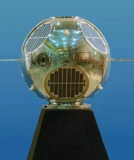
Vanguard 1, 17 March 1958, is an American satellite that was the fourth artificial Earth-orbiting satellite to be successfully launched. Vanguard 1 was the first satellite to have solar electric power. Although communications with the satellite were lost in 1964, it remains the oldest human-made object still in orbit, together with the upper stage of its launch vehicle.

MISTRAM

MISTRAM was a high-resolution tracking system used by the United States Air Force to provide highly detailed trajectory analysis of rocket launches.

Project Vanguard was a program managed by the United States Naval Research Laboratory (NRL), which intended to launch the first artificial satellite into Earth orbit using a Vanguard rocket as the launch vehicle from Cape Canaveral Missile Annex, Florida.

A guidance system is a virtual or physical device, or a group of devices implementing a controlling the movement of a ship, aircraft, missile, rocket, satellite, or any other moving object. Guidance is the process of calculating the changes in position, velocity, altitude, and/or rotation rates of a moving object required to follow a certain trajectory and/or altitude profile based on information about the object's state of motion.

Goldstone Deep Space Communications Complex US observatory near Barstow, California

The Goldstone Deep Space Communications Complex (GDSCC), commonly called the Goldstone Observatory, is a satellite ground station located in the Mojave Desert near Barstow in the U.S. state of California. Operated by NASA's Jet Propulsion Laboratory (JPL), its main purpose is to track and communicate with interplanetary space missions. It is named after Goldstone, California, a nearby gold-mining ghost town.

United States Space Surveillance Network

The United States Space Surveillance Network detects, tracks, catalogs and identifies artificial objects orbiting Earth, e.g. active/inactive satellites, spent rocket bodies, or fragmentation debris. The system is the responsibility of United States Space Command and operated by the United States Space Force.

Spacecraft Tracking and Data Acquisition Network 1960s American spacecraft communications system

The Spacecraft Tracking and Data (Acquisition) Network was established by NASA in the early 1960s to satisfy the requirement for long-duration, highly-available space-to-ground communications. The network was the “follow-on” to the earlier Minitrack, which tracked the flights of Sputnik, Vanguard, Explorer, and other early space efforts (1957–1962). Real-time operational control and scheduling of the network was provided by the Network Operations Control Center (NOCC) at the Goddard Space Flight Center (GSFC) in Greenbelt, Maryland.

The UDOP multistatic radar and multiradar system (MSRS) utilizes Doppler radar for missile tracking and trajectory measurement. A target is illuminated at 450 MHz. Five receiving stations, located along the baselines with the lengths from 40 to 120 km, receive signals from the target's transponder at 900 MHz. These five stations yield slant-range rate. To compute the range or position, an initial position is required from some other tracking system. The random error is 6 cm (2.4 in), but total error includes the systematic error of 2.7 m (8.9 ft) plus the initial error. UDOP had relatively low cost compared with other high-accuracy systems. In the US, MSRS has found important application in the precision measurement of missile trajectories at the Air Force Eastern Test Range, which extends from the Florida mainland to the Indian Ocean. These MSRSs include the AZUSA, the MISTRAM, and the UDOP. All systems employ a cooperative beacon transponder on the observed target and a ground-based transmitting station with several receiving stations at separate, precisely located sites.

RCA AN/FPS-16 Instrumentation Radar

The AN/FPS-16 is a highly accurate ground-based monopulse single object tracking radar (SOTR), used extensively by the NASA manned space program, the U.S. Air Force and the U.S. Army. The accuracy of Radar Set AN/FPS-16 is such that the position data obtained from point-source targets has azimuth and elevation angular errors of less than 0.1 milliradian and range errors of less than 5 yards (5 m) with a signal-to-noise ratio of 20 decibels or greater.

The Manned Space Flight Network was a set of tracking stations built to support the American Mercury, Gemini, Apollo, and Skylab space programs.

The Minitrack Network was the first U.S. satellite tracking network to become operational, in 1957. It was used to track the flights of Sputnik, Vanguard, Explorer, and other early space efforts. Minitrack was the progenitor of Spacecraft Tracking and Data Acquisition Network (STADAN) and the Manned Space Flight Network (MSFN).

History of the Goddard Space Flight Center

Goddard Space Flight Center is NASA's first, and oldest, space center. It is named after Dr. Robert H. Goddard, the father of modern rocketry. Throughout its history, the center has managed, developed, and operated many notable missions, including the Cosmic Background Explorer, the Hubble Space Telescope, the Tracking and Data Relay Satellite System (TDRSS), the Lunar Reconnaissance Orbiter, and the Solar Dynamics Observatory.

NASCOM terrestrial communications network operated by NASA

The NASA (Ground) Communications System (NASCOM) manages terrestrial communications between ground stations, mission control centers, and other elements of spacecraft ground segments, providing worldwide, near real-time transmission of commands, telemetry, voice, and television signals. It is managed out of NASA's Goddard Space Flight Center in Greenbelt, Maryland.

Ionospheric Connection Explorer

The Ionospheric Connection Explorer (ICON) is a satellite designed to investigate changes in the ionosphere of Earth, the dynamic region high in our atmosphere where terrestrial weather from below meets space weather from above. ICON studies the interaction between Earth's weather systems and space weather driven by the Sun, and how this interaction drives turbulence in the upper atmosphere. It is hoped that a better understanding of this dynamic will mitigate its effects on communications, GPS signals, and technology in general. It is part of NASA's Explorers program and is operated by University of California, Berkeley's Space Sciences Laboratory.

Vanguard TV-0

Vanguard TV-0, also called Vanguard Test Vehicle-Zero, was the first sub-orbital test flight of a Vanguard rocket as part of the Project Vanguard.

Vanguard TV-5 Failed rocket launch

Vanguard TV-5, also called Vanguard Test Vehicle-Five, was a failed flight of the American Vanguard rocket following the successful launch of Vanguard 1 on Vanguard TV-4. Vanguard TV-5 launched on 29 April 1958 at 02:53:00 GMT, from Launch Complex 18A at the Cape Canaveral Air Force Station. The rocket was unsuccessful in its attempt to place an unnamed satellite into orbit.

Explorer 29

Explorer 29 was an American satellite launched as part of the Explorers program, being the first of the two satellites GEOS. Explorer 29 was launched on 6 November 1965 from Cape Canaveral, Florida, United States, with Delta rocket.

SOLRAD 1 U.S. solar X-ray and surveillance satellite

SOLRAD1 is the public designation for SOLRAD/GRAB 1, a combination science and surveillance satellite launched into orbit on 22 June 1960. It was the first satellite to successfully observe solar X-rays, the first to conduct surveillance from orbit, and the first to be launched with another instrumented satellite.

SOLRAD 2 U.S. satellite launched in 1960

SOLRAD 2 was the public designation for a combination surveillance and solar X-rays and ultraviolet scientific satellite, the second in the SOLRAD program developed by the United States Navy's Naval Research Laboratory. The SOLRAD scientific package aboard the satellite provided cover for the GRAB electronic surveillance package, the mission of which was to map the Soviet Union's air defense radar network.

References

  1. Corliss, William R., 'The Evolution of the Satellite Tracking and Data Acquisition Network (STADAN)'. Goddard Historical Note No. 3. Greenbelt, MD.: Goddard Space Flight Center, 1967.
  2. Earth-based Electronics in Electronics, vol. 34, no. 46, pp. 108-118, 17 November 1961.
  3. F.O. Vonbun, 'Ground Tracking of the Apollo', NASA Report N66-22219, 1966.
  4. Jack Williams. Robert Weaver; Inventor of missile-tracking system. San Diego, California Union-Tribune, September 25, 2003.

Further reading