Rustam Nurgaliyevich Minnikhanov is a Russian politician and the second and current President of Tatarstan, a federal subject of Russia.

Arsk is a town and the administrative center of Arsky District in the Tatarstan, Russia, located on the Kazanka River, 65 kilometers (40 mi) from the republic's capital of Kazan. As of the 2010 Census, its population was 18,114.
Yelabuga is a town in the Republic of Tatarstan, Russia, located on the right bank of the Kama River and 200 kilometers (120 mi) east from Kazan. Population: 70,728 (2010 Census); 68,663 (2002 Census); 53,537 (1989 Census).

Menzelinsk is a town and the administrative center of Menzelinsky District in the Republic of Tatarstan, Russia, located on the Menzelya River near its confluence with the Kama, 292 kilometers (181 mi) from the republic's capital of Kazan. Population: 16,476 (2010 Census); 16,730 (2002 Census); 15,223 (1989 Census); 15,800 (1973).

The Kazan Governorate, or the Government of Kazan, was a governorate of the Tsardom of Russia, the Russian Empire, and the Russian SFSR from 1708–1920, with its seat in the city of Kazan.

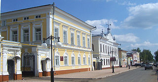
Chistopol is a town in the Republic of Tatarstan, Russia, located on the left bank of the Kuybyshev Reservoir, on the Kama River. As of the 2010 Census, its population was 60,755.
Administratively, Tver Oblast is divided into two urban-type settlements under the federal government management, five cities and towns of oblast significance, and thirty-six districts.
Archa is a transliteration of the Tatar name of Arsk, a town in the Republic of Tatarstan, Russia.
Tetyushi is a town and the administrative center of Tetyushsky District in the Republic of Tatarstan, Russia, located on the right bank of the Volga River, on the shore of the Kuybyshev Reservoir, 180 kilometers (110 mi) south of Kazan, the capital of the republic. As of the 2010 Census, its population was 11,596. It was previously known as Tetyushskaya zastava

Mamadysh is a town and the administrative center of Mamadyshsky District in the Republic of Tatarstan, Russia, located on the Vyatka River, 167 kilometers (104 mi) from the republic's capital of Kazan. As of the 2010 Census, its population was 14,435.
Laishevo is a town and the administrative center of Laishevsky District in the Republic of Tatarstan, Russia, located on the right bank of the Kama River on the shore of the Kuybyshev Reservoir, 62 kilometers (39 mi) southeast of the republic's capital of Kazan. As of the 2010 Census, its population was 7,735.

Arsky District is an administrative and municipal district (raion), one of the forty-three in the Tatarstan, Russia. It is located in the northwest of the republic. The area of the district is 1,843.6 square kilometers (711.8 sq mi). Its administrative center is the town of Arsk. Population: 51,667 (2010 Census); 51,343 ; 61,959 (1989 Census). The population of Arsk accounts for 35.1% of the district's total population. It is possible to go by means of a commuter train from Kazan to Arsk and visa versa. There is a Teachers College in the town of Arsk. The district specializes in writing Tatar language ABC textbooks. Wheat, rhye and beans are cultivated here.
The Pitchfork Uprising of 1920, also known as Black Eagle Uprising, was a peasant uprising against the Soviet policy of the war communism in what is today Eastern Tatarstan and Western Bashkortostan. It started in the village of Yanga Yelan, Menzelinsky Uyezd, Ufa Governorate on February 4, 1920, where local peasants tried to resist confiscation of their food. When they refused to give up their produce, the leader of the military confiscation unit ("prodotryad") arrested some of them. Peasants asked him to free the hostages, but he refused. Peasants killed the members of prodotryad and circulated the appeal to rise.
Buinsk is a town in the Republic of Tatarstan, Russia, located on the left bank of the Karla River, 137 kilometers (85 mi) southwest of Kazan. Population: 20,352 (2010 Census); 19,736 (2002 Census); 16,800 (1989 Census).

Tatar mosque — is the typical mosque architecture in Tatarstan and other Volga Tatar-populated areas of Russia. Occasionally found in other regions of Russia, modern Tatar religious architecture was developed in the late 18th century and gained popularity in the 19th century Idel-Ural.

Chistopolsky District is an administrative and municipal district (raion), one of the forty-three in the Republic of Tatarstan, Russia. It is located in the center of the republic. The area of the district is 1,823 square kilometers (704 sq mi). Its administrative center is the town of Chistopol. Population: 19,406 (2010 Census); 21,716 ; 21,823 (1989 Census).

Laishevsky District is an administrative and municipal district (raion), one of the forty-three in the Republic of Tatarstan, Russia. It is located in the west of the republic. The area of the district is 2,094.43 square kilometers (808.66 sq mi). Its administrative center is the town of Laishevo. Population: 36,516 (2010 Census); 37,011 ; 35,521 (1989 Census). The population of Laishevo accounts for 21.2% of the district's total population.

Mamadyshsky District is an administrative and municipal district (raion), one of the forty-three in the Republic of Tatarstan, Russia. It is located in the north of the republic. The area of the district is 2,600.7 square kilometers (1,004.1 sq mi). Its administrative center is the town of Mamadysh. Population: 45,005 (2010 Census); 48,075 ; 50,685 (1989 Census). The population of Mamadysh accounts for 32.1% of the district's total population. Wheat, rhye, barley, peas, oats, flax is produced in this district.

Yelabuzhsky District is an administrative and municipal district (raion), one of the forty-three in the Republic of Tatarstan, Russia. It is located in the north of the republic. The area of the district is 1,362.1 square kilometers (525.9 sq mi). Its administrative center is the town of Yelabuga. Population: 10,904 (2010 Census); 10,785 ; 9,957 (1989 Census).
Vyatka Governorate was a governorate of the Russian Empire and Russian SFSR, with its capital in city Vyatka, from 1796 to 1929. In the governorate’s area were situated most parts of modern Kirov Oblast and Udmurt Republic.