Related Research Articles

Union Parish is a parish located in the north central section of the U.S. state of Louisiana. As of the 2020 census, the population was 21,107. The parish seat is Farmerville. The parish was created on March 13, 1839, from a section of Ouachita Parish. Its boundaries have changed four times since then.

Claiborne Parish is a parish located in the northwestern section of the U.S. state of Louisiana. The parish was formed in 1828, and was named for the first Louisiana governor, William C. C. Claiborne. As of the 2020 census, the population was 14,170. The parish seat is Homer.
The Battle of Goodrich's Landing, Louisiana, was fought on June 29 and June 30, 1863, between Union and Confederate forces during the American Civil War. The Confederates attacked several Union regiments, who were composed mostly of black soldiers, in an attempt to disrupt the campaign at Vicksburg, Mississippi.
Shiloh Valley Township is located in St. Clair County, Illinois. As of the 2010 census, its population was 11,631 and it contained 4,284 housing units. Shiloh Valley Township was originally called Shiloh before its name was changed on an unknown date.
A roundabout interchange is a type of interchange between a controlled access highway, such as a motorway or freeway, and a minor road. The slip roads to and from the motorway carriageways converge at a single roundabout, which is grade-separated from the motorway lanes with bridges.
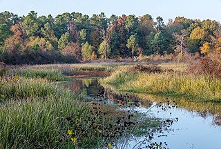
Bayou Bartholomew is the longest bayou in the world, meandering approximately 364 miles (586 km) between the U.S. states of Arkansas and Louisiana. It contains over 100 aquatic species making it the second most diverse stream in North America. Known for its excellent bream, catfish, and crappie fishing, portions of the bayou are considered some of the best kept secrets of Arkansas anglers. It starts northwest of the city of Pine Bluff, Arkansas, in the Hardin community, winds through parts of Jefferson, Lincoln, Desha, Drew, Chicot, and Ashley counties in Arkansas, and Morehouse Parish, Louisiana, and eventually enters the Ouachita River after passing the northernmost tip of Ouachita Parish, near Sterlington, Louisiana. The bayou serves as the primary border separating the Arkansas Delta from the Arkansas Timberlands.

J.C. Love Field at Pat Patterson Park is a baseball stadium in Ruston, Louisiana, United States. It is the home field of the Louisiana Tech University Bulldogs college baseball team.

The Castle Dome Mountains are a mountain range in Yuma County, Arizona, within the Kofa National Wildlife Refuge. Castle Dome Peak, the high point of the range, is a prominent butte and distinctive landmark. The peak is 3,776 feet (1,151 m) high, and is located at 33°05′04″N114°08′36″W. Castle Dome was named by American soldiers at old Fort Yuma in the 1880s. Early Spanish explorers called the same peak Cabeza de Gigante, "Giant's Head."
CHAR-FM is a radio station that broadcasts on 92.7 FM in Rankin Inlet, Nunavut, Canada. The station is owned by James Sandy and Todd McKay.
The Eliza Battle was a Tombigbee River steamboat that ran a route between Columbus, Mississippi and Mobile, Alabama in the United States during the 1850s. She was destroyed in a fire on the river near modern Pennington, Alabama on March 1, 1858. It was the greatest maritime disaster in Tombigbee River history, with an estimated thirty-three people killed, out of roughly sixty passengers and a crew of forty-five. The disaster and its aftermath saw the Eliza Battle enter southwestern Alabama folklore as a ghost ship, with numerous purported sightings of the burning ship from just north of Pennington to Nanafalia downriver. The story of the disaster and associated folklore has been fictionalized in several published short stories, most notably in “The Phantom Steamboat of the Tombigbee” in 13 Alabama Ghosts and Jeffrey.
Coochie Brake is a cypress swamp in Louisiana of more than 700 acres. It is between Verda and Atlanta. This swamp also referred to as a brake is home to alligators, massive cypress trees, deer and much more. Coochie Brake is a colorful local source full of history and folklore dating back to when it was a Spanish fort. Once owned by JM Ferguson, it is now a state owned property.
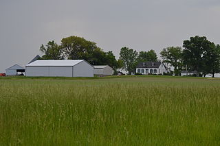
Pleasant Hill is an unincorporated community in Lincoln Parish, Louisiana, United States.
Norths Landing is an unincorporated community in Randolph Township, Ohio County, in the U.S. state of Indiana.
Olentangy is an unincorporated community in Whetstone Township, Crawford County, Ohio, United States.
Arizona is an unincorporated community in Claiborne Parish, Louisiana, United States. Arizona is located at 32°47′21″N92°57′28″W
Barnet Springs is an unincorporated community in Lincoln Parish, Louisiana, United States.
Oak Grove is an unincorporated community in Lincoln Parish, Louisiana, United States.

The Downtown Ruston Historic District is a historic district located in downtown Ruston, Louisiana.
Antioch is an unincorporated community in Lincoln Parish, Louisiana, United States.
References
- ↑ U.S. Geological Survey Geographic Names Information System: Alabama Landing, Louisiana
- ↑ Leeper, Clare D'Artois (October 19, 2012). Louisiana Place Names: Popular, Unusual, and Forgotten Stories of Towns, Cities, Plantations, Bayous, and Even Some Cemeteries. LSU Press. p. 12. ISBN 978-0-8071-4740-5.
Municipalities and communities of Union Parish, Louisiana, United States | ||
|---|---|---|
| Towns |  | |
| Villages | ||
| Unincorporated communities | ||
| Footnotes | ‡This populated place also has portions in an adjacent parish or parishes | |
32°52′25″N92°05′04″W / 32.87361°N 92.08444°W
| | This Louisiana state location article is a stub. You can help Wikipedia by expanding it. |