
Tenleytown–AU is a subway station on the Red Line of the Washington Metro in Washington, D.C. Located in the Upper Northwest neighborhood, it is the last station on the Red Line heading outbound wholly within the District of Columbia; the next stop, Friendship Heights, lies within both the District and the state of Maryland.

Tenleytown is a historic neighborhood in Northwest, Washington, D.C.

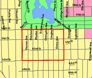
Mount Pleasant is a neighborhood in the northwestern quadrant of Washington, D.C. It is bounded by Rock Creek Park to the north and west; Harvard Street NW to the south; and 16th Street NW to the east. It is north of Adams Morgan and west of Columbia Heights. It is home to about 10,000 people.

Northwest is the northwestern quadrant of Washington, D.C., the capital of the United States, and is located north of the National Mall and west of North Capitol Street. It is the largest of the four quadrants of the city, and it includes the central business district, the Federal Triangle, and the museums along the northern side of the National Mall, as well as many of the District's historic neighborhoods.

Wesley Heights is a small affluent neighborhood of Washington, D.C. situated south of Spring Valley. Wesley Heights was founded in 1890 by a land speculation group led by John Waggaman and funded primarily by Charles C. Glover; Wesley Heights was further developed by the brothers William C. and Allison N. Miller during the 1920s. Modern-day Wesley Heights is bordered by Massachusetts Avenue, Nebraska Avenue, Battery-Kemble Park and Glover Parkway. Foxhall Road and New Mexico Avenue are the main roadway passing through Wesley Heights. To protect the character of the original historic housing design of Wesley Heights, the Wesley Heights Zoning Overlay was developed and approved by District of Columbia Zoning Commission on July 13, 1992, at the urging of the Wesley Heights Historical Society. Current homeowners and new housing development within the Wesley Heights overlay must meet specific building codes. The Wesley overlay covers areas west of New Mexico Avenue, Nebraska Avenue, Battery-Kemble Park and Glover Parkway. The overlay restriction does not cover development on housing located on the former Charles C. Glover country estate. Modern day Wesley Heights is located in Ward 3 Advisory Neighborhood Commission under 3D01.

Chevy Chase is a neighborhood in northwest Washington, D.C. It borders Chevy Chase, Maryland, a collection of similarly affluent neighborhoods.

Neighborhoods in Washington, D.C., are distinguished by their history, culture, architecture, demographics, and geography. The names of 131 neighborhoods are unofficially defined by the D.C. Office of Planning. Neighborhoods can be defined by the boundaries of wards, historic districts, Advisory Neighborhood Commissions, civic associations, and business improvement districts (BIDs); these boundaries will overlap. The eight wards each elect a member to the Council of the District of Columbia and are redistricted every ten years.

Massachusetts Avenue is a major diagonal transverse road in Washington, D.C., and the Massachusetts Avenue Historic District is a historic district that includes part of it.
A covenant, in its most general sense and historical sense, is a solemn promise to engage in or refrain from a specified action. Under historical English common law, a covenant was distinguished from an ordinary contract by the presence of a seal. Because the presence of a seal indicated an unusual solemnity in the promises made in a covenant, the common law would enforce a covenant even in the absence of consideration. In United States contract law, an implied covenant of good faith is presumed.

Wisconsin Avenue is a major thoroughfare in Washington, D.C., and its Maryland suburbs. The southern terminus begins in Georgetown just north of the Potomac River, at an intersection with K Street under the elevated Whitehurst Freeway. The section of Wisconsin Avenue in Georgetown was called High Street before the street names in Georgetown were changed in 1895 to conform to those of the L'Enfant Plan for the federal city.

Spring Valley is a largely residential neighborhood in Ward 3, Northwest Washington, D.C. As of July 2021, it was the most expensive neighborhood in the District, with homes selling at a median price of $1.465 million.

Tenley Circle is a traffic circle in the Northwest Washington, D.C. neighborhood of Tenleytown. Tenley Circle lies at the intersection of Nebraska Avenue, Wisconsin Avenue, and Yuma Street. Unlike many of the circles in Washington, Tenley's traffic pattern has evolved such that the dominant roadway, Wisconsin Avenue, can pass straight through the center instead of going around the outside circumference.
The Washington Park Subdivision is the name of the historic 3-city block by 4-city block subdivision in the northwest corner of the Woodlawn community area, on the South Side of Chicago in Illinois that stands in the place of the original Washington Park Race Track. The area evolved as a redevelopment of the land previously occupied by the racetrack. It was originally an exclusively white neighborhood that included residential housing, amusement parks, and beer gardens.

The Immaculata Seminary Historic District, commonly known as Tenley Campus, is an 8.2-acre (3.3 ha) parcel of land, located off of Tenley Circle in the Northwest Washington, D.C. neighborhood of Tenleytown. The site of Dunblane, an early to mid-nineteenth-century Federal/Greek Revival-style manor house, it was once part of a large country estate on the outskirts of the capital city, owned by a succession of prominent Georgetown residents. From 1904 to 1906, the land was acquired by the Catholic Sisters of Providence of Saint Mary-of-the-Woods, who, for decades, operated all-girls primary, secondary, and postsecondary schools there under the Immaculata name, before being forced to shutter due to financial issues. Since 1986, it has been a satellite campus of American University, which purchased the site in part because of its proximity to Tenleytown station on the Red Line of the Washington Metro. It currently houses the school's Washington College of Law.
Cultural Tourism DC is an independent non-profit coalition of more than 230 culture, heritage, and community-based organizations in Washington, DC. Cultural Tourism DC and its members develop and present programs in Washington for area residents and visitors. Member organizations represent cultural and community organizations throughout Washington, DC; they include large institutions such as the John F. Kennedy Center for the Performing Arts and U.S. National Arboretum to smaller ones such as the Frederick Douglass House and the Hillwood Estate, Museum & Gardens.
Washington, D.C., is administratively divided into four geographical quadrants of unequal size, each delineated by their ordinal directions from the medallion located in the Crypt under the Rotunda of the Capitol. Street and number addressing, centered on the Capitol, radiates out into each of the quadrants, producing a number of intersections of identically named cross-streets in each quadrant. Originally, the District of Columbia was a near-perfect square. However, even then the Capitol was never located at the geographic center of the territory. As a result, the quadrants are of greatly varying size. Northwest is quite large, encompassing over a third of the city's geographical area, while Southwest is little more than a neighborhood and military base.

The following outline is provided as an overview of and topical guide to District of Columbia:
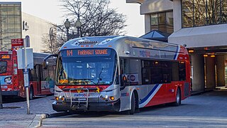
The Massachusetts Avenue Line, designated Route N2, N4, N6, is a daily bus route operated by the Washington Metropolitan Area Transit Authority between Friendship Heights station of the Red Line of the Washington Metro and Farragut Square in Downtown Washington DC. The line operates every 24–30 minutes during the weekdays and 35–45 minutes on weekends. Trips take roughly 45 minutes to complete.
The W.C. and A.N. Miller Companies are a group of related privately-held real estate firms known for developing residential communities in Washington, D.C. and its surrounding metropolitan area. Developers of neighborhoods including Spring Valley and Wesley Heights in D.C., Sumner in Bethesda, and Potomac Falls in Potomac, Maryland, they were considered to be one of Washington's most renowned realty developers in the early 20th century.
Rock Creek Forest is a mostly residential neighborhood in Silver Spring / Chevy Chase, Maryland.


