Amherst, Texas

Last updated

Amherst, Texas
City
Amherst Texas Grain Elevators 2010.jpg
Grain elevators of Amherst
Amherst, Texas
Amherst, Texas
Amherst, Texas
Amherst, Texas
Relief map of Texas.png
Red pog.svg
Amherst
Coordinates: 34°00′37″N102°24′56″W / 34.01028°N 102.41556°W / 34.01028; -102.41556
CountryFlag of the United States.svg  United States
StateFlag of Texas.svg  Texas
County Lamb
Region Llano Estacado
Established1923
Area
[1]
  Total0.92 sq mi (2.37 km2)
  Land0.92 sq mi (2.37 km2)
  Water0.00 sq mi (0.00 km2)
Elevation
[2]
3,652 ft (1,113 m)
Population
 (2020)
  Total678
  Density740/sq mi (290/km2)
Time zone UTC-6 (CST)
ZIP code
79312
Area code 806
FIPS code 48-03084
Website cityofamhersttx.com

Amherst is a city in Lamb County, Texas, United States. The population was 678 at the 2020 census.

Contents

History

Amherst, on U.S. Route 84 and the BNSF Railway in west central Lamb County, began in 1913 as a Pecos and Northern Texas Railway station for William E. Halsell's Mashed O Ranch. A townsite was platted a mile from the Santa Fe depot in 1923 and named for Amherst College by a railroad official. The post office opened in 1924. [3] By 1930 thirty-five businesses and 964 people constituted a lively trade center, and amenities included a newspaper, the Amherst Argus. For many years the Amherst Hotel, the town's first permanent building, was the most popular stopping place between Clovis, New Mexico and Lubbock, Texas. The population in Amherst was 749 in 1940, when the first co-op hospital in Texas was built there. Incorporation came in 1970, when the population was 825. In 1980 the population was 971, and businesses included five cotton gins and two grain elevators. Sod House Spring Monument, commemorating the first cow camp in the area, is located 6 miles (10 km) northwest of Amherst, and Plant X, one of Southwestern Public Service's largest generating plants, is nine miles north. [3]

Geography

Amherst is in central Lamb County, 8 miles (13 km) northwest of Littlefield, the county seat, and 24 miles (39 km) southeast of Muleshoe. U.S. Route 84 passes just southwest of Amherst, connecting Littlefield and Muleshoe.

According to the U.S. Census Bureau, Amherst has an area of 0.93 square miles (2.4 km2), all land. [1]

Climate

According to the Köppen Climate Classification system, Amherst has a semi-arid climate, abbreviated "BSk" on climate maps. [4]

Demographics

Historical population
CensusPop.Note
1930 964
1940 749−22.3%
1950 92223.1%
1960 883−4.2%
1970 825−6.6%
1980 97117.7%
1990 742−23.6%
2000 7916.6%
2010 721−8.8%
2020 678−6.0%
U.S. Decennial Census [5]
2020 Census [6]

As of the census [7] of 2000, there were 791 people, 269 households, and 210 families residing in the city. The population density was 951.4 inhabitants per square mile (367.3/km2). There were 341 housing units at an average density of 410.2 per square mile (158.4/km2). The racial makeup of the city was 68.90% White, 9.36% African American, 0.25% Native American, 21.11% from other races, and 0.38% from two or more races. Hispanic or Latino of any race were 39.95% of the population.

There were 269 households, out of which 36.1% had children under the age of 18 living with them, 62.1% were married couples living together, 11.5% had a female householder with no husband present, and 21.6% were non-families. 20.1% of all households were made up of individuals, and 10.8% had someone living alone who was 65 years of age or older. The average household size was 2.83 and the average family size was 3.25.

In the city, the population was spread out, with 31.2% under the age of 18, 7.5% from 18 to 24, 24.3% from 25 to 44, 18.1% from 45 to 64, and 19.0% who were 65 years of age or older. The median age was 34 years. For every 100 females, there were 87.0 males. For every 100 females age 18 and over, there were 83.8 males.

The median income for a household in the city was $24,276, and the median income for a family was $25,714. Males had a median income of $22,625 versus $19,063 for females. The per capita income for the city was $9,911. About 25.0% of families and 31.7% of the population were below the poverty line, including 45.8% of those under age 18 and 8.4% of those age 65 or over.

Education

The city is served by the Amherst Independent School District.

Notable people

See also

Related Research Articles

<span class="mw-page-title-main">Lamb County, Texas</span> County in Texas, United States

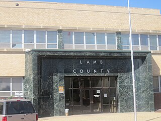
Lamb County is a county located in the U.S. state of Texas. As of the 2020 census, its population was 13,045. Its county seat is Littlefield. The county was created in 1876, but not organized until 1908. It is named for George A. Lamb, who died in the Battle of San Jacinto.

<span class="mw-page-title-main">Bailey County, Texas</span> County in Texas, United States

Bailey County is a county located in the U.S. state of Texas. It is in West Texas and its county seat is Muleshoe. As of the 2020 census, its population was 6,904.

<span class="mw-page-title-main">Diboll, Texas</span> City in Texas, United States

Diboll is a city in Angelina County, Texas, United States. The population was 4,457 at the 2020 census. Diboll is named for J. C. Diboll, a local timber salesman.

<span class="mw-page-title-main">Jourdanton, Texas</span> City in Texas, United States

Jourdanton is a city in and the county seat of Atascosa County, Texas, United States. The population is 4,094. It is part of the San Antonio metropolitan statistical area. The mayor is Robert "Doc" Williams. The city manager is Bobby J. Martinez. The police chief is Eric Kaiser. The fire chief is Jay Fojtik.

<span class="mw-page-title-main">Muleshoe, Texas</span> City in Texas, United States

Muleshoe is a city in Bailey County, Texas, United States. It was founded in 1913, when the Pecos and Northern Texas Railway built an 88-mile (142 km) line from Farwell, Texas, to Lubbock through northern Bailey County. In 1926, Muleshoe was incorporated. Its population was 5,158 at the 2010 census. The county seat of Bailey County, it is home to the National Mule Memorial.

<span class="mw-page-title-main">Meridian, Texas</span> City in Texas, United States

Meridian is a city and the county seat of Bosque County in central Texas, United States. It is forty-seven miles northwest of Waco. The population was 1,396 at the 2020 census.

<span class="mw-page-title-main">Caldwell, Texas</span> City in Texas, United States

Caldwell is a city in and the county seat of Burleson County, Texas, United States. The population was 3,993 at the 2020 census. It is part of the Bryan-College Station metropolitan area.

<span class="mw-page-title-main">Paducah, Texas</span> Town in Cottle County, Texas, United States

Paducah is a town in Cottle County, Texas, United States. The population was 1,186 at the 2010 census, down from 1,498 in 2000. It is the county seat of Cottle County. It is just south of the Texas Panhandle and east of the Llano Estacado.

<span class="mw-page-title-main">Dickens, Texas</span> City in Texas, United States

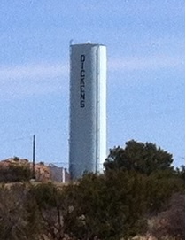
Dickens is a city in and the county seat of Dickens County, Texas, United States. The population was 286 at the 2010 census, down from 332 at the 2000 census.

<span class="mw-page-title-main">Fairfield, Texas</span> City in Texas, United States

Fairfield is a city and county seat of Freestone County, Texas, United States. The population was 2,850 at the 2020 census, down from 3,094 at the 2000 census. It was founded in 1851.

Briaroaks is a city in Johnson County, Texas, United States. The population was 507 at the 2020 census.

<span class="mw-page-title-main">Blossom, Texas</span> City in Texas, United States

Blossom is a town in Lamar County, Texas, United States. The population was 1,402 at the 2020 census.

<span class="mw-page-title-main">Olton, Texas</span> City in Texas, United States

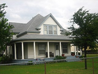
Olton is a city in Lamb County, Texas, United States. The population was 1,989 at the 2020 census.

<span class="mw-page-title-main">Jewett, Texas</span> City in Texas, United States

Jewett is a city in Leon County, Texas, United States. The population was 1,167 at the 2010 census. It was laid out in 1871 by the International Railroad Company.

<span class="mw-page-title-main">Madisonville, Texas</span> City in Texas, United States

Madisonville is a city in Madison County, Texas, United States. The population was 4,420 at the 2020 census. It is the county seat of Madison County. Both the City of Madisonville and the County of Madison were named for U.S. President James Madison, the fourth chief executive.

<span class="mw-page-title-main">Natalia, Texas</span> City in Texas, United States

Natalia is a city in Medina County, Texas, United States. The population was 1,202 at the 2020 census. It was founded in 1912 and was named after Natalie Pearson Nicholson, daughter of Frederick Stark Pearson, engineer, designer and builder of the Medina Dam.

<span class="mw-page-title-main">Wheeler, Texas</span> City in Texas, United States

Wheeler is a city, and the county seat of Wheeler County, Texas, United States, located on the eastern border of the Texas Panhandle. The population was last reported at 1,592 in the 2010 census.

<span class="mw-page-title-main">Scotland, Texas</span> City in Texas, United States

Scotland is a city in Archer County in the U.S. state of Texas. It is part of the Wichita Falls, Texas Metropolitan Statistical Area. The population was 501 at the 2010 census. The town is named for its founder, Henry J. Scott.

<span class="mw-page-title-main">Horseshoe Bay, Texas</span> City in Texas, United States

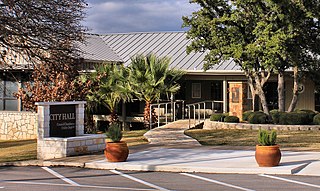
Horseshoe Bay is a city in Llano and Burnet counties in the U.S. state of Texas.

<span class="mw-page-title-main">Reklaw, Texas</span> City in Texas, United States

Reklaw is a city in Cherokee and Rusk counties in the U.S. state of Texas. The population was 332 at the 2020 census.

References

  1. 1 2 "2019 U.S. Gazetteer Files". United States Census Bureau. Retrieved August 7, 2020.
  2. "Amherst". Geographic Names Information System . United States Geological Survey, United States Department of the Interior.
  3. 1 2 Hunt, William R. "Amherst, Texas (Lamb County)". Handbook of Texas Online. Retrieved March 12, 2013.
  4. Climate Summary for Amherst, Texas
  5. "Census of Population and Housing". Census.gov. Retrieved June 4, 2015.
  6. "Census Bureau profile: Amherst, Texas". United States Census Bureau. May 2023. Retrieved June 3, 2024.
  7. "U.S. Census website". United States Census Bureau . Retrieved January 31, 2008.
  8. "Texas Sheriff: Reports Warn of ISIS Terrorist Cells Coming Across the Border". CBS-TV in Houston, Texas. September 15, 2014. Archived from the original on September 15, 2014. Retrieved September 17, 2014.