Related Research Articles

Avon Park is a city in Highlands County, Florida, United States. As of the 2010 census the population was 8,836, and in 2018 the estimated population was 10,695. It is the oldest city in Highlands County, and was named after Stratford-upon-Avon, England.

The Lake of the Arbuckles is a reservoir located in southern Oklahoma, 8 miles (13 km) southwest of Sulphur in Murray County. The lake covers 2,350 acres (950 ha) and is a principal water supply reservoir for the city of Ardmore, some 30 mi (48 km) to the southwest. It also supplies water to the cities of Sulphur, Davis, Wynnewood and a large oil refinery near Wynnewood. The lake also provides flood control, fish and wildlife habitat and recreation opportunities.

Lake Istokpoga is a 26,762.9-acre (108.306 km2) freshwater lake in Highlands County, Florida. It is fed by two creeks, Arbuckle Creek and Josephine Creek. The oblong-shaped lake is approximately 5 miles (8.0 km) wide by 10 miles (16 km) long. It is considered the fifth largest lake in the state of Florida. Despite its area, it is very shallow, with an average depth of only 4 feet (1.2 m). Maximum depth is 10 feet (3.0 m). As a result, boaters must be cautious to not become stranded in muck near the shore line. Bass and pontoon boats are the most commonly used watercraft, with some use of airboats. With such shallowness, this lake is extremely dangerous for boaters during windstorms, as the waves get quite high.
Chickasaw National Recreation Area is a national recreation area in the foothills of the Arbuckle Mountains in south-central Oklahoma near Sulphur in Murray County. It includes the former Platt National Park and Arbuckle Recreation Area.

Lake Lafayette is a prairie lake located in the coastal lowland in eastern Tallahassee, Leon County, Florida with US 27 / State Road 20 running close on its south side.

The Withlacoochee River or Crooked River is a river in central Florida, in the United States. It originates in the Green Swamp, east of Polk City, flowing west, then north, then northwest and finally west again before emptying into the Gulf of Mexico near Yankeetown. The river is 141 miles (227 km) long and has a drainage basin of 1,170 square miles (3,000 km2). It is believed to have been named after the Withlacoochee River in the northern part of the state, near the border with Georgia.

Lake Sinclair is a man-made lake in central Georgia near Milledgeville. It is operated by Georgia Power.
Blue Cypress Lake, originally called Lake Wilmington, is a lake in Indian River County of the Treasure Coast in Florida. It is the largest lake in the Treasure Coast and Indian River County. It is the headwaters lake of the St. Johns River. The sources of water are several creeks from the south, two from the west, and Moonshine Bay from the North that flow into the lake. All the water flows out of the lake to the northwest into M Canal and Zigzag Canal. The lake is over 6,500 acres (26 km²) in size, 21 mi (34 km) in circumference, and has an average depth of 8 feet. The lake is 2,100 acres (8.7 km²) larger than Lake Washington, 27 mi (43 km) north of this lake. The lake's name comes from the blue appearance of the cypress trees as the morning sun's rays reflect off the water. A fishing camp called Blue Cypress Lakeside Cabins is 4 mi (6 km) off State Road 60. The Blue Cypress Village is south of the small boat canal from the fish camp.

State Road 64 extends from City Road 789 near the Gulf of Mexico in Holmes Beach on Anna Maria Island in Manatee County to US 27/US 98 in Avon Park in Highlands County. State Road 64 travels from west to east through the counties of Manatee, Hardee and Highlands. It is a mostly rural two-lane highway going through only two cities, Bradenton and Zolfo Springs. It crosses the Gulf Intracoastal Waterway as well as the Braden River, Lake Manatee, and the Myakka River. East of Avon Park, a bi-county extension runs northeast into Polk County which runs through Lake Wales Ridge State Forest and terminates at the Avon Park US Air Force Base. It is designated as the Florida Cracker Trail from Bradenton to the Hardee County Line.

Black Creek is a tributary of the St. Johns River in Clay County, Florida. It is formed by the confluence of North Fork Black Creek and South Fork Black Creek. North Fork Black Creek originates as an outflow from Kingsley Lake and flows north and then southeast, meeting South Fork Black Creek on the east side of MIddleburg. North Fork Black Creek has Yellow Water Creek as its main tributary. South Fork Black Creek originates in a chain of lakes about four miles south of Kingsley Lake, with Ates Creek, Bull Creek, and Greens Creek as its main tributaries. Both forks are fed by areas of wetlands and numerous small streams.

The Adirondack Canoe Classic, also known as the 90-miler, is a three-day, 90-mile (140 km) canoe race from Old Forge to Saranac Lake in the Adirondacks of New York, United States. The race has drawn as many as 500 competitors from California to Florida, New Zealand and Canada paddling 250 canoes, kayaks and guideboats. Included in the ninety mile length is 5.25 miles (8.45 km) of carries.

Lake Viola is a round natural lake in northern Highlands County, Florida. It is directly north of the city of Avon Park, Florida. Lake Viola has a surface area of fifty-six acres and a maximum depth of twenty-six feet.
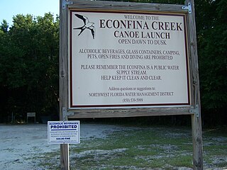
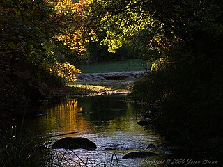
Econfina Creek is a small river in the middle Florida Panhandle. It flows through hilly country, and has sections of whitewater rapids. Much of its flow comes from springs. The river ends at Deer Point Lake, a reservoir that provides the freshwater supply for Panama City and much of Bay County.
Lake Letta is a natural freshwater lake in Highlands County, Florida. It has a 478-acre (1,930,000 m2) surface area. It is bounded on the east and north by Florida State Highway 17, on the southeast by Lake Letta Drive, on the south by citrus orchards, on the west by Little Bonnet Lake and a golf course and on the northwest by pastures. It is connected to Little Lake Bonnet by a canal. Lake Letta is about 0.6 miles (0.97 km) southwest of the city limits of Avon Park, Florida. Residences, along Highway 17 and Lake Letta Drive, line most of the east and southeast sides of Lake Letta. Lake Letta RV Park is across Highway 17 from the lake in the middle of its east side.
Counterfeit Lake is a circular, natural freshwater lake in Highlands County, Florida. Much of the time, the lake is more of a swamp, rather than a lake. It is about 0.2 miles (0.32 km) north of the south branch of Lake Letta Road, which itself is just north of Florida State Highway 17 and Lake Letta. Counterfeit Lake is 0.25 miles (0.40 km) south of the north branch of Lake Letta Road. Griffin Grove Road, which looks more like a private grove road than a public road, reaches the north shore of the lake. Counterfeit Lake is completely surrounded by citrus groves and cannot be seen from either branch of Lake Letta Road. This lake has a 18-acre (73,000 m2) surface area.
Little Bonnet Lake, in Highlands County, Florida, is about 1,000 ft (305 m) west of Lake Letta and about twice as far south of Lake Lotela. This lake is bounded on the southwest by a rail line and on the southeast and part of the north side by citrus groves. Woods are on the east, part of the west and part of the north. A golf course borders Little Bonnet Lake on the northwest.
Lake Eloise is a large natural freshwater lake on the south side of Winter Haven, Florida. It is part of the southern Chain of Lakes. With a 1,174-acre (4,750,000 m2) surface area, it is one of the larger lakes in Polk County, Florida. Lake Eloise has a somewhat oval shape and has a large cove on its south side. It borders Lake Summit on its northeast and it almost borders Lake Lulu on its northwest. Lake Eloise is mostly surrounded by residential areas. However, the northern half of its eastern shore is occupied by Legoland Florida, which was once Cypress Gardens, a large area theme park. Some citrus groves border the lake on its west side. Eloise Loop Road passes by the south end of the cove on the lake's south side.
The Clermont chain of lakes is a chain of lakes centered on Clermont, Florida. The chain is orientated from southeast to northwest and fed primarily by streams and groundwater flow. They make up the middle part of the Palatlakaha River watershed which forms the headwaters of the Ocklawaha River. The lakes are notable for their red to tea-colored water from tannic acid.
Spring Creek is a rural locality in the Shire of Banana, Queensland, Australia. In the 2016 census Spring Creek had a population of 15 people.
References
- ↑ "Kayaking Arbuckle Creek: Unexpected beauty at a bombing range - Florida Rambler". Florida Rambler.
- ↑ Herald, SUSAN COCKING. "Outdoors: Arbuckle Creek in central Florida a scene to behold". Miami Herald June 22, 2012.
- ↑ "View Ramp". public.myfwc.com.
- ↑ "Paddling through cattle country on Lake Arbuckle". Tampa Bay Times. 20 December 2013.
- ↑ Boltin, Thelma (1984). Foreman, Ronald (ed.). First Citizens of Florida. Florida Division of Archives. p. 4.