
Winter Beach is a census-designated place (CDP) in Indian River County, Florida, United States. The population was 2,067 at the 2010 census, up from 965 at the 2000 census. It is part of the Sebastian–Vero Beach Metropolitan Statistical Area.
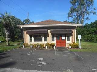
Hillcrest Heights is a town in Polk County, Florida, United States. Hillcrest Heights is part of the Lakeland–Winter Haven Metropolitan Statistical Area. The population was 243 at the 2020 census.

Clancy is an unincorporated community and census-designated place (CDP) in Jefferson County, Montana, United States. The population was 1,661 at the 2010 census, up from 1,406 in 2000. It is part of the Helena Micropolitan Statistical Area.
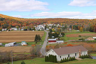
Nuremberg is a census-designated place (CDP) that is located in Schuylkill and Luzerne counties, Pennsylvania, United States. The population was 434 at the time of the 2010 census.
Allen is a census-designated place on the Pine Ridge Indian Reservation in Bennett County, South Dakota, United States, that was named for the Allen Township, which it encompasses. As of the 2020 census, the CDP had a population of 460. It is one of two places which are closest to the North American continental pole of inaccessibility.

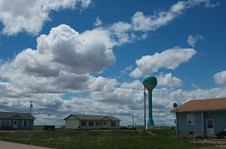
North Spearfish is a census-designated place (CDP) in Lawrence County, South Dakota, United States. The population was 2,366 at the 2020 census.

Kyle is a census-designated place (CDP) in Oglala Lakota County, South Dakota, United States. Its population was 943 at the 2020 census. Located within the Pine Ridge Indian Reservation of the Oglala Lakota, it is one of two settlements which are closest to the North American continental pole of inaccessibility.

Sandia is an unincorporated community and census-designated place (CDP) in Jim Wells County, Texas, United States. The population was 379 at the 2010 census, down from 431 at the 2000 census.

Hermleigh is a census-designated place (CDP) in Scurry County, Texas, United States.

Great Falls is a census-designated place in Fairfax County, Virginia, United States. The population at the 2020 census was 15,953.

Merrifield is a census-designated place (CDP) in Fairfax County, Virginia, United States. The population was 20,488 at the 2020 census.

Ardmore is an unincorporated community and census-designated place (CDP) spanning the border between Delaware and Montgomery counties in the U.S. state of Pennsylvania. The population was 12,455 at the time of the 2010 census and had risen to 13,566 in the 2020 census.

Wawona is a census-designated place in Mariposa County, California, United States. The population was 111 at the 2020 census.
Rowena is an unincorporated community and a census-designated place (CDP) in Minnehaha County, South Dakota, United States. The population of the CDP was 68 at the 2020 census. It is located along South Dakota Highway 42.

Summerset is a city in Meade County, South Dakota, United States. The population was 2,972 at the 2020 census. Located in the western part of the state, it is the first city to incorporate in the state since 1985.

Raleigh is a census-designated place (CDP) in Grant County, North Dakota, United States. An unincorporated community, it was designated as part of the U.S. Census Bureau's Participant Statistical Areas Program on March 31, 2010. It was not counted separately during the 2000 Census, but was included in the 2010 Census, where a population of 12 was reported.

Beulah is a census-designated place (CDP) in eastern Crook County, Wyoming, United States, along Sand Creek, a tributary of the Belle Fourche River. According to local residents, the population is 33. When the 2010 census reported the population as 73, the highway sign at the town entrance was changed. In 2012, Beulah residents succeeded in appealing to the Wyoming Governor to remove the new sign and replace it with one that proclaimed the population to be 33.

Little Falls is a census-designated place (CDP) in the town of Gorham in Cumberland County, Maine, United States. The population of the CDP was 708 at the 2010 census. Prior to 2010, Little Falls was part of the Little Falls-South Windham census-designated place.
Provo is an unincorporated community and census-designated place (CDP) in Fall River County, in the U.S. state of South Dakota. The population was 10 at the 2020 census.
Rochford is an unincorporated community in Pennington County, South Dakota, United States. It is not tracked by the U.S. Census Bureau.

