
The Grand Staircase–Escalante National Monument (GSENM) is a United States national monument protecting the Grand Staircase, the Kaiparowits Plateau, and the Canyons of the Escalante in southern Utah. It was established in 1996 by President Bill Clinton under the authority of the Antiquities Act with 1.7 million acres of land, later expanded to 1,880,461 acres (7,610 km2). In 2017, the monument's size was reduced by half in a succeeding presidential proclamation, and it was restored in 2021. The land is among the most remote in the country; it was the last to be mapped in the contiguous United States.

The Amargosa River is an intermittent waterway, 185 miles (298 km) long, in southern Nevada and eastern California in the United States. It drains a high desert region, the Amargosa Valley in the Amargosa Desert northwest of Las Vegas, into the Mojave Desert, and finally into Death Valley where it disappears into the ground aquifer. Except for a small portion of its route in the Amargosa Canyon in California and a small portion at Beatty, Nevada, the river flows above ground only after a rare rainstorm washes the region. A 26-mile (42 km) stretch of the river between Shoshone and Dumont Dunes is protected as a National Wild and Scenic River. At the south end of Tecopa Valley the Amargosa River Natural Area protects the habitat.

The Monongahela National Forest is a national forest located in the Allegheny Mountains of eastern West Virginia, USA. It protects over 921,000 acres of federally managed land within a 1,700,000 acres proclamation boundary that includes much of the Potomac Highlands Region and portions of 10 counties.
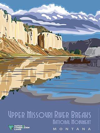
National Conservation Lands, formally known as the National Landscape Conservation System, is a 35-million-acre (140,000 km2) collection of lands in 873 federally recognized areas considered to be the crown jewels of the American West. These lands represent 10% of the 258 million acres (1,040,000 km2) managed by the Bureau of Land Management (BLM). The BLM is the largest federal public land manager and is responsible for over 40% of all the federal public land in the nation. The other major federal public land managers include the US Forest Service (USFS), National Park Service (NPS), and the US Fish and Wildlife Service (USFWS).

The Big Morongo Canyon Preserve is a 31,000-acres (130 km2) native plants habitat and wildlife preserve located in the Little San Bernardino Mountains of the Transverse Ranges, in the transition zone between the higher Mojave Desert and lower elevation Colorado Desert section of the Sonoran Desert. Due to its location within this transition zone, the area is especially high in natural diversity. The natural spring fed desert oasis found here is one of the 10 largest Cottonwood and Willow riparian habitats in California. It is also identified by the Audubon Society as one of the most important avian habitat areas in California.

The New River is a stream, about 8 miles (13 km) long, on the southern coast of the U.S. state of Oregon. It begins slightly north of Floras Lake, at the confluence of the lake outlet and Floras Creek, and runs north behind a foredune until entering the Pacific Ocean between Bandon and Port Orford.

The Crooked River is a tributary, 125 miles (201 km) long, of the Deschutes River in the U.S. state of Oregon. The river begins at the confluence of the South Fork Crooked River and Beaver Creek. Of the two tributaries, the South Fork Crooked River is the larger and is sometimes considered part of the Crooked River proper. A variant name of the South Fork Crooked River is simply "Crooked River". The Deschutes River flows north into the Columbia River.

The Canyons of the Escalante is a collective name for the erosional landforms created by the Escalante River and its tributaries—the Escalante River Basin. Located in southern Utah in the western United States, these sandstone features include high vertical canyon walls, numerous slot canyons, waterpockets, domes, hoodoos, natural arches and bridges. This area—extending over 1,500 square miles (3,885 km2) and rising in elevation from 3,600 ft (1,097 m) to over 11,000 ft (3,353 m)—is one of the three main sections of the Grand Staircase–Escalante National Monument, and also a part of the Glen Canyon National Recreation Area, with Capitol Reef National Park being adjacent to the east.

According to the California Protected Areas Database (CPAD), in the state of California, United States, there are over 14,000 inventoried protected areas administered by public agencies and non-profits. In addition, there are private conservation areas and other easements. They include almost one-third of California's scenic coastline, including coastal wetlands, estuaries, beaches, and dune systems. The California State Parks system alone has 270 units and covers 1.3 million acres (5,300 km2), with over 280 miles (450 km) of coastline, 625 miles (1,006 km) of lake and river frontage, nearly 18,000 campsites, and 3,000 miles (5,000 km) of hiking, biking, and equestrian trails.
Sleeping Giant Wilderness Study Area is a non-motorized recreation area located on the west side of the Missouri River and Holter Lake located about 30 miles (48 km) north of Helena, Montana. Designated as a wilderness study area in 1981, the Sleeping Giant Wilderness Study Area contains approximately 6,666 acres (2,698 ha) of nearly roadless land, about half of which is forested. A portion of the Lewis and Clark National Historic Trail is contained inside the study area.

The South Fork Eel River Wilderness is a 12,868-acre (5,207 ha) wilderness area located in Mendocino County, California. The wilderness was added to the National Wilderness Preservation System when the United States Congress passed the Northern California Coastal Wild Heritage Wilderness Act in 2006. The Department of the Interior's Bureau of Land Management (BLM) is the agency in charge.

The Regional designations of Montana vary widely within the U.S state of Montana. The state is a large geographical area that is split by the Continental Divide, resulting in watersheds draining into the Pacific Ocean, Gulf of Mexico and Hudson's Bay. The state is approximately 545 miles (877 km) east to west along the Canada–United States border and 320 miles (510 km) north to south. The fourth largest state in land area, it has been divided up in official and unofficial ways into a variety of regions. Additionally, Montana is part of a number of larger federal government administrative regions.

American Prairie is a prairie-based nature reserve in Central Montana, United States, on a mixed grass prairie ecosystem with migration corridors and native wildlife. This wildlife conservation area is being developed as a private project of the American Prairie Foundation (APF). This independent non-profit organization aims to include over 3 million acres (12,000 km2) through a combination of both private and public lands.

Little Finland is a scenic red rock area, located in a remote section of Clark County, Nevada, south of Mesquite, known for its red rock scenery and strangely-shaped, delicate rock formations. The landscape is similar to Valley of Fire State Park, which is about 20 miles (32 km) to the west, across Lake Mead. The rock formations are composed of red Aztec Sandstone, fossil sand dunes. Many of the features are small erosional fins, hence the name.

Sand to Snow National Monument is a U.S. National Monument located in San Bernardino County and northern Riverside County, Southern California.

Grape Creek is a tributary of the Arkansas River that flows through Custer and Fremont counties in South-Central Colorado. The creek drains much of the Wet Mountain Valley, located between the Sangre de Cristo Mountains and the Wet Mountains in Custer County.
Cold Spring Mountain is a summit in Moffat County, Colorado. It was also known as O-WI-YU-KUTS Plateau. It is on the United States Geological Survey (USGS) topographic maps of Sparks, Beaver Basin, Willow Creek Butte, Big Joe Basin, and Irish Canyon.
Irish Canyon is a valley in Moffat County in the northwest portion of the U.S. state of Colorado, at 6,099 feet in elevation according to the United States Geological Survey (USGS). The Bureau of Land Management states the elevation in the valley rises from 6,100 to 8,636 feet. It is a scenic and somewhat remote canyon. It is designated both as the Irish Canyon Natural Area and the Irish Canyon Area of Critical Environmental Concern.


