Related Research Articles

Fannin County is a county in the far northeast of the U.S. state of Texas,d on the border with Oklahoma. As of the 2010 census, its population was 33,915. The county seat is Bonham.

Union County is a county located in the U.S. state of Georgia. As of the 2010 census, the population was 21,356. The county seat is Blairsville.

Gilmer County is a county located in the north central portion of the U.S. state of Georgia. As of the 2010 census, the population was 28,292. The county seat is Ellijay. The county was created on December 3, 1832 and was named for George Rockingham Gilmer.

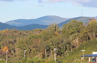
Fannin County is a county located in the north central portion of the U.S. state of Georgia. As of the 2010 census, the population was 23,682. The county seat is Blue Ridge. The county was created on January 21, 1854.

Blue Ridge is a city in Fannin County, Georgia, United States. As of the 2010 census, the city had a population of 1,290. The city is the county seat of Fannin County.

McCaysville is a city in Fannin County, Georgia, United States. The population was 1,056 at the 2010 census.

Morganton is a city in Fannin County, Georgia, United States. The population was 303 at the 2010 census.

Georgia's 9th congressional district is a congressional district in the north of the U.S. state of Georgia. The district has been represented since 2013 by Republican Doug Collins.
Rich Mountain, elevation 4,040 feet (1,230 m), is the highest point in the Rich Mountain Wilderness of the Chattahoochee National Forest in Gilmer County, Georgia. It is the second-highest peak in Gilmer County; only Big Bald Mountain is taller, with its summit at 4,081 feet (1,244 m).

Northeast Georgia is a region of Georgia in the United States. The northern part is also in the north Georgia mountains, while the southern part is still hilly but much flatter in topography. Northeast Georgia is also served by the Asheville/Spartanburg/Greenville/Anderson market.
Epworth is an unincorporated community and census-designated place (CDP) in Fannin County, Georgia, United States. As of the 2010 census it had a population of 480. It lies at an elevation of 1,706 feet (520 m) in the north-central part of the county. A former name was Atalla. The ZIP code is 30541.
Graysville is an unincorporated community in Catoosa County, in the U.S. state of Georgia. It is part of the Chattanooga, Tennessee–GA Metropolitan Statistical Area.
Hemp is an unincorporated community in Fannin County, in the U.S. state of Georgia.
Due is a ghost town in Fannin County, Georgia, United States.
Treadwell is an unincorporated community in Murray County, in the U.S. state of Georgia.
Aska is an unincorporated community in Fannin County, in the U.S. state of Georgia.
Beaverdale is an unincorporated community in Whitfield County, in the U.S. state of Georgia.

The 1900 United States presidential election in Georgia took place on November 6, 1900, as part of the wider United States Presidential election. Voters chose 13 representatives, or electors, to the Electoral College, who voted for president and vice president.
Hothouse is an unincorporated community in Fannin County, in the U.S. state of Georgia.
Sweet Gum is an unincorporated community in Fannin County, in the U.S. state of Georgia.
References
- ↑ U.S. Geological Survey Geographic Names Information System: Argo
- ↑ "Fannin County". Jim Forte Postal History. Retrieved 6 September 2017.
- ↑ Candler, Allen Daniel; Evans, Clement Anselm (1906). Georgia: Comprising Sketches of Counties, Towns, Events, Institutions, and Persons. State historical association. p. 73.
Municipalities and communities of Fannin County, Georgia, United States | ||
|---|---|---|
| Cities |  | |
| CDPs | ||
| Unincorporated communities | ||
| Ghost towns | ||
Coordinates: 34°41′28″N84°08′29″W / 34.69111°N 84.14139°W
| This Fannin County, Georgia state location article is a stub. You can help Wikipedia by expanding it. |