Arizona State Route 24

Last updated

Arizona 24.svg

State Route 24

Williams Gateway Freeway
Arizona State Route 24
SR 24 highlighted in red
Route information
Maintained by ADOT
Length5.48 mi [1]  (8.82 km)
ExistedMay 4, 2014 (2014-05-04)–present
Major junctions
West endArizona Loop 202.svg Loop 202 in Mesa
East endIronwood Road in Apache Junction
Location
Country United States
State Arizona
Counties Maricopa, Pinal
Highway system
  • Arizona State Highway System
I-19.svg I-19 SR 24Arizona 30.svg SR 30
Arizona 801.svg SR 801 Arizona 802.svg Arizona 989.svg SR 989

State Route 24 (SR 24), also known as the Gateway Freeway or the Williams Gateway Freeway, is a freeway in the extreme southeastern region of the Phoenix Metropolitan Area. [2] The roadway is planned as a controlled-access highway to move traffic from the southeastern suburbs of Phoenix to planned ones in northwestern Pinal County. It is the lowest-numbered state route in Arizona. The first mile from Loop 202 to Ellsworth Road opened on May 4, 2014. An extension to Ironwood Drive opened in 2022, with the completion of "Interim Phase II"; [3] the first mile of this extension from Ellsworth Road to Williams Field Road opened on April 1, 2022, [4] with the remainder following on August 11. [5] Planning for future sections has been halted until studies for the Pinal North-South Freeway are completed to confirm how the two freeways will intersect. [6]

Contents

In earlier planning stages, the freeway was formerly labeled State Route 802 (SR 802).

Route description

State Route 24 is a controlled-access highway at the intersection of Loop 202's southern leg (Santan Freeway) and Hawes Road, extending southeast near the Phoenix-Mesa Gateway Airport. The road continues along the Frye Road alignment to the Pinal County line, where it has a diamond interchange with Meridian Road. [7] Shortly after crossing into Pinal County, State Route 24 ends at an intersection with Ironwood Road.

Within Pinal County, State Route 24 is planned to continue further east, intersecting a future north-south freeway under study, [8] and reaching an eastern terminus in the general vicinity of Florence Junction, where US 60 and AZ 79 intersect. [9]

History

Freeway origins

The first mention of a controlled-access highway facility in the Gateway Freeway area occurred in 2003, when the Maricopa Association of Governments (MAG)'s Southeast Maricopa/Northern Pinal County Area Transportation Study identified a freeway starting at Route 202, passing by the Williams Gateway Airport (now Phoenix-Mesa Gateway Airport), and extending east into Pinal County, having its eastern terminus at Route 60. This new freeway was listed as a "potential new regional facility" that would benefit from right-of-way protection. [10] That same year, the Williams Gateway corridor was identified as a new corridor in Maricopa County's Regional Transportation Plan, with construction for the segment within the county planned in the 2016–2020 timeframe. [11] However, the implementation of the plan was based on the assumption that the ½¢ sales tax dedicated to transportation would be extended past its expiration at the end of 2005. [12]

In November 2004, voters in Maricopa County approved Proposition 400, an extension to the existing sales tax funding transportation improvements. A portion of those funds are earmarked toward improvements of the county's regional freeway system, which experiences significant volumes of traffic in parts of the Phoenix Metropolitan Area. These improvements are made either through expansion of existing freeways, or the development of new freeway corridors. [13] The Maricopa County portion of the Williams Gateway corridor, as a part of the county's Regional Transportation Plan, was included in the list of projects to be funded with the sales tax. [14]

In 2006, MAG identified a preferred alignment for Route 802 within Maricopa County. The alignment travels southeast from Route 202, between the airport and the former General Motors Desert Proving Grounds, until it turns to the east at Frye Road, continuing eastward to the Pinal County line. [7]

In response to a projected budget shortfall of $6.6 billion brought on by the Great Recession, MAG voted to modify its Regional Transportation Plan by suspend funding to numerous projects during a meeting on October 28, 2009. The Williams Gateway Freeway was among the projects affected, since the construction of most of the Maricopa County portion of the route—the alignment between Ellsworth Road and Meridian Road—was deferred to 2026 or later. [15] An interim roadway between the Santan Freeway and Ellsworth Road would still be constructed in the 2016–2020 time period. [16]

Phase I

In 2011, the City of Mesa announced it would provide $148 million (2011 USD) to advance construction of the first mile of the freeway, between the Santan Freeway and Ellsworth Road, to provide access to the eastern side of Phoenix-Mesa Gateway Airport. The Arizona State Transportation Board moved construction of the interim facility from fiscal year 2016 to fiscal year 2012, and renumbered the freeway to State Route 24. [2] The interim facility will contain the semi-directional T interchange with the Santan Freeway, consisting of four one-lane ramps; additional traffic lanes on the Santan Freeway; a half-diamond interchange at Ellsworth Road; and a two-lane roadway mainline connecting the two termini of the roadway. [17]

On March 30, 2012, Mesa officials announced plans to start construction the following Friday near Phoenix-Mesa Gateway Airport. Mesa Mayor Scott Smith and Arizona Department of Transportation Director John Halikowski attended a groundbreaking ceremony for the Gateway Freeway, State Route 24. Mesa officials said in a statement that by issuing bonds, the city was able to speed up construction on the project by four years.[ citation needed ]

Phase II

The intersection of Meridian Road and SR 24 in Arizona, prior to the full interchange being built there Meridian Rd-Arizona SR 24.png
The intersection of Meridian Road and SR 24 in Arizona, prior to the full interchange being built there

Route 24's extension, opened in August 2022, has been labeled as an "interim" phase. [3] This is due to the fact that the freeway lanes will travel on the ramps and service roads at each intersection.

Interim Phase II built two general-purpose lanes in each direction. [18] Ultimately, ADOT plans to have three general-purpose lanes, one auxiliary lane, and one HOV lane in each direction. [19] These updates will coincide with the build-out of the actual interchanges at each new intersection, which are anticipated to be completed during Phase V of MAG's Regional Transportation Plan. [3] Bridges over Ellsworth Road were also added to the plan.

The first mile of Interim Phase II opened on April 1, 2022, from Ellsworth Road to an extended Williams Field Road. This was done in order to provide additional access to and from Bell Bank Park, a brand new sports complex adjacent to the road. Bell Bank Park was constructed on the former local General Motors Desert Proving Grounds. [4] The remainder, to Ironwood Drive, opened on August 11. [5] This stretch includes junctions with Signal Butte Road and Meridian Road, which was extended north from Combs Road to meet SR 24, [20] replacing a rural avenue known as Moeur Road.

Further extensions

No specific alignment of Route 24 has been set within Pinal County. The study that would determine the preferred alignment for the state route was suspended to allow it to advance in conjunction with the study for the North-South Corridor. [21] However, study maps from the Arizona Department of Transportation show that the freeway's study area in Pinal County runs between the end of the Maricopa County segment and the intersection of U.S. 60 and Arizona 79 in the vicinity of Florence Junction. [9] However, no funds have been identified for the Pinal County segment. [22]

Exit list

See also

Related Research Articles

<span class="mw-page-title-main">Interstate 17</span> Interstate Highway in central Arizona

Interstate 17 (I-17) is a north–south Interstate Highway entirely within the US state of Arizona. I-17's southern terminus lies in Phoenix, at I-10/US 60 and its northern terminus is in Flagstaff, at Milton Road north of I-40.

<span class="mw-page-title-main">Arizona State Route 85</span> State highway in Arizona, United States

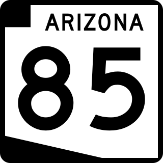
State Route 85 is a 128.86-mile-long (207.38 km) state highway in the U.S. state of Arizona. The highway runs from the United States–Mexico border near Lukeville to the north ending at Interstate 10 (I-10) in Buckeye. The highway also intersects I-8 in Gila Bend and serves as a connector between I-8 and I-10 and for travelers between Phoenix and Yuma as well as San Diego. SR 85 between I-10 and I-8, as well as I-8 between SR 85 and I-10 in Casa Grande, is touted as a bypass of the Phoenix area for long-distance travelers on I-10.

<span class="mw-page-title-main">Arizona State Route 51</span> Freeway in the Phoenix metropolitan area in Arizona, United States

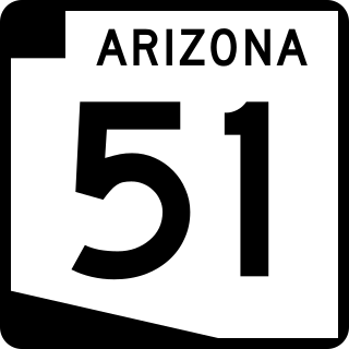
Arizona State Route 51 (SR 51), also known as the Piestewa Freeway, is a numbered state highway in Phoenix, Arizona. It connects Interstate 10 just outside Downtown Phoenix with Loop 101 on the north side of Phoenix, making it one of the area's major freeways. It is a largely north–south route and is known for traversing the Piestewa Peak Recreation Area. The peak was named after Lori Piestewa, the first Native American woman to die in combat in the U.S. military. Prior to this time, the freeway was known as the Squaw Peak Parkway, a name considered offensive by Native Americans. Rapid growth and increased traffic demand on the east side of Metro Phoenix made the Piestewa Freeway necessary.

<span class="mw-page-title-main">Arizona State Route 87</span> State highway in Arizona, United States

State Route 87 is a 272.66-mile (438.80 km) north–south highway that travels from I-10 near Picacho northward to State Route 264 near Second Mesa.

<span class="mw-page-title-main">Interstate 11</span> Interstate Highway in the U.S. state of Nevada

Interstate 11 (I-11) is an Interstate Highway that currently runs for 22.8 miles (36.7 km) on a predominantly northwest–southeast alignment in the US state of Nevada, running concurrently with US Route 93 (US 93) between the Arizona state line and Henderson. The freeway is tentatively planned to run from Nogales, Arizona, to the vicinity of Reno, Nevada, generally following the current routes of I-19, I-10, US 93, and US 95. Planners anticipate widening two existing highway segments to carry future I-11: US 93 in Arizona from Wickenburg to the Nevada state line on the Mike O'Callaghan–Pat Tillman Memorial Bridge over the Colorado River, and US 95 in Nevada from the Las Vegas Valley to Tonopah. In 2022, officials in Nevada announced that they planned to extend I-11 through the Las Vegas Valley along the existing alignments of I-515/US 93/US 95 to downtown Las Vegas, then running concurrently with US 95 northwest to SR 157. An exact alignment for I-11 has yet to be determined outside of these sections; however, a number of corridor alternatives have been identified for further study and refinement. The building of I-11 in Arizona is also facing local opposition from conservation groups.

<span class="mw-page-title-main">Arizona State Route 101</span> Freeway in the Phoenix metropolitan area, Arizona, United States

Arizona State Route 101 or Loop 101 is a semi-beltway looping around the Phoenix Metropolitan Area in central Arizona, United States. It connects several suburbs of Phoenix, including Tolleson, Glendale, Peoria, Scottsdale, Mesa, Tempe, and Chandler. Construction began in the late-1980s and was completed in 2002.

<span class="mw-page-title-main">Arizona State Route 202</span> Freeway in the Phoenix metropolitan area in Arizona, United States

Arizona State Route 202 (SR 202) or Loop 202 (202L) is a semi-beltway circling the eastern and southern areas of the Phoenix metropolitan area in central Maricopa County, Arizona. It traverses the eastern end and the southern end of the city of Phoenix, in addition to the cities of Tempe, Mesa, Chandler, and Gilbert, and is a vital route in the metropolitan area freeway system. Loop 202 has three officially designated sections along its route; the Red Mountain Freeway, the SanTan Freeway, and the Congressman Ed Pastor Freeway, also known as the South Mountain Freeway. The Red Mountain Freeway runs from the Mini Stack Interchange with Interstate 10 (I-10) and State Route 51 (SR 51) in Phoenix to the SuperRedTan Interchange with U.S. Route 60 (US 60) in Mesa. The SanTan Freeway runs from there to an interchange with Interstate 10 (I-10) in Chandler. The Congressman Ed Pastor Freeway runs from there to I-10 in western Phoenix.

<span class="mw-page-title-main">Arizona State Route 143</span> Expressway/Freeway in the Phoenix metropolitan area, Arizona, United States

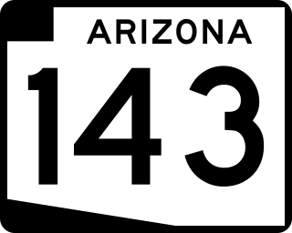
Arizona State Route 143, also known as SR 143 and the Hohokam Expressway, is a north–south and access-controlled freeway in Maricopa County, Arizona, that runs from a junction with Interstate 10 at 48th Street in Phoenix to McDowell Road. The only other major junction along the 3.93-mile (6.32 km) route is with Loop 202, which is located one half-mile south of McDowell Road and the northern terminus.

<span class="mw-page-title-main">Interstate 10 in Arizona</span> Interstate highway in Arizona

In the U.S. state of Arizona, Interstate 10 (I‑10), the major east–west Interstate Highway in the United States Sun Belt, runs east from California, enters Arizona near the town of Ehrenberg and continues through Phoenix and Tucson and exits at the border with New Mexico near San Simon. The highway also runs through the cities of Casa Grande, Eloy, and Marana. Segments of the highway are referred to as either the Papago Freeway, Inner Loop, or Maricopa Freeway within the Phoenix area and the Pearl Harbor Memorial Highway outside metro Phoenix.

<span class="mw-page-title-main">Arizona State Route 153</span> Former state highway in Arizona

State Route 153, also known as SR 153 and the Sky Harbor Expressway, is a former state highway in Maricopa County, in the U.S. state of Arizona, that ran from the intersection of 44th Street and Washington Street in Phoenix south to University Drive. It was a controlled access arterial expressway, with a speed limit of 45 mph (72 km/h), lower than the standard freeway speed of 65 mph (105 km/h). Route 153 was a north–south route that skirted the eastern edge of Sky Harbor International Airport, and along with SR 143, SR 153 served a portion of East Valley residents with access to the airport. Many motorists used SR 143 instead, because of its quick access to and from Interstate 10 and Loop 202. The freeway did, however, provide a direct link to office developments in the Southbank commercial project in east Phoenix with the city of Tempe.

<span class="mw-page-title-main">Arizona State Route 74</span> Highway in Arizona

Arizona State Route 74 (SR 74), locally known as the Carefree Highway, is a state highway in central Arizona that stretches east to west from its junction with U.S. Route 60 (US 60) just south of Wickenburg to its junction with Interstate 17 (I-17) in North Phoenix. It serves Lake Pleasant Regional Park and serves as a northern bypass around the often congested stretches of US 60 through the northwest suburbs of the Phoenix metropolitan area. From end to end, it is 30.4 miles (48.9 km) long.

<span class="mw-page-title-main">Arizona State Route 303</span> State highway in Arizona, United States

Arizona State Route 303 or Loop 303, also known as the Bob Stump Memorial Parkway, is a freeway that serves the west part of the Phoenix metropolitan area. The freeway, originally a two-lane rural highway, was maintained by Maricopa County until 2004 when the Arizona Department of Transportation again took control of upgrading the interim road to a freeway.

<span class="mw-page-title-main">Arizona State Route 347</span> State highway in Arizona, United States

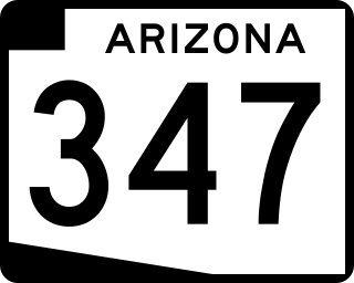
State Route 347, also known as John Wayne Parkway, is a 28.69 miles (46.17 km) long, north–south state highway in central Arizona. The route begins at SR 84 and heads north. It passes through Maricopa, meeting SR 238. The route ends at an interchange with Interstate 10 (I-10) south of Chandler. It primarily serves as the major road to Maricopa; much of the road lies within the Gila River Indian Community, with another short stretch through the Ak-Chin Indian Community. The road was built in the late 1930s and established as a state highway in the 1990s. On average, between 4,000 and 35,000 vehicles use the roadway daily.

<span class="mw-page-title-main">Arizona State Route 30</span> Planned state highway in Arizona

State Route 30, also known as the Tres Rios Freeway, is a planned freeway in the southwest part of the Phoenix metropolitan area. It is planned as a reliever for Interstate 10 five miles to the south and will run through the communities of Buckeye, Goodyear, Avondale, and Phoenix.

<span class="mw-page-title-main">U.S. Route 60 in Arizona</span> Section of U.S. Highway in Arizona, United States

U.S. Route 60 (US 60) is an east–west United States Highway within Arizona. The highway runs for 369 miles (594 km) from a junction with Interstate 10 near Quartzsite to the New Mexico state line near Springerville. As it crosses the state, US 60 overlaps at various points: I-17, I-10, SR 77, SR 260, US 191, and US 180. Between Wickenburg and Phoenix, the route is known as Grand Avenue. From Tempe to Apache Junction, it is known as the Superstition Freeway.

The metropolitan area of Phoenix in the U.S. state of Arizona contains one of the nation's largest and fastest-growing freeway systems, with over 1,405 lane miles (2,261 km) as of 2005.

Below is a list and summary of the former state routes in Arizona, including mileage tables and maps. Between the establishment of Arizona's numbered state highway system in 1927 and the present date, several state routes have been decommissioned. Some state routes were retired as a result of the state relinquishing ownership to local authorities, while others were made extensions of or redesignated as other highways, with some former state routes being upgraded to U.S. Highway or Interstate status.

<span class="mw-page-title-main">Unconstructed state routes in Arizona</span>

Below is a list and summary of the unconstructed state highways in the U.S. state of Arizona. Some are currently proposed while the others have since been cancelled prior to being constructed.

Transportation in Phoenix, Arizona is primarily via private cars. Public transport is run under the brand Valley Metro, and consists of buses and a light rail system.

Many arterial roads in the Phoenix metropolitan area have the same name in multiple cities or towns. Some roads change names or route numbers across town borders, resulting in occasional confusion. For example, the road known as Apache Boulevard in Tempe continues east as Main Street in neighboring Mesa and then as Apache Trail in Apache Junction. Although Broadway Road maintains the same name through Goodyear, Avondale, Phoenix, Tempe, Mesa, and Apache Junction, each town uses a different reference point for address numbers.

References

  1. 1 2 Nelson, Gary (2011-01-26). "Gateway freeway gets state OK". AZCentral . Retrieved 2011-06-17.
  2. 1 2 3
  3. 1 2 "ADOT to extend SR 24 east to Williams Field Road on Friday, April 1". Arizona Department of Transportation. March 31, 2022. Retrieved April 1, 2022.
  4. 1 2 "ADOT opens new stretch of SR 24 east of Williams Field Road". Arizona Department of Transportation. August 11, 2022.
  5. "Hundreds walk on State Route 24 freeway in Mesa April 15 prior to its opening". May 2014. Archived from the original on 2014-05-12. Retrieved 2014-05-10.
  6. 1 2 DMJM Harris (March 2006). "Final Preferred Alignment Report" (PDF). Williams Gateway Freeway Alignment and Environmental Overview Study. Maricopa Association of Governments. pp. 43–44. Retrieved 2011-06-17.
  7. "Northern Possible Route Alternatives" (PDF). North-South Corridor Study. Arizona Department of Transportation. December 2011. Retrieved 2012-01-08.
  8. 1 2 "State Route 802 Corridor Study Location/Design Concept Study & Environmental Assessment" (PDF). Arizona Department of Transportation. December 2009. Archived from the original (PDF) on 2010-02-03. Retrieved 2011-06-23.
  9. Parsons Brinckerhoff (September 2003). "Southeast Maricopa / Northern Pinal County Area Transportation Study" (PDF). Maricopa Association of Governments. pp. 4–4, 7-1–7-3. Archived from the original (PDF) on 2012-03-14. Retrieved 2011-06-17.
  10. Maricopa Association of Governments (November 2003). "Regional Transportation Plan: Executive Summary" (PDF). pp. 13, 15. Retrieved 2011-06-17.
  11. Maricopa Association of Governments (November 2003). "Regional Transportation Plan" (PDF). pp. 1–2, 5–1, 5–4. Retrieved 2011-06-21.
  12. Intermodal Transportation Division, Arizona Department of Transportation; Federal Highway Administration (October 2010). "Draft Environmental Assessment: State Route 802, Williams Gateway Freeway" (PDF). Arizona Department of Transportation. pp. 2–10. Retrieved 2011-06-17.
  13. "What's in the Regional Transportation Plan?" (PDF). MAGAZine. Maricopa Association of Governments. November 2004. p. 8. Retrieved 2011-06-17.
  14. Holstege, Sean (2009-10-29). "Valley freeway projects shelved". The Arizona Republic. Retrieved 2009-11-04.
  15. Maricopa Association of Governments (December 2010). "Regional Transportation Plan: 2010 Update" (PDF). pp. 8-18–8-19. Retrieved 2011-06-21.
  16. Intermodal Transportation Division, Arizona Department of Transportation; Federal Highway Administration (October 2010). "Draft Environmental Assessment: State Route 802, Williams Gateway Freeway" (PDF). Arizona Department of Transportation. pp. 31–32. Retrieved 2011-06-21.
  17. "Typical Interim SR 24 Roadway Section" (PDF). November 2019. Retrieved January 9, 2020.
  18. Bill Fathauer (November 14, 2019). "Public Information Meeting, State Route 24 (Gateway Freeway)" (PDF). Arizona Department of Transportation. Retrieved January 9, 2020.
  19. Staff Reports (August 19, 2021). "Pinal County, Queen Creek break ground on major road extension". Pinal Central. Casa Grande Valley Newspapers Inc. Retrieved October 22, 2022.
  20. "December 2009 Frequently Asked Questions" (PDF). State Route 802 Study. Arizona Department of Transportation. December 2009. Retrieved 2011-06-23.
  21. "State Route 802". ADOT. Retrieved 2011-06-23.
Template:Attached KML/Arizona State Route 24
KML is not from Wikidata
CountyLocationmi [1] kmExit [2] Destinations [3] Notes
Maricopa Mesa 0.000.00Arizona Loop 202.svg Loop 202 Exit 34A on Loop 202 (Santan Freeway)
0.801.291Ellsworth RoadFull interchange opened on April 1, 2022 [4] [5]
2Williams Field Road [4] At-grade intersection, future interchange [4]
3Signal Butte Road [4] At-grade intersection, future interchange [4]
MaricopaPinal
county line
MesaApache Junction
Queen Creek tripoint
4Meridian Road [4] At-grade intersection, future interchange [4]
Pinal Apache JunctionQueen Creek line5Ironwood DriveAt-grade intersection, future interchange; current eastern terminus [4]
Apache Junction 6Idaho RoadPlanned Interchange
7Tomahawk RoadPlanned interchange
8Goldfield RoadPlanned interchange
9Mountain View RoadPlanned interchange
Pinal Apache JunctionGold Canyon line10Barkley RoadPlanned Interchange
Gold Canyon US 60.svg US 60  Phoenix, Globe Planned Interchange
Module:Jctint/USA warning: Unused argument(s): cspan
  1. Google (August 20, 2022). "Arizona State Route 24" (Map). Google Maps . Google. Retrieved August 20, 2022.
  2. Transportation Planning Division. "2018 Average Annual Daily Traffic Report - State Routes" (PDF). Phoenix: Arizona Department of Transportation . Retrieved October 16, 2019.
  3. 1 2 3 4 5 6 7 8 "State Route 24 Interim Phase II: Ellsworth Road to Ironwood Drive". Arizona Department of Transportation . Retrieved January 9, 2020.