Arlington, Georgia

Last updated

Arlington, Georgia
Arlington City Hall Police Station.jpg
City hall and police station
Calhoun County Georgia Incorporated and Unincorporated areas Arlington Highlighted.svg
Location in Calhoun County and the state of Georgia
USA Georgia location map.svg
Red pog.svg
Arlington
Location in Georgia
Usa edcp location map.svg
Red pog.svg
Arlington
Arlington (the United States)
North America laea location map.svg
Red pog.svg
Arlington
Arlington (North America)
Coordinates: 31°26′22″N84°43′29″W / 31.43944°N 84.72472°W / 31.43944; -84.72472
Country United States
State Georgia
Counties Calhoun, Early
Area
[1]
  Total4.01 sq mi (10.38 km2)
  Land4.00 sq mi (10.35 km2)
  Water0.01 sq mi (0.03 km2)
Elevation
299 ft (91 m)
Population
 (2020)
  Total1,209
  Density302.48/sq mi (116.79/km2)
Time zone UTC-5 (Eastern (EST))
  Summer (DST) UTC-4 (EDT)
ZIP codes
31713, 39813
Area code 229
FIPS code 13-02928 [2]
GNIS feature ID0310614 [3]

Arlington is a city in Calhoun and Early counties, Georgia, United States. Per the 2020 census, the population was 1,209. [4]

Contents

History

Arlington was founded in 1873, and was chartered in 1881. [5] Arlington served as county seat from 1923 to 1929. [6] The community was named after the Arlington House, the Virginia home of General Robert E. Lee. [6]

Geography

Arlington is located at 31°26′22″N84°43′29″W / 31.43944°N 84.72472°W / 31.43944; -84.72472 (31.439461, -84.724835). [7] It is located 46 miles northeast of Dothan, Alabama and 45 miles southwest of Albany. According to the United States Census Bureau, the city has a total area of 4.1 square miles (10.7 km2), of which 0.012 square miles (0.03 km2), or 0.24%, is water. [8] it is located in Calhoun and Early counties and borders Baker County to the east.

Demographics

Historical population
CensusPop.Note
1880 250
1890 41766.8%
1900 75581.1%
1910 1,30873.2%
1920 1,3311.8%
1930 1,232−7.4%
1940 1,3378.5%
1950 1,3823.4%
1960 1,4625.8%
1970 1,69816.1%
1980 1,572−7.4%
1990 1,513−3.8%
2000 1,6025.9%
2010 1,479−7.7%
2020 1,209−18.3%
U.S. Decennial Census [9]
1850-1870 [10] 1880 [11]
1890-1910 [12] 1920-1930 [13]
1930-1940 [14] 1940-1950 [15]
1960-1980 [16] 1980-2000 [17]
2010 [18] 2020 [19]
Arlington city, Georgia – Racial and Ethnic Composition
(NH = Non-Hispanic)
Note: the US Census treats Hispanic/Latino as an ethnic category. This table excludes Latinos from the racial categories and assigns them to a separate category. Hispanics/Latinos may be of any race.
Race / EthnicityPop 2010 [18] Pop 2020 [19] % 2010% 2020
White alone (NH)32121421.70%17.70%
Black or African American alone (NH)1,12596476.06%79.74%
Native American or Alaska Native alone (NH)320.20%0.17%
Asian alone (NH)020.00%0.17%
Pacific Islander alone (NH)000.00%0.00%
Some Other Race alone (NH)100.07%0.00%
Mixed Race/Multi-Racial (NH)590.34%0.74%
Hispanic or Latino (any race)24181.62%1.49%
Total1,4791,209100.00%100.00%

In 2010, the city's population was 1,479. By the 2020 census, its population declined to 1,209.

Education

On Calhoun County's side of the Calhoun County School District unit, Calhoun County Elementary School (grades K-5) serves Calhoun County, including some students from Arlington, Edison, Leary, and Morgan. Calhoun County Middle/High are in Edison. On Early County's side, all schools belong to the Early County School District; elementary, middle, and high schools are in Blakely, including Early County High School.

Notable person

Related Research Articles

<span class="mw-page-title-main">Clay County, Georgia</span> County in Georgia, United States

Clay County is a county located in the southwestern part of the U.S. state of Georgia. As of the 2020 census, the population was 2,848, making it the fourth-least populous county in Georgia. The county seat is Fort Gaines.

<span class="mw-page-title-main">Talbot County, Georgia</span> County in Georgia, United States

Talbot County is a county located in the west central portion of the U.S. state of Georgia. The 2020 census showed a population of 5,733. The county seat and largest city is Talbotton.

<span class="mw-page-title-main">Seminole County, Georgia</span> County in Georgia, United States

Seminole County is a county located in the southwestern corner of U.S. state of Georgia. As of the 2020 census, the population was 9,147. The county seat is Donalsonville.

<span class="mw-page-title-main">Randolph County, Georgia</span> County in Georgia, United States

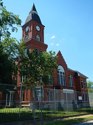
Randolph County is a county located in the southwestern portion of the U.S. state of Georgia and is considered part of the Black Belt, historically an area of plantations. As of the 2020 census, the population was 6,425, roughly one-third of its peak population in 1910, when there were numerous agricultural workers. The county seat is Cuthbert.

<span class="mw-page-title-main">Miller County, Georgia</span> County in Georgia, United States

Miller County is a county located in the southwestern part of the U.S. state of Georgia. As of the 2020 census, the population was 6,000. The county seat is Colquitt. The county was created on February 26, 1856, and named after Andrew Jackson Miller (1806–56), president of the Medical College of Georgia.

<span class="mw-page-title-main">Lamar County, Georgia</span> County in Georgia, United States

Lamar County is a county located in the west central portion of the U.S. state of Georgia. As of the 2020 census, the population was 18,500. The county seat is Barnesville.

<span class="mw-page-title-main">Early County, Georgia</span> County in Georgia, United States

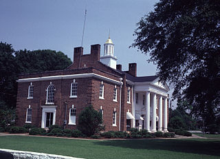
Early County is a county located on the southwest border of the U.S. state of Georgia. As of the 2020 census, the population was 10,854. The county seat is Blakely, where the Early County Courthouse is located. Created on December 15, 1818, it was named for Peter Early, 28th Governor of Georgia. The county is bordered on the west by the Chattahoochee River, forming the border with Alabama.

<span class="mw-page-title-main">Dougherty County, Georgia</span> County in Georgia, United States

Dougherty County is located in the southwestern portion of the U.S. state of Georgia. As of the 2020 census, the population was 85,790. The county seat and sole incorporated city is Albany.

<span class="mw-page-title-main">Calhoun County, Georgia</span> County in Georgia, United States

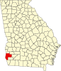
Calhoun County is a rural county in the southwestern part of the U.S. state of Georgia. Its county seat is Morgan and its population was 5,573 in 2020.

<span class="mw-page-title-main">Baker County, Georgia</span> County in Georgia, United States

Baker County is a county in Georgia. As of the 2020 census, the population was 2,876. The county seat and only city is Newton. The county was created December 12, 1825 from the eastern portion of Early County by an act of the Georgia General Assembly and is named for Colonel John Baker, a hero of the American Revolutionary War.

<span class="mw-page-title-main">Edison, Georgia</span> City in Georgia, United States

Edison is a city in Calhoun County, Georgia, United States. Per the 2020 census, the population was 1,230. The Edison Commercial Historic District is listed on the National Register of Historic Places.

<span class="mw-page-title-main">Morgan, Georgia</span> City in Georgia, United States

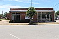
Morgan is a city in Calhoun County, Georgia, United States. The population was 1,741 at the 2020 census. The city is the county seat of Calhoun County.

<span class="mw-page-title-main">Belvedere Park, Georgia</span> Place in Georgia, United States

Belvedere Park is an unincorporated community and census-designated place (CDP) in DeKalb County, Georgia, United States. The population was 15,113 at the 2020 census.

<span class="mw-page-title-main">Damascus, Georgia</span> City in Georgia, United States

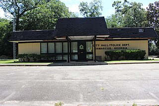
Damascus is a city in Early County, Georgia, United States. The population was 212 in the 2020 census, down from 254 in the 2010 census.

<span class="mw-page-title-main">Oglethorpe, Georgia</span> City in Georgia, United States

Oglethorpe is a city in Macon County, Georgia, United States. The population was 995 at the 2020 census, down from 1,328 in 2010. The city is the county seat of Macon County. It was named for Georgia's founder, James Oglethorpe.

<span class="mw-page-title-main">Coleman, Georgia</span> Place in Georgia, United States

Coleman is a former incorporated city in Randolph County, Georgia, United States. It is listed as a census-designated place (CDP). The population was 149 at the 2000 census. The city was abolished by House Bill 1102 effective January 1, 2007, and no longer exists as a municipality.

<span class="mw-page-title-main">De Soto, Georgia</span> City in Georgia, United States

De Soto is a city in Sumter County, Georgia, United States. The population was 214 at the 2000 census. It is part of the Americus micropolitan statistical area.

<span class="mw-page-title-main">Junction City, Georgia</span> Town in Georgia, United States

Junction City is a town in Talbot County, Georgia, United States. The population was 138 at the 2020 census.

<span class="mw-page-title-main">Bronwood, Georgia</span> Town in Georgia, United States

Bronwood is a town in Terrell County, Georgia, United States. As of the 2020 census, the city had a population of 334. It is part of the Albany, Georgia metropolitan statistical area.

<span class="mw-page-title-main">Varnell, Georgia</span> City in Georgia, United States

Varnell is a city in Whitfield County, Georgia, United States. It is part of the Dalton, Georgia Metropolitan Statistical Area. The population was 2,179 at the 2020 census.

References

  1. "2020 U.S. Gazetteer Files". United States Census Bureau. Retrieved December 18, 2021.
  2. "U.S. Census website". United States Census Bureau . Retrieved January 31, 2008.
  3. "US Board on Geographic Names". United States Geological Survey. October 25, 2007. Retrieved January 31, 2008.
  4. "Arlington city, Georgia". United States Census Bureau . Retrieved April 15, 2022.
  5. Krakow, Kenneth K. (1975). Georgia Place-Names: Their History and Origins (PDF). Macon, GA: Winship Press. p. 7. ISBN   0-915430-00-2.
  6. 1 2 "Calhoun County". New Georgia Encyclopedia. Retrieved April 1, 2018.
  7. "US Gazetteer files: 2010, 2000, and 1990". United States Census Bureau. February 12, 2011. Retrieved April 23, 2011.
  8. "Geographic Identifiers: 2010 Demographic Profile Data (G001): Arlington city, Georgia". U.S. Census Bureau, American Factfinder. Archived from the original on February 12, 2020. Retrieved July 17, 2014.
  9. "Decennial Census of Population and Housing by Decades". US Census Bureau.
  10. "1870 Census of Population - Georgia" (PDF). US Census Bureau . 1870.
  11. "1880 Census of Population - Georgia" (PDF). US Census Bureau . 1880.
  12. "1910 Census of Population - Georgia" (PDF). US Census Bureau . 1930.
  13. "1930 Census of Population - Georgia" (PDF). US Census Bureau . 1930. p. 253.
  14. "1940 Census of Population - Georgia" (PDF). US Census Bureau . 1940.
  15. "1950 Census of Population - Georgia" (PDF). US Census Bureau . 1980.
  16. "1980 Census of Population - Number of Inhabitants - Georgia" (PDF). US Census Bureau . 1980.
  17. "2000 Census of Population - General Population Characteristics - Georgia" (PDF). US Census Bureau . 2000.
  18. 1 2 "P2 Hispanic or Latino, and Not Hispanic or Latino by Race – 2010: DEC Redistricting Data (PL 94-171) – Arlington city, Georgia". United States Census Bureau .
  19. 1 2 "P2 Hispanic or Latino, and Not Hispanic or Latino by Race – 2020: DEC Redistricting Data (PL 94-171) – Arlington city, Georgia". United States Census Bureau .