
Woodlands is a model village 4 miles (6 km) north-west of Doncaster in South Yorkshire, England. The village lies adjacent to Highfields and Adwick le Street within the City of Doncaster. The colliery village was designed and built in the early 20th century by the architect Percy Houfton as tied cottages for the miners of the neighbouring Brodsworth Colliery. In an era of model villages such as Saltaire, Port Sunlight and Bournville, Woodlands, with extensive open spaces, many different designs of houses, and overall living conditions excellent for their time, possibly represents the height of the model village movement. The village is a conservation area.

Thorne is a market town and civil parish in the City of Doncaster in South Yorkshire, England. It was historically part of the West Riding of Yorkshire until 1974. It has a population of 16,592, increasing to 17,295 at the 2011 Census.

Darfield is a village within the Metropolitan Borough of Barnsley, South Yorkshire, England. It is historically part of the West Riding of Yorkshire. The village is situated approximately 4 miles (6 km) east from Barnsley town centre. Darfield had a population of 8,066 at the 2001 UK Census, increasing to 10,685 at the 2011 Census.

Campsall is a village and former civil parish, now in the parish of Norton, in the Doncaster district, in the county of South Yorkshire, England. It lies 7 miles (11 km) to the north-west of Doncaster, at an elevation of around 50 feet above sea level. The village contains Campsall Country Park. The village falls within the Norton & Askern ward of Doncaster Council and the House of Commons constituency of Doncaster North. The Parish is situated on the “Magnesian Limestone Belt”, a landscape feature formed by a narrow north–south trending escarpment. The Magnesian Limestone Belt is typified by well drained and fertile soils, which were ideal for agriculture and the establishment of settlements like Campsall. Before the industrial revolution, the area to the east was occupied by the inaccessible and waterlogged marshes of the Humberhead Levels, whilst to the west was the Barnsdale Forest, an area associated with the legend of Robin Hood and various outlaws and bandits who preyed upon travellers on the Great North Road. In 1931 the parish had a population of 260.

Maltby is a former mining town and civil parish in the Metropolitan Borough of Rotherham, South Yorkshire, England. It was historically in the West Riding of Yorkshire. It is located 6 miles (10 km) east of Rotherham and 10 miles (16 km) north-east of Sheffield. It forms a continuous urban area with Hellaby, separated from the rest of Rotherham by the M18 motorway. It had a population of 16,688 at the 2011 Census.
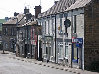
Worsbrough is a district to the south of Barnsley in the metropolitan borough of Barnsley, South Yorkshire, England. Before 1974, Worsbrough had its own urban district council in the West Riding of Yorkshire. Much of Worsbrough is now part of Barnsley Metropolitan Borough Council's, Worsbrough ward, although certain parts of the historic Worsbrough district, such as Birdwell, Rockley and Blacker Hill, currently lie within neighbouring council wards.

Thurnscoe is a village in the Metropolitan Borough of Barnsley in South Yorkshire, England. The village falls within the Dearne North ward of the Barnsley Metropolitan Borough Council. Historically within the West Riding of Yorkshire, the village is approximately 9 miles (14 km) from Barnsley and 8 miles (13 km) from Doncaster. It is served by Thurnscoe railway station with bus links provided by Stagecoach. In 2011 it had a population of 8687.

Birdwell is a suburb in the Metropolitan Borough of Barnsley in South Yorkshire, England and is located approximately 4.5 miles (7 km) south of Barnsley, 12.1 miles (19 km) north-east of Sheffield. The village falls within the Rockingham Ward of the Barnsley Metropolitan Council. Neighbouring areas include Worsbrough Village, Tankersley, Pilley and Hoyland Common.

Rossington is a civil parish and former mining village in the Metropolitan Borough of Doncaster in South Yorkshire, England and is surrounded by countryside and the market towns of Bawtry and Tickhill.
Stainforth is a town and civil parish in the City of Doncaster, in South Yorkshire, England. It is around 7 miles (11 km) north-east of Doncaster, close to Hatfield and Thorne. It had a population of 6,342 in the 2001 census, reducing slightly to 6,282 at the 2011 census.

South Kirkby is a town in the City of Wakefield in West Yorkshire, England which is governed locally by South Kirkby and Moorthorpe Town Council. The town forms half of the civil parish of South Kirkby and Moorthorpe. The parish has a population of 10,979.

Garforth is a town in the metropolitan borough of the City of Leeds, West Yorkshire, England.

Adwick le Street is a village in the City of Doncaster, South Yorkshire, England. The Adwick ward of Doncaster Metropolitan Borough Council had a population of 15,911 at the 2011 Census. It is situated north-west of Doncaster. Under the 2011 census, the settlement had a population of 10,507.

Harworth is an area and former civil parish, now in the parish of Harworth Bircotes in the Bassetlaw district in Nottinghamshire, England, on the border with South Yorkshire. It is 8 miles (13 km) north of Worksop. The population of the civil parish of Harworth Bircotes was 7,948 in the 2011 Census.
Killamarsh is a village and civil parish in North East Derbyshire, England, bordering Rotherham to the north and Sheffield to the north-west. It lies close to Derbyshire’s border with South Yorkshire.

Outwood is a district to the north of Wakefield in West Yorkshire, England. The district is centred on the A61 Leeds Road south of Lofthouse. It grew up as a pit village and was only a small settlement until the 1970s, when construction of new houses caused it to grow and merge with neighbouring settlements such as Wrenthorpe and Stanley. In 2001, it had a population of 7,623.

Edlington is a town and civil parish in the City of Doncaster, South Yorkshire, England, lying to the south west of Doncaster and Warmsworth. It has a population of 8,276. The original parish town of Edlington is now known as Old Edlington; adjacent, and to the north, is New Edlington. It is often referred to by locals as 'Edlo'. Since 1974 Edlington has been part of the Metropolitan Borough of Doncaster in the metropolitan county of South Yorkshire. It had, since 1894, formed part of Doncaster Rural District in the West Riding of Yorkshire.
Wheatley Hills is a suburb of Doncaster, South Yorkshire, England. It is situated around 2 miles (3.2 km) north-east of the city centre. The Wheatley Hills & Intake ward within the Metropolitan Borough of Doncaster had a population of 17,733 at the 2011 census.

Markham Main Colliery was a coal mine in Armthorpe, on the eastern edge of Doncaster, South Yorkshire, England. It could be seen, and was a landmark, from the nearby M18.


