Arp, Texas

Last updated

Arp, Texas
Arp, TX water tower IMG 4418.JPG
Water tower in Arp, Texas
Arp, Texas
Arp, Texas
Arp, Texas
Arp, Texas
Coordinates: 32°13′33″N95°3′19″W / 32.22583°N 95.05528°W / 32.22583; -95.05528
Country United States
State Texas
County Smith
Area
[1]
  Total2.64 sq mi (6.83 km2)
  Land2.62 sq mi (6.78 km2)
  Water0.02 sq mi (0.05 km2)
Elevation
495 ft (151 m)
Population
 (2020)
  Total892
  Density393.58/sq mi (151.97/km2)
Time zone UTC-6 (Central (CST))
  Summer (DST) UTC-5 (CDT)
ZIP code
75750
Area code(s) 430, 903
FIPS code 48-04156 [2]
GNIS feature ID1329695 [3]
Arp State Bank at the Thanksgiving season Arp State Bank, Arp, TX, with Thanksgiving exhibit IMG 4419.JPG
Arp State Bank at the Thanksgiving season

Arp is a city in Smith County, in the U.S. state of Texas. It is part of the Tyler metropolitan statistical area. According to the United States Census Bureau. The population was 892 in the 2020 census. [4]

Contents

History

The area where the town of Arp now sits was occupied by Caddoan peoples in pre-Columbian periods and was a part of the Treaty of Bowles Village in 1836 that granted Smith and Cherokee counties along with parts of Rusk, Gregg and Van Zandt counties to the Texas Cherokee and twelve associated tribes. The Cherokee War of 1839 forced the Native Americans out. However, the area was again occupied by Cherokee, Choctaw, Chickasaw and Creek Indians after 1845. The descendants of these people formed the Mount Tabor Indian Community and a number continue to reside in Smith and Rusk counties today.

The settlement that would become Arp was called Bissa, from the Choctaw/Chickasaw word for blackberry, as early as the 1800s. It was later called Jarvis Junction and then Strawberry, after the fruit that was grown in the area. It was finally renamed "Arp" for Bill Arp (pen name of Charles Henry Smith), a Georgia humorist who was nationally known in the late 19th century. Supposedly, the three-letter name was also chosen for its brevity, which allowed local strawberry producers to spend less time hand-marking their crates. [5]

Geography

Arp is located at 32°13′33″N95°3′19″W / 32.22583°N 95.05528°W / 32.22583; -95.05528 (32.225794, –95.055140). [6]

According to the United States Census Bureau, the city has a total area of 2.5 square miles (6.3 km2), all land.

Demographics

Historical population
CensusPop.Note
1940 1,139
1950 909−20.2%
1960 812−10.7%
1970 8160.5%
1980 93915.1%
1990 812−13.5%
2000 90111.0%
2010 9707.7%
2020 892−8.0%
U.S. Decennial Census [7]
Arp racial composition as of 2020 [8]
(NH = Non-Hispanic) [lower-alpha 1]
RaceNumberPercentage
White (NH)72180.83%
Black or African American (NH)374.15%
Native American or Alaska Native (NH)80.9%
Asian (NH)10.11%
Pacific Islander (NH)40.45%
Mixed/Multi-Racial (NH)262.91%
Hispanic or Latino 9510.65%
Total892

As of the 2020 United States census, there were 892 people, 383 households, and 292 families residing in the city.

As of the census [2] of 2010, there were 970 people, 361 households, and 259 families residing in the city. The population density was 367.6 inhabitants per square mile (141.9/km2). There were 405 housing units at an average density of 165.2 per square mile (63.8/km2). The racial makeup of the city was 95.34% White, 3.22% African American, 0.11% Native American, 0.44% from other races, and 0.89% from two or more races. Hispanic or Latino of any race were 2.55% of the population.

There were 361 households, out of which 32.1% had children under the age of 18 living with them, 59.3% were married couples living together, 8.6% had a female householder with no husband present, and 28.0% were non-families. 26.3% of all households were made up of individuals, and 13.3% had someone living alone who was 65 years of age or older. The average household size was 2.50 and the average family size was 2.97.

In the city, the population was spread out, with 25.2% under the age of 18, 8.7% from 18 to 24, 27.3% from 25 to 44, 24.0% from 45 to 64, and 14.9% who were 65 years of age or older. The median age was 37 years. For every 100 females, there were 91.7 males. For every 100 females age 18 and over, there were 89.3 males.

The median income for a household in the city was $33,750, and the median income for a family was $38,807. Males had a median income of $27,443 versus $22,202 for females. The per capita income for the city was $16,619. About 4.2% of families and 4.9% of the population were below the poverty line, including 5.5% of those under age 18 and 6.2% of those age 65 or over.

Education

The City of Arp is served by the Arp Independent School District, and includes an elementary school, junior high school and high school. [10]

Notable people

Related Research Articles

<span class="mw-page-title-main">Smith County, Texas</span> County in Texas, United States

Smith County is a county in the U.S. state of Texas. As of the 2020 census, its population was 233,479. Its county seat is Tyler. Smith County is named for James Smith, a general during the Texas Revolution.

<span class="mw-page-title-main">Rusk County, Texas</span> County in Texas, United States

Rusk County is a county located in Texas. As of the 2020 census, its population was 52,214. Its county seat is Henderson. The county is named for Thomas Jefferson Rusk, a secretary of war of the Republic of Texas.

<span class="mw-page-title-main">Panola County, Texas</span> County in Texas, United States

Panola County is a county located in the U.S. state of Texas. As of the 2020 census, its population was 22,491. The county seat is Carthage. Located in East Texas and originally developed for cotton plantations, the county's name is derived from a Choctaw word for cotton.

<span class="mw-page-title-main">Gregg County, Texas</span> County in Texas, United States

Gregg County is a county located in the eastern part of the U.S. state of Texas. As of the 2020 census, its population was 124,239. Its county seat is Longview. The county is named after John Gregg, a Confederate general killed in action during the American Civil War.

<span class="mw-page-title-main">Cherokee County, Texas</span> County in Texas, United States

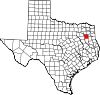
Cherokee County is a county located in the U.S. state of Texas. As of the 2020 census, its population was 50,412. The county seat is Rusk, which lies 130 miles southeast of Dallas and 160 miles north of Houston. The county was named for the Cherokee, who lived in the area before being expelled in 1839. Cherokee County comprises the Jacksonville micropolitan statistical area, which is also included in the Tyler–Jacksonville combined statistical area.

<span class="mw-page-title-main">Pontotoc County, Oklahoma</span> County in Oklahoma, United States

Pontotoc County is in the south central part of Oklahoma. As of the 2020 census, the population was 38,065. Its county seat is Ada. The county was created at statehood from part of the Chickasaw Nation in Indian Territory. It was named for a historic Chickasaw tribal area in Mississippi. According to the Encyclopedia of Oklahoma History and Culture, Pontotoc is usually translated "cattail prairie" or "land of hanging grapes."

<span class="mw-page-title-main">Love County, Oklahoma</span> County in Oklahoma, United States

Love County is a county on the southern border of the U.S. state of Oklahoma. As of the 2020 census, the population was 10,146. Its county seat is Marietta. The county was created at statehood in 1907 and named for Overton Love, a prominent Chickasaw farmer, entrepreneur and politician.

<span class="mw-page-title-main">Grady County, Oklahoma</span> County in Oklahoma, United States

Grady County is a county located in the U.S. state of Oklahoma. As of the 2020 census, the population was 54,795. Its county seat is Chickasha. It was named for Henry W. Grady, an editor of the Atlanta Constitution and southern orator.

<span class="mw-page-title-main">Bryan County, Oklahoma</span> County in Oklahoma, United States

Bryan County is a county in the U.S. state of Oklahoma. As of the 2020 census, the population was 46,067. Its county seat is Durant. It is the only county in the United States named for Democratic politician William Jennings Bryan.

<span class="mw-page-title-main">Cherokee, Kansas</span> City in Crawford County, Kansas

Cherokee is a city in Crawford County, Kansas, United States. As of the 2020 census, the population of the city was 590.

<span class="mw-page-title-main">Cuney, Texas</span> Town in Texas, United States

Cuney is a town located in northwestern Cherokee County, Texas, United States. With a population of 116 at the 2020 U.S. census, Cuney was the only "wet" town in Cherokee County from the mid-1980s until 2009, when voters in Rusk came out in favor of beer/wine sales. After that result, voters in Jacksonville and Frankston have since voted in favor of beer/wine sales, and Rusk voters returned to the polls to vote in favor of liquor sales.

<span class="mw-page-title-main">Rusk, Texas</span> City in Cherokee County, Texas

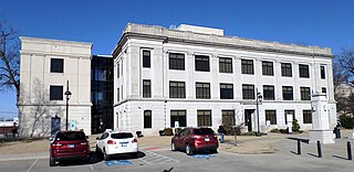
Rusk is a city and the county seat of Cherokee County in the U.S. state of Texas. At the 2020 United States census, it had a population of 5,285.

<span class="mw-page-title-main">Taylor Lake Village, Texas</span> City in Harris County, Texas, United States

Taylor Lake Village is a city in Harris County, Texas, United States. The population was 3,704 at the 2020 U.S. census.

<span class="mw-page-title-main">Malakoff, Texas</span> City in Texas, United States

Malakoff is a city in Henderson County, Texas, United States. The population was 2,179 at the 2020 census. The city is named after a Russian fort of Malakoff, which played a pivotal role during the siege of Sevastopol during the Crimean War.

<span class="mw-page-title-main">New London, Texas</span> City in Texas, United States

New London is a city in Rusk County, Texas, United States. The population was 958 at the 2020 census.

<span class="mw-page-title-main">Lindale, Texas</span> City in Texas, United States

Lindale is a city in Smith County, Texas, United States. Located in East Texas, the population was 6,059 as of 2020 census. It is part of the Tyler, Texas, metropolitan statistical area.

<span class="mw-page-title-main">Reklaw, Texas</span> City in Texas, United States

Reklaw is a city in Cherokee and Rusk counties in the U.S. state of Texas. The population was 332 at the 2020 census.

<span class="mw-page-title-main">Troup, Texas</span> City in Texas, United States

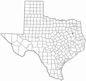
Troup is a city in Smith and Cherokee Counties in the U.S. state of Texas. Its population was 2,006 at the 2020 census. Troup lies in two counties in East Texas.

<span class="mw-page-title-main">Overton, Texas</span> City in Texas, United States

Overton is a city in Rusk and Smith counties in the U.S. state of Texas. Overton lies in two counties as well as two metropolitan areas. The Rusk County portion of the city is part of the Longview Metropolitan Statistical Area, while the Smith County portion is part of the Tyler Metropolitan Statistical Area.

<span class="mw-page-title-main">Tyler–Jacksonville combined statistical area</span> Combined Statistical Area in Texas, United States

The Tyler–Jacksonville combined statistical area is made up of two counties in East Texas. The statistical area consists of the Tyler metropolitan statistical area and the Jacksonville micropolitan statistical area. As of the 2000 census, the CSA had a population of 221,365.

References

  1. "2019 U.S. Gazetteer Files". United States Census Bureau. Retrieved August 7, 2020.
  2. 1 2 "U.S. Census website". United States Census Bureau . Retrieved January 31, 2008.
  3. "US Board on Geographic Names". United States Geological Survey. October 25, 2007. Retrieved January 31, 2008.
  4. "2010 Census: Population of Texas Cities Arranged in Alphabetical Order | TSLAC".
  5. Cannon, Bill (January 1, 2004). Texas: Land of Legend and Lore. Taylor Trade Publications. p. 124. ISBN   9781556229497.
  6. "US Gazetteer files: 2010, 2000, and 1990". United States Census Bureau. February 12, 2011. Retrieved April 23, 2011.
  7. "Census of Population and Housing". Census.gov. Retrieved June 4, 2015.
  8. "Explore Census Data". data.census.gov. Retrieved May 25, 2022.
  9. "About the Hispanic Population and its Origin". www.census.gov. Retrieved May 18, 2022.
  10. "Arp ISD". Arp ISD. Archived from the original on June 5, 2012. Retrieved February 6, 2012.
  1. Note: the US Census treats Hispanic/Latino as an ethnic category. This table excludes Latinos from the racial categories and assigns them to a separate category. Hispanics/Latinos can be of any race. [9]