Cardonald is an outlying suburb of the Scottish city of Glasgow. Formerly a village in its own right, it lies to the southwest of the city and is bounded to the south by the White Cart Water. The area was part of Renfrewshire until 1926 when the villages of Cardonald, Crookston, Halfway and their surrounding farmland were annexed to Glasgow.

Kempston is a town and civil parish in the Borough of Bedford, Bedfordshire, England, situated around 2 miles (3.2 km) south-west of Bedford town centre. It had a population of 19,330 in the 2011 census, and forms part of the wider Bedford built-up area. The River Great Ouse separates it from the Queen's Park area of Bedford.

Drayton Parslow is a village and civil parish in Buckinghamshire, England, about 3.5 miles (5.6 km) south of Bletchley, within the Buckinghamshire Council unitary authority area. In the 2001 census the parish had a population of 596, increasing at the 2011 census to 614.

Kings Langley is a village, former manor and civil parish in Hertfordshire, England, 21 miles north-west of Westminster in the historic centre of London and to the south of the Chiltern Hills. It now forms part of the London commuter belt. The village is divided between two local government districts by the River Gade with the larger western portion in the Borough of Dacorum and smaller part, to the east of the river, in Three Rivers District. It was the location of Kings Langley Palace and the associated King's Langley Priory, of which few traces survive.
Colonel Morgan Morgan was an American pioneer. He was thought to have founded the first permanent settlement in present-day West Virginia at Cool Spring Farm.

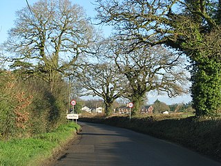
West Kingsdown is a village and civil parish in the Sevenoaks district of Kent, England, on the A20 5 miles (8 km) southeast of Swanley, 5.5 miles (9 km) northeast of Sevenoaks and 22.5 miles (36.2 km) from London.
Rowland's Castle is a village and civil parish in the East Hampshire district of Hampshire, England. It is 2.9 miles (4.7 km) north of Havant, on the Hampshire/West Sussex border.

The Garden District is a neighborhood of the city of New Orleans, Louisiana, United States. A subdistrict of the Central City/Garden District Area, its boundaries as defined by the New Orleans City Planning Commission are: St. Charles Avenue to the north, 1st Street to the east, Magazine Street to the south, and Toledano Street to the west. The National Historic Landmark district extends a little farther.
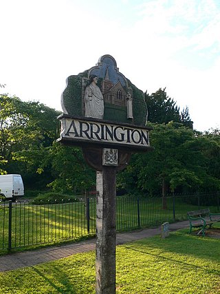
Arrington is a small village and civil parish in the South Cambridgeshire district of Cambridgeshire, England, with a population of 415 at the time of 2011 census. The village is 6 miles (10 km) north of Royston, Hertfordshire, and 9 miles (14 km) south-west of the county city of Cambridge.
Calvert is an unincorporated community in Cecil County, Maryland, United States, approximately six miles east of Rising Sun.

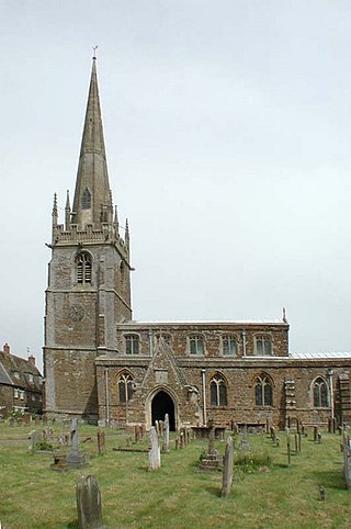
Highworth is a market town and civil parish in the Borough of Swindon, England, about 6 miles (10 km) north-east of Swindon town centre. The 2011 Census recorded a population of 8,151. The town is notable for its Queen Anne and Georgian buildings, dating from its pre-eminence in the 18th century. It also has a 13th-century church, St. Michael and All Angels.

Farrar is an unincorporated community in Salem Township in eastern Perry County, Missouri, United States. It is located eight miles east of Perryville, ninety miles south of Saint Louis and 3.7 miles from the Mississippi River.
Middleton Cheney is a large village and civil parish in West Northamptonshire, England. The village is about 3 miles (5 km) east of Banbury in Oxfordshire and about 6 miles (10 km) west-northwest of Brackley. The A422 road between Banbury and Brackley used to pass through Middleton Cheney, but now bypasses it to the south.
Feniton is a village and civil parish in East Devon in the English county of Devon. The village lies about 4 miles (6.4 km) west of Honiton, 3 miles (4.8 km) north of Ottery St Mary, and 2 miles (3.2 km) east of Talaton.

Drypool is an area within the city of Kingston upon Hull, England.
Skellingthorpe is a village and civil parish in the North Kesteven district of Lincolnshire, England. The population of the village at the 2011 census was 3,465. It is situated 3 miles (5 km) west of Lincoln, 4 miles (6 km) southeast of Saxilby, 6 miles (10 km) northwest of North Hykeham and 15 miles (24 km) east of Tuxford.

Leiper's Fork is an unincorporated rural village in Williamson County, Tennessee. It has a population of about 650 on an area of about 1,100 acres (450 ha). Most of the village shares a ZIP code with Franklin.

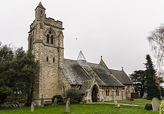
Stretton-on-Fosse is a village in the Stratford District in Warwickshire, England. It is situated between the towns of Moreton-in-Marsh and Shipston-on-Stour. The village is situated along the ancient Fosse Way road which runs from Exeter in Devon to Lincoln in Lincolnshire. The road bypasses the village to the east and is now the modern-day A439 road. The village is close to the Gloucestershire and Warwickshire border. While the lower ground of the village is heavy clay the upper parts are composed of sand and shingle. During commercial extraction of sand important graves of the Roman-British and Anglo-Saxon periods were uncovered and interesting skeletons and personal belongings were unearthed. These burials were the result of internecine warfare between local tribal factions.

The Morgan Morgan Monument, also known as Morgan Park, is a 1.05-acre (0.4 ha) roadside park in the unincorporated town of Bunker Hill in Berkeley County, West Virginia. It is located along Winchester Avenue and Mill Creek. The park features a granite monument that was erected in 1924 to memorialize Morgan Morgan (1688–1766), an American pioneer of Welsh descent, who was among the earliest European persons to settle permanently within the present-day boundaries of West Virginia.
Fort Slocum was one of seven temporary earthwork forts, part of the Civil War Defenses of Washington, D.C., during the Civil War, built in the Northeast quadrant of the city after the beginning of the war by the Union Army to protect the city from the Confederate Army. From west to east, the forts were as follow: Fort Slocum, Fort Totten, Fort Slemmer, Fort Bunker Hill, Fort Saratoga, Fort Thayer and Fort Lincoln.


