
The Toliara Province is a former province of Madagascar with an area of 161,405 square kilometres (62,319 sq mi). It had a population of 2,229,550. Its capital was Toliara. Near Toliara was the "spiny forest".
Sava is a region in northern Madagascar. Its capital is Sambava. Until 2009 Sava belonged to Antsiranana Province. The region is situated at the northern part of the east coast of Madagascar. It is bordered by the region Diana to the north, Sofia to the west, and Analanjirofo to the south. As of 2018, its population was 1,123,013 and the total area is 25,518 km2 (9,853 sq mi). The region contains wild areas such as Marojejy National Park.
Articles related to Madagascar include:
Beroroha is a municipality in Atsimo-Andrefana Region, Madagascar. Made up of 17 villages, the commune has a total population of 17,000. The area was severely affected by the 2009 passage of Cyclone Fanele.

Analanjirofo is a region in northeastern Madagascar. Until 2009 it was a part of Toamasina Province. It borders Sava Region to the north, Sofia Region to the west, Alaotra-Mangoro Region to the southwest and Atsinanana Region to the south.

Amoron'i Mania is a region in central Madagascar bordering Vakinankaratra Region in north, Atsinanana in northeast, Fitovinany in southeast, Haute Matsiatra in south, Atsimo-Andrefana in southwest and Menabe in west.
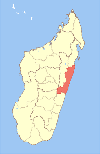
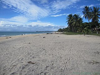
Atsinanana is a coastal region in eastern Madagascar. It borders Analanjirofo region in the north, Alaotra-Mangoro in the west, Vakinankaratra and Amoron'i Mania in the southwest, and Vatovavy in the south. The region contains over 285km of coastline, which includes many beaches and cultural heritage sites.
Haute Matsiatra is a region in Madagascar. It borders Amoron'i Mania region in north, Vatovavy-Fitovinany in east, Ihorombe in south and Atsimo-Andrefana in west. The capital of the region is Fianarantsoa, and the population was 1,447,296 in 2018. The area is 21,080 km2 (8,139 sq mi).
Ihorombe is a region in Madagascar. It borders Haute Matsiatra region in north, Atsimo-Atsinanana in east, Anosy in south and Atsimo-Andrefana in west. The capital is Ihosy and the population was 418,520 in 2018. The area of Ihorombe is 26,391 km2 (10,190 sq mi) and it has one of the lowest population densities of the Malagasy regions.
Belamoty is a town and commune in southwest Madagascar. It belongs to the district of Betioky Sud, which is a part of Atsimo-Andrefana Region. The population of the commune was estimated to be approximately 19,000 in 2001 commune census.

Bezaha is a municipality in southwest Madagascar. It belongs to the district of Betioky, which is a part of Atsimo-Andrefana Region. The population of the commune was estimated to be approximately 19,000 in 2001 commune census.
Tameantsoa is a rural municipality in southwest Madagascar. It belongs to the district of Betioky Atsimo, which is a part of Atsimo-Andrefana Region and is crossed by the Onilahy River and the Route nationale 10.

Saint Augustin is a rural municipality in Madagascar. It belongs to the district of Toliara II, which is a part of Atsimo-Andrefana Region. The population of the commune was estimated to be approximately 15,000 in 2001 commune census. The mouth of the Onilahy River is near the town.
Antanimena is a municipality in Madagascar. It belongs to the district of Toliara II, which is a part of Atsimo-Andrefana Region. The population of the commune was estimated to be approximately 4,000 in 2001 commune census.
Ambahikily is a municipality in Madagascar. It belongs to the district of Morombe, which is a part of Atsimo-Andrefana Region. The population of this municipality is 58,027 inhabitants. It is situated on the National road 55 and in the Mangoky River delta.
Tanandava Station is a rural municipality in Madagascar. It belongs to the district of Morombe, which is a part of Atsimo-Andrefana Region. It has a population of 18,235.

Route nationale 10 is an unpaved, secondary highway in Madagascar of 512 km, running from Andranovory to Ambovombe. It crosses the regions of Atsimo-Andrefana and Androy.
Betioky is a town in Atsimo-Andrefana Region, Madagascar and is crossed by the Route nationale 10. An airport serves the town.

Route nationale 9 is a secondary highway in Madagascar of 382 km, running from Toliara to Mandabe. It crosses the regions of Menabe and Atsimo-Andrefana.
Mitsinjo is a town and commune in western Madagascar.

