Auburntown, Tennessee

Last updated

Auburntown, Tennessee
Auburntown tennessee stores 2009.jpg
Stores in Auburntown
Cannon County Tennessee Incorporated and Unincorporated areas Auburntown Highlighted 4702400.svg
Location of Auburntown in Cannon County, Tennessee.
Coordinates: 35°56′59″N86°5′45″W / 35.94972°N 86.09583°W / 35.94972; -86.09583
Country United States
State Tennessee
County Cannon
Incorporated1949
Area
[1]
  Total0.58 sq mi (1.50 km2)
  Land0.58 sq mi (1.50 km2)
  Water0.00 sq mi (0.00 km2)
Elevation
[2]
715 ft (218 m)
Population
 (2020) [3]
  Total272
  Density470.59/sq mi (181.73/km2)
Time zone UTC-6 (Central (CST))
  Summer (DST) UTC-5 (CDT)
ZIP code
37016
Area code 615
FIPS code 47-02400 [4]
GNIS feature ID1304896 [2]

Auburntown is a town in Cannon County, Tennessee, United States. The population was 272 as of the 2020 census, up from 269 at the 2010 census. [5]

Contents

History

Once known as Poplar Stand, due to large population of poplar trees in the area, Auburntown was eventually renamed after Auburn, New York. It was incorporated in 1949. [6]

Geography

Auburntown is located at 35°56′59″N86°05′45″W / 35.949611°N 86.095913°W / 35.949611; -86.095913 . [7]

According to the United States Census Bureau, the town has a total area of 0.6 square miles (1.6 km2), all of it land.

Demographics

Post office in Auburntown Auburntown tennessee post office 2009.jpg
Post office in Auburntown
Historical population
CensusPop.Note
1880 107
1950 273
1960 256−6.2%
1970 213−16.8%
1980 204−4.2%
1990 24017.6%
2000 2525.0%
2010 2696.7%
2020 2721.1%
Sources: [8] [9] [3]

2020 census

Auburntown racial composition [10]
RaceNumberPercentage
White (non-Hispanic)25292.65%
Asian 20.74%
Other/Mixed 134.78%
Hispanic or Latino 51.84%

As of the 2020 United States census, there were 272 people, 87 households, and 61 families residing in the town.

2000 census

As of the census [4] of 2000, there were 252 people, 102 households, and 74 families residing in the town. The population density was 445.8 inhabitants per square mile (172.1/km2). There were 115 housing units at an average density of 203.4 per square mile (78.5/km2). The racial makeup of the town was 98.41% White, 0.40% African American, 0.40% Asian, and 0.79% from two or more races.

There were 102 households, out of which 34.3% had children under the age of 18 living with them, 64.7% were married couples living together, 5.9% had a female householder with no husband present, and 26.5% were non-families. 26.5% of all households were made up of individuals, and 10.8% had someone living alone who was 65 years of age or older. The average household size was 2.47 and the average family size was 2.96.

In the town, the population was spread out, with 25.0% under the age of 18, 5.6% from 18 to 24, 28.2% from 25 to 44, 25.8% from 45 to 64, and 15.5% who were 65 years of age or older. The median age was 38 years. For every 100 females, there were 85.3 males. For every 100 females age 18 and over, there were 81.7 males.

The median income for a household in the town was $32,857, and the median income for a family was $38,750. Males had a median income of $31,429 versus $26,250 for females. The per capita income for the town was $17,275. About 8.1% of families and 11.0% of the population were below the poverty line, including 12.0% of those under the age of eighteen and 9.8% of those 65 or over.

Related Research Articles

<span class="mw-page-title-main">Hytop, Alabama</span> Town in Alabama, United States

Hytop is a town in Jackson County, Alabama, United States. It incorporated on May 17, 1991. As of the 2010 census, the population of the town was 354, up from 315 in 2000. The Walls of Jericho, a popular hiking area, is located just north of Hytop.

<span class="mw-page-title-main">Argo, Alabama</span> Town in Alabama, United States

Argo is a town in Jefferson and St. Clair counties, Alabama, United States. It incorporated in 1987. At the 2020 census, the population was 4,368.

<span class="mw-page-title-main">Priceville, Alabama</span> City in Alabama, United States

Priceville is the third largest municipality in Morgan County, Alabama, United States and is included in the Decatur Metropolitan Area, as well as the Huntsville-Decatur Combined Statistical Area. The 2020 census counted a population of 3,513, up from 2,658 in 2010.

<span class="mw-page-title-main">Wilton, Alabama</span> Town in Alabama, United States

Wilton, also known by the previous names of Birmingham Junction, Bismark, and Catoosa, is a town in Shelby County, Alabama, United States. It was incorporated in 1918. This town is part of the Birmingham–Hoover–Cullman Combined Statistical Area. At the 2010 census the population was 687, up from 580 in 2000.

<span class="mw-page-title-main">Margaret, Alabama</span> City in Alabama, United States

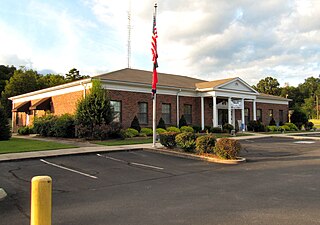
Margaret is a city in St. Clair County, Alabama, United States. At the 2020 census, the population was 5,106. As of the 2010 census, the population is 4,428, an increase of 278.8%. Margaret incorporated in 1960 and became a city in October 2011.

<span class="mw-page-title-main">Steele, Alabama</span> Town in Alabama, United States

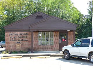
Steele is a town in northeastern St. Clair County, Alabama, United States. It was incorporated in 1952. At the 2010 census the population was 1,043, down from 1,093. The town is a part of the Birmingham–Hoover–Cullman Combined Statistical Area. It was initially known as Steel's Station or Steele's Depot in the late 19th century.

<span class="mw-page-title-main">Bryant, Indiana</span> Town in Indiana, United States

Bryant is a town in Bearcreek Township, Jay County, Indiana, United States. The population was 252 at the 2010 census.

<span class="mw-page-title-main">Normandy, Tennessee</span> Town in Tennessee, United States

Normandy is a town in Bedford County, Tennessee. The population was 108 at the 2020 census. Normandy Dam is located just northeast of the town. The town is listed on the National Register of Historic Places as the Normandy Historic District. The historic Beech Hall is also located near Normandy.

<span class="mw-page-title-main">Woodbury, Tennessee</span> Town in Tennessee, United States

Woodbury is a town in Cannon County, Tennessee, United States. Woodbury is part of the Nashville Metropolitan Statistical Area and is located 55 miles (89 km) southeast of downtown Nashville. The population of Woodbury was 2,680 at the 2010 census. It is the county seat of Cannon County.

<span class="mw-page-title-main">Maury City, Tennessee</span> Town in Tennessee, United States

Maury City is a town in Crockett County, Tennessee. The population was 674 at the 2010 census. Locals pronounce the town's name as "Murray City."

<span class="mw-page-title-main">Alexandria, Tennessee</span> Town in Tennessee, United States

Alexandria is a town in DeKalb County, Tennessee, United States. The population was 966 at the 2010 census.

<span class="mw-page-title-main">Decherd, Tennessee</span> City in Tennessee, United States

Decherd is a city in Franklin County, Tennessee, United States. The population was 2,379 at the 2020 census and 2,361 at the 2010 census.

<span class="mw-page-title-main">Kimball, Tennessee</span> Town in Tennessee, United States

Kimball is a town in Marion County, Tennessee, United States. The population was 1,545 at the 2020 census and 1,395 in 2010. It is part of the Chattanooga, TN–GA Metropolitan Statistical Area.

<span class="mw-page-title-main">Cornersville, Tennessee</span> Town in Tennessee, United States

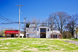
Cornersville is a town in Marshall County, Tennessee, United States. The population was 1,228 at the 2020 census. The town is home to Cornersville high school.

<span class="mw-page-title-main">Madisonville, Tennessee</span> City in Tennessee, United States

Madisonville is the county seat of Monroe County, Tennessee, United States. It is located in East Tennessee on the eastern border of the state. As of the 2020 census, the city's population was 5,132.

<span class="mw-page-title-main">Obion, Tennessee</span> Town in Tennessee, United States

Obion is a town in Obion County, Tennessee, United States, along the Obion River. The population was 1,119 at the 2010 census. It is part of the Union City, TN–KY Micropolitan Statistical Area.

Walnut Grove is a census-designated place in Sumner County, Tennessee, United States. Its population was 864 as of the 2010 census. The community incorporated as a town in 1998. It disincorporated on July 1, 2001, after the law under which it had incorporated was ruled unconstitutional.

<span class="mw-page-title-main">Worthington, West Virginia</span> Town in West Virginia, United States

Worthington is a town in Marion County, West Virginia, United States. The population was 158 at the 2010 census. Worthington was incorporated in 1893 and named for Colonel George Worthington, an early settler. U.S. Route 19 passes through the town.

<span class="mw-page-title-main">Ardmore, Tennessee</span> City in Tennessee, United States

Ardmore is a city in Giles and Lincoln counties, Tennessee, United States. The population was 1,217 at the 2020 census. Ardmore is the site of a Tennessee Department of Tourist Development Welcome Center. It borders its sister city, Ardmore, Alabama.

<span class="mw-page-title-main">Petersburg, Tennessee</span> Town in Tennessee, United States

Petersburg is a town in Lincoln and Marshall counties in the U.S. state of Tennessee. The population was 580 at the 2000 census and 544 at the 2010 census. It used to be the location of Morgan school before consolidation

References

  1. "ArcGIS REST Services Directory". United States Census Bureau. Retrieved October 15, 2022.
  2. 1 2 U.S. Geological Survey Geographic Names Information System: Auburntown, Tennessee
  3. 1 2 "Census Population API". United States Census Bureau. Retrieved October 15, 2022.
  4. 1 2 "U.S. Census website". United States Census Bureau . Retrieved January 31, 2008.
  5. Tennessee Department of Economic and Community Development, Certified Population of Tennessee Incorporated Municipalities and Counties Archived June 30, 2014, at the Wayback Machine , State of Tennessee official website, July 14, 2011. Retrieved: December 6, 2013.
  6. Larry L. Miller (October 2001). Tennessee place names. Indiana University Press. p. 10. ISBN   978-0-253-21478-2 . Retrieved November 21, 2011.
  7. "US Gazetteer files: 2010, 2000, and 1990". United States Census Bureau. February 12, 2011. Retrieved April 23, 2011.
  8. "Census of Population and Housing: Decennial Censuses". United States Census Bureau . Retrieved March 4, 2012.
  9. "Incorporated Places and Minor Civil Divisions Datasets: Subcounty Resident Population Estimates: April 1, 2010 to July 1, 2012". Population Estimates. U.S. Census Bureau. Archived from the original on June 11, 2013. Retrieved December 11, 2013.
  10. "Explore Census Data". data.census.gov. Retrieved December 26, 2021.