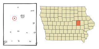
Aulander, North Carolina

Last updated

Aulander, North Carolina
Aulander, North Carolina.jpg
Commerce Street
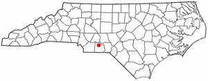
NCMap-doton-Aulander.PNG
Location of Aulander, North Carolina
Coordinates: 36°13′41″N77°06′49″W / 36.22806°N 77.11361°W / 36.22806; -77.11361
Country United States
State North Carolina
County Bertie
Area
[1]
  Total1.48 sq mi (3.83 km2)
  Land1.48 sq mi (3.83 km2)
  Water0.00 sq mi (0.00 km2)
Elevation
[2]
62 ft (19 m)
Population
 (2020)
  Total763
  Density516.59/sq mi (199.44/km2)
Time zone UTC-5 (Eastern (EST))
  Summer (DST) UTC-4 (EDT)
ZIP code
27805
Area code 252
FIPS code 37-02580 [3]
GNIS feature ID2405185 [2]

Aulander is a town in Bertie County, North Carolina, United States. The population was 895 at the 2010 census. [4]

Contents

Demographics

Historical population
CensusPop.Note
1890 163
1900 342109.8%
1910 54358.8%
1920 80347.9%
1930 1,04129.6%
1940 1,0571.5%
1950 1,1125.2%
1960 1,083−2.6%
1970 947−12.6%
1980 1,21428.2%
1990 1,209−0.4%
2000 888−26.6%
2010 8950.8%
2020 763−14.7%
U.S. Decennial Census [5]

2020 census

Aulander racial composition [6]
RaceNumberPercentage
White (non-Hispanic)33143.38%
Black or African American (non-Hispanic)36047.18%
Native American 10.13%
Asian 20.26%
Other/Mixed 395.11%
Hispanic or Latino 303.93%

As of the 2020 United States census, there were 763 people, 315 households, and 175 families residing in the town.

2000 census

As of the census [3] of 2000, there were 888 people, 371 households, and 247 families residing in the town. The population density was 601.4 inhabitants per square mile (232.2/km2). There were 412 housing units at an average density of 279.0 per square mile (107.7/km2). The racial makeup of the town was 57.09% White, 41.10% African American, 0.11% Native American, 0.23% Asian, 1.13% from other races, and 0.34% from two or more races. Hispanic or Latino of any race were 1.24% of the population.

There were 371 households, out of which 25.1% had children under the age of 18 living with them, 42.0% were married couples living together, 19.1% had a female householder with no husband present, and 33.4% were non-families. 29.1% of all households were made up of individuals, and 18.3% had someone living alone who was 65 years of age or older. The average household size was 2.39 and the average family size was 2.90.

In the town, the population was spread out, with 24.7% under the age of 18, 7.9% from 18 to 24, 24.3% from 25 to 44, 23.9% from 45 to 64, and 19.3% who were 65 years of age or older. The median age was 40 years. For every 100 females, there were 90.1 males. For every 100 females age 18 and over, there were 79.8 males.

The median income for a household in the town was $24,808, and the median income for a family was $34,125 . Males had a median income of $30,000 versus $21,528 for females. The per capita income for the town was $13,767. About 22.1% of families and 26.7% of the population were below the poverty line, including 43.1% of those under age 18 and 26.5% of those age 65 or over.

Related Research Articles

<span class="mw-page-title-main">Garrison, Iowa</span> City in Iowa, United States

Garrison is a city in Benton County, Iowa, United States. The population was 344 at the time of the 2020 census. It is part of the Cedar Rapids Metropolitan Statistical Area.

<span class="mw-page-title-main">Green Level, North Carolina</span> Town in North Carolina, United States

Green Level is a town in Alamance County, North Carolina, United States. It is part of the Burlington, North Carolina Metropolitan Statistical Area. As of the 2020 census, the population was 3,156.
<span class="mw-page-title-main">Ansonville, North Carolina</span> Town in North Carolina, United States

Ansonville is a town in Anson County, North Carolina, United States. The population was 440 at the 2020 census. The town has a total area of 1.5 square miles (3.8 km2), all land. It is located on the northern edge of Anson County, about a mile west of the Pee Dee River.

<span class="mw-page-title-main">Sugar Mountain, North Carolina</span> Village in North Carolina, United States

Sugar Mountain is a village in Avery County, North Carolina, United States. The village is located on Sugar Mountain's north slope. The population was 371 at the 2020 census.

<span class="mw-page-title-main">Colerain, North Carolina</span> Town in North Carolina, United States

Colerain is a town in Bertie County, North Carolina, United States. The population was 204 at the 2010 census.

<span class="mw-page-title-main">Kelford, North Carolina</span> Town in North Carolina, United States

Kelford is a town in Bertie County, North Carolina, United States. The population was 251 at the 2010 census.
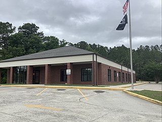
<span class="mw-page-title-main">Shallotte, North Carolina</span> Town in North Carolina, United States

Shallotte is a town in Brunswick County, North Carolina, United States. The population was 3,675 at the 2010 census. The Shallotte River passes through the town.

<span class="mw-page-title-main">Drexel, North Carolina</span> Town in North Carolina, United States

Drexel is a town in Burke County, North Carolina, United States. The population was 1,858 at the 2010 census. It is part of the Hickory–Lenoir–Morganton Metropolitan Statistical Area.

<span class="mw-page-title-main">Kingstown, North Carolina</span> Town in North Carolina, United States

Kingstown is a town in Cleveland County, North Carolina, United States. The population was 681 at the 2010 census.

<span class="mw-page-title-main">Cove City, North Carolina</span> Town in North Carolina, United States

Cove City is a town in Craven County, North Carolina, United States. The population was 378 at the 2020 U.S. census. It is part of the New Bern, North Carolina Micropolitan Statistical Area.

<span class="mw-page-title-main">Pleasant Garden, North Carolina</span> Town in North Carolina, United States

Pleasant Garden is a town in Guilford County, North Carolina, United States.

<span class="mw-page-title-main">Whitsett, North Carolina</span> Town in North Carolina, United States

Whitsett is a town in Guilford County, North Carolina, United States. The population was 584 at the 2020 census.

<span class="mw-page-title-main">Oak City, North Carolina</span> Town in North Carolina, United States

Oak City, formerly known as Goose Nest, is a town in Martin County, North Carolina, United States. The population was 266 at the 2020 census.

<span class="mw-page-title-main">Macon, North Carolina</span> Town in North Carolina, United States

Macon is a town located in Warren County, North Carolina, United States. As of the 2010 census, the town had a total population of 119. It is named for Nathaniel Macon, long-time Speaker of the U.S. House of Representatives.

<span class="mw-page-title-main">Franklin Township, Susquehanna County, Pennsylvania</span> Township in Pennsylvania, United States

Franklin Township is a township in Susquehanna County, Pennsylvania, United States. The population was 833 at the 2020 census. Salt Springs State Park, a Pennsylvania state park, is in Franklin Township.

<span class="mw-page-title-main">Jackson, South Carolina</span> Town in South Carolina, United States of America

Jackson is a town in Aiken County, South Carolina, United States. The population was 1,700 at the 2010 census. It is part of the Augusta, Georgia metropolitan area.

<span class="mw-page-title-main">Fairfax, South Carolina</span> Town in South Carolina, United States

Fairfax is a town in Allendale and Hampton counties, South Carolina, United States. The population was 2,025 at the 2010 census, a decline of over one-third of its population of 3,206 from 2000.

<span class="mw-page-title-main">Williston, South Carolina</span> Town in South Carolina, United States

Williston is a town in Barnwell County, South Carolina, United States. The population was 3,139 at the 2010 census.

<span class="mw-page-title-main">Athens, West Virginia</span> Town in West Virginia, United States

Athens is a town in Mercer County, West Virginia, United States. The population was 944 at the 2020 census. It is part of the Bluefield, WV-VA micropolitan area which has a population of 107,578. Athens is the home of Concord University.

<span class="mw-page-title-main">Lebo, Kansas</span> City in Coffey County, Kansas

Lebo is a city in Coffey County, Kansas, United States. As of the 2020 census, the population of the city was 885.

References

  1. "ArcGIS REST Services Directory". United States Census Bureau. Retrieved September 20, 2022.
  2. 1 2 U.S. Geological Survey Geographic Names Information System: Aulander, North Carolina
  3. 1 2 "U.S. Census website". United States Census Bureau . Retrieved January 31, 2008.
  4. "Geographic Identifiers: 2010 Demographic Profile Data (G001): Aulander town, North Carolina". U.S. Census Bureau, American Factfinder. Archived from the original on February 12, 2020. Retrieved February 6, 2014.
  5. "Census of Population and Housing". Census.gov. Retrieved June 4, 2015.
  6. "Explore Census Data". data.census.gov. Retrieved December 24, 2021.