Related Research Articles

Clay County is located in the U.S. state of Missouri and is part of the Kansas City metropolitan area. As of the 2020 census, the county had a population of 253,335, making it the fifth-most populous county in Missouri. Its county seat is Liberty. The county was organized January 2, 1822, and named in honor of U.S. Representative Henry Clay from Kentucky, later a member of the United States Senate and United States Secretary of State.
Platte County is a county located in the northwestern portion of the U.S. state of Missouri and is part of the Kansas City metropolitan area. As of the 2020 census, the population was 106,718. Its county seat is Platte City. The county was organized December 31, 1838, from the Platte Purchase, named for the Platte River. The Kansas City International Airport is located in the county, approximately one mile west of Interstate 29 between mile markers 12 and 15. The land for the airport was originally in an unincorporated portion of Platte County before being annexed by Platte City, and eventually Kansas City.

Jackson County is located in the western portion of the U.S. state of Missouri. As of the 2020 census, the population was 717,204. The estimated population in 2021 is 719,511 making it the second-most populous county in the state. Although Independence retains its status as the original county seat, Kansas City, Missouri, serves as a second county seat and the center of county government. The county was organized December 15, 1826, and named for President Andrew Jackson. Jackson County is the most populated county in the Kansas City metropolitan area. Total employment in 2019 was 344,993.

Wyandotte County is a county in the U.S. state of Kansas. As of the 2020 census, the population was 169,245, making it Kansas's fourth-most populous county. Its county seat and most populous city is Kansas City, with which it shares a unified government. Wyandotte County is directly north of Johnson County, Kansas, and west of Kansas City, Missouri.

Plattsburg is a city and county seat of Clinton County, Missouri and is part of the Kansas City metropolitan area in the western part of the state, within the United States. It developed along the Little Platte River. As of the 2010 census, the city population was 2,319.

Lee's Summit is a city located within the counties of Jackson (primarily) and Cass in the U.S. state of Missouri. As of the 2020 census its population was 101,108, making it the sixth-largest city in both the state and in the Kansas City Metropolitan Area.

The Kansas City metropolitan area is a bi-state metropolitan area anchored by Kansas City, Missouri. Its 14 counties straddle the border between the U.S. states of Missouri and Kansas. With 8,472 square miles (21,940 km2) and a population of more than 2.2 million people, it is the second-largest metropolitan area centered in Missouri and is the largest metropolitan area in Kansas, though Wichita is the largest metropolitan area centered in Kansas. Alongside Kansas City, Missouri, these are the suburbs with populations above 100,000: Overland Park, Kansas; Kansas City, Kansas; Olathe, Kansas; Independence, Missouri; and Lee's Summit, Missouri.

The Platte Purchase was a land acquisition in 1836 by the United States government from American Indian tribes. It comprised lands along the east bank of the Missouri River and added 3,149 square miles (8,156 km2) to the northwest corner of the state of Missouri.

Route 152 is a state highway in the northern Kansas City metropolitan area. It begins at Interstate 435 south of the Kansas City International Airport and ends at Route 291 in Liberty. The route is a limited access highway between its two junctions with I-435. It crosses I-29 five miles (8.0 km) south of the airport in Platte County and US 169 in Clay County.

The One Hundred and Two River is a tributary of the Platte River of Missouri in northwestern Missouri in the United States. It flows from source tributaries in southwestern Iowa about 80 miles (130 km) to the Platte. Via the Platte, it is part of the watershed of the Missouri River. Much of the river's course has been straightened and channelized.
East Leavenworth is an unincorporated community in Platte County, Missouri, United States. It is located on Route 45, approximately three miles east of Leavenworth, Kansas. It is within the Kansas City metropolitan area.
The Red Crown Tavern and Red Crown Tourist Court in Platte County, Missouri was the site of the July 20, 1933 gun battle between lawmen and outlaws Bonnie and Clyde and three members of their gang. The outlaws made their escape, but would be tracked down and cornered four days later near Dexter, Iowa and engaged by another posse. The shootout was depicted in Arthur Penn's 1967 film Bonnie and Clyde, though the sign on the motel in the movie reads "Platte City, Iowa," not Missouri.

Missouri's 6th congressional district takes in a large swath of land in northern Missouri, stretching across nearly the entire width of the state from Kansas to Illinois. Its largest voting population is centered in the northern portion of the Kansas City metropolitan area and the town of St. Joseph. The district includes nearly all of Kansas City north of the Missouri River.
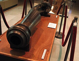
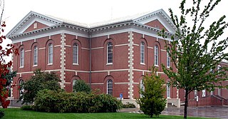
The Liberty Arsenal, known by Federal authorities as the Missouri Depot was a United States Army arsenal at Liberty, Missouri in Clay County, Missouri. The depot was seized twice by Southern partisans, once during the Kansas troubles in 1855, and again shortly after the outbreak of the American Civil War. It was located generally west of the junction of Missouri Route 291 and old 210 Highway.
Platte Township is an inactive township in Clay County, in the U.S. state of Missouri.
Beverly is an unincorporated community in Platte County, in the U.S. state of Missouri. It is within the Kansas City metropolitan area.
Kerrville is an unincorporated community in Platte County, in the U.S. state of Missouri. It is within the Kansas City metropolitan area.
Linkville is a neighborhood of Kansas City, Missouri, United States.
West Platte is an unincorporated community in Platte County, in the U.S. state of Missouri. It lies within the Kansas City metropolitan area.
Defiance was a community in Worth County, Missouri during the late 19th century.
References
- ↑ "Barry". Geographic Names Information System . United States Geological Survey . Retrieved November 27, 2020.
- ↑ "A Directory of Towns, Villages, and Hamlets Past and Present of Clay County, Missouri".
- ↑ "Honoring Northland History City of Kansas City Installs Two Historical Markers".
- ↑ "Town of Barry".