
Burbank is an unincorporated community and a census-designated place (CDP) in Clay County, South Dakota, United States. The population was 93 at the 2020 census.
Chester is an unincorporated community and census-designated place (CDP) in Lake County, South Dakota, United States. The population was 257 as of the 2020 census. Chester has been assigned the ZIP code of 57016.
Ferney is an unincorporated community and census-designated place in Brown County, South Dakota, United States. As of the 2020 census it had a population of 42.
Lyons is an unincorporated community and census-designated place (CDP) in Minnehaha County, South Dakota, United States. The CDP had a population of 70 at the 2020 census. Lyons has been assigned the ZIP code of 57041.
Mansfield is an unincorporated community and census-designated place on the border between Brown and Spink counties, South Dakota, United States. The population was 86 according to the 2020 census.
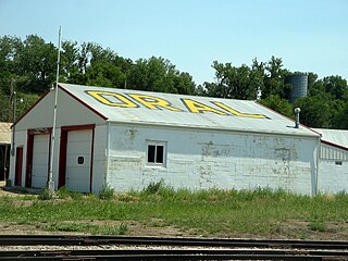
Oral is an unincorporated community and census-designated place (CDP) in Fall River County, South Dakota, United States. The population was 66 at the 2020 census.
Saint Onge is an unincorporated community and census-designated place (CDP) in Lawrence County, South Dakota, United States. As of the 2020 census, the population was 170.
Winfred is an unincorporated community and census-designated place (CDP) in Lake County, South Dakota, United States, approximately 12 miles (19 km) west of Madison. The population was 38 as of the 2020 census.
Shindler is an unincorporated community and census-designated place (CDP) in Lincoln County, South Dakota, United States. The population was 607 at the 2020 census.
Bath Corner is an unincorporated community and census-designated place in Brown County, South Dakota, United States. As of the 2020 census, it had a population of 51. Bath Corner is adjacent to the somewhat larger CDP of Bath and is 7 miles (11 km) east of the city of Aberdeen, the Brown County seat.
Mina is an unincorporated community and a census-designated place (CDP) in Edmunds County, in the U.S. state of South Dakota. The population of the CDP was 554 at the 2020 census.
Anderson, also known as Anderson Subdivision, is an unincorporated community and census-designated place in Minnehaha County, South Dakota, United States. Its population was 388 as of the 2020 census. The community is east of Sioux Falls.
Meadow View Addition is an unincorporated community and census-designated place in Minnehaha County, South Dakota, United States. Its population was 531 as of the 2020 census. The community is located on South Dakota Highway 115, north of Sioux Falls.
Pine Lakes Addition is an unincorporated community and census-designated place in Minnehaha County, South Dakota, United States. Its population was 306 as of the 2020 census. The community is east of Sioux Falls.
Renner Corner is an unincorporated community and census-designated place in Minnehaha County, South Dakota, United States. Its population was 347 as of the 2020 census. The community is located along South Dakota Highway 115, north of Sioux Falls.
Blucksberg Mountain is an unincorporated community and census-designated place in Meade County, South Dakota, United States. Its population was 467 as of the 2020 census. Interstate 90 passes through the community.
Corn Creek is an unincorporated community and census-designated place in Mellette County, South Dakota, United States. Its population was 113 as of the 2020 census. The community is located near the intersection of South Dakota Highway 44 and South Dakota Highway 63.
Long Hollow is an unincorporated community and census-designated place in Roberts County, South Dakota, United States. Its population was 265 as of the 2020 census.
Hutterville Colony is a Hutterite colony and census-designated place (CDP) in Brown County, South Dakota, United States. It was first listed as a CDP prior to the 2020 census. The CDP had a population of 95 at the 2020 census.
Prairiewood Village is an unincorporated community and census-designated place (CDP) in Brown County, South Dakota, United States. It was first listed as a CDP prior to the 2020 census. The CDP had a population of 303 at the 2020 census.


