Beaver, West Virginia

Last updated

Beaver, West Virginia
WVMap-doton-Beaver.PNG
Location of Beaver, West Virginia
Coordinates: 37°44′51″N81°8′31″W / 37.74750°N 81.14194°W / 37.74750; -81.14194
Country United States
State West Virginia
County Raleigh
Area
  Total4.4 sq mi (11.4 km2)
  Land4.4 sq mi (11.4 km2)
  Water0.0 sq mi (0.0 km2)
Elevation
[1]
2,717 ft (828 m)
Population
 (2010) [2]
  Total1,308
  Density300/sq mi (110/km2)
Time zone UTC-5 (Eastern (EST))
  Summer (DST) UTC-4 (EDT)
ZIP code
25813
Area code 304
FIPS code 54-05260 [3]
GNIS feature ID2389185 [1]

Beaver is a census-designated place (CDP) in Raleigh County, West Virginia, United States. The population was 1,308 at the 2010 census. [2]

Contents

Etymology

Beaver first acquired its name c.1860 “from the great numbers of beavers abounding in the creeks during the early days of settlement”, according to A History of Shady Spring District (1979), compiled by the Shady Spring District Woman's Club. When the community became eligible for a post office in the early 1900s, the residents discovered another West Virginia town already had the name. The town adopted the name "Oxley", after a Huntington man who ran a clothing store there. In 1929 or 1930, Grover Hedrick bought Ritter Lumber Company and had the community name changed to "Glen Hedrick." The residents petitioned the federal government for another name change and finally, the community was officially named Beaver in 1939.[ citation needed ]

Geography

According to the United States Census Bureau, the C.D.P. has a total area of 4.4 square miles (11.4 km2), of which 4.4 square miles (11.4 km2) is land and 0.23% is water.

Demographics

As of the census [3] of 2000, there were 1,378 people, 602 households, and 388 families residing in the C.D.P. The population density was 313.7 people per square mile (121.2/km2). There were 696 housing units at an average density of 158.4/sq mi (61.2/km2). The racial composition of the C.D.P. was 98.77% white, 0.07% black, 0.15% aboriginal American, 0.94% Asian, and 0.07% from two or more races. Hispanic or Latino of any race were 0.51% of the population.

There were 602 households, out of which 25.6% had children under the age of 18 living with them, 51.3% were married couples living together, 10.6% had a female householder with no husband present, and 35.4% were non-families. 30.1% of all households were made up of individuals, and 13.5% had someone living alone who was 65 years of age or older. The average household size was 2.26 and the average family size was 2.81.

In the C.D.P., the population was spread out, with 21.8% under the age of 18, 9.8% from 18 to 24, 27.2% from 25 to 44, 25.7% from 45 to 64, and 15.5% who were 65 years of age or older. The median age was 39 years. For every 100 females, there were 91.4 males. For every 100 females age 18 and over, there were 88.9 males.

The median income for a household in the C.D.P. was $25,863, and the median income for a family was $32,083. Males had a median income of $35,156 versus $16,836 for females. The per capita income for the C.D.P. was $16,694. About 9.2% of families and 16.6% of the population were below the poverty line, including 20.6% of those under age 18 and 10.0% of those age 65 or over.

Notable resident

Related Research Articles

<span class="mw-page-title-main">Beaver, Alaska</span> CDP in Alaska, United States

Beaver is a census-designated place (CDP) in Yukon-Koyukuk Census Area, Alaska, United States. At the time of the 2010 census the population was 84, unchanged from 2000, however the 2020 census reported a total population of 48.

<span class="mw-page-title-main">Lake Montezuma, Arizona</span> CDP in Yavapai County, Arizona

Lake Montezuma is a census-designated place (CDP) in Yavapai County in the U.S. state of Arizona. The population was 5,111 at the 2020 census. The CDP includes the communities of Rimrock and McGuireville. Located along Interstate 17, it is 20 miles (32 km) south of Sedona and 8 miles (13 km) north of Camp Verde in central Arizona's Verde Valley.

<span class="mw-page-title-main">Shady Hills, Florida</span> CDP in Florida, United States

Shady Hills is a census-designated place (CDP) in Pasco County, Florida, United States. The population was 7,798 at the 2000 census. It is in the Tampa-St. Petersburg-Clearwater, Florida Metropolitan Statistical Area and home to a pigeon racing group.

<span class="mw-page-title-main">Shady Side, Maryland</span> Census-designated place in Maryland, United States

Shady Side is a census-designated place (CDP) in Anne Arundel County, Maryland, United States. The population was 5,803 at the 2010 census.

<span class="mw-page-title-main">Rosemount, Ohio</span> Census-designated place in Ohio, United States

Rosemount is a census-designated place (CDP) in Clay Township, Scioto County, Ohio, United States. The population was 2,117 at the 2020 census.

<span class="mw-page-title-main">Shady Grove, Cherokee County, Oklahoma</span> Census-designated place in Oklahoma, United States

Shady Grove is an unincorporated community and census-designated place (CDP) in Cherokee County, Oklahoma, United States. The population was 556 at the 2010 census. This is not to be confused with the similarly-named Shady Grove in McIntosh County, or the Shady Grove in Pawnee County.

Shady Grove is a census-designated place (CDP) in McIntosh County, Oklahoma, United States. The population was 199 at the 2010 census, a decrease of 14.4 percent from 229 in 2000. This is not to be confused with the similarly-named Shady Grove in Cherokee County, or the Shady Grove in Pawnee County.

<span class="mw-page-title-main">Beaver, Oregon</span> Unincorporated community in the state of Oregon, United States

Beaver is an unincorporated community in Tillamook County, Oregon, United States, along U.S. Route 101 and the Nestucca River, about 12 miles (19 km) south of Tillamook. For statistical purposes, the United States Census Bureau has defined Beaver as a census-designated place (CDP). The census definition of the area may not precisely correspond to local understanding of the area with the same name. The population of the CDP was 122 at the 2010 census.

<span class="mw-page-title-main">Brodheadsville, Pennsylvania</span> Census-designated place in Pennsylvania, United States

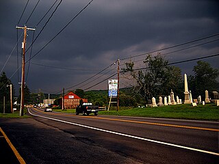
Brodheadsville is a census-designated place (CDP) in Monroe County, Pennsylvania, United States. The population was 1,700 at the 2020 census. The community is served by Pleasant Valley School District.

<span class="mw-page-title-main">Lyndhurst, Virginia</span> CDP in Virginia, United States

Lyndhurst is a census-designated place (CDP) in Augusta County, Virginia, United States. The population was 1,490 at the 2010 census. It is part of the Staunton–Waynesboro Micropolitan Statistical Area.

<span class="mw-page-title-main">Chesterfield Court House, Virginia</span> Unincorporated community in Virginia, United States

Chesterfield Court House is an unincorporated community and census-designated place that is the county seat of Chesterfield County, Virginia, United States. It was a census-designated place (CDP) at the 2020 census. It was not delineated as a CDP for the 2010 census. The Chesterfield County Courthouse and Courthouse Square are listed in the National Register of Historic Places. The area is also home of the Chesterfield County Government Complex.

<span class="mw-page-title-main">Montclair, Virginia</span> Census-designated place in Virginia, United States

Montclair is a census-designated place (CDP) in Prince William County, Virginia, United States. The population was 22,279 in the 2020 census. An affluent residential community surrounding a man-made lake and golf course, development began in the late 1960s and new home construction ended during the 1990s.

<span class="mw-page-title-main">Red Jacket, West Virginia</span> Census-designated place in West Virginia, United States

Red Jacket is a census-designated place (CDP) in Mingo County, West Virginia, United States. The population was 581 at the 2010 census. The community was named for Red Jacket, a Seneca chief.

<span class="mw-page-title-main">Craigsville, West Virginia</span> CDP in West Virginia, United States

Craigsville is a census-designated place (CDP) in Nicholas County, West Virginia, United States. The population was 2,213 at the 2010 census.

<span class="mw-page-title-main">Bradley, West Virginia</span> Census-designated place in West Virginia, United States

Bradley is a census-designated place (CDP) in Raleigh County, West Virginia, United States, named in honor of General Omar Bradley, a field commander in North Africa and Europe during World War II and a General of the Army. The population was 1,928 at the 2020 census.

<span class="mw-page-title-main">Coal City, West Virginia</span> Census-designated place in West Virginia, United States

Coal City is a census-designated place (CDP) in Raleigh County, West Virginia, United States. The population was 1,815 at the 2010 census. Coal City's population is composed of other surrounding unincorporated communities.

<span class="mw-page-title-main">MacArthur, West Virginia</span> Census-designated place in West Virginia, United States

MacArthur is a census-designated place (CDP) in Raleigh County, West Virginia, United States. Originally, it was named Hollywood and renamed MacArthur after General of the Army Douglas MacArthur in 1942. The population was 1,500 at the 2010 census.

<span class="mw-page-title-main">Piney View, West Virginia</span> Census-designated place in West Virginia, United States

Piney View is a census-designated place (CDP) in Raleigh County, West Virginia, United States. The population was 989 at the 2010 census.

<span class="mw-page-title-main">Shady Spring, West Virginia</span> Census-designated place in West Virginia, United States

Shady Spring is a census-designated place (CDP) in Raleigh County, West Virginia, United States. The population was 2,998 at the 2010 census. It is a residential community, with a low crime rate.

Norridgewock is a census-designated place (CDP) in the town of Norridgewock in Somerset County, Maine, United States. The population was 1,351 at the 2020 census.

References

  1. 1 2 U.S. Geological Survey Geographic Names Information System: Beaver, West Virginia
  2. 1 2 "U.S. Census website". United States Census Bureau . Retrieved May 14, 2011.
  3. 1 2 "U.S. Census website". United States Census Bureau . Retrieved January 31, 2008.
  4. "Cynthia Rylant" Archived 27 September 2011 at the Wayback Machine , Annie Merner Pfeiffer Library at West Virginia Wesleyan College, accessed 9 May 2024