Beaver Springs, Pennsylvania

Last updated
Beaver Springs
CDP
Beaver Springs, Pennsylvania (4143216747).jpg
USA Pennsylvania location map.svg
Red pog.svg
Beaver Springs
Location within the U.S. state of Pennsylvania
Usa edcp location map.svg
Red pog.svg
Beaver Springs
Beaver Springs (the United States)
Coordinates: 40°44′40″N77°12′53″W / 40.74444°N 77.21472°W / 40.74444; -77.21472 Coordinates: 40°44′40″N77°12′53″W / 40.74444°N 77.21472°W / 40.74444; -77.21472
Country United States
State Pennsylvania
County Snyder
Area
[1]
  Total1.36 sq mi (3.52 km2)
  Land1.35 sq mi (3.51 km2)
  Water0.01 sq mi (0.01 km2)
Population
 (2020) [2]
  Total691
  Density510.34/sq mi (197.01/km2)
Time zone UTC-5 (Eastern (EST))
  Summer (DST) UTC-4 (EDT)
ZIP codes
17812, 17843
Area code(s) 570 and 272
FIPS code 42-04824

Beaver Springs is a census-designated place in Spring Township, Snyder County, Pennsylvania, United States. The population was 634 at the 2000 census.

Contents

Map of Snyder County, Pennsylvania with Municipal Labels showing Boroughs (red), Townships (white), and Census-designated places (blue). Map of Snyder County Pennsylvania With Municipal and Township Labels.png
Map of Snyder County, Pennsylvania with Municipal Labels showing Boroughs (red), Townships (white), and Census-designated places (blue).

Beaver Springs was first called Reigertown before the name was changed by the post office. It was named for Adam Reiger. He was given the land as a land grant from the Penn proprietors. The town was also known for a time as Adamsburg. [3] The current name was based on the beavers who were active in a local stream and an important spring that was along its main street. [4] In 2006, Beaver Springs celebrated its bicentennial.

Geography

Beaver Springs is located at 40°44′40″N77°12′53″W / 40.74444°N 77.21472°W / 40.74444; -77.21472 (40.744464, -77.214598). [5]

According to the United States Census Bureau, the community has a total area of 2.5 square miles (6.5 km2), all land.

Demographics

Historical population
CensusPop.
2020 691
U.S. Decennial Census [6] [2]

As of the census [7] of 2000, there were 634 people, 267 households, and 190 families residing in the community. The population density was 256.4 people per square mile (99.1/km2). There were 274 housing units at an average density of 110.8/sq mi (42.8/km2). The racial makeup of the community was 98.58% White, 0.32% African American, 0.16% Asian, and 0.95% from two or more races.

There were 267 households, out of which 30.7% had children under the age of 18 living with them, 58.8% were married couples living together, 9.4% had a female householder with no husband present, and 28.5% were non-families. 25.5% of all households were made up of individuals, and 14.6% had someone living alone who was 65 years of age or older. The average household size was 2.37 and the average family size was 2.83.

The population was spread out, with 22.2% under the age of 18, 5.8% from 18 to 24, 27.0% from 25 to 44, 26.7% from 45 to 64, and 18.3% who were 65 years of age or older. The median age was 42 years. For every 100 females, there were 83.8 males. For every 100 females age 18 and over, there were 87.5 males.

The median income for a household in Beaver Springs was $30,000, and the median income for a family was $35,987. Males had a median income of $27,120 versus $18,125 for females. The per capita income for the CDP was $14,796. About 7.3% of families and 7.9% of the population were below the poverty line, including 6.1% of those under age 18 and 9.9% of those age 65 or over.

Related Research Articles

<span class="mw-page-title-main">Black, Alabama</span> Town in Alabama, United States

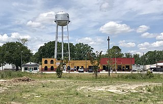
Black is a town in Geneva County, Alabama, United States. It incorporated in 1905. It is part of the Dothan, Alabama Metropolitan Statistical Area. At the 2020 census the population was 468, up from 207 in 2010.

<span class="mw-page-title-main">Sun Lakes, Arizona</span> CDP in Maricopa County, Arizona

Sun Lakes is an unincorporated community and census-designated place (CDP) in Maricopa County, Arizona, United States. The population was 14,868 at the 2020 census. Sun Lakes is an active adult community comprising five country club communities in three homeowner associations. These include the gated communities of Oakwood and IronWood (IronOaks), the gated and non-gated communities of Palo Verde and Cottonwood, and the non-gated community of Sun Lakes 1. Sun Lakes is a master-planned community developed by Robson Communities.

<span class="mw-page-title-main">Monroe, Adams County, Indiana</span> Town in Indiana, United States

Monroe is a town in Washington and Monroe townships, Adams County, Indiana, United States. The population of the town was 945 residents at the 2019 census. Adams Central Community Schools is located in Monroe.

<span class="mw-page-title-main">Connelly Springs, North Carolina</span> Town in North Carolina, United States

Connelly Springs is a town in Burke County, North Carolina, United States. The population was 1,669 at the 2010 census. It is part of the Hickory–Lenoir–Morganton Metropolitan Statistical Area.

<span class="mw-page-title-main">Pink Hill, North Carolina</span> Town in North Carolina, United States

Pink Hill is a town in Lenoir County, North Carolina, United States. The population was 552 at the 2010 census. The town was incorporated in 1915.

<span class="mw-page-title-main">Chest Township, Clearfield County, Pennsylvania</span> Township in Pennsylvania, United States

Chest Township is a township in Clearfield County, Pennsylvania, United States. The population was 511 at the 2020 census.

<span class="mw-page-title-main">Richfield, Pennsylvania</span> Census-designated place in Pennsylvania, United States

Richfield is an unincorporated community and census-designated place (CDP) in Juniata and Snyder counties in Pennsylvania, United States. The population was 549 at the 2010 census.

<span class="mw-page-title-main">Menno Township, Mifflin County, Pennsylvania</span> Township in Pennsylvania, United States

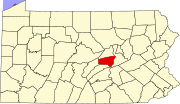
Menno Township is a township in Mifflin County, Pennsylvania, United States. The population was 1,978 at the 2020 census. The township was named for Menno Simons, an early Mennonite leader. Mennonites and Amish were among the early settlers of the area, and members of these faiths continue to form a part of the area's population.

<span class="mw-page-title-main">Adams Township, Snyder County, Pennsylvania</span> Township in Pennsylvania, United States

Adams Township in Snyder County, Pennsylvania, United States, is a township which had a population of 907 at the 2010 census. Per the US Census Bureau, by 2020 the population had reduced to 895 people.

<span class="mw-page-title-main">Beaver Township, Snyder County, Pennsylvania</span> Township in Pennsylvania, United States

Beaver Township is a township in Snyder County, Pennsylvania, United States. The population was 502 at the 2020 census.

<span class="mw-page-title-main">Franklin Township, Snyder County, Pennsylvania</span> Township in Pennsylvania, United States

Franklin Township is a township in Snyder County, Pennsylvania, United States. The population was 2,202 at the 2020 census.

<span class="mw-page-title-main">Mount Pleasant Mills, Pennsylvania</span> CDP in Pennsylvania, United States

Mount Pleasant Mills is a census-designated place (CDP) in Snyder County, Pennsylvania, United States. The population was 342 at the 2000 census.

<span class="mw-page-title-main">Spring Township, Snyder County, Pennsylvania</span> Township in Pennsylvania, United States

Spring Township is a township in Snyder County, Pennsylvania, United States. The population was 1,632 at the 2020 census.

<span class="mw-page-title-main">Troxelville, Pennsylvania</span> CDP in Pennsylvania, United States

Troxelville is a census-designated place (CDP) in Snyder County, Pennsylvania, United States. The population was 192 at the 2000 census.

<span class="mw-page-title-main">West Beaver Township, Snyder County, Pennsylvania</span> Township in Pennsylvania, United States

West Beaver Township is a township in Snyder County, Pennsylvania, United States. The population was 1,127 at the 2020 census.

<span class="mw-page-title-main">West Perry Township, Snyder County, Pennsylvania</span> Township in Pennsylvania, United States

West Perry Township is a township in Snyder County, Pennsylvania, United States. The population was 1,082 at the 2020 census.

<span class="mw-page-title-main">Great Bend, Pennsylvania</span> Borough in Pennsylvania, United States

Great Bend is a borough in Susquehanna County, Pennsylvania, United States, 39 miles (63 km) north of Scranton. According to 2020 Census data, Great Bend's population was 634, down 13.6% from 2010. Great Bend sits along the Susquehanna River, less than two miles from the New York State border, and is located directly off Interstate 81. Several small manufacturers also call Great Bend home. Great Bend is considered a bedroom community of the Binghamton, NY metropolitan area. Downtown Binghamton is roughly 11 miles (18 km) from Great Bend. The borough has three public parks. Billy Greenwood Memorial Park on Kilrow Avenue and Veterans' Memorial Park on Spring St. overlook the Susquehanna River. Great Bend is within the Blue Ridge School District.

<span class="mw-page-title-main">Beaver, West Virginia</span> Census-designated place in West Virginia, United States

Beaver is a census-designated place (C.D.P.) in Raleigh County, West Virginia, United States. The population was 1,308 at the 2010 census.

Fence is a town in Florence County, Wisconsin, United States. The population was 231 at the 2000 census. The unincorporated community of Fence is located in the town.

<span class="mw-page-title-main">Smithtown (CDP), New York</span> Hamlet and census-designated place in New York, United States

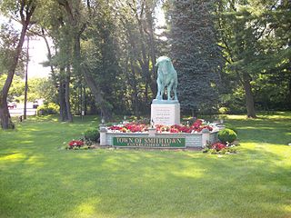
Smithtown is a hamlet and census-designated place (CDP) within the Town of Smithtown in Suffolk County, New York. The population was 26,470 at the 2010 census. The hamlet includes the former Village of The Landing, which was dissolved in 1939.

References

  1. "ArcGIS REST Services Directory". United States Census Bureau. Retrieved October 12, 2022.
  2. 1 2 "Census Population API". United States Census Bureau. Retrieved Oct 12, 2022.
  3. "History of Beaver Springs, Penna" 1906
  4. The Writings of Agnes Selin Schoch, reprinted by Snyder County Times, February 23, 2008.
  5. "US Gazetteer files: 2010, 2000, and 1990". United States Census Bureau. 2011-02-12. Retrieved 2011-04-23.
  6. "Census of Population and Housing". Census.gov. Retrieved June 4, 2016.
  7. "U.S. Census website". United States Census Bureau . Retrieved 2008-01-31.