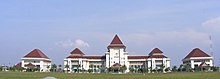
Bekasi is a city in West Java, Indonesia, located on the eastern border of Jakarta. It serves as a commuter city within the Jakarta metropolitan area. According to the 2020 Census by Statistics Indonesia (BPS), Bekasi had 2,543,676 inhabitants. The official estimate for mid 2023 was 2,627,207 - comprising 1,320,682 males and 1,306,525 females. It lies within the largest metropolitan area in Indonesia (Jabodetabek). The city is bordered by Bekasi Regency to the north and the east, Bogor Regency and Depok City to the south, and the city of East Jakarta to the west.

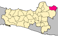
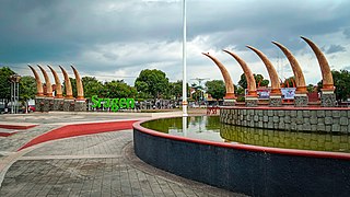
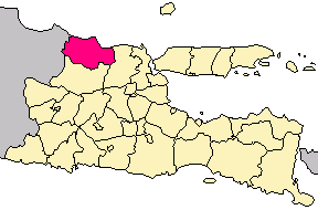
Jombang Regency is a regency of East Java, Indonesia, situated to the southwest of Surabaya. The capital of the regency is the town of Jombang. The regency has an area of 1,159.50 km2 and a population of 1,202,407 at the 2010 census and 1,318,062 at the 2020 census; the official estimate as of mid-2023 was 1,370,510. It became a regency in 1910. It was the birthplace of Abdurrahman Wahid, the 4th president of Indonesia.

Wonosobo Regency is a regency in Central Java province in Indonesia. The administrative centre of the regency is located in the town of Wonosobo, located at 7.3684940°S 109.8983841°E, about 120 km from Semarang on the Dieng Plateau. The regency's area is 984.68 km2 and its population was 754,883 at the 2010 census and 879,124 at the 2020 census; the official estimate as at mid 2023 was 909,664.

Bangkalan Regency is a regency of East Java province in Indonesia. The seat of its government is the town of Bangkalan. The regency is located on the west side of Madura Island, bordering Sampang Regency to the east, Java Sea to the north, and Madura Strait to the west and the south sides. It covers an area of 1,260.15 km2, and had a population of 906,761 at the 2010 census and reached 1,060,377 at the 2020 census; however the official estimate as at mid-2023 showed a decline to 1,047,306 – comprising 515,428 males and 531,878 females.

Lamongan Regency is a regency of the East Java Province of Indonesia. It has a total land area of approximately 1,812.8 km2 (699.9 sq mi) or + 3.78% of the area of East Java Province. With a length of 47 km (29 mi) along the coastline, the sea area of Lamongan Regency is about 902.4 km2 (348.4 sq mi), if calculated to a distance of 12 miles (19 km) across the ocean surface. At the 2010 census it had a population of 1,179,059; the 2020 Census produced a total of 1,379,628 and the official estimate as at mid-2023 was 1,385,835. The regency seat is the town of Lamongan, situated on the Solo River which passes from west to east through the regency, effectively dividing it in two.
Sampang Regency is a regency of East Java province, Indonesia. It is situated on Madura Island, bordering on Pamekasan Regency to the east, the Java Sea to the north, Bangkalan Regency to the west, and Madura Strait to the south. It covers an area of 1,228.25 km2, and had a population of at the 2010 census 877,772 and at the 2020 census 969,694; the official estimate as of mid-2023 was 988,360 - comprising 488,900 males and 499,460 females. The administrative centre is the port of Sampang, on the south coast of Madura.
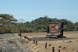
Situbondo Regency is a regency (kabupaten) in the east of East Java province, Indonesia. It covers an area of 1,658.03 km2, and had a population of 647,619 at the 2010 Census and 685,967 at the 2020 Census; the official estimate as at mid 2023 was 684,343. It is located towards the eastern end of Java, before Banyuwangi. The administrative centre is Situbondo, a small town within the regency. One of the famous tourist sites is Baluran National Park.

Bogor Regency is a landlocked regency (kabupaten) of West Java province in Indonesia, situated south of DKI Jakarta. Covering an area of 2,991.78 km2, it is considered a bedroom community for Jakarta, and was home to 5,427,068 people at the 2020 census. The official estimate as at mid 2023 was 5,627,071. The town of Cibinong serves as the regency seat.

Sumedang Regency is a landlocked regency (kabupaten) of the West Java Province of Indonesia. The regency covers an area of 1,558.72 km2 and had a population of 1,093,602 at the 2010 Census and 1,152,507 at the 2020 Census; the official estimate as of mid-2023 was 1,178,235 - comprising 593,815 males and 584,420 females. Its administrative centre is in the district of North Sumedang.

Purwakarta Regency is a landlocked regency (kabupaten) of West Java, Indonesia. The town of Purwakarta is its regency seat.

Tanah Bumbu is one of the regencies in the Indonesian province of South Kalimantan. It was formerly part of Kotabaru Regency, but was split off on 25 February 2003 to form a separate regency, following dissatisfaction on the Kalimantan mainland territories with administration from Laut Island. It covers an area of 4,890.3 km2 and had a population of 267,929 at the 2010 Census and 322,646 at the 2020 Census; the latest official estimate is 343,741. The regency's capital is the town of Batulicin.
Tanah Laut Regency is one of the regencies in the Indonesian province of South Kalimantan. It encompasses the southernmost part of Kalimantan (Borneo). The area is 3,841.37 km2, and the population was 296,333 at the 2010 Census and 348,966 at the 2020 Census; the official estimate as at mid 2023 was 364,117. The capital is the town of Pelaihari. Motto: "Tuntung Pandang" (Banjarese); Tuntung Pandang has the meaning of "nice to see until forever"
Rembang Regency is a regency on the extreme northeast coast of Central Java Province, on the island of Java in Indonesia. The regency covers an area of 1,036.70 km2 on Java, and it had a population of 591,359 at the 2010 Census and 645,333 at the 2020 Census; the official estimate as of mid-2023 was 660,166, of whom 331,870 were males and 328,296 were females. Its administrative capital is the town of Rembang.
Sragen Regency is a regency in the eastern part of Central Java province in Indonesia. It covers an area of 994.57 km2 and had a population of 858,266 at the 2010 Census and 976,951 at the 2020 Census; the official estimate as at mid 2023 was 997,485. Its capital is the town of Sragen, located about 30 km to the northeast of Surakarta. Sragen is bordered by East Java Province to the east.

Semarang is a landlocked regency in Central Java province in Indonesia. It covers an area of 1,019.27 km2 and had a population of 930,727 at the 2010 census and 1,053,094 at the 2020 census; the official estimate at mid 2023 was 1,080,648, comprising 538,117 males and 542,531 females. These figures exclude the independent cities of Semarang and Salatiga, which are administratively separate from the regency. The regency's capital is Ungaran, which lies immediately to the south of Semarang City.

Bulukumba Regency is a regency in the southeast corner of South Sulawesi Province, Indonesia. It covers an area of 1,175.53 km2, and had a population of 394,757 at the 2010 Census and 437,607 at the 2020 Census; the official estimate for mid 2022 was 471,688. The town of Ujung Bulu is its capital.

Paser Regency is the southernmost regency (kabupaten) within the East Kalimantan province of Indonesia. It was created in 1959, originally spelt "Pasir Regency", but renamed "Paser" in 2007; however its northeastern districts were split off on 10 April 2002 to form the new Penajam North Paser Regency. The residual regency covers an area of 11,603.94 km2, and it had a population of 230,316 at the 2010 Census and 275,452 at the 2020 Census; the official estimate as at mid-2023 was 303,424. Its administrative centre is the town of Tana Paser.

East Kotawaringin Regency is one of the thirteen regencies which comprise the Central Kalimantan Province on the island of Kalimantan (Borneo), Indonesia. It originally covered a much larger part of the province, having been split from a single Kotawaringin Regency on 26 June 1959 into separate regencies for East and West Kotawaringin, but on 10 April 2002 several districts in the west of the regency were split off to form the new Seruyan Regency, and several districts in the east of the regency were similarly split off to form the new Katingan Regency. The area of the residual East Kotawaringin Regency is 16,796 km2, and its population was 374,175 at the 2010 Census, and 428,900 at the 2020 Census; the official estimate as at mid 2023 was 443,359. The town of Sampit is the capital of East Kotawaringin Regency.

Bantaeng Regency is a regency of South Sulawesi Province in Indonesia. It covers an area of 395.83 km2 and had a population of 176,984 at the 2010 Census, rising to 196,716 at the 2020 Census. The official estimate as at mid 2023 was 211,623. The administrative centre is the town of Bantaeng, which lies on the south coast of the southern peninsula of Sulawesi island.
Tuban Regency is a regency in the East Java province of Indonesia. The Dutch name of the regency is 'Toeban'. It covers a land area of 1,839.94 sq. km, and had a population of 1,118,464 at the 2010 Census and 1,198,012 at the 2020 Census; the official estimate as of mid-2023 was 1,258,368. The administrative centre is the coastal town of Tuban.