Belle Vernon, Pennsylvania

Last updated

Belle Vernon, Pennsylvania
Bvernonpa.jpg
Belle Vernon, as seen from across the Monongahela River in a view showing the underside of the I-70 bridge looking east-north-east from Speers
Fayette County Pennsylvania Incorporated and Unincorporated areas Belle Vernon Highlighted.svg
Location of Belle Vernon in Fayette County, Pennsylvania.
Pennsylvania in United States (US48).svg
Location of Pennsylvania in the United States
Coordinates: 40°7′37″N79°52′6″W / 40.12694°N 79.86833°W / 40.12694; -79.86833
CountryUnited States
StatePennsylvania
County Fayette
Established1813
Government
_Mayor - Gerald W. Jackson II
Area
[1]
  Total0.33 sq mi (0.85 km2)
  Land0.26 sq mi (0.68 km2)
  Water0.07 sq mi (0.18 km2)
Highest elevation
1,080 ft (330 m)
Lowest elevation
738 ft (225 m)
Population
 (2020) [2]
  Total1,024
  Density3,923.37/sq mi (1,513.80/km2)
Time zone UTC-4 (EST)
  Summer (DST) UTC-5 (EDT)
ZIP code
15012 [3]
Area code 724
FIPS code42-05288

Belle Vernon is a borough in Fayette County, Pennsylvania, United States. It is situated along the Monongahela River, abutting two other counties, Westmoreland to the north and Washington across the river. As of the 2020 census, Belle Vernon had a population of 1,025. [4]

Contents

"Bellevernon", as it was originally spelled, was laid out in 1813 by Noah Speers in northwestern Fayette County. French for "beautiful green", this was the name chosen by both Noah Speers for his little community on the Monongahela River and later by his son Louis, who founded a town with nearly the same name just up the hill (North Belle Vernon). Directly across the river lies the borough of Speers, anchoring the far side of the landmark I-70 bridge as the east bridge abutments lie in adjacent Rostraver Township.

Geography

Belle Vernon is located at 40°7′37″N79°52′6″W / 40.12694°N 79.86833°W / 40.12694; -79.86833 (40.126936, −79.868285), [5] nestled in the northwestern corner of Fayette County, with abutting borders on Washington County, to the west across the river, and Westmoreland County to the north.

According to the United States Census Bureau, the borough has a total area of 0.31 square miles (0.81 km2), of which 0.25 square miles (0.65 km2) is land and 0.07 square miles (0.17 km2), or 20.29%, is water. [6]

Surrounding and adjacent neighborhoods

Belle Vernon has three land borders with Washington Township to the southeast and the Westmoreland County neighborhoods of North Belle Vernon to the north and Rostraver Township to the northwest.

Across the Monongahela River to the south in Washington County, Belle Vernon runs adjacent with the aforementioned borough of Speers as well as Dunlevy.

History

Main Street Belle Vernon 2014.jpg
Main Street

Noah Speers was the father of Louis M. Speers, born in a log cabin on the Speers homestead/Gibsonton farm in 1810. The younger Speers played a large role in the development of Belle Vernon. During his lifetime, the population grew to about 700, and there was a steam ferry connecting Belle Vernon with Allen Township across the river. The little hamlet boasted five dry goods stores, four groceries, two glasshouses with 87 employees, a boot and shoe, cabinet, chair, wagon, saddle/harness, blacksmith/tanning shops, and two sawmills. Louis Speers owned a sandbank outside of town which produced the best quality glass sand. He also owned a large coal works and a large boat yard with more than 50 employees. Louis resided on the northwest corner of Main and 2nd streets.

Boat hulls were built at his boatyard (owned in partnership with a man named Morgan Gaskill), located on 3rd Street in the 1830s and 1840s. Several steamboats are noted to have come from the yard, including the Minstrel, which in 1842 fell off its building docks killing one and injuring 10. The St. Anthony bound for Galena, Illinois, and the Cassandra headed to Knoxville, Tennessee, came from the Belle Vernon yard. Two boats bound for customers in Pittsburgh were the Alert and the Avalanche (1847).

In 1853, Mr. Speers built a sawmill with partner William Latta, a boat builder, below the mouth of Speers Run. It was destroyed by fire in 1877 and rebuilt by his son William F. Speers. William, who spent three months in Libby Prison during the Civil War, left the army after attaining the rank of lieutenant colonel. William went bankrupt soon after completing the new mill and sold it to the Belle Vernon Saw and Planing Company in 1880.

The small village of Speers across the river, laid out in 1860 by a kinsman, gets its name from the same family. North Belle Vernon, in Westmoreland County, was laid out in 1872 by Louis and was incorporated in 1876. Louis died two years later in 1878 and is buried at the Rehoboth Presbyterian Church Cemetery.

Samuel Dougherty, a carpenter, is claimed to have built the first dwelling in North Belle Vernon on Broad Avenue near Spring Alley. He was justice of the peace, council member, school director, and judge of election, all at the same time. The first two industries were a foundry in 1873 on Broad Avenue above Spring Alley and a flour mill on Speer Street in 1874. Most of these early buildings surrounded the intersection of Short Street and Broad Avenue. Lots were not sold until 1900 and the area beyond Arch Street then began to build up.

Demographics

Historical population
CensusPop.Note
1870 906
1880 1,16428.5%
1890 1,147−1.5%
1900 1,90165.7%
1910 2,37224.8%
1920 2,342−1.3%
1930 2,4896.3%
1940 2,463−1.0%
1950 2,271−7.8%
1960 1,784−21.4%
1970 1,496−16.1%
1980 1,489−0.5%
1990 1,213−18.5%
2000 1,211−0.2%
2010 1,093−9.7%
2020 1,025−6.2%
2021 (est.)1,011 [4] −1.4%
Sources: [7] [8] [9] [10] [2]

As of the 2000 census, [8] there were 1,211 people, 612 households, and 288 families residing in the borough. The population density was 4,647.4 inhabitants per square mile (1,794.4/km2). There were 716 housing units at an average density of 2,747.7 per square mile (1,060.9/km2). The racial makeup of the borough was 96.12% White, 2.15% African American, 0.08% Native American, 0.41% Asian, 0.25% from other races, and 0.99% from two or more races. Hispanic or Latino of any race were 0.91% of the population.

There were 612 households, out of which 17.8% had children under the age of 18 living with them, 32.7% were married couples living together, 9.6% had a female householder with no husband present, and 52.9% were non-families. 48.9% of all households were made up of individuals, and 30.4% had someone living alone who was 65 years of age or older. The average household size was 1.96 and the average family size was 2.89.

In the borough the population was spread out, with 17.1% under the age of 18, 7.8% from 18 to 24, 25.1% from 25 to 44, 21.1% from 45 to 64, and 28.8% who were 65 years of age or older. The median age was 45 years. For every 100 females, there were 80.5 males. For every 100 females age 18 and over, there were 75.8 males.

The median income for a household in the borough was $18,068, and the median income for a family was $36,094. Males had a median income of $22,434 versus $20,950 for females. The per capita income for the borough was $12,919. About 5.8% of families and 16.2% of the population were below the poverty line, including 21.7% of those under age 18 and 23.1% of those age 65 or over.

Education

The borough, along with the abutting communities on the right bank of the Monongahela such as Fayette City and North Belle Vernon, is served by the Belle Vernon Area School District, whose buildings are located in adjacent Rostraver Township in Westmoreland County.

Notable people

Related Research Articles

<span class="mw-page-title-main">Elizabeth Township, Allegheny County, Pennsylvania</span> Township in Pennsylvania, United States

Elizabeth Township is a township in Allegheny County, Pennsylvania, United States. The population was 12,972 at the 2020 census. Elizabeth Township – along with Pitt, Plum, Versailles, St. Clair, Moon, and Mifflin – was one of the original seven townships of Allegheny County.

<span class="mw-page-title-main">Forward Township, Allegheny County, Pennsylvania</span> Township of Allegheny County, Pennsylvania

Forward Township is a township in Allegheny County, Pennsylvania, United States. The population was 3,068 at the 2020 census. The township is named after Walter Forward, U.S. Secretary of the Treasury from 1841 to 1843.

<span class="mw-page-title-main">Brownsville Township, Pennsylvania</span> Township in Pennsylvania, United States

Brownsville Township is a township in Fayette County, Pennsylvania, United States. The population was 536 at the 2020 census, a decline from the figure of 683 tabulated in 2010. It is served by the Brownsville School District.

<span class="mw-page-title-main">Fayette City, Pennsylvania</span> Borough in Pennsylvania, United States

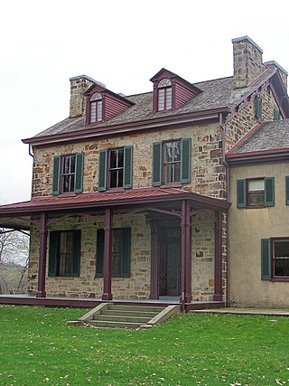
Fayette City is a borough in Fayette County, Pennsylvania, United States. The population was 502 at the 2020 census, a decline from the figure of 596 tabulated in 2010. It is served by the Belle Vernon Area School District. Some buildings in the town antedate 1820.

<span class="mw-page-title-main">Franklin Township, Fayette County, Pennsylvania</span> Township in Pennsylvania, United States

Franklin Township is a township in Fayette County, Pennsylvania, United States. The population was 2,380 at the 2020 census, a decline from the figure of 2,528 tabulated in 2010. The township is served by the Uniontown Area School District.

<span class="mw-page-title-main">German Township, Fayette County, Pennsylvania</span> Township in Pennsylvania, United States

German Township is a township in Fayette County, Pennsylvania, United States. The population was 4,672 at the 2020 census, a decline from the figure of 5,097 tabulated in 2010. McClellandtown is the township's largest village. The Albert Gallatin Area School District serves the region.

<span class="mw-page-title-main">Jefferson Township, Fayette County, Pennsylvania</span> Township in Pennsylvania, United States

Jefferson Township is a township in Fayette County, Pennsylvania, United States. The population was 2,007 at the 2020 census, a decline from the figure of 2,008 tabulated in 2010. It is named for former president Thomas Jefferson, and many of the township's streets are named after other U.S. presidents. Frazier School District serves the area.

<span class="mw-page-title-main">Luzerne Township, Pennsylvania</span> Township in Pennsylvania, United States

Luzerne Township is a township in Fayette County, Pennsylvania, United States. The population was 5,585 at the 2020 census, down from 5,965 at the 2010 census.

<span class="mw-page-title-main">Masontown, Pennsylvania</span> Borough in Pennsylvania, United States

Masontown is a borough in Fayette County, Pennsylvania, United States. It is part of the Pittsburgh Metro Area. The population of the borough was 3,274 at the 2020 census. It is served by the Albert Gallatin Area School District. Masontown is a small crossroads for the rural portions of western Fayette County, and it contains a small shopping center and a grocery store within its business district.

<span class="mw-page-title-main">Perry Township, Fayette County, Pennsylvania</span> Township in Pennsylvania, United States

Perry Township is a township in Fayette County, Pennsylvania, United States. The population was 2,339 at the 2020 census, a decline from the figure of 2,552 tabulated in 2010. The Frazier School District serves the township.

<span class="mw-page-title-main">Springhill Township, Fayette County, Pennsylvania</span> Township in Pennsylvania, United States

Springhill Township is a township in Fayette County, Pennsylvania, United States. The population was 2,726 at the 2020 census. The Albert Gallatin Area School District serves the region.

<span class="mw-page-title-main">Washington Township, Fayette County, Pennsylvania</span> Township in Pennsylvania, United States

Washington Township is a township in Fayette County, Pennsylvania, United States. The population was 3,899 at the 2020 census, down from 3,902 at the 2010 census.

<span class="mw-page-title-main">Monongahela Township, Pennsylvania</span> Township in Pennsylvania, United States

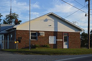
Monongahela Township is a township in Greene County, Pennsylvania, United States. The population was 1,483 at the 2020 census, down from 1,572 at the 2010 census.

<span class="mw-page-title-main">Charleroi, Pennsylvania</span> Borough in Pennsylvania, United States

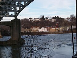
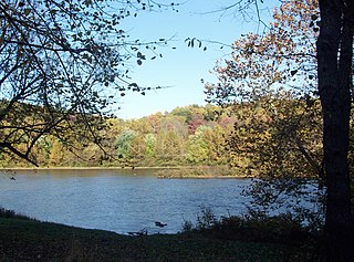
Charleroi is a borough in Washington County, Pennsylvania, United States, along the Monongahela River, 21 miles south of Pittsburgh.

<span class="mw-page-title-main">Dunlevy, Pennsylvania</span> Borough in Pennsylvania, United States

Dunlevy is a borough in Washington County, Pennsylvania, United States. The population was 369 at the 2020 census.

<span class="mw-page-title-main">Speers, Pennsylvania</span> Borough in Pennsylvania, United States

Speers is a borough that is located in Washington County, Pennsylvania, United States. The population was 1,087 at the time of the 2020 census.

<span class="mw-page-title-main">Rostraver Township, Pennsylvania</span> Township in Pennsylvania, United States

Rostraver Township is a township in Westmoreland County, Pennsylvania, United States. The population was 11,374 at the 2020 census.

Lynnwood-Pricedale is a census-designated place (CDP) in Fayette and Westmoreland counties in the Pennsylvania. The population was 2,031 at the 2010 census, down from 2,168 at the 2000 census. The community of Lynwood is located in Fayette County's Washington Township, while Pricedale is part of Westmoreland County's Rostraver Township.

<span class="mw-page-title-main">Pennsylvania Route 906</span> State highway in Pennsylvania, US

Pennsylvania Route 906 is a 10.6-mile-long (17.1 km) state highway located in Fayette, Westmoreland, and Allegheny counties in Pennsylvania. The southern terminus is at PA 201 in Washington Township. The northern terminus is at PA 136 in Forward Township.

<span class="mw-page-title-main">Belle Vernon Area School District</span> School district in Pennsylvania

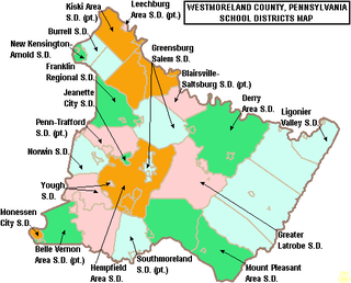
The Belle Vernon Area School District is a midsized, rural, public school district located approximately 25 miles (40 km) southeast of Pittsburgh in rural Westmoreland County and Fayette County. The present school district was formed by a merger of the previous Belmar and Rostraver school districts in 1965. The district serves five political subdivisions located in 2 counties: Washington Township, Fayette City, North Belle Vernon, Belle Vernon, and Rostraver Township. Belle Vernon Area School District area is 42.2 square miles (109 km2). Belle Vernon Area School District in southwestern Pennsylvania lies midway between the cities of Pittsburgh on the north, Uniontown on the south, Washington to the west, and Greensburg to the east. Belle Vernon Area School District had a population as of 2000 of 20,127 residents. By 2010, the district's population declined to 18,912 people. The educational attainment levels for the School District population were 91% high school graduates and 21.6% college graduates. The district is one of the 500 public school districts of Pennsylvania.

References

  1. "ArcGIS REST Services Directory". United States Census Bureau. Retrieved October 12, 2022.
  2. 1 2 "Census Population API". United States Census Bureau. Retrieved October 12, 2022.
  3. "Belle Vernon PA ZIP Code". zipdatamaps.com. 2023. Retrieved June 27, 2023.
  4. 1 2 Bureau, US Census. "City and Town Population Totals: 2020—2021". Census.gov. US Census Bureau. Retrieved July 24, 2022.
  5. "US Gazetteer files: 2010, 2000, and 1990". United States Census Bureau. February 12, 2011. Retrieved April 23, 2011.
  6. "Geographic Identifiers: 2010 Census Summary File 1 (G001), Belle Vernon borough, Pennsylvania". American FactFinder. U.S. Census Bureau. Archived from the original on February 13, 2020. Retrieved July 6, 2016.
  7. "Census of Population and Housing". U.S. Census Bureau. Retrieved December 11, 2013.
  8. 1 2 "U.S. Census website". United States Census Bureau . Retrieved January 31, 2008.
  9. "Incorporated Places and Minor Civil Divisions Datasets: Subcounty Resident Population Estimates: April 1, 2010 to July 1, 2012". Population Estimates. U.S. Census Bureau. Archived from the original on June 11, 2013. Retrieved December 11, 2013.
  10. "Census of Population and Housing". Census.gov. Retrieved June 4, 2016.
  11. "Robert Mountsier, former Sun editor", The New York Times, p. 34.