Bellingham Cruise Terminal

Last updated
Bellingham Cruise Terminal Bellingham Cruise Terminal 3100px.jpg
Bellingham Cruise Terminal
Interior of the terminal, set up for an event At Alaska Ferry Terminal. The Coop rents it for their party. (33528058325).jpg
Interior of the terminal, set up for an event
Vehicles waiting to drive onto a ferry docked at the terminal Vehicles waiting to drive onto ferry at Bellingham Cruise Terminal.jpg
Vehicles waiting to drive onto a ferry docked at the terminal

The Bellingham Cruise Terminal is a ferry terminal and transportation hub located in Bellingham, Washington, United States. It is near the Fairhaven neighborhood and was completed in 1989 [1] and provides easy interchange between various modes of transportation. Operated by the Port of Bellingham [2] the facility serves over 200,000 passengers a year. [1]

Contents

Services and associated facilities

Ferry services include weekly Friday departures and arrivals on the state-run Alaska Marine Highway System. [3] There is also an additional summer ferry on alternating Saturdays. Alaska-bound ferries also stop in Prince Rupert, British Columbia, providing a direct link between the lower 48 states and northern British Columbia. [4] [5]

The terminal offers regular passenger ferry access to the nearby San Juan Islands, operated by private companies. [6] [ unreliable source? ] [7] [8] [ unreliable source? ] It is home port for small cruise ships, whale watching boats and charter vessels. [9] [10] [ unreliable source? ] Beginning in September 2020, the terminal has also been home to a temporary ferry to Point Roberts, providing alternative access amid the COVID-19 pandemic and closure of the Canadian border. [11]

The cruise ship terminal is located adjacent to the Fairhaven train station, which is served by Amtrak's regional Cascades service. It is the northernmost stop in the United States, with trains continuing to Vancouver, British Columbia, and south to Seattle, Portland, Oregon, and Eugene, Oregon. [12] The building is owned by the Port of Bellingham and also serves as a Greyhound bus terminal. Whatcom Transportation Authority operates local buses between the terminal and other parts of Bellingham. [13] Private airport shuttles offer scheduled service to Bellingham International Airport. [13]

A visitor information center is nearby on Harris Street. The Cruise Terminal includes a restaurant, [1] short and long term parking, and vessel sewer pump-out. [14] [15] The terminal is accessed from Interstate 5 via State Route 11.[ citation needed ]

Future

Boulevard Park and Boardwalk and Bellingham Cruise Terminal Boulevard Park and Boardwalk and Bellingham Cruise Terminal.jpg
Boulevard Park and Boardwalk and Bellingham Cruise Terminal

The proposed 2019 budget from the Alaskan state government includes $100 million in cuts to the Alaska Marine Highway system, representing a loss of 75% of current funding. With the cuts, the ferry system could be modified into a seasonal, summer-only service, or cut entirely. [16] [17]

Related Research Articles

Transportation in Puerto Rico includes a system of roads, highways, freeways, airports, ports and harbors, and railway systems, serving a population of approximately 4 million year-round. It is funded primarily with both local and federal government funds.

<span class="mw-page-title-main">Bellingham, Washington</span> City in Washington, United States

Bellingham is the most populous city in, and county seat of, Whatcom County in the U.S. state of Washington. It lies 21 miles (34 km) south of the U.S.–Canada border and in between Vancouver, British Columbia and Seattle.

A ferry is a watercraft that carries passengers, and sometimes vehicles and cargo, across a body of water. A small passenger ferry with many stops, such as in Venice, Italy, is sometimes called a water taxi or water bus.

<span class="mw-page-title-main">Whatcom County, Washington</span> County in Washington, United States

Whatcom County is a county located in the northwestern corner of the U.S. state of Washington, bordered by the Lower Mainland of British Columbia to the north, Okanogan County to the east, Skagit County to the south, San Juan County across Rosario Strait to the southwest, and the Strait of Georgia to the west. Its county seat and largest population center is the coastal city of Bellingham, comprising the Bellingham, WA Metropolitan Statistical Area, and as of the 2020 census, the county's population was 226,847.

<span class="mw-page-title-main">Blaine, Washington</span> Border city in Washington, United States

Blaine is a city in Whatcom County, Washington, United States. The city's northern boundary is the Canada–U.S. border; the Peace Arch international monument straddles the border of both countries. The population was 5,884 at the 2020 census. Since Blaine is located right on the border with Canada, it is the northernmost city on Interstate 5.

<span class="mw-page-title-main">Fairhaven, Bellingham, Washington</span> United States historic place

Fairhaven was a settlement in Washington state founded in 1883 by Dan Harris. In 1903, it became part of the city of Bellingham.

<span class="mw-page-title-main">Alaska Marine Highway</span> Ferry system serving the U.S. state of Alaska

The Alaska Marine Highway (AMH) or the Alaska Marine Highway System (AMHS) is a ferry service operated by the U.S. state of Alaska. It has its headquarters in Ketchikan, Alaska.

<span class="mw-page-title-main">Bellingham International Airport</span> Airport in Whatcom County

Bellingham International Airport is three miles (5 km) northwest of Bellingham, in Whatcom County, Washington, United States. BLI covers 2,190 acres of land, and is the third-largest commercial airport in Washington.

<span class="mw-page-title-main">Washington State Route 11</span> Highway in Washington

State Route 11 (SR 11) is a 21.28-mile (34.25 km) long state highway that serves Skagit and Whatcom counties in the U.S. state of Washington. SR 11, known as Chuckanut Drive, begins at an interchange with Interstate 5 (I-5) north of Burlington and continues northwest through several small towns and the Chuckanut Mountains to the Fairhaven district of Bellingham, where the highway turns east and ends again at I-5.

MV <i>Matanuska</i>

MV Matanuska, colloquially known as the Mat, is a mainline Malaspina-class ferry vessel operated by the Alaska Marine Highway System.

MV <i>Columbia</i>

The M/V Columbia is a mainline ferry vessel for the Alaska Marine Highway System.

<span class="mw-page-title-main">Port of Jacksonville</span> Port in United States

The Port of Jacksonville (JAXPORT) is an international trade seaport on the St. Johns River in Jacksonville, Florida. JAXPORT is the largest port by volume in Florida, and the 14th largest container port in the United States. It carries about 18 million short tons of cargo each year and has an annual economic impact of over $31 billion, including 138,500 jobs across the state of Florida related to cargo moving through the port. It handled 1,338,000 containers, and is the second largest handler of vehicles in the United States with 696,500 in 2019.

<span class="mw-page-title-main">Fairhaven Station</span> Train station in Fairhaven, Washington

Fairhaven Station, also called Bellingham, is a train station serving Amtrak's Cascades route, as well as a bus station serving Greyhound Lines and local Whatcom Transportation Authority buses, in Bellingham, Washington, United States. Built in 1995, the station is located near the Bellingham Cruise Terminal, the southern connection for the Alaska Marine Highway. Water Taxi services and seasonal whale watching excursions also provide connections from the Bellingham Cruise Terminal to the San Juan Islands.

<span class="mw-page-title-main">Ferries in Washington (state)</span> Overview of ferry transportation in the U.S. state of Washington

The U.S. state of Washington is home to a number of public and private ferry systems, most notably the state-run Washington State Ferries.

<span class="mw-page-title-main">Transportation in New Jersey</span> Overview of the transportation in New Jersey

Transportation in New Jersey utilizes a combination of road, rail, air, and water modes. New Jersey is situated between Philadelphia and New York City, two major metropolitan centers of the Boston-Washington megalopolis, making it a regional corridor for transportation. As a result, New Jersey's freeways carry high volumes of interstate traffic and products. The main thoroughfare for long distance travel is the New Jersey Turnpike, the nation's fifth-busiest toll road. The Garden State Parkway connects the state's densely populated north to its southern shore region. New Jersey has the 4th smallest area of U.S. states, but its population density of 1,196 persons per sq. mi causes congestion to be a major issue for motorists.

Transportation in San Diego consists of a variety of air, road, sea, and public transportation options.

<i>General Miles</i>

General Miles was a steamship constructed in 1882 which served in various coastal areas of the states of Oregon and Washington, as well as British Columbia and the territory of Alaska. It was apparently named after US General Nelson A. Miles.

<span class="mw-page-title-main">Whatcom Chief</span> Ferry serving Lummi Island, Washington, US

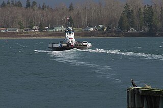
The Whatcom Chief is a ferry in Washington state, United States. The ferry carries both pedestrians and vehicles to Lummi Island from Gooseberry Point west of Bellingham, Washington.

<i>General Frisbie</i> (steamship) Steamship, built 1900

The steamship General Frisbie was a wooden two-deck passenger ship built in 1900, named after John B. Frisbie. She was designed for use as a ferry between Vallejo and San Francisco. The steamer was successful in that role and was the fastest ship on the route when she began service. Improved roads, bridges, and automobiles reduced demand for ferry service in the Bay Area, and newer ships were optimized for transporting cars, so General Frisbie was retired in the late 1920s.

MV <i>Tazlina</i>

MV Tazlina is a ferry operated by the Alaska Marine Highway System. It began serving Southeast Alaska Communities in 2019.

References

  1. 1 2 3 "Bellingham Cruise Terminal". Port of Bellingham.
  2. https://www.whatcomtalk.com/2018/11/02/bellingham-shipping-terminal-prepares-to-accept-international-cargo-vessels/%5B%5D%5B%5D
  3. "Alaska State Ferry – Alaska Marine Highway System". Alaska Department of Transportation & Public Facilities.
  4. "Prince Rupert British Columbia". Alaska Department of Transportation & Public Facilities.
  5. "Cruise to Alaska Like a Local – On the Ferry". Bellingham Whatcom County Tourism. February 1, 2019.
  6. "Passenger Ferries & Water Taxis". San Juan Islands Washington Visitors Bureau. November 29, 2011.
  7. "Travel by Ferry". Washington State Department of Transportation.
  8. "About the Island". Friday Harbor Travel Guide.
  9. "Passenger Ferries & Charters". Port of Bellingham.
  10. "Discover the San Juan Islands on a Small Ship Cruise out of Bellingham". Bellingham Whatcom County Tourism. February 1, 2019.
  11. Gallagher, Dave (September 2, 2020). "Demand for the first Point Roberts ferry was strong, so these changes are planned". The Bellingham Herald. Retrieved September 3, 2020.
  12. "Bellingham". Amtrak.
  13. 1 2 "Trains & Buses". Port of Bellingham.
  14. "Port of Bellingham". Washington State Parks and Recreation Commission.
  15. "Parking". Port of Bellingham.
  16. Gallagher, Dave (February 20, 2019). "With Alaska budget cuts looming, Bellingham could lose longtime ferry route". Bellingham Herald. Retrieved April 9, 2019.
  17. Lam, Kristin (March 10, 2019). "The end of Alaska's marine highway? Budget cuts threaten ferry system". USA Today . Retrieved April 9, 2019.

48°43′18″N122°30′45″W / 48.72167°N 122.51250°W / 48.72167; -122.51250