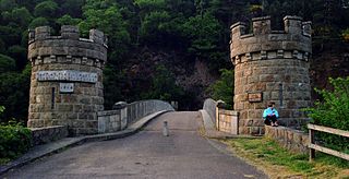
Oliver is a town near the south end of the Okanagan Valley in the Southern Interior of British Columbia, Canada, with a population of nearly 5,000 people. It is located along the Okanagan River by Tuc-el-nuit Lake between Osoyoos and Okanagan Falls, and is labelled as the Wine Capital of Canada by Tourism British Columbia. It was once "The Home of the Cantaloupe" as well as the "Home of the International Horseshow."

Westbank is one of the communities within the City of West Kelowna in the province of British Columbia. It is 12 km to the west of Kelowna. Other communities in West Kelowna include Casa Loma, West Kelowna Estates, Shannon Lake, Smith Creek, Glenrosa, Rose Valley and Lakeview Heights. Westbank sits to the south of West Kelowna.

The Monashee Mountains are a mountain range lying mostly in British Columbia, Canada, extending into the U.S. state of Washington. They stretch 530 km (329 mi) from north to south and 150 km (93 mi) from east to west. They are a sub-range of the Columbia Mountains. The highest summit is Mount Monashee, which reaches 3,274 m (10,741 ft). The name is from the Scottish Gaelic monadh and sìth, meaning "moor" and "peace".

Knight Inlet is one of the principal inlets of the British Columbia Coast, and the largest of the major inlets in the southern part of the Coast. It is fifth in sequence of the great saltwater inlets north from the 49th parallel near Vancouver, but it is the first whose outflow points away from the Strait of Georgia, opening into Queen Charlotte Strait at the Kwakwakaʼwakw community of Memkumlis on Village Island.

Cathedral Provincial Park and Protected Area, usually known as Cathedral Provincial Park and also as Cathedral Park, is a provincial park in British Columbia, Canada. It is located east of E.C. Manning Provincial Park, south of BC Highway 3, and southeast of the town of Princeton, and southwest of Keremeos. Its southern boundary is the border with the United States. Much of the park is the basin of the Ashnola River. Cathedral Park is home to teal sub-alpine lakes, vast ridges and jarred peaks, old-growth forests, and rock formations of siltstone, granodiorite, and basalt. Hikers can scramble along various peaks such as the 8000-foot Grimface Mountain and Lakeview Mountain. Tourists flock to Smokey the Bear and Stone City because of their unique formations with incredible views formed by millennia of erosion, volcanic and tectonic activity, and glacial recession.
Memory Island Provincial Park is a provincial park located on Vancouver Island in British Columbia, Canada. It was established by BC Parks on 23 August 1945 to protect a small island located at the southern end of Shawnigan Lake.

Craigellachie is a small village in Moray, Scotland, at the confluence of the River Spey and River Fiddich, in walking distance of the town of Aberlour.
Winfield is a neighbourhood and formal ward within the District Municipality of Lake Country, British Columbia, located adjacent to the northern city boundary of Kelowna.

Errington is a small community on Vancouver Island, British Columbia, Canada, located on Errington Road, off Highway 4, just south of Parksville and Qualicum Beach.
Lumby is a small community of 2,063 people, located near the edge of the Monashee Mountains. It is mainly a logging, manufacturing and agriculture community.

Lax-Kwʼalaams, previously called Port Simpson until 1986, is an Indigenous village community in British Columbia, Canada, not far from the city of Prince Rupert. It is located on Port Simpson Indian Reserve No. 1, which is shared with other residential communities of the Tsimshian Nation. The Nine Allied Tribes are: Gilutsʼaaw, Ginadoiks, Ginaxangiik, Gispaxloʼots, Gitando, Gitlaan, Gitsʼiis, Gitwilgyoots, and Gitzaxłaał.

Discovery Passage is a strait that forms part of the Inside Passage between Vancouver Island and the Discovery Islands of British Columbia. The strait is considered the most important natural passage for vessels' entering or leaving the Salish Sea from the north.

Princess Louisa Inlet is a fjord on British Columbia’s Sunshine Coast and within the swiya of the shíshálh Nation.
Burke Channel is a channel in the Central Coast region of the Canadian province of British Columbia, separating the south and east coasts of King Island from the mainland. It was first charted in 1792 by James Johnstone, one of George Vancouver's officers during his 1791-1795 expedition. Vancouver named it "Burke's Channel" after Edmund Burke.
Fisher Channel is a channel in the Central Coast region of the Canadian province of British Columbia. To its west are Hunter and Denny Islands, to its east King Island. It was first charted in 1793 by George Vancouver during his 1791-95 expedition. He named it "Fisher’s Channel" after "a much-respected friend" Reverend John Fisher.
Joseph William McKay (Mackay) (31 January 1829 – 17 December 1900) was a fur trader, businessman, politician and explorer who had a long career in the employ of the Hudson's Bay Company in Canada.
Global News: BC 1 is a Canadian English language specialty channel owned by Corus Entertainment and operated alongside the Corus-owned Global Television Network's Vancouver owned-and-operated television station CHAN-DT. The channel primarily broadcast local news for the province of British Columbia. The channel's branding is derived from the Global network and its news division Global News. It broadcasts from CHAN-DT's studios on 7850 Enterprise Street in Burnaby.

Oyama is a neighbourhood and formal ward located within the district municipality of Lake Country, which is located in the Okanagan region in British Columbia, Canada. It is located at the north end of Wood Lake and at the south end of Kalamalka Lake opposite BC Highway 97.

McIntyre Bluff, officially called nʕaylintn since 7 August 2015, is a large ridge of rock, made of gneiss, located south of Vaseux Lake between Okanagan Falls and Oliver in British Columbia, Canada. The bluff rises prominently over the surrounding valley and is one of the most well known landmarks in the Okanagan.


