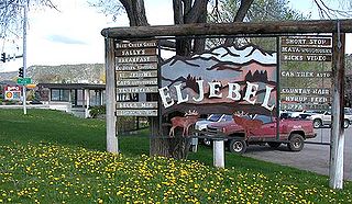
El Jebel is an unincorporated community and a census-designated place (CDP) located in and governed by Eagle County, Colorado, United States. The CDP is a part of the Edwards, CO Micropolitan Statistical Area. The population of the El Jebel CDP was 4,130 at the United States Census 2020. The Carbondale Post Office serves El Jebel postal addresses.
Deerfield is an unincorporated community and census-designated place (CDP) located within Upper Deerfield Township, Cumberland County, in the U.S. state of New Jersey. It was first listed as a CDP in the 2020 census with a population of 230.
Stanley is an unincorporated community in Santa Fe County, New Mexico. The ZIP code is 87056.
Fernwood is a census-designated place and unincorporated community in Pike County, Mississippi, United States. Its ZIP code is 39635.
Zortman is a census-designated place and unincorporated community in Phillips County, Montana, United States. Its population was 69 as of the 2010 census. Zortman has a post office with ZIP code 59546.
Grenloch is an unincorporated community and census-designated place (CDP) located within Washington Township, in Gloucester County, in the U.S. state of New Jersey. Grenloch is located along New Jersey Route 168 10.25 miles (16.50 km) south-southeast of Camden. Grenloch has a post office with ZIP Code 08032.

Dividing Creek is an unincorporated community and census-designated place (CDP) located in Downe Township in Cumberland County, in the U.S. state of New Jersey.
Shawmut is a census-designated place and unincorporated community in Wheatland County, Montana, United States. Its population was 42 as of the 2010 census. Shawmut has a post office with ZIP code 59078, which opened on October 27, 1885. The community is located along U.S. Route 12 and Montana Highway 3.
Buckhorn is a census-designated place in Grant County, New Mexico, United States. Its population was 200 as of the 2010 census. Buckhorn has a post office with ZIP code 88025. U.S. Route 180 passes through the community. The post office was established in 1913. Buckhorn was named for the nearby Buckhorn Creek.
Watrous is a census-designated place in Mora County, New Mexico, United States. Its population was 135 as of the 2010 census. Watrous has a post office with ZIP code 87753, which opened on April 14, 1868. The community is located along Interstate 25. It was named after merchant and landowner Samuel Watrous, who moved to New Mexico from Vermont in 1835.
Bent is a census-designated place in Otero County, New Mexico, United States. Its population was 119 as of the 2010 census. Bent has a post office with ZIP code 88314. U.S. Route 70 passes through the community.

Cubero is a census-designated place in Cibola County, New Mexico, United States. Its population was 289 as of the 2010 census. Cubero has a post office with ZIP code 87014. The town was founded by Mexicans and was along the route of the Santa Fe Railroad's first transcontinental rail line through the Southwestern United States.

La Joya is a census-designated place in Socorro County, New Mexico, United States. The community is located on the east bank of the Rio Grande, 20 miles (32 km) north of Socorro. Its population was 82 as of the 2010 census. La Joya has a post office with ZIP code 87028, which opened on February 28, 1883.
Sandia Park is a census-designated place in Bernalillo County, New Mexico, United States. Its population was 237 as of the 2010 census and 265 as of the 2020 census. Sandia Park has a post office with ZIP code 87047.
McIntosh is a census-designated place in Torrance County, New Mexico, United States. Its population was 1,484 as of the 2010 census. McIntosh has a post office with ZIP code 87032, which opened on August 28, 1906. New Mexico State Road 41 passes through the community.
Canjilon is a census-designated place in Rio Arriba County, New Mexico, United States. Its population was 256 as of the 2010 census. Canjilon has a post office with ZIP code 87515. The community is located along New Mexico State Road 115. Canjilon was first settled in 1870, and by 1880, 35 families lived here.
Blanco is a census-designated place in San Juan County, New Mexico, United States. Its population was 388 as of the 2010 census. Blanco has a post office with ZIP code 87412, which opened on March 6, 1901. U.S. Route 64 passes through the community.
La Plata is a census-designated place in San Juan County, New Mexico, United States. Its population was 612 as of the 2010 census. La Plata has a post office with ZIP code 87418. The community is located at the junction of state roads 170 and 574.
Navajo Dam is a census-designated place in San Juan County, New Mexico, United States. Its population was 253 as of the 2020 census. Navajo Dam has a post office with ZIP code 87419. The community is located in the vicinity of Navajo Dam.
Lemitar is a census-designated place in Socorro County, New Mexico, United States. Its population was 330 as of the 2010 census. Lemitar has a post office with ZIP code 87823. Exit 156 on Interstate 25 serves the community.