
Prairies are ecosystems considered part of the temperate grasslands, savannas, and shrublands biome by ecologists, based on similar temperate climates, moderate rainfall, and a composition of grasses, herbs, and shrubs, rather than trees, as the dominant vegetation type. Temperate grassland regions include the pampas of Argentina, Brazil and Uruguay, and the steppe of Ukraine, Russia and Kazakhstan. Lands typically referred to as "prairie" tend to be in North America. The term encompasses the area referred to as the Interior Lowlands of Canada, the United States, and Mexico, which includes all of the Great Plains as well as the wetter, hillier land to the east.

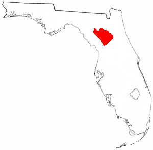
Alachua County is a county located in the north central portion of the U.S. state of Florida. As of the 2010 census, the population was 247,336. The county seat is Gainesville, the home of the University of Florida since 1906, when the campus opened with 106 students.

Gainesville is the county seat of, and the largest city in, Alachua County, Florida, and is both the principal city of the Gainesville, Florida, metropolitan statistical area and the largest city in North Central Florida. In 2019 the US Census Bureau estimated Gainesville's population at 133,997, a 7.6% increase from 2010, and the metropolitan statistical area's population at 288,212.

Corkscrew Swamp Sanctuary is a National Audubon Society sanctuary located in southwest Florida, north of Naples, Florida and east of Bonita Springs, in the United States. The sanctuary was established to protect one of the largest remaining stands of bald cypress and pond cypress in North America from extensive logging that was ongoing throughout the 1940s and 1950s.
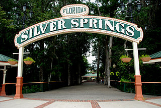
Silver Springs is an unincorporated community in Marion County, Florida, United States. It is the site of Silver Springs, a group of artesian springs and a historic tourist attraction that is now part of Silver Springs State Park. The community is part of the Ocala metropolitan area.

Blackburn Lake Sanctuary is an example of regenerated and remnant bushland in suburban Melbourne, Australia. It is located in the suburb of Blackburn. It is the most significant of the many parks in the City of Whitehorse, featuring areas of regenerated bushland and various walking tracks.

The Ocala National Forest ls the second largest nationally protected forest in the U.S. State of Florida. It covers 607 square miles (1,570 km2) of Central Florida. It is located three miles (5 km) east of Ocala and 16 miles (26 km) southeast of Gainesville. The Ocala National Forest, established in 1908, is the oldest national forest east of the Mississippi River and the southernmost national forest in the continental U.S. The word Ocala is thought to be a derivative of a Timucuan term meaning "fair land" or "big hammock". The forest is headquartered in Tallahassee, as are all three National Forests in Florida, but there are local ranger district offices located in Silver Springs and Umatilla.

Paynes Prairie Preserve State Park is a Florida State Park, encompassing a 21,000-acre (85 km2) savanna in Alachua County, Florida lying between Micanopy and Gainesville. It is also a U.S. National Natural Landmark. It is crossed by both I-75 and U.S. 441. It is in the center of the Paynes Prairie Basin. The basin's primary source of drainage is Alachua Sink. During occasional wet periods, the basin will become full. A notable period occurred from 1871 to 1891 when the Alachua Sink was temporarily blocked. During this period, shallow draft steamboats were a frequent sight on Alachua Lake in the center of the prairie. The region was also historically known as the Alachua Savannah. Its drainage has been modified by several canals. Since 1927, Camps Canal has linked the basin to the River Styx which leads to Orange Lake and eventually the Atlantic Ocean through the St. Johns River. That reduced the basins water intake by half. Additional changes to the prairie's environment have been detrimental to its hydrology. In 1970, the state of Florida acquired the land and has been in the process of restoring the environment to a more natural condition ever since.

Gainesville-Hawthorne State Trail is a rail trail in Florida.
The Cades Pond culture is defined as a Middle Woodland Southeast period archaeological culture in north-central Florida, dating from around 100 to 600 CE.

Long Lake Provincial Park is located in Halifax, Nova Scotia, Canada. It was initiated in 1981 by then Premier John Buchanan after Halifax's water supply had been shifted from the Spruce Hill/Long Lake/Chain Lakes watershed to the Pockwock Lake watershed near Hammonds Plains. The 2095-hectare park, formally established in 1984, constitutes the bulk of these former watershed lands. Other portions were deeded to the municipality of Halifax, and the area around the Chain Lakes is still administered by the Halifax Regional Water Commission, since the Chain Lakes remain the city's emergency water supply.
Lake Lafayette is a prairie lake located in the coastal lowland in eastern Tallahassee, Leon County, Florida with US 27 / State Road 20 running close on its south side.
In 1999, the Guana Tolomato Matanzas National Estuarine Research Reserve was designated in St. Johns and Flagler counties, Florida as a part of the National Oceanic and Atmospheric Administration (NOAA) National Estuarine Research Reserve (NERR) system. The GTM Research Reserve represents the east Florida sub-region of the Carolinian bioregion. It is one of 29 NERRs in 23 states and one territory. GTM is one of three NERRs in Florida, and is administered on behalf of the state by the Florida Department of Environmental Protection's Florida Coastal Office as part of a network that includes forty-one aquatic preserves, three NERRs, a National Marine Sanctuary, the Coral Reef Conservation Program and the Florida Oceans and Coastal Council. Additional interests are held in the research and management of the GTM and connected preserved or conserved lands including:

Newnans Lake is a lake located off State Road 20, east of Gainesville, Florida. Approximately 1.12 miles (2 km) wide, Newnans Lake is home to many forms of wildlife, and had been designated as a protected site by Alachua County. It was earlier known as Lake Pithlachocco.

Alachua County, Florida is home to six state parks. Two of them are also National Natural Landmarks, one is a historic district, one is a National Historic Landmark, and one is a rail trail. Unless otherwise noted, all of the parks adhere to the Florida State Parks schedule; Florida state parks are open between 8 a.m. and sundown every day of the year.
State Road 331 is a short state highway running south and east of Gainesville, although it once stretched as far south as Williston. It also serves as a truck route for State Roads 24, 26, and 121 and US 441. Despite skirting the Gainesville City Limits, SR 331 runs north and south as a four-lane divided rural highway.

North Florida is a region of the U.S. state of Florida, comprising the northernmost part of the state. It is one of Florida's three most common "directional" regions, along with South Florida and Central Florida. It includes Jacksonville and nearby localities in Northeast Florida, an interior region known as North Central Florida, and the Florida Panhandle.
The Land Between the Lakes National Recreation Area is a United States National Recreation Area located in Kentucky and Tennessee between Lake Barkley and Kentucky Lake. The area was designated as a national recreation area in 1963 by President John F. Kennedy.
The city of Gainesville, Florida, USA, was incorporated in 1869.


