Drainage basin

Last updated
The Mississippi River drains the largest area of any U.S. river, much of it agricultural regions. Agricultural runoff and other water pollution that flows to the outlet is the cause of the hypoxic, or dead zone in the Gulf of Mexico. Major River Systems within the Mississippi River Basin.svg
The Mississippi River drains the largest area of any U.S. river, much of it agricultural regions. Agricultural runoff and other water pollution that flows to the outlet is the cause of the hypoxic, or dead zone in the Gulf of Mexico.

A drainage basin is an area of land where all flowing surface water converges to a single point, such as a river mouth, or flows into another body of water, such as a lake or ocean. A basin is separated from adjacent basins by a perimeter, the drainage divide , [1] made up of a succession of elevated features, such as ridges and hills. A basin may consist of smaller basins that merge at river confluences, forming a hierarchical pattern. [2]

Contents

Other terms for a drainage basin are catchment area, catchment basin, drainage area, river basin, water basin, [3] [4] and impluvium. [5] [6] [7] In North America, they are commonly called a watershed, though in other English-speaking places, "watershed" is used only in its original sense, that of a drainage divide.

A drainage basin's boundaries are determined by watershed delineation, a common task in environmental engineering and science.

In a closed drainage basin, or endorheic basin, rather than flowing to the ocean, water converges toward the interior of the basin, known as a sink, which may be a permanent lake, a dry lake, or a point where surface water is lost underground. [8]

Drainage basins are similar but not identical to hydrologic unit code, which are drainage areas delineated so as to nest into a multi-level hierarchical drainage system. Hydrologic units are defined to allow multiple inlets, outlets, or sinks. In a strict sense, all drainage basins are hydrologic units but not all hydrologic units are drainage basins. [8]

Major drainage basins of the world

Major continental divides, showing how terrestrial drainage basins drain into the oceans. Grey areas are endorheic basins that do not drain to the oceans Ocean drainage.png
Major continental divides, showing how terrestrial drainage basins drain into the oceans. Grey areas are endorheic basins that do not drain to the oceans

Ocean basins

About 48.71% of the world's land drains to the Atlantic Ocean.[ citation needed ] In North America, surface water drains to the Atlantic via the Saint Lawrence River and Great Lakes basins, the Eastern Seaboard of the United States, the Canadian Maritimes, and most of Newfoundland and Labrador. Nearly all of South America east of the Andes also drains to the Atlantic, as does most of Western and Central Europe and the greatest portion of western Sub-Saharan Africa, as well as Western Sahara and part of Morocco.

The two major mediterranean seas of the world also flow to the Atlantic. The Caribbean Sea and Gulf of Mexico basin includes most of the U.S. interior between the Appalachian and Rocky Mountains, a small part of the Canadian provinces of Alberta and Saskatchewan, eastern Central America, the islands of the Caribbean and the Gulf, and a small part of northern South America. The Mediterranean Sea basin, with the Black Sea, includes much of North Africa, east-central Africa (through the Nile River), Southern, Central, and Eastern Europe, Turkey, and the coastal areas of Israel, Lebanon, and Syria.

The Arctic Ocean drains most of Western Canada and Northern Canada east of the Continental Divide, northern Alaska and parts of North Dakota, South Dakota, Minnesota, and Montana in the United States, the north shore of the Scandinavian peninsula in Europe, central and northern Russia, and parts of Kazakhstan and Mongolia in Asia, which totals to about 17% of the world's land. [9]

Just over 13% of the land in the world drains to the Pacific Ocean. [9] Its basin includes much of China, eastern and southeastern Russia, Japan, the Korean Peninsula, most of Indochina, Indonesia and Malaysia, the Philippines, all of the Pacific Islands, the northeast coast of Australia, and Canada and the United States west of the Continental Divide (including most of Alaska), as well as western Central America and South America west of the Andes.

The Indian Ocean's drainage basin also comprises about 13% of Earth's land. It drains the eastern coast of Africa, the coasts of the Red Sea and the Persian Gulf, the Indian subcontinent, Burma, and most parts of Australia. [10]

Largest river basins

The five largest river basins (by area), from largest to smallest, are those of the Amazon (7M km2), the Congo (4M km2), the Nile (3.4M km2), the Mississippi (3.22M km2), and the Río de la Plata (3.17M km2). The three rivers that drain the most water, from most to least, are the Amazon, Ganges, and Congo rivers. [11]

Endorheic drainage basins

Endorheic basin in Central Asia Uureg Nuur.jpg
Endorheic basin in Central Asia

Endorheic basin are inland basins that do not drain to an ocean. Endorheic basins cover around 18% of the Earth's land. Some endorheic basins drain to an Endorheic lake or Inland sea. Many of these lakes are ephemeral or vary dramatically in size depending on climate and inflow. If water evaporates or infiltrates into the ground at its terminus, the area can go by several names, such playa, salt flat, dry lake, or alkali sink.

The largest endorheic basins are in Central Asia, including the Caspian Sea, the Aral Sea, and numerous smaller lakes. Other endorheic regions include the Great Basin in the United States, much of the Sahara Desert, the drainage basin of the Okavango River (Kalahari Basin), highlands near the African Great Lakes, the interiors of Australia and the Arabian Peninsula, and parts in Mexico and the Andes. Some of these, such as the Great Basin, are not single drainage basins but collections of separate, adjacent closed basins.

In endorheic bodies of water where evaporation is the primary means of water loss, the water is typically more saline than the oceans. An extreme example of this is the Dead Sea.[ citation needed ]

Importance

Geopolitical boundaries

Drainage basins have been historically important for determining territorial boundaries, particularly in regions where trade by water has been important. For example, the English crown gave the Hudson's Bay Company a monopoly on the fur trade in the entire Hudson Bay basin, an area called Rupert's Land. Bioregional political organization today includes agreements of states (e.g., international treaties and, within the US, interstate compacts) or other political entities in a particular drainage basin to manage the body or bodies of water into which it drains. Examples of such interstate compacts are the Great Lakes Commission and the Tahoe Regional Planning Agency.

Hydrology

Drainage basin of the Ohio River, part of the Mississippi River drainage basin Ohiorivermap.png
Drainage basin of the Ohio River, part of the Mississippi River drainage basin

In hydrology, the drainage basin is a logical unit of focus for studying the movement of water within the hydrological cycle. The process of finding a drainage boundary is referred to as watershed delineation. Finding the area and extent of a drainage basin is an important step in many areas of science and engineering.

The majority of water that discharges from the basin outlet originated as precipitation falling on the basin. [12] A portion of the water that enters the groundwater system beneath the drainage basin may flow towards the outlet of another drainage basin because groundwater flow directions do not always match those of their overlying drainage network. Measurement of the discharge of water from a basin may be made by a stream gauge located at the basin's outlet. Depending on the conditions of the drainage basin, as rainfall occurs some of it seeps directly into the ground. This water will either remain underground, slowly making its way downhill and eventually reaching the basin, or it will permeate deeper into the soil and consolidate into groundwater aquifers. [13]

As water flows through the basin, it can form tributaries that change the structure of the land. There are three different main types, which are affected by the rocks and ground underneath. Rock that is quick to erode forms dendritic patterns, and these are seen most often. The two other types of patterns that form are trellis patterns and rectangular patterns. [14]

Rain gauge data is used to measure total precipitation over a drainage basin, and there are different ways to interpret that data. If the gauges are many and evenly distributed over an area of uniform precipitation, using the arithmetic mean method will give good results. In the Thiessen polygon method, the drainage basin is divided into polygons with the rain gauge in the middle of each polygon assumed to be representative for the rainfall on the area of land included in its polygon. These polygons are made by drawing lines between gauges, then making perpendicular bisectors of those lines form the polygons. The isohyetal method involves contours of equal precipitation are drawn over the gauges on a map. Calculating the area between these curves and adding up the volume of water is time-consuming.

Isochrone maps can be used to show the time taken for runoff water within a drainage basin to reach a lake, reservoir or outlet, assuming constant and uniform effective rainfall. [15] [16] [17] [18]

Geomorphology

Drainage basins are the principal hydrologic unit considered in fluvial geomorphology. A drainage basin is the source for water and sediment that moves from higher elevation through the river system to lower elevations as they reshape the channel forms.

Ecology

Top-down illustration of a dendritic drainage basin. The dashed line is the main water divide of the hydrography basin. Hydrographic basin.svg
Top-down illustration of a dendritic drainage basin. The dashed line is the main water divide of the hydrography basin.
Digital terrain map of the Latorita River's drainage basin in Romania EN Bazinul hidrografic al Raului Latorita, Romania.jpg
Digital terrain map of the Latorița River's drainage basin in Romania

Drainage basins are important in ecology. As water flows over the ground and along rivers it can pick up nutrients, sediment, and pollutants. With the water, they are transported towards the outlet of the basin, and can affect the ecological processes along the way as well as in the receiving water body.

Modern use of artificial fertilizers, containing nitrogen (as nitrates), phosphorus, and potassium, has affected the mouths of drainage basins. The minerals are carried by the drainage basin to the mouth, and may accumulate there, disturbing the natural mineral balance. This can cause eutrophication where plant growth is accelerated by the additional material.

Resource management

Because drainage basins are coherent entities in a hydrological sense, it has become common to manage water resources on the basis of individual basins. In the U.S. state of Minnesota, governmental entities that perform this function are called "watershed districts". [19] In New Zealand, they are called catchment boards. Comparable community groups based in Ontario, Canada, are called conservation authorities. In North America, this function is referred to as "watershed management". In Brazil, the National Policy of Water Resources, regulated by Act n° 9.433 of 1997, establishes the drainage basin as the territorial division of Brazilian water management.

When a river basin crosses at least one political border, either a border within a nation or an international boundary, it is identified as a transboundary river. Management of such basins becomes the responsibility of the countries sharing it. Nile Basin Initiative, OMVS for Senegal River, Mekong River Commission are a few examples of arrangements involving management of shared river basins.

Management of shared drainage basins is also seen as a way to build lasting peaceful relationships among countries. [20]

Catchment factors

The catchment is the most significant factor determining the amount or likelihood of flooding.

Catchment factors are: topography, shape, size, soil type, and land use (paved or roofed areas). Catchment topography and shape determine the time taken for rain to reach the river, while catchment size, soil type, and development determine the amount of water to reach the river.

Topography

Generally, topography plays a big part in how fast runoff will reach a river. Rain that falls in steep mountainous areas will reach the primary river in the drainage basin faster than flat or lightly sloping areas (e.g., > 1% gradient).

Shape

Shape will contribute to the speed with which the runoff reaches a river. A long thin catchment will take longer to drain than a circular catchment.

Size

Size will help determine the amount of water reaching the river, as the larger the catchment the greater the potential for flooding. It is also determined on the basis of length and width of the drainage basin.

Soil type

Soil type will help determine how much water reaches the river. The runoff from the drainage area is dependent on the soil type. Certain soil types such as sandy soils are very free-draining, and rainfall on sandy soil is likely to be absorbed by the ground. However, soils containing clay can be almost impermeable and therefore rainfall on clay soils will run off and contribute to flood volumes. After prolonged rainfall even free-draining soils can become saturated, meaning that any further rainfall will reach the river rather than being absorbed by the ground. If the surface is impermeable the precipitation will create surface run-off which will lead to higher risk of flooding; if the ground is permeable, the precipitation will infiltrate the soil. [5]

Land use

Land use can contribute to the volume of water reaching the river, in a similar way to clay soils. For example, rainfall on roofs, pavements, and roads will be collected by rivers with almost no absorption into the groundwater. A drainage basin is an area of land where all flowing surface water converges to a single point, such as a river mouth, or flows into another body of water, such as a lake or ocean.

See also

Related Research Articles

<span class="mw-page-title-main">Hydrology</span> Science of the movement, distribution, and quality of water on Earth and other planets

Hydrology is the scientific study of the movement, distribution, and management of water on Earth and other planets, including the water cycle, water resources, and drainage basin sustainability. A practitioner of hydrology is called a hydrologist. Hydrologists are scientists studying earth or environmental science, civil or environmental engineering, and physical geography. Using various analytical methods and scientific techniques, they collect and analyze data to help solve water related problems such as environmental preservation, natural disasters, and water management.

<span class="mw-page-title-main">Flood</span> Water overflow submerging usually-dry land

A flood is an overflow of water that submerges land that is usually dry. In the sense of "flowing water", the word may also be applied to the inflow of the tide. Floods are an area of study of the discipline hydrology and are of significant concern in agriculture, civil engineering and public health. Human changes to the environment often increase the intensity and frequency of flooding, for example land use changes such as deforestation and removal of wetlands, changes in waterway course or flood controls such as with levees, and larger environmental issues such as climate change and sea level rise. In particular climate change's increased rainfall and extreme weather events increases the severity of other causes for flooding, resulting in more intense floods and increased flood risk.

<span class="mw-page-title-main">Endorheic basin</span> Closed drainage basin that allows no outflow

An endorheic basin is a drainage basin that normally retains water and allows no outflow to other, external bodies of water ; instead, the water drainage flows into permanent and seasonal lakes and swamps that equilibrate through evaporation. Endorheic basins are also called closed basins, terminal basins, and internal drainage systems.

<span class="mw-page-title-main">Hydrograph</span>

A hydrograph is a graph showing the rate of flow (discharge) versus time past a specific point in a river, channel, or conduit carrying flow. The rate of flow is typically expressed in cubic meters or cubic feet per second . Hydrographs often relate changes of precipitation to changes in discharge over time. It can also refer to a graph showing the volume of water reaching a particular outfall, or location in a sewerage network. Graphs are commonly used in the design of sewerage, more specifically, the design of surface water sewerage systems and combined sewers.

In hydrology, discharge is the volumetric flow rate of a stream. It equals the product of average flow velocity and the cross-sectional area. It includes any suspended solids, dissolved chemicals, or biologic material in addition to the water itself. Terms may vary between disciplines. For example, a fluvial hydrologist studying natural river systems may define discharge as streamflow, whereas an engineer operating a reservoir system may equate it with outflow, contrasted with inflow.

The United States Environmental Protection Agency (EPA) Storm Water Management Model (SWMM) is a dynamic rainfall–runoff–subsurface runoff simulation model used for single-event to long-term (continuous) simulation of the surface/subsurface hydrology quantity and quality from primarily urban/suburban areas.

<span class="mw-page-title-main">Surface runoff</span> Flow of excess rainwater not infiltrating in the ground over its surface

Surface runoff is the unconfined flow of water over the ground surface, in contrast to channel runoff. It occurs when excess rainwater, stormwater, meltwater, or other sources, can no longer sufficiently rapidly infiltrate in the soil. This can occur when the soil is saturated by water to its full capacity, and the rain arrives more quickly than the soil can absorb it. Surface runoff often occurs because impervious areas do not allow water to soak into the ground. Furthermore, runoff can occur either through natural or human-made processes.

Runoff is the flow of water across the earth, and is a major component in the hydrological cycle. Runoff that flows over land before reaching a watercourse is referred to as surface runoff or overland flow. Once in a watercourse, runoff is referred to as streamflow, channel runoff, or river runoff. Urban runoff is surface runoff created by urbanization.

<span class="mw-page-title-main">Water balance</span> Looks at how water moves in a closed system

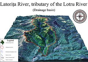
The law of water balance states that the inflows to any water system or area is equal to its outflows plus change in storage during a time interval. In hydrology, a water balance equation can be used to describe the flow of water in and out of a system. A system can be one of several hydrological or water domains, such as a column of soil, a drainage basin, an irrigation area or a city.

Streamflow, or channel runoff, is the flow of water in streams and other channels, and is a major element of the water cycle. It is one runoff component, the movement of water from the land to waterbodies, the other component being surface runoff. Water flowing in channels comes from surface runoff from adjacent hillslopes, from groundwater flow out of the ground, and from water discharged from pipes. The discharge of water flowing in a channel is measured using stream gauges or can be estimated by the Manning equation. The record of flow over time is called a hydrograph. Flooding occurs when the volume of water exceeds the capacity of the channel.

<span class="mw-page-title-main">Hydrological transport model</span>

An hydrological transport model is a mathematical model used to simulate the flow of rivers, streams, groundwater movement or drainage front displacement, and calculate water quality parameters. These models generally came into use in the 1960s and 1970s when demand for numerical forecasting of water quality and drainage was driven by environmental legislation, and at a similar time widespread access to significant computer power became available. Much of the original model development took place in the United States and United Kingdom, but today these models are refined and used worldwide.

Open and closed lakes refer to the major subdivisions of lakes – bodies of water surrounded by land. Exorheic, or open, lakes drain into a river or other body of water that ultimately drains into the ocean. Endorheic basins fall into the category of endorheic or closed lakes, wherein waters do not drain into the ocean, but are reduced by evaporation, and/or drain into the ground.

<span class="mw-page-title-main">Continental divide</span> Drainage divide on a continent

A continental divide is a drainage divide on a continent such that the drainage basin on one side of the divide feeds into one ocean or sea, and the basin on the other side either feeds into a different ocean or sea, or else is endorheic, not connected to the open sea. Every continent on earth except Antarctica has at least one continental drainage divide; islands, even small ones like Killiniq Island on the Labrador Sea in Canada, may also host part of a continental divide or have their own island-spanning divide. The endpoints of a continental divide may be coastlines of gulfs, seas or oceans, the boundary of an endorheic basin, or another continental divide. One case, the Great Basin Divide, is a closed loop around an endorheic basin. The endpoints where a continental divide meets the coast are not always definite since the exact border between adjacent bodies of water is usually not clearly defined. The International Hydrographic Organization's publication Limits of Oceans and Seas defines exact boundaries of oceans, but it is not universally recognized. Where a continental divide meets an endorheic basin, such as the Great Divide Basin of Wyoming, the continental divide splits and encircles the basin. Where two divides intersect, they form a triple divide, or a tripoint, a junction where three watersheds meet.

<span class="mw-page-title-main">Stream</span> Body of surface water flowing down a channel

A stream is a continuous body of surface water flowing within the bed and banks of a channel. Depending on its location or certain characteristics, a stream may be referred to by a variety of local or regional names. Long, large streams are usually called rivers, while smaller, less voluminous and more intermittent streams are known as streamlets, brooks or creeks.

The following outline is provided as an overview of and topical guide to hydrology:

<span class="mw-page-title-main">Vflo</span>

Vflo is a commercially available, physics-based distributed hydrologic model generated by Vieux & Associates, Inc. Vflo uses radar rainfall data for hydrologic input to simulate distributed runoff. Vflo employs GIS maps for parameterization via a desktop interface. The model is suited for distributed hydrologic forecasting in post-analysis and in continuous operations. Vflo output is in the form of hydrographs at selected drainage network grids, as well as distributed runoff maps covering the watershed. Model applications include civil infrastructure operations and maintenance, stormwater prediction and emergency management, continuous and short-term surface water runoff, recharge estimation, soil moisture monitoring, land use planning, water quality monitoring, and water resources management.

DPHM-RS is a semi-distributed hydrologic model developed at University of Alberta, Canada.

The flash flood guidance system (FFGS) was designed and developed by the Hydrologic Research Center, a non-profit public-benefit corporation located in San Diego, CA, US, for use by meteorological and hydrologic forecasters throughout the world. The primary purpose of the FFGS is to provide operational forecasters and disaster management agencies with real-time information pertaining to the threat of small-scale flash flooding throughout a specified region.

<span class="mw-page-title-main">South Lahontan hydrologic region</span> Regional subdivision, CA Dept of Water Resources

The South Lahonton is a hydrologic region defined by the State of California that encompasses several interior basins east of the Sierra Nevada and the Transverse Ranges, with an area of 17 million acres (69,000 km2). It covers the western portion of the Mojave Desert and a southwestern portion of the Great Basin desert, and extends into the forests of the southeastern Sierra Nevada and the montane chaparral and woodlands of the northeastern Transverse ranges. The ecoregion has an arid to semi-arid climate, with average annual rainfall of 7.9 inches (200 mm).

References

  1. "drainage basin". The Physical Environment. University of Wisconsin–Stevens Point. Archived from the original on March 21, 2004.
  2. "What is a watershed and why should I care?". University of Delaware. Archived from the original on 2012-01-21. Retrieved 2008-02-11.
  3. Lambert, David (1998). The Field Guide to Geology . Checkmark Books. pp.  130–13. ISBN   0-8160-3823-6.
  4. Uereyen, Soner; Kuenzer, Claudia (9 December 2019). "A Review of Earth Observation-Based Analyses for Major River Basins". Remote Sensing. 11 (24): 2951. Bibcode:2019RemS...11.2951U. doi: 10.3390/rs11242951 .
  5. 1 2 Huneau, F.; Jaunat, J.; Kavouri, K.; Plagnes, V.; Rey, F.; Dörfliger, N. (2013-07-18). "Intrinsic vulnerability mapping for small mountainous karst aquifers, implementation of the new PaPRIKa method to Western Pyrenees (France)". Engineering Geology. 161. Elsevier: 81–93. Bibcode:2013EngGe.161...81H. doi:10.1016/j.enggeo.2013.03.028. Efficient management is strongly correlated to the proper protection perimeter definition around springs and proactive regulation of land uses over the spring's catchment area ("impluvium").
  6. Lachassagne, Patrick (2019-02-07). "Natural mineral waters". Encyclopédie de l'environnement. Retrieved 2019-06-10. In order to preserve the long-term stability and purity of natural mineral water, bottlers have put in place "protection policies" for the impluviums (or catchment areas) of their sources. The catchment area is the territory on which the part of precipitated rainwater and/or snowmelt that infiltrates the subsoil feeds the mineral aquifer and thus contributes to the renewal of the resource. In other words, a precipitated drop on the impluvium territory may join the mineral aquifer; ...
  7. Labat, D.; Ababou, R.; Manginb, A. (2000-12-05). "Rainfall–runoff relations for karstic springs. Part I: convolution and spectral analyses". Journal of Hydrology. 238 (3–4): 123–148. Bibcode:2000JHyd..238..123L. doi:10.1016/S0022-1694(00)00321-8. The non-karstic impluvium comprises all elements of the ground surface and soils that are poorly permeable, on a part of which water is running while also infiltrating on another minor part. This superficial impluvium, if it exists, constitutes the first level of organization of the drainage system of the karstic basin.
  8. 1 2 "Hydrologic Unit Geography". Virginia Department of Conservation & Recreation. Archived from the original on 14 December 2012. Retrieved 21 November 2010.
  9. 1 2 Vörösmarty, C. J.; Fekete, B. M.; Meybeck, M.; Lammers, R. B. (2000). "Global system of rivers: Its role in organizing continental land mass and defining land-to-ocean linkages". Global Biogeochemical Cycles. 14 (2): 599–621. Bibcode:2000GBioC..14..599V. doi: 10.1029/1999GB900092 . ISSN   1944-9224. S2CID   129463497. Archived from the original on 2021-08-15. Retrieved 2021-08-15.
  10. "Largest Drainage Basins in the World". WorldAtlas. 17 May 2018.
  11. Encarta Encyclopedia articles on Amazon River, Congo River, and Ganga Published by Microsoft in computers.
  12. "drainage basin Definition, Example, & Facts". Encyclopedia Britannica. Retrieved 2021-10-22.
  13. "Watersheds and Drainage Basins". www.usgs.gov. Retrieved 2021-10-22.
  14. Earle, Steven (2015-09-01). "13.2 Drainage Basins".
  15. Bell, V. A.; Moore, R. J. (1998). "A grid-based distributed flood forecasting model for use with weather radar data: Part 1. Formulation" (PDF). Hydrology and Earth System Sciences. 2 (2/3). Copernicus Publications: 265–281. Bibcode:1998HESS....2..265B. doi: 10.5194/hess-2-265-1998 .
  16. Subramanya, K (2008). Engineering Hydrology. Tata McGraw-Hill. p. 298. ISBN   978-0-07-064855-5.
  17. "EN 0705 isochrone map". UNESCO. Archived from the original on November 22, 2012. Retrieved March 21, 2012.
  18. "Isochron Map". Archived from the original on 2021-09-03. Retrieved 2021-09-03.
  19. "Twin Cities Metropolitan Area (TCMA) Watersheds". Minnesota Pollution Control Agency. 2010-09-07. Retrieved 2021-09-22.
  20. bin Talal, Hassan; Waslekar, Sundeep (25 November 2013). "Water Cooperation for a Secure World". www.strategicforesight.com.